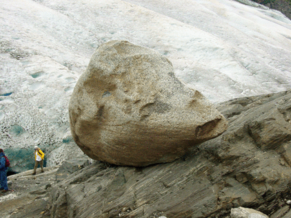
Northeast-looking photograph of a ~6-foot diameter, sub-rounded granite erratic boulder sitting on an outcrop of schist. The erratic was deposited by the Mendenhall Glacier, seen in the background. Coast Mountains, Juneau Icefield, Tongass National Forest, AK. |
Erratic
A rock of unspecified shape and size, transported a significant
distance from its origin by a glacier or iceberg and deposited
by melting of the ice. Erratics range from pebble-size to
larger than a house and usually are of a different composition
that the bedrock or sediment on which they are deposited.
|

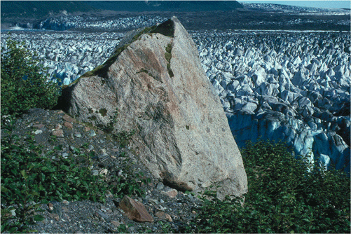
Southeast-looking photograph of an area recently
exposed by the retreat of Steller Glacier in August
1996, the western-most part of Bering Glacier's
piedmont lobe. The ground surface is covered by
glacial sediment deposited as lodgement and ablation
till. The erratic is an angular, ~ 20-ft-high
piece of gneiss. Bering Glacier, Alaska. Bering
Glacier flows through Wrangell-Saint Elias National
Park. |
|
|
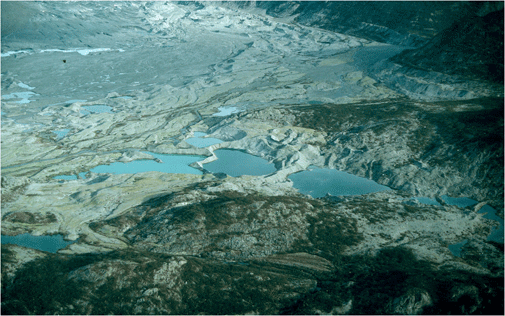
Esker
A meandering, water-deposited, generally steep-sided sediment
ridge that forms within a subglacial or englacial stream
channel. Its floor can be bedrock, sediment, or ice. Subsequent
melting of the glacier exposes the deposit. Generally composed
of stratified sand and gravel, eskers can range from feet
to miles in length and may exceed 100 feet in height.

Northeast-looking oblique aerial photograph of
several meandering eskers and other glacially-produced
sedimentary features, adjacent to the margin of
the retreating Casement Glacier, St Elias mountains,
Glacier Bay National Park, Alaska. |
|
|
Eustacy
Fluctuations in the worldwide sea-level regime caused by
changes in the quantity of seawater available. The greatest
changes are caused by water being added to, or removed from,
glaciers.

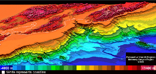
Color-coded DEM of Monterey Bay. The white line
represents the current coastline. Note Monterey
Canyon valley in the center of the image. DEM taken
from USGS
TerraWeb. |
|
|
|

