Surficial Geology and Analysis of post-impoundment sediment of Lake Mohave
Open-File Report 2004-1256
|
Title Page / Introduction / Methods / Results / Discussion / Conclusion / Acknowledgments / References |
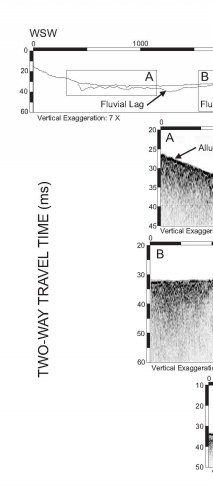
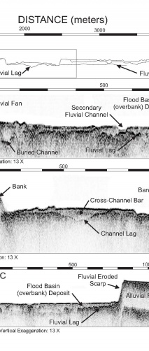
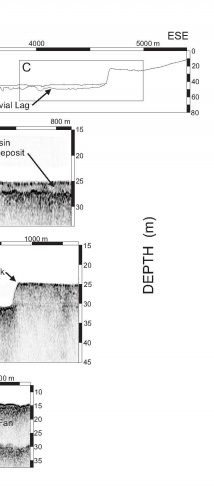
Figure 10. Straigraphic interpretive cross-section showing fluvial deposits in the main basin of Lake Mohave (see figure 5 and figure 7 for location). Insets of Chirp profile images (A, B, and C) are shown with location on the cross-section. Depth is relative to lake level at the time of the survey assuming a sound velocity of 1500 m/s.
Click for larger image (PDF version, 350 KB).
 |
 |
 |
![]() To view files in PDF format, download free copy of Adobe Reader.
To view files in PDF format, download free copy of Adobe Reader.
