Link to USGS home page Link to USGS home page
Coastal and Marine Geology Program
Coastal & Marine Geology Program > Coastal Classification Mapping Project > Open File Report 2005-1003

Coastal Classification Atlas

Southeastern Louisiana Coastal Classification Maps - Pass Abel to East Timbalier Island

USGS Open File Report 2005-1003

Robert A. Morton, Russell L. Peterson

Report Home Maps Overview Mapping Methods Coastal Classifications Geologic Setting Coastal Processes Coastal Vulnerability Classification Summary References
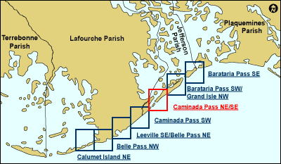
Introduction || City: Calumet Island | Belle Pass | Leeville/Belle Pass | Caminada Pass | Barataria Pass/Grand Isle | Barataria Pass
Area: Caminada Pass Southwest | Caminada Pass Northeast/Southeast
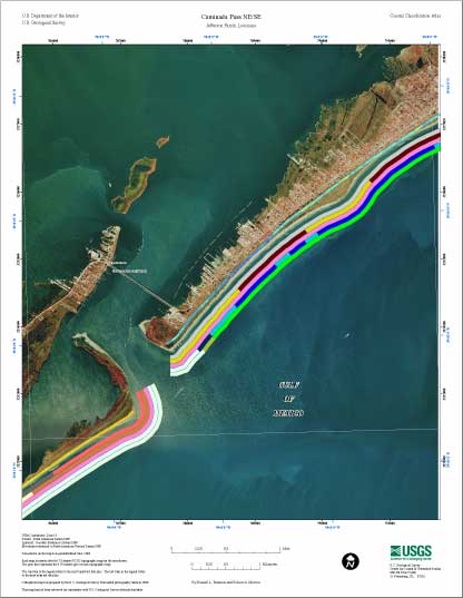
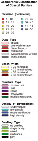
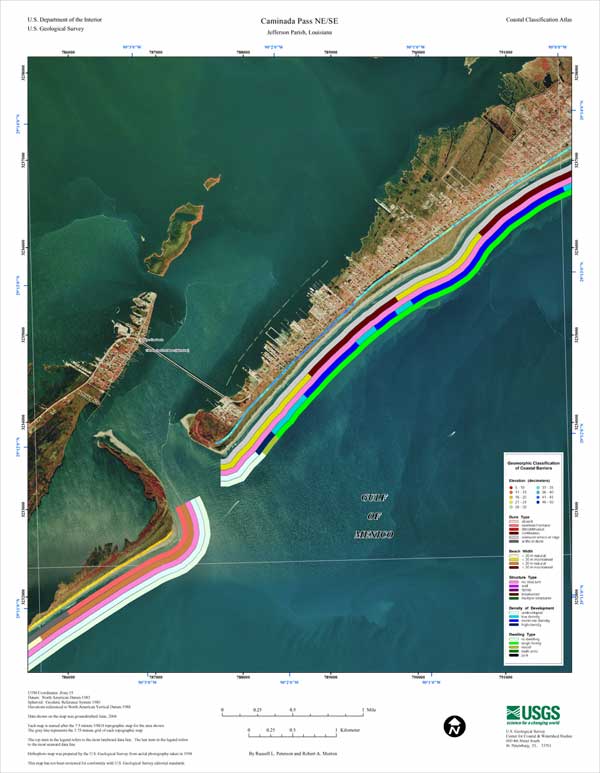
Caminada Pass NE/SE Classification Map

Map showing the coastal classifications along the southeastern Louisiana shoreline. The top item in the legend refers to the most landward data line. The last item in the legend refers to the most seaward data line. Click on the links below to download and view larger versions of the map. At the bottom of the page is a clickable index map that will take you to the other maps.

8 1/2" X 11" (50 KB JPEG)
14" X 18" (127 KB JPEG)
21" X 27" (265 KB JPEG)
  Printable PDF version (11 MB PDF)
Can't see the PDF version?
Get Adobe Acrobat® Reader
 
Coastal classification map for Caminada Pass NE/SE
Coastal Classification Map for Caminada Pass NE/SE.
map legend
Map legend.
Index map.
Clickable Index Map. Use the index map above to navigate to the different coastal areas. The selected area is outlined in red.
 
Calumet Island NECalumet Island NEBelle Pass NWBelle Pass NWBarataria Pass SEBarataria Pass SEBarataria Pass SW/Grand Isle NWBarataria Pass SW/Grand Isle NWCaminada Pass SWCaminada Pass SWLeeville SE/Belle Pass NELeeville SE/Belle Pass NE

Coastal & Marine Geology Program > Coastal Classification Mapping Project > Open File Report 2005-1003


[an error occurred while processing this directive]