

|
|
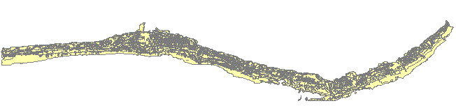
| U.S. Geological Survey Open File Report 2005-1070 Version 1.0 Moloka'i Benthic Habitat MappingSummaryThe detailed high-resolution map layer provided here documents habitat characterization of a critical coral reef in Hawai'i. Integration of the aerial imagery, SHOALS bathymetry, and field observations made it possible to create detailed thematic maps reaching depths of 35 m (120 ft). This depth range encompasses the base of the Moloka'i forereef, and is deeper than can be mapped with standard optical remote sensing instruments. These maps can be used as stand-alone or in a GIS to provide useful information to scientists, managers and the general public. AcknowledgementsThe author wishes to thank Pat Chavez and his group from the USGS in Flagstaff for coordinating our acquisition of the SHOALS bathymetric data and their work on processing the aerial photomosaics. With help from Ann Gibbs (USGS Santa Cruz), they collected the deep-water video tows and also the underwater video data points used in the field check. Josh Logan (USGS Santa Cruz) created the SHOALS image used as a base layer. His help in field operations and his GIS advice were invaluable throughout the entire process. Paul Jokiel, Eric Brown and others from the University of Hawai'i assisted with field observations and insight. Will Smith (UH) and Miles Anderson (Analytical Laboratories of Hawai'i) provided many hours of discussion regarding the classification scheme, methodology, and accuracy assessments. A special mahalo goes to Captain Joe Reich, owner of the Alyce C on Moloka'i, whose exceptional navigation and local expertise was critical to the success of this project. The benthic habitat mapping of Moloka'i was carried out under the leadership of Project Chief Mike Field (USGS Santa Cruz), as part of a USGS effort to understand geologic processes of coral reef systems in the U.S. and its trust territories. This work benefited greatly from reviews by Curt Storlazzi (USGS Santa Cruz) and Greg Piniak (USGS Santa Cruz). Literature CitedCoyne, M. S., Batista, T.A., Anderson, M., Waddell, J., Smith, W., Jokiel, P., Kendall, M.S., and Monaco, M.E., 2003, Benthic Habitats of the Main Hawaiian Islands: Silver Spring, MD, National Oceanic and Atmospheric Administration, Technical Memorandum NOS NCCOS CCMA 152. Jokiel, P.L., Brown, E.K., Friedlander, A., Rodgers, S.K., and Smith, W.R., 2001, Hawaii Coral Reef Initiative Coral Reef Assessment and Monitoring Program (CRAMP) Final Report 1999-2000: Hawaii Institute of Marine Biology. Kendall, M.S., Buja, D.R., Christensen, J.D., Kruer, C.R., and Monaco, M.E., 2004, The seascape approach to coral ecosystem mapping: an integral component of understanding the habitat utilization patterns of reef fish: Bulletin of Marine Science, v. 75, no. 2, p. 225-237. Lillesand, T.M., and Keifer, R.W., 1994, Remote sensing and image interpretation, 3rd ed., John Wiley and Sons, Inc., New York. Mapworks, Manoa, 1984, Molokai Coastal Resource Atlas: US Army Corps of Engineers, Pacific Ocean Division. NOAA National Centers for Coastal Ocean Science (NCCOS). 2005. Shallow-Water Benthic Habitats of American Samoa, Guam, and the Commonwealth of the Northern Mariana Islands (CD-ROM). NOAA Technical Memorandum NOS NCCOS 8, Biogeography Team. Silver Spring, MD. Storlazzi, C.D., Logan, J.B., and Field, M.E., 2003, Quantitative morphology of a fringing reef from high-resolution laser bathymetry: Southern Moloka'i, Hawai'i: GSA Bulletin, v. 115, no. 11, p. 1344-1355. Digital Files
Download this report in full as a PDF document (5.1 MB). Download a free copy of the current version of Adobe Reader. Contact Information
|
|
For information regarding this report: |
For general project information: |
For more information on the U.S. Geological Survey's Coral Reef Project, please see: http://coralreefs.wr.usgs.gov/
Cochran-Marquez, S.A., 2005, Moloka'i benthic habitat mapping: U.S. Geological Survey Open-File Report 2005-1070, 18 p.
URL of this page: http://pubs.usgs.gov/of/2005/1070/
Date created: 18 February 2005
Created by: Susan A. Cochran
Maintained by: Susan A. Cochran
Date last modified: 5 July 2007 (sac)
USGS Privacy Statement | Disclaimer | Feedback | Accessibility
Department of the Interior | US Geological Survey | Biology | Geology | Mapping | Water