
Open-File Report 2005-1293
Title Page / Table of Contents / List of Figures / Introduction / Maps / Data Collection/Processing / Interpretation / Acknowledgments / Appendix 1 / Appendix 2 / Appendix 3 / Appendix 4
 |
 |
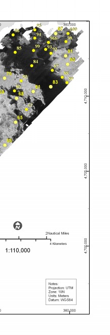 |
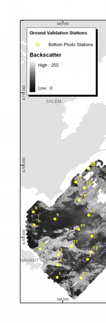
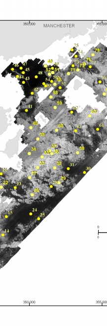
Figure A3.1. Map showing station locations of bottom photographs obtained in the region Nahant to Gloucester. Also see Map Sheet 5, Panel B (Geologic Interpretation) for interpretation of photographs superimposed on shaded relief topography. | ||


![]() U.S. Department of the Interior |
U.S. Geological Survey
U.S. Department of the Interior |
U.S. Geological Survey
URL: http://pubsdata.usgs.gov/pubs/of/2005/1293/html/imagepages/figa3_1.html
Page Contact Information: GS Pubs Web Contact
Page Last Modified: Friday, 03-May-2024 15:47:09 EDT

