Sample Collection
Soil samples were collected by the U.S. Geological Survey in April, 2003 and April, 2004 and were analyzed with a laboratory gamma-ray spectrometer . The sample locations are shown in Figure 3. The sample locations were determined using a GPS device and were collected from the top 5 cm of soil. The samples were sieved to retain only the size fraction less than 2 mm and were dried in a laboratory at 25 °C.
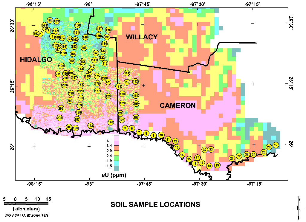
Figure 3. Map of soil sample locations. The yellow circles indicate the locations and sample identification numbers. The background image shows equivalent uranium concentrations (eU) from aerial gamma-ray surveys. The equivalent uranium image is a composite made using regional data (large pixels) from Duval and Riggle (1999) and higher resolution data from Duval (2005). Scale differences required that the regional data be multiplied by a factor of two to achieve better agreement with the more detailed aerial survey. The scale difference suggests a problem with the relative calibrations of the surveys.
|


