Surficial sediment character of the Louisiana offshore continental shelf region: A GIS Compilation
|
|
Data CatalogData provided in this publication include geographic coordinates to allow for integration into a Geographic Information System (GIS). A GIS is defined as a system of hardware and software to support the display, manipulation, and analysis of spatial data for mapping and complex data solving. This integrated package provides researchers the ability to integrate, analyze, and map the various data sets as an aid to scientific research, and policy-making decisions tied to the environment. The five individual sediment/seafloor data layers along with additional basemap data layers have been compiled into an ArcView ™ project file (la.apr) that is located at the top-level directory of this publication. The project file is intended to be opened and the data viewed with the Environmental Systems Research Institute, Inc. (ESRI) ArcView™ or ArcGIS™ software. The project file has been modified to reflect relative paths to the archived data as organized for this publication. To open the supplied project file and view the datasets, the user must start the appropriate software, navigate to the top-level of this publication and open the project file (la.apr). Federal Geographic Data Committee (FGDC) metadata for the individual data layers is provided in three versions (HTML, FAQ, and text). Selecting associated metadata files from the table below will open the information in a new browser window. A 'zip' compressed, downloadable archive file containing the ArcView™ shapefile for each data layer is also provided. Compressed downloadable files were created using the Windows program WINZIP v8.0. For those users who do not have software capable of uncompressing the archived zip files, they may obtain a free version of the software from Winzip Computing, Inc. or Pkware, Inc. In addition to the ArcView™ shapefile, the sediment data layers are available in an ASCII text format and a Microsoft Excel spreadsheet format to allow users who may not have access to GIS software to read the shapefile and examine the datasets. The first record of the ASCII file and Excel spreadsheet contains the name of the data fields for that file. |
![]() return to top
return to top
DIRECTORY: data/usseabed
| Data Layer Name and Description |
Metadata | Files |
|---|---|---|
| LA_PRS - usSEABED parsed (word-based) data for the Louisiana region. An explanation of the individual data sets may be found in the Data Dictionary section. | HTML FAQ text |
zip Excel text |
| LA_EXT - usSEABED extracted data for the Louisiana region . An explanation of the individual data sets may be found in the Data Dictionary section. | HTML FAQ text |
zip Excel text |
| LA_CLC - usSEABED calculated data for the Louisiana region. An explanation of the individual data sets may be found in the Data Dictionary section. | HTML FAQ text |
zip Excel text |
| LA_FAC - usSEABED facies data for the Louisiana region. An explanation of the individual data sets may be found in the Data Dictionary section. | HTML FAQ text |
zip Excel text |
| LA_CMP - usSEABED component data for the Louisiana region. An explanation of the individual data sets may be found in the Data Dictionary section. | HTML FAQ text |
zip Excel text |
| GMX_SRC - usSEABED source data for the Gulf Coast. An explanation of the individual data sets may be found in the Data Dictionary section. |
![]() return to top
return to top
| Data Layer Name and Description |
Metadata | Files |
|---|---|---|
| gmx_grd8bit.sid - Coastal Relief Model Bathymetry image for the Gulf of Mexico. | HTML FAQ text |
zip |
![]() return to top
return to top
DIRECTORY: data/basemaps
| Data Layer Name and Description |
Metadata | Files |
|---|---|---|
| eez - USEEZ Boundaries of the U.S. Exclusive Economic Zone (USEEZ) of the United States and territories. | HTML FAQ text |
zip |
| state_bounds - Internal United States boundaries | HTML FAQ text |
zip |
| - Medium Resolution Digital Vector U.S. Shoreline shapefile | HTML FAQ text |
zip |
![]() return to top
return to top
| Data Layer Name and Description |
Metadata | Files |
|---|---|---|
| coastal change - Previously included in USGS Digital Data Series 79 (Williams and others, 2003) | online | online |
![]() return to top
return to top
| Data Layer Name and Description |
Information | Files |
|---|---|---|
| Google Earth Files |
|
|
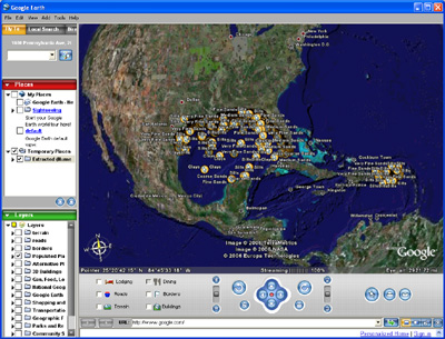 |
A KMZ file is available for download and use with Google Earth! |
Main Menus
OFR 2006-1195 Home | Introduction | Nomenclature | Coastal Change | Data Dictionary | Data Catalog | Browse Maps | References | Related Web Sites | For Educators | Acknowledgments | Contacts | Disclaimer| README
Sub-Menus
Data Catalog | usSEABED Data | Basemaps | Bathymetry | Coastal Change | Google Earth

![]() U.S. Department of the Interior |
U.S. Geological Survey
U.S. Department of the Interior |
U.S. Geological Survey
URL: http://pubsdata.usgs.gov/pubs/of/2006/1195/htmldocs/data_catalog.htm
Page Contact Information: Publishing Services
Page Last Modified: Saturday, 12-Jan-2013 22:32:29 EST