Open-File Report 2006-1381
![]() Title |
Figures |
1-Introduction |
2-Data Collection and Processing |
3- Geologic Interpretation |
4-References |
5-Maps |
Spatial Data |
Acknowledgments
Title |
Figures |
1-Introduction |
2-Data Collection and Processing |
3- Geologic Interpretation |
4-References |
5-Maps |
Spatial Data |
Acknowledgments
 |
||
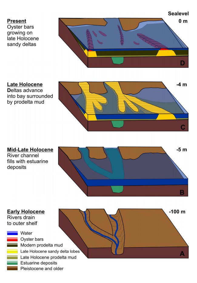
Figure 14. Schematic block diagram showing important steps in the evolution of the Apalachicola Bay region since the last lowstand of sea level. | ||

![]() U.S. Department of the Interior |
U.S. Geological Survey
U.S. Department of the Interior |
U.S. Geological Survey
URL: http://pubsdata.usgs.gov/pubs/of/2006/1381/html/fig14.html
Page Contact Information: GS Pubs Web Contact
Page Last Modified: Thursday, 15-Aug-2024 15:11:20 EDT
