U.S. Geological Survey Open-File Report 2008-1206
Coastal Change Along the Shore of Northeastern South Carolina: The South Carolina Coastal Erosion Study
Return to: Title and Abstract » Table of Contents » Section 1 » Section 2 » Section 3 » Section 4 » Section 5 » Section 6 » Acknowledgments » References » List of Figures » Acronymns » Glossary |
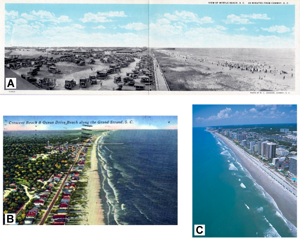
Figure 1.4. Views of the Grand Strand before and after high-density oceanfront development. (A) Picture postcard of Myrtle Beach Pavilion area with boardwalk and small structures behind a natural dune. Photograph taken by W. C. Johnson around 1927 (published by permission of the Lake County (IL) Discovery Museum, Curt Teich Postcard Archives). (B) Picture postcard of the Crescent Beach and Ocean Drive Beach sections of North Myrtle Beach around 1955 (published by permission of the South Caroliniana Library, University of South Carolina–Columbia). During this period, single-family cottages represented most of the development and, although structures did stand close to the shoreline, the integrity of primary coastal dunes was preserved. (C) Photograph of oceanfront along the downtown section of Myrtle Beach around 2000 (published by permission of the Myrtle Beach Area Convention and Visitors Bureau). High-rise condominiums and hotels now dominate development along the Grand Strand. In many areas, structures stand directly adjacent to the beach and frontal dunes are absent. [Click here for high-resolution image.] |
 |

 U.S. Department of the Interior |
U.S. Geological Survey
U.S. Department of the Interior |
U.S. Geological Survey
[an error occurred while processing this directive]
URL: https://pubsdata.usgs.gov
Page Contact Information: Publishing Service Center
Page Last Modified: Wednesday, 07-Dec-2016 21:39:15 EST
