U.S. Geological Survey Open-File Report 2008-1206
Coastal Change Along the Shore of Northeastern South Carolina: The South Carolina Coastal Erosion Study
Return to: Title and Abstract » Table of Contents » Section 1 » Section 2 » Section 3 » Section 4 » Section 5 » Section 6 » Acknowledgments » References » List of Figures » Acronymns » Glossary |
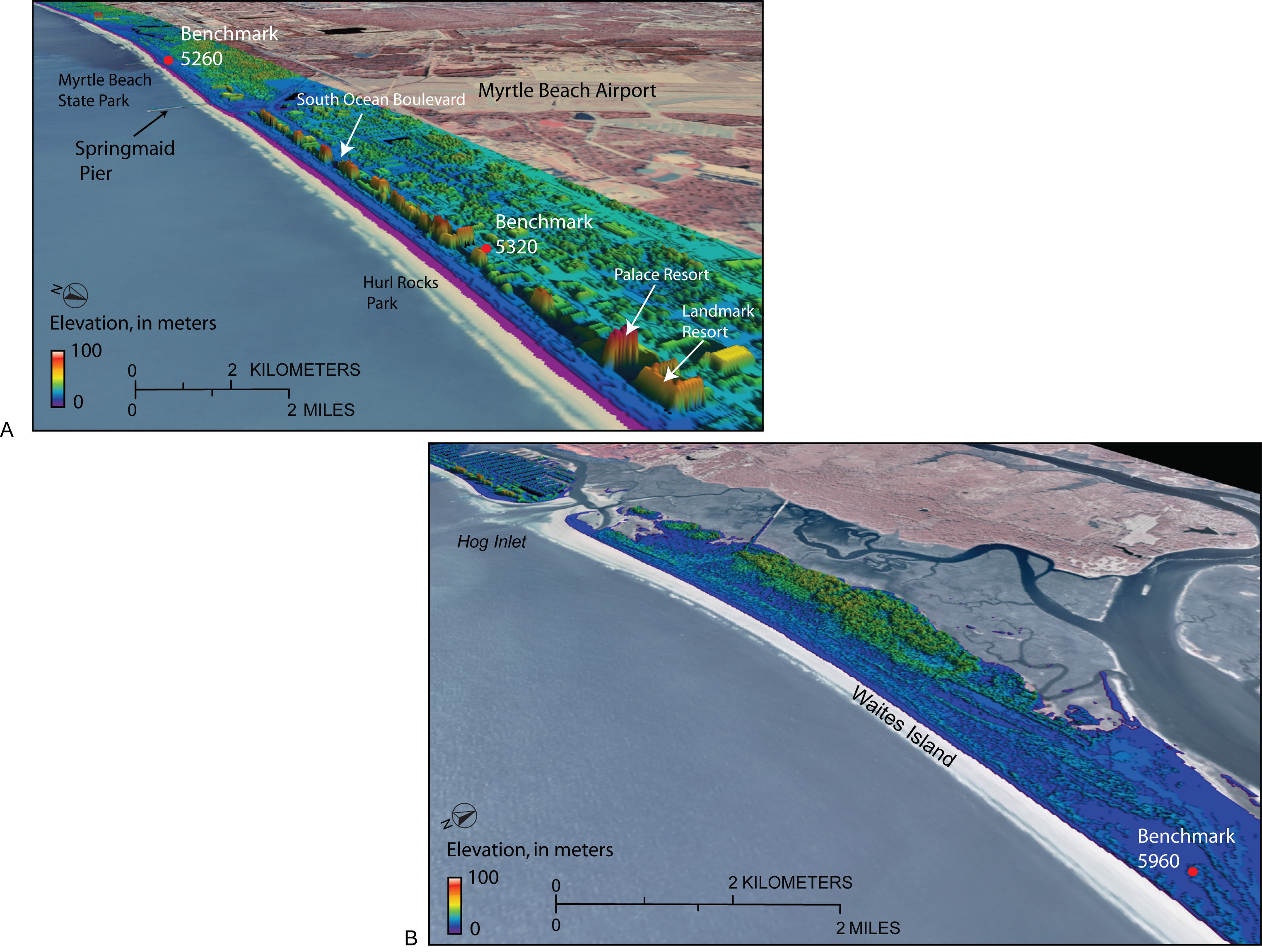
Figure 2.10. Aerial photographs overlain with Light Detection and Ranging (LIDAR) topography show A) dense coastal development at Myrtle Beach, and B) undeveloped beach and dunes at Waites Island. Data were collected in 2006 as part of the National Coastal Mapping Program by the U.S. Army Corps of Engineers. Frequent surveys allow geologists to assess short-term change to the shoreline, such as the immediate impact of large storms. [Click here for high-resolution image.] |
 |

 U.S. Department of the Interior |
U.S. Geological Survey
U.S. Department of the Interior |
U.S. Geological Survey
[an error occurred while processing this directive]
URL: https://pubsdata.usgs.gov
Page Contact Information: Publishing Service Center
Page Last Modified: Wednesday, 07-Dec-2016 21:39:18 EST
