U.S. Geological Survey Open-File Report 2008-1206
Coastal Change Along the Shore of Northeastern South Carolina: The South Carolina Coastal Erosion Study
Return to: Title and Abstract » Table of Contents » Section 1 » Section 2 » Section 3 » Section 4 » Section 5 » Section 6 » Acknowledgments » References » List of Figures » Acronymns » Glossary |
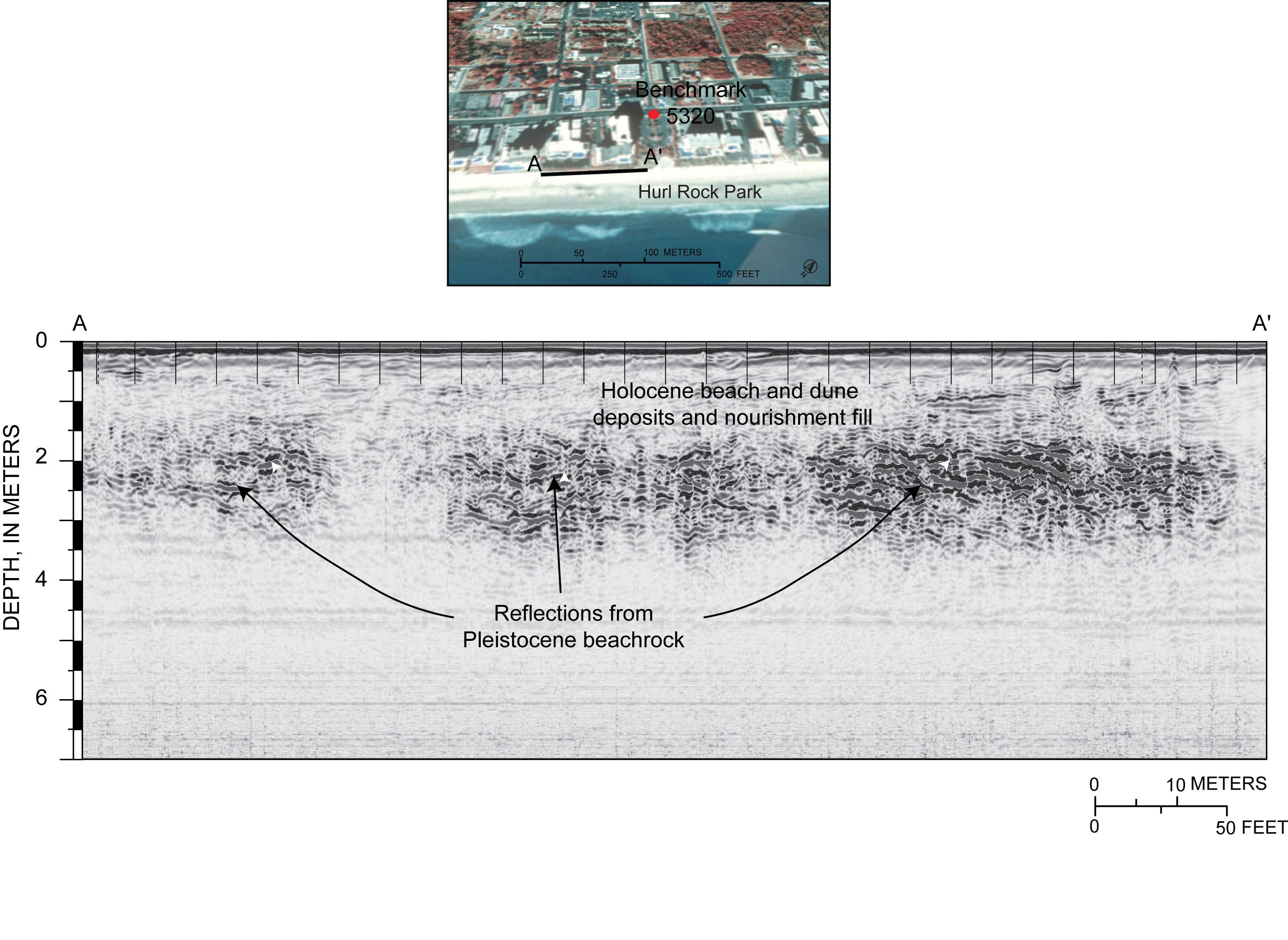
Figure 2.7. TOP: Aerial photograph of Myrtle Beach showing location of ground-penetrating radar (GPR) profile collected at Hurl Rock Park. BOTTOM: GPR profile showing Pleistocene beachrock buried 1–2 m beneath the beach. These rocks are episodically exposed when storms erode the beach (see photograph in Figure 4.4B). [Click here for high-resolution image.] |
 |

 U.S. Department of the Interior |
U.S. Geological Survey
U.S. Department of the Interior |
U.S. Geological Survey
[an error occurred while processing this directive]
URL: https://pubsdata.usgs.gov
Page Contact Information: Publishing Service Center
Page Last Modified: Wednesday, 07-Dec-2016 21:39:22 EST
