U.S. Geological Survey Open-File Report 2008-1206
Coastal Change Along the Shore of Northeastern South Carolina: The South Carolina Coastal Erosion Study
Return to: Title and Abstract » Table of Contents » Section 1 » Section 2 » Section 3 » Section 4 » Section 5 » Section 6 » Acknowledgments » References » List of Figures » Acronymns » Glossary |
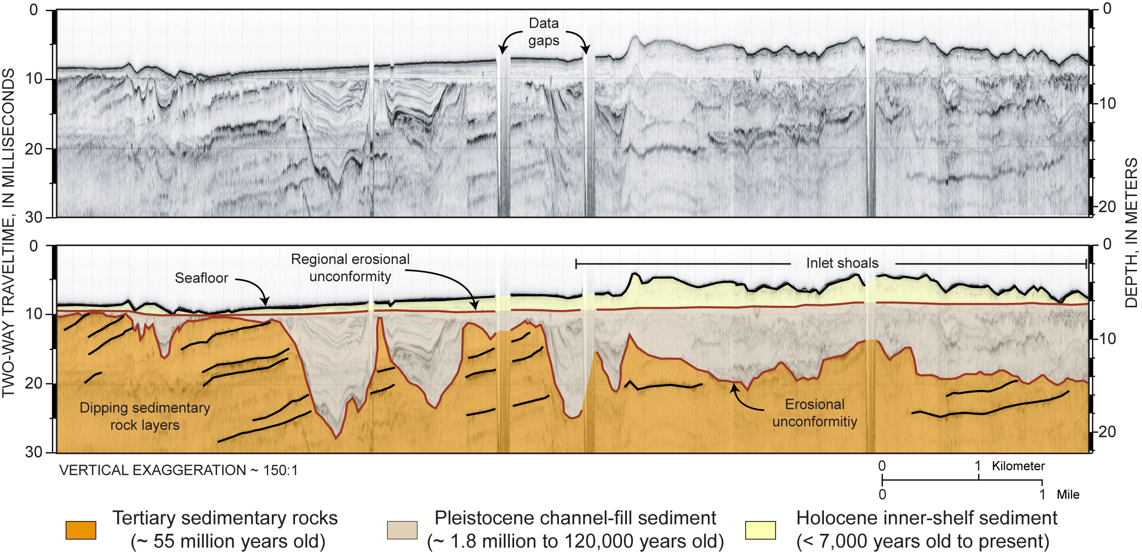
Figure 3.4. Seismic-reflection profile offshore of the Murrells Inlet area. TOP: Original data showing vertical slice through the upper 20 m (66 ft) of the seafloor. BOTTOM: Interpreted profile showing the primary framework components underlying the inner shelf. Location indicated in Figure 3.1D. Two-way traveltime is in milliseconds and depth is in meters. A constant seismic velocity of 1.5 km/s was used to convert from two-way traveltime to depth (modified from Baldwin and others, 2006). ~, about; <, less than. [Click here for high-resolution image.]
 |

 U.S. Department of the Interior |
U.S. Geological Survey
U.S. Department of the Interior |
U.S. Geological Survey
URL: https://pubsdata.usgs.gov/pubs/of/2008/1206/html/figs/fig3_4.html
Page Contact Information: Publishing Service Center
Page Last Modified: Monday, 03-Jun-2019 11:36:33 EDT
