U.S. Geological Survey Open-File Report 2008-1206
Coastal Change Along the Shore of Northeastern South Carolina: The South Carolina Coastal Erosion Study
Return to: Title and Abstract » Table of Contents » Section 1 » Section 2 » Section 3 » Section 4 » Section 5 » Section 6 » Acknowledgments » References » List of Figures » Acronymns » Glossary |
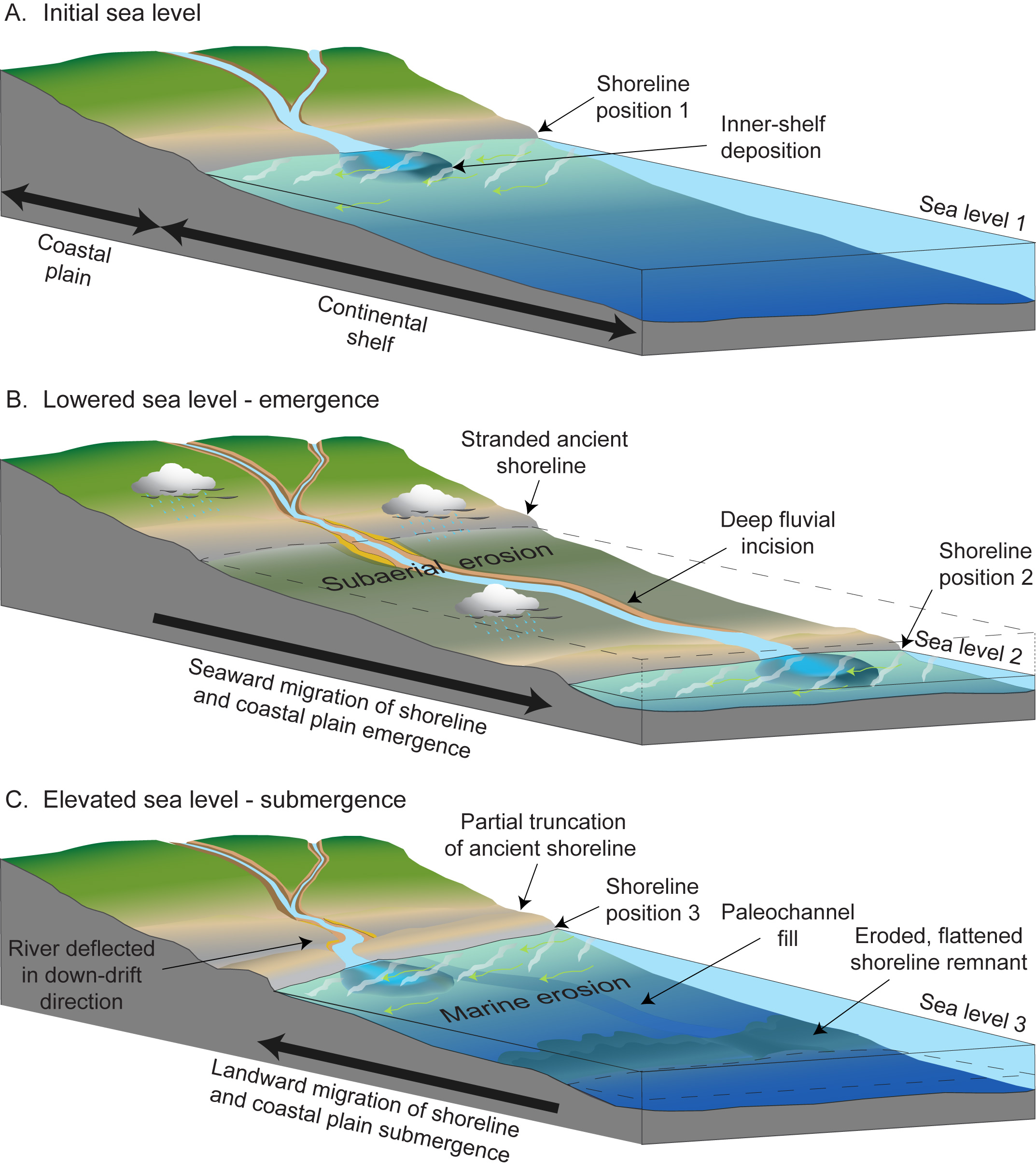
Figure 3.8. A three-phase conceptual model showing evolution of the Grand Strand region over a cycle of emergence-submergence driven by relative sea-level changes. Schematic diagrams illustrate shoreline migration seaward and landward across the coastal plain and continental shelf. A) Initial sea level is high; stable shoreline deposits develop at relatively high elevation. B) Sea level falls and shoreline migrates seaward. Inner shelf emerges, leaving older shoreline stranded high on the coastal plain. Unconformity produced by broad subaerial erosion and deep fluvial incision. C) Sea level rises and shoreline migrates landward. Eroded remnants of lowstand shoreline stranded on the continental shelf. Erosion by waves and currents generally flattens the landscape and partially truncates older highstand shoreline. As sea level stabilizes, shoreline deposits accumulate at higher elevations and cause river mouth to migrate downdrift. [Click here for high-resolution image.]
 |

 U.S. Department of the Interior |
U.S. Geological Survey
U.S. Department of the Interior |
U.S. Geological Survey
URL: https://pubsdata.usgs.gov/pubs/of/2008/1206/html/figs/fig3_8.html
Page Contact Information: Publishing Service Center
Page Last Modified: Monday, 03-Jun-2019 11:36:34 EDT
