U.S. Geological Survey Open-File Report 2008-1206
Coastal Change Along the Shore of Northeastern South Carolina: The South Carolina Coastal Erosion Study
Return to: Title and Abstract » Table of Contents » Section 1 » Section 2 » Section 3 » Section 4 » Section 5 » Section 6 » Acknowledgments » References » List of Figures » Acronymns » Glossary |
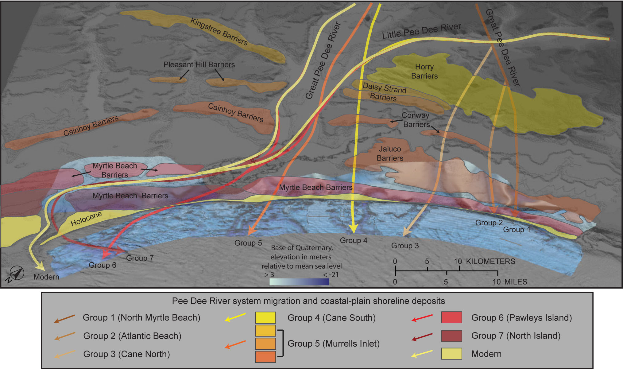
Figure 3.9. Perspective view of the Grand Strand region looking towards the northwest. Arrows indicate changing locations of the Pee Dee River over time (generalized from Baldwin and others, 2006). Progressive, southwestward deposition along ancient shorelines gradually deflected the river toward the southwest. Older (more landward) shorelines initially trended east-west, but rotated to northeast-southwest as they were deposited progressively closer to the modern coastline. Shaded relief of the regional surface defining the base of Quaternary sediments (also displayed in Figure 3.5a) shows that the river carved at least seven distinct courses across the region prior to its current configuration, which flows through Winyah Bay. The background-shaded relief imagery was constructed by using the NOAA-NGDC coastal-relief model. >, higher than; <, deeper than. [Click here for high-resolution image.]
 |

 U.S. Department of the Interior |
U.S. Geological Survey
U.S. Department of the Interior |
U.S. Geological Survey
[an error occurred while processing this directive]
URL: https://pubsdata.usgs.gov
Page Contact Information: Publishing Service Center
Page Last Modified: Wednesday, 07-Dec-2016 21:39:28 EST
