U.S. Geological Survey Open-File Report 2008-1288
Geophysical Data Collected off the South Shore of Martha's Vineyard, Massachusetts
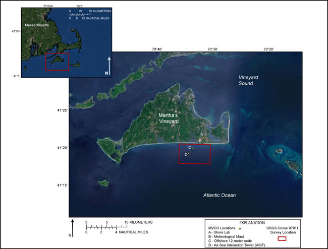 |
Figure 1. Location map showing the USGS Cruise 07011 survey bounds and the Woods Hole Oceanographic Institute (WHOI) Martha's Vineyard Coastal Observatory (MVCO) locations. Environmental Systems Research Institute (ESRI) USA Prime Imagery is used as background image (I-cubed, 2009).
|

![]() U.S. Department of the Interior |
U.S. Geological Survey
U.S. Department of the Interior |
U.S. Geological Survey
URL: https://pubsdata.usgs.gov/pubs/of/2008/1288/html/imagepages/figure1.html
Page Contact Information: Contact USGS
Page Last Modified: Wednesday, 07-Dec-2016 21:27:14 EST
