U.S. Geological Survey Open-File Report 2008-1288
Geophysical Data Collected off the South Shore of Martha's Vineyard, Massachusetts
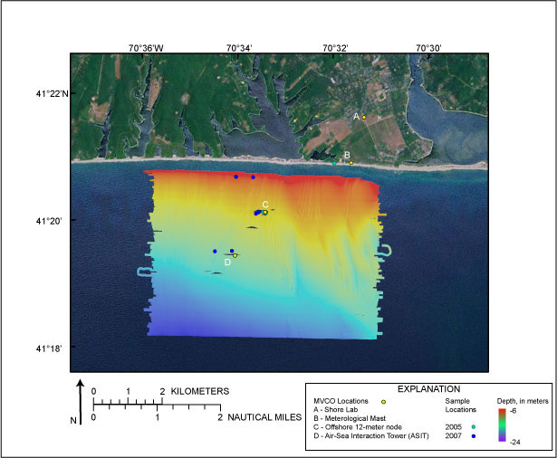 |
Figure 8. Color shaded-relief image of swath bathymetric data collected by the USGS during Cruise 07011. Depth is in meters and ranges from approximately 6 to 24 m water depth. No data were collected in the gray regions, where moored instruments and structures were located. The locations of the Martha's Vineyard Coastal Observatory (MVCO) (yellow dots) and beach and seafloor sediment samples collected in 2005 (green dots) and 2007 (blue dots) are also displayed. Environmental Systems Research Institute (ESRI) USA Prime Imagery is used as background image.
|

![]() U.S. Department of the Interior |
U.S. Geological Survey
U.S. Department of the Interior |
U.S. Geological Survey
URL: https://pubsdata.usgs.gov/pubs/of/2008/1288/html/imagepages/figure8.html
Page Contact Information: Contact USGS
Page Last Modified: Wednesday, 07-Dec-2016 21:27:23 EST
