U.S. Geological Survey Open-File Report 2009-1042
National Assessment of Historical Shoreline Change: A Pilot Study of Historical Coastal Bluff Retreat in the Great Lakes, Erie, Pennsylvania
Return to: Abstract » Introduction » Prior Assessments » Geology, Physiography, and Recession » Methodology » Bluff-Retreat Rates » Conclusion » Acknowledgments » References Cited |
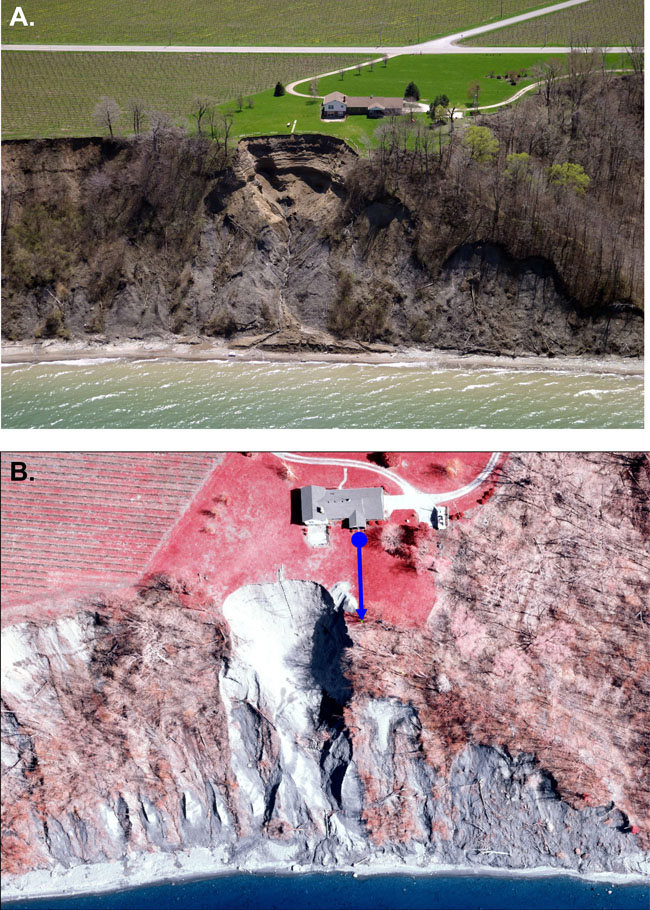
| Figure 1. (A) This low-angle oblique aerial photograph shows an area of high recession along Lake Erie, Pennsylvania, bluffs that is not documented in a State Coastal Resources Management Program monitoring study as a result of the original location of the control point from which distance to the bluff edge is measured. (B) This low-altitude vertical aerial photograph of the same area shows the location of the control point (blue dot) and the azimuth (blue arrow) along which the transects are measured. Photographs from Pennsylvania Coastal Resource Management Program. |
 |

![]() U.S. Department of the Interior |
U.S. Geological Survey
U.S. Department of the Interior |
U.S. Geological Survey
[an error occurred while processing this directive]
URL: https://pubsdata.usgs.gov
Page Contact Information: Contact USGS
Page Last Modified: Wednesday, 07-Dec-2016 21:51:26 EST
