U.S. Geological Survey Open-File Report 2009-1042
National Assessment of Historical Shoreline Change: A Pilot Study of Historical Coastal Bluff Retreat in the Great Lakes, Erie, Pennsylvania
Return to: Abstract » Introduction » Prior Assessments » Geology, Physiography, and Recession » Methodology » Bluff-Retreat Rates » Conclusion » Acknowledgments » References Cited |
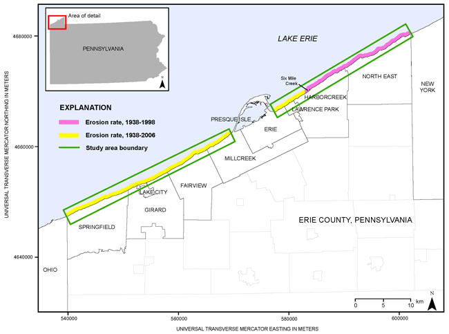
Figure 3. Location map of the Lake Erie, Pa., Coastal Zone including the study areas along which recession rates were calculated. [Click here or on figure for high-resolution image in PDF format, 1.1 MB.] |
 |
To view files in PDF format, download a free copy of Adobe Reader.

![]() U.S. Department of the Interior |
U.S. Geological Survey
U.S. Department of the Interior |
U.S. Geological Survey
[an error occurred while processing this directive]
URL: https://pubsdata.usgs.gov
Page Contact Information: Contact USGS
Page Last Modified: Wednesday, 07-Dec-2016 21:51:29 EST
