U.S. Geological Survey Open-File Report 2009-1072
Geophysical and Sampling Data from the Inner Continental Shelf: Duxbury to Hull, Massachusetts
Title Page / Contents / List of Figures / Conversion Factors / Abstract / Introduction / Data Collection/Processing / Acknowledgments / References Cited / Appendix 1 / Appendix 2 / Appendix 3
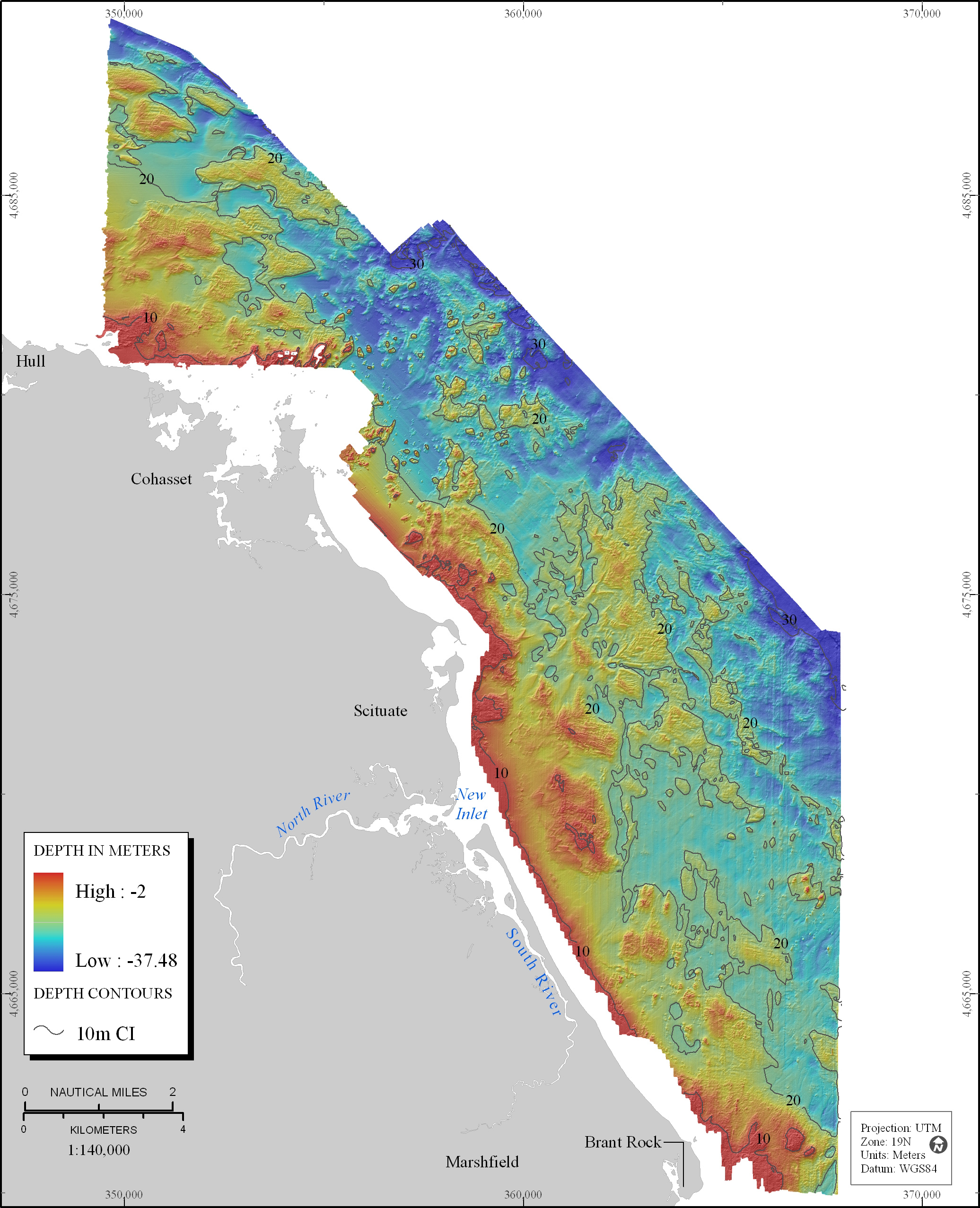
Figure 4. Map showing shaded-relief topography of seafloor in study area. Coloring and bathymetric contours represent depths in meters, relative to the Mean Lower Low Water (MLLW) datum.
View the full size image in JPEG format (1.35 MB).
« Previous: Figure 3
Next: Figure 5 »