U.S. Geological Survey Open-File Report 2009-1137
Quaternary Geologic Framework of the St. Clair River between Michigan and Ontario, Canada
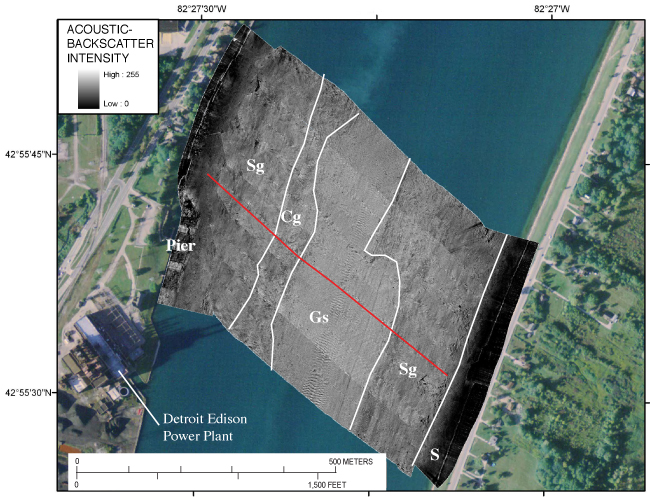
Figure 25. Acoustic-backscatter (processed from SWATHplus®) map for transect across the river at Marysville, MI. Red line shows the location of the Chirp sub-bottom profile shown in figure 26. S, area of low backscatter (dark), which is probably sand; Sg, moderate backscatter area, which is likely sand and gravel; Gs, high backscatter (light) area with dune bedforms (3- to 5-meter wavelengths), mostly gravel with sand; Cg, mottled area of high to low backscatter, which is most likely areas of clay till or glaciolacustrine with patches of gravel. Interpretations based on video transect obtained 500 m to the south (Krishnappan, 2009). Click on figure for full-sized image in PDF format, 6.5 MB. |
 |
To view files in PDF format, download a free copy of Adobe Reader.

![]() U.S. Department of the Interior |
U.S. Geological Survey
U.S. Department of the Interior |
U.S. Geological Survey
URL: https://pubsdata.usgs.gov/pubs/of/2009/1137/html/figure25.html
Page Contact Information: Contact USGS
Page Last Modified: Wednesday, 07-Dec-2016 21:58:25 EST
