U.S. Geological Survey Open-File Report 2009-1150
Surficial Geology of the Floor of Lake Mead (Arizona and Nevada) as Defined by Sidescan-Sonar Imagery, Lake-Floor Topography, and Post-Impoundment Sediment Thickness
 |
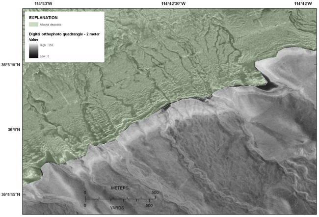
| Figure 11. Digital orthophotograph (gray) and interpretation of the sidescan-sonar image (green) of the southern edge of Boulder Basin showing the continuation of channels from the subaerially exposed parts of the alluvial deposits with the parts that are now submerged. The preservation of the submerged parts of the channels indicates limited reworking of this part of the lake floor by waves and limited burial by post-impoundment sediment. See figure 1 for the location of this figure. Click on figure for larger image. The digital orthophotograph was acquired from the TerraServer Extension in ArcMap 9.2. This tool provides the ability to download imagery hosted by Microsoft's TerraServer. |