U.S. Geological Survey Open-File Report 2009-1150
Surficial Geology of the Floor of Lake Mead (Arizona and Nevada) as Defined by Sidescan-Sonar Imagery, Lake-Floor Topography, and Post-Impoundment Sediment Thickness
 |
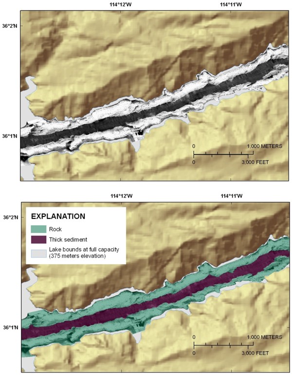
| Figure 4. Sidescan-sonar image from Virgin Canyon showing the uniform high-backscatter signature (light tones) associated with rock outcrops. The top panel shows the sidescan-sonar image and the color-hillshade relief image of the surrounding area and indicates the steepness of the walls flanking this part of the lake. The bottom panel shows the interpretation of the sidescan-sonar image. See figure 1 for the location of this figure. Click on figure for larger image. |