U.S. Geological Survey Open-File Report 2009-1150
Surficial Geology of the Floor of Lake Mead (Arizona and Nevada) as Defined by Sidescan-Sonar Imagery, Lake-Floor Topography, and Post-Impoundment Sediment Thickness
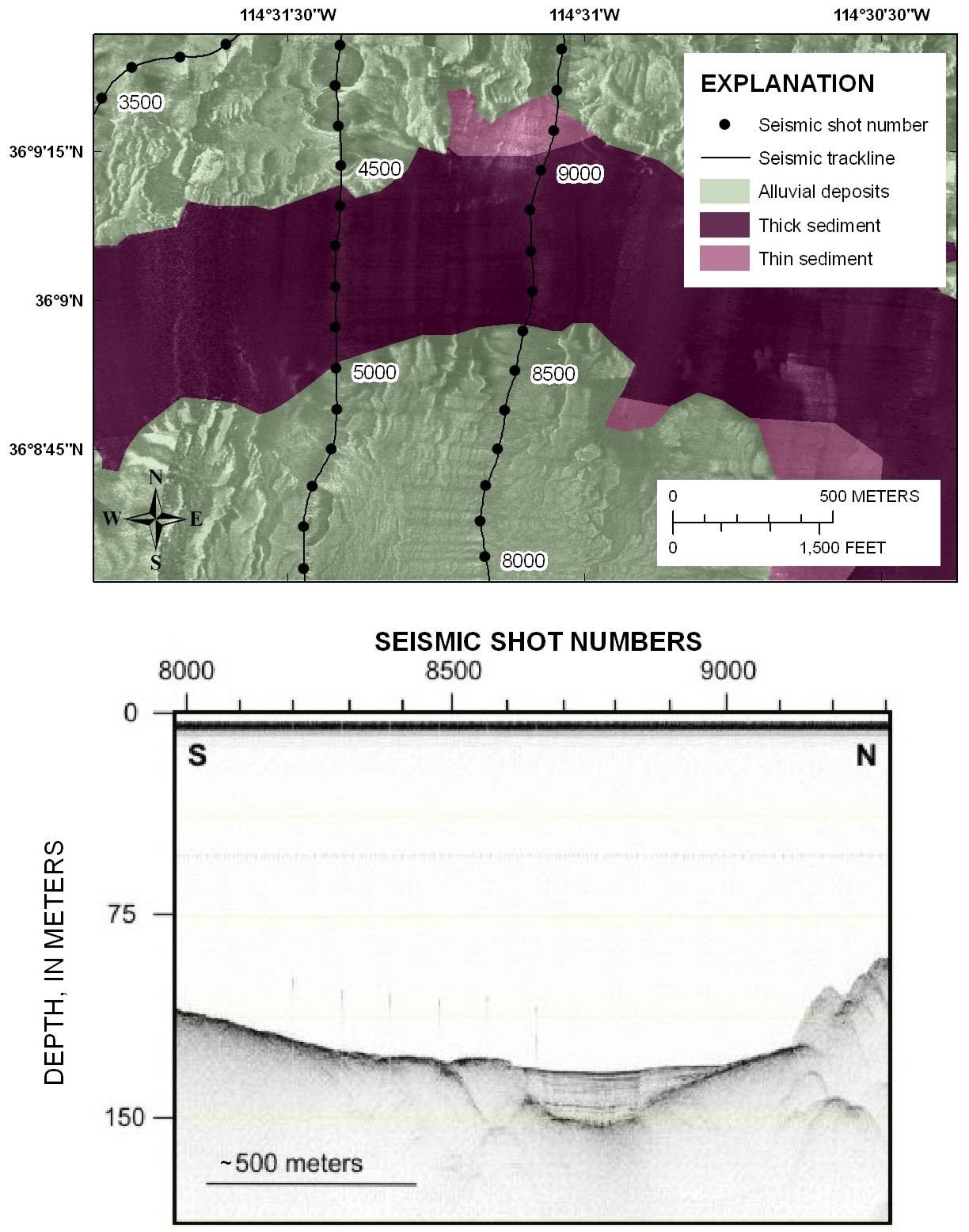 |
| Figure 7. Sidescan-sonar image with interpretation (top panel) and seismic-reflection profile (bottom panel) from the western part of Virgin Basin. The sidescan image shows the low-backscatter nature of the thick post-impoundment sediment deposit in this part of the lake. The sediment is onlapping alluvial deposits. The seismic profile shows the thickness of the post-impoundment sediment. The two images are correlated by seismic shot numbers. The numbers along the top of the seismic profile are shot numbers that correspond to the dots along the seismic tracklines in the top panel. See figure 1 for the location of this figure. Click on figure for larger image. |

![]() U.S. Department of the Interior |
U.S. Geological Survey
U.S. Department of the Interior |
U.S. Geological Survey
URL: https://pubsdata.usgs.gov/pubs/of/2009/1150/html/figurepages/fig7.html
Page Contact Information: Contact USGS
Page Last Modified: Wednesday, 07-Dec-2016 22:18:41 EST
