U.S. Geological Survey Open-File Report 2009-1150
Surficial Geology of the Floor of Lake Mead (Arizona and Nevada) as Defined by Sidescan-Sonar Imagery, Lake-Floor Topography, and Post-Impoundment Sediment Thickness
 |
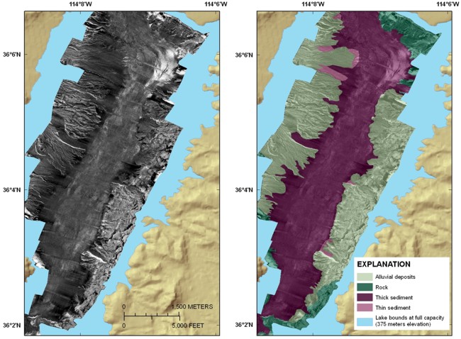
| Figure 8. Sidescan-sonar image (left panel) and sidescan interpretation (right panel) of Gregg Basin. Alluvial deposits are exposed along both sides of the basin, and the post-impoundment sediment covering its floor shows a gradual transition from moderate backscatter (medium-gray tones) at the northern end of the basin to low backscatter (dark-gray to black tones) at the southern end of the basin. This transition appears to be due to a progressive decrease in the amount of sand in this deposit toward the south. See figure 1 for the location of this figure. Click on figure for larger image. |