Skip past header information
USGS - science for a changing world

U.S. Geological Survey Open-File Report 2009-1151

Continuous Resistivity Profiling and Seismic-Reflection Data Collected in 2006 from the Potomac River Estuary, Virginia and Maryland


Skip past navigation menu to main text Title Page / List of Figures / Conversion Factors / Acronyms / Abstract / Introduction / Methods / Profile Previews / Summary / Data Catalog / Acknowledgments / References Cited / Glossary


Figure 4, photograph of electronic instrument.
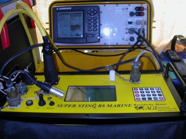
Figure 4. The Continuous Resistivity Profile (CRP) data acquisition system included the AGI SuperSting R8 Resistivity Meter (foreground) and the display screen of the Lowrance GPS-enabled fathometer. Photo by John Bratton, USGS-GD-WHCMSC.
Skip USGS links group

Accessibility FOIA Privacy Policies and Notices

Take Pride in America logo USAGov logo U.S. Department of the Interior | U.S. Geological Survey
End of USGS links group