U.S. Geological Survey Open-File Report 2009–1231
Integrated Multibeam and LIDAR Bathymetry Data Offshore of New London and Niantic, Connecticut
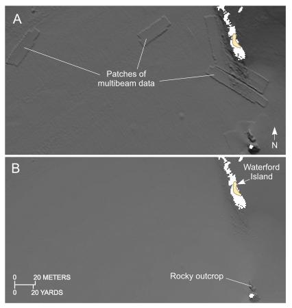 |
Figure 10. Clips from digital terrain models of the sea floor produced from the combined multibeam and LIDAR bathymetric data collected during National Oceanic and Atmospheric Administration surveys H11442 and H11225 off Niantic, Connecticut: (A) Unadjusted bathymetry showing artifacts caused by the multibeam dataset being shallower than the corresponding LIDAR bathymetry, and (B) image showing the same area of the sea floor after the multibeam dataset was adjusted 25 cm deeper. (Location of clips is shown in figure 3.) |

![]() U.S. Department of the Interior |
U.S. Geological Survey
U.S. Department of the Interior |
U.S. Geological Survey
URL: https://pubsdata.usgs.gov/pubs/of/2009/1231/html/fig10.html
Page Contact Information: Contact USGS
Page Last Modified: Wednesday, 07-Dec-2016 22:24:56 EST


