U.S. Geological Survey Open-File Report 2009–1231
Integrated Multibeam and LIDAR Bathymetry Data Offshore of New London and Niantic, Connecticut
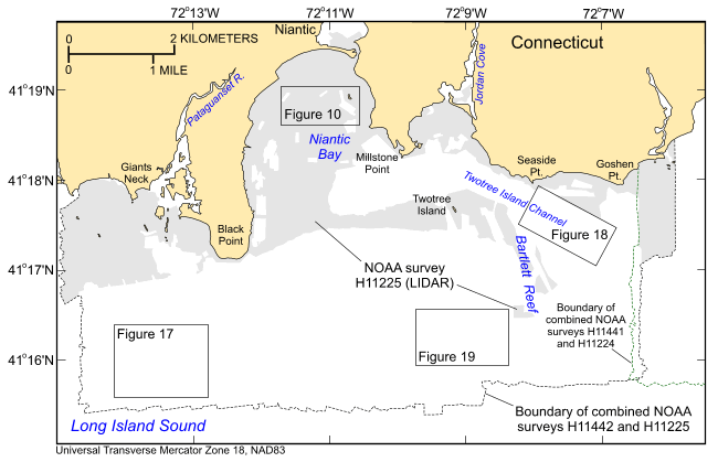 |
Figure 3. Index map showing boundaries of the Niantic survey areas (H11225 LIDAR: light gray shaded polygons; H11442 multibeam: dashed line), local physiographic features, and locations of figures 10, 17, 18, and 19. Green dashed line shows the boundary of the combined New London surveys. |

![]() U.S. Department of the Interior |
U.S. Geological Survey
U.S. Department of the Interior |
U.S. Geological Survey
URL: https://pubsdata.usgs.gov/pubs/of/2009/1231/html/fig3.html
Page Contact Information: Contact USGS
Page Last Modified: Wednesday, 07-Dec-2016 22:25:02 EST


