U.S. Geological Survey Open-File Report 2009–1231
Integrated Multibeam and LIDAR Bathymetry Data Offshore of New London and Niantic, Connecticut
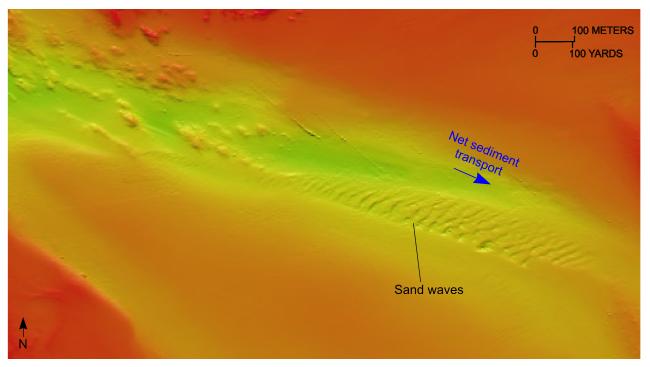 |
Figure 18. Detailed planar view of a sand-wave field at the eastern end of Twotree Island Channel in the combined multibeam and LIDAR bathymetric data from National Oceanic and Atmospheric Administration surveys H11442 and H11225. Sand-wave asymmetry indicates net eastward sediment transport. (Location of view is shown in figure 3.) |

![]() U.S. Department of the Interior |
U.S. Geological Survey
U.S. Department of the Interior |
U.S. Geological Survey
URL: https://pubsdata.usgs.gov/pubs/of/2009/1231/html/fig18.html
Page Contact Information: Contact USGS
Page Last Modified: Wednesday, 07-Dec-2016 22:25:00 EST


