Skip past header information
USGS - science for a changing world

U.S. Geological Survey Open-File Report 2010-1094

Continuous Resistivity Profiling Data from the Corsica River Estuary, Maryland


Skip past navigation menu to main text Title Page / List of Figures / Conversion Factors / Acronyms / Abstract / Introduction / Methods / Profile Previews / Summary / Data Catalog / Acknowledgments / References Cited / Glossary


Figure 3, photograph of CRP acquisition equipment in the boat.
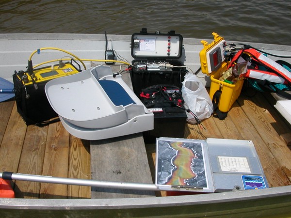
Figure 3. Continuous resistivity profile (CRP) data acquisition system in the survey boat. The yellow box to the left is the AGI SuperSting R8 Resistivity Meter, the black box in the middle manages the battery power to the system, and the yellow box to the right contains the Lowrance GPS-enabled fathometer. Photo by John Bratton, NOAA.
Skip USGS links group

Accessibility FOIA Privacy Policies and Notices

Take Pride in America logo USAGov logo U.S. Department of the Interior | U.S. Geological Survey
End of USGS links group