U.S. Geological Survey Open-File Report 2010-1094
Continuous Resistivity Profiling Data from the Corsica River Estuary, Maryland
This report contains Geographic Information System (GIS) data in vector and raster format. The vector data are available in Environmental Systems Research Institute (ESRI) shapefile format. Shapefiles generally include *.shp, *.shx, and *.dbf files at a minimum. All of the data files also include the *.prj files, which contain the dataset projection information. The raster data are available in ESRI binary grid format and GeoTIFF format. For the sake of brevity, only the filename prefix has been included in the column 'Filename' listed below; extensions have been excluded. Clicking on the image in the 'View' column of GIS-compatible data will display a thumbnail image of the dataset. The files necessary to load each dataset into a compatible GIS have been compressed into a single WinZip file, along with FGDC-compliant metadata in text, FAQ, and HTML formats. The XML metadata format generated and viewable by ArcCatalog is also included in the WinZip file. In addition, the text, FAQ, and HTML versions of the metadata for each dataset have links provided below. These data files can be downloaded directly from the DVD or from the table below. In addition to the GIS data, this report also contains CRP data available in both raw and processed formats. Each line of data acquisition comprises multiple files as described in the Methods section of this report. For this reason, these data are organized by day of collection and are available as WinZip files for each day of data. The CRP tracklines can be hyperlinked to associated images within ArcGIS. Within the CRP tracklines shapefile, two text attributes, "hotlink" and "hlink2", can be utilized to hyperlink to the JPEG images of the resistivity profiles. The "hotlink" attribute points to the MATLAB JPEG image, while the "hlink2" attribute points to the long version of the EarthImager 2D JPEG image. The metadata for each trackline give further instruction on using the hyperlink feature. The handwritten data acquisition logs maintained during the survey were scanned and converted into the Portable Document Format (PDF). This PDF file is available from the table below. To download the data from the table below, right mouse click on the link in the 'Download' column. Select 'Save Target As...' to save a compressed WinZip file to the local hard drive. The download file size is indicated under the file name. Microsoft Windows, since the Millennium Edition, supports extracting zip files natively without additional third party software. Simply double-click on the file to begin the extraction wizard. In cases where WinZip is needed and not currently installed on the local system, go to WinZip (www.winzip.com) to download the latest version of the utility. When this report is accessed from the DVD, the top level of the report contains an ArcView 3.3 project file (ofr2010_1094.apr) and an ESRI ArcMap 9.2 map document (ofr2010_1094.mxd). These files contain the GIS-compatible data layers presented within this report. A free viewer, ArcExplorer, is available from ESRI (www.esri.com) if access to ESRI software or a compatible GIS data browser is unavailable. |
basemap (data/basemap/)
| Filename | Description | View | Metadata | Download |
|---|---|---|---|---|
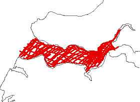
| QueenAnne | Polyline shapefile from the Maryland Department of Natural Resources and Maryland Geological Survey representing the recent Maryland Shoreline for Queen Anne County. (Geographic, NAD83) | 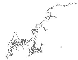 |
QueenAnne.zip 1.2 MB |
|
| combelev | ESRI binary grid of the combined elevation and bathymetric data in the Corsica River Estuary area (UTM, Zone 18, NAD83) | 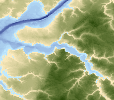 |
elevation.zip 0.396 MB |
|
| combhshd | ESRI binary grid of the hillshade relief created from the elevation grid of the Corsica River Estuary area (UTM, Zone 18, NAD83). | 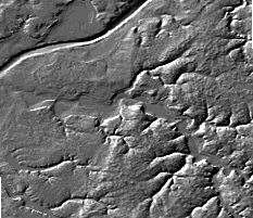 |
hillshade.zip 0.104 MB |
|
| corsica_clrhshd | Color-hillshade relief GeoTIFF created from the combined elevation and bathymetric data in the Corsica River Estuary area (UTM, Zone 18, NAD83). | 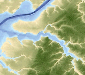 |
corsical_clrhshd.zip 0.3 MB |
|
| corsica_clrhshd_geo | Color-hillshade relief GeoTIFF created from the combined elevation and bathymetric data in the Corsica River Estuary area (Geographic, NAD83). |  |
corsica_clrhshd_geo.zip 0.36 MB |
navigation (data/navigation/)
| Filename | Description | View | Metadata | Download |
|---|---|---|---|---|
| resgpspnts_jd135 | Point shapefile of all the navigation fixes acquired with the CRP data on Julian day 135 (May 15, 2007). Only the processed lines are represented. (Geographic, NAD83) | 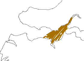 |
resgpspnts_jd135.zip 0.112 MB |
|
| resgpslns_jd135 | Polyline shapefile showing the tracklines of processed CRP profiles from Julian day 135 (May 15, 2007). (Geographic, NAD83) | 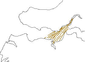 |
resgpslns_jd135.zip 0.048 MB |
|
| resgpspnts_jd136 | Point shapefile of all the navigation fixes acquired with the CRP data on Julian day 136 (May 16, 2007). (Geographic, NAD83) |  |
resgpspnts_jd136.zip 0.160 MB |
|
| resgpslns_jd136 | Polyline shapefile showing the tracklines of processed CRP profiles from Julian day 136 (May 16, 2007). (Geographic, NAD83) |  |
resgpslns_jd136.zip 0.060 MB |
|
| resgpspnts_jd137 | Point shapefile of all the navigation fixes acquired with the CRP data on Julian day 137 (May 17, 2007). (Geographic, NAD83) | 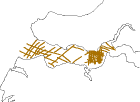 |
resgpspnts_jd137.zip 0.168 MB |
|
| resgpslns_jd137 | Polyline shapefile showing the tracklines of processed CRP profiles from Julian day137 (May 17, 2007). (Geographic, NAD83) | 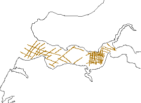 |
resgpslns_jd137.zip 0.056 MB |
CRP data (data/resistivity/)
| Raw CRP data (data/resistivity/raw_resis/): WinZip file contains the raw resistivity data collected by the AGI SuperSting system. |
| Processed CRP data (data/resistivity/proc_resis/): WinZip file includes the linearized STG file and accompanying DEP file, EarthImager processed files that used the measured water resistivity value when possible, and the MATLAB-generated profile images. |
| RES2DINV format CRP data (data/resistivity/res2dinv_format/): WinZip file includes the RES2DINV format files based on the linearized STG and DEP files. |
See the metadata for more details on the individual file types and how they were generated.
| Filename | Description | Metadata | Download |
|---|---|---|---|
| may15_raw | WinZip file containing the raw CRP data from May 15, 2007 (Julian day 135). | may15_raw.zip 1.00 MB |
|
| may16_raw | WinZip file containing the raw CRP data from May 16, 2007 (Julian day 136). | may16_raw.zip 1.32 MB |
|
| may17_raw | WinZip file containing the raw CRP data from May 17, 2007 (Julian day 137). | may17_raw.zip 0.79 MB |
|
| fixbathyraw | WinZip file containing the GPS navigation for the CRP data that needed supplemental bathymetry data to fill bathymetry gaps in the original dataset. | fixbathyraw.zip 0.48 MB |
|
| may15_proc | WinZip file containing the processed CRP data from May 15, 2007 (Julian day 135). | ||
| may16_proc | WinZip file containing the processed CRP data from May 16, 2007 (Julian day 136). | may16_proc.zip 22.3 MB |
|
| may17_proc | WinZip file containing the processed CRP data from May 17, 2007 (Julian day 137). | may17_proc.zip 20.9 MB |
|
| fixbathy | WinZip file containing the processed CRP data that needed supplemental bathymetry data to fill bathymetry gaps in the original dataset. | fixbathy.zip 7.24 MB |
|
mrg2007_Corsica_allxyz |
Point shapefile of all the processed resistivity data with data points in the water column removed. | mrg2007_Corsica_allxyz.zip 25.6 MB |
|
| may15_res2dinv | WinZip file containing the RES2DINV formatted CRP data from May 15, 2007 (Julian day 135). | may15_res2dinv.zip 0.5 MB |
|
| may16_res2dinv | WinZip file containing the RES2DINV formatted CRP data from May 16, 2007 (Julian day 136). | may16_res2dinv.zip 0.52 MB |
|
| may17_res2dinv | WinZip file containing the RES2DINV formatted CRP data from May 17, 2007 (Julian day 137). | may17_res2dinv.zip 0.42 MB |
|
| fixedbathy_res2dinv | WinZip file containing the RES2DINV formatted CRP data from May 15 and 16, 2007 (Julian days 135 and 136) that used supplemental bathymetry data to fill data gaps in the original dataset. | fixedbathy_res2dinv.zip 0.08 MB |
PDF logs (data/survey_log/)
| Filename | Description | Metadata | Download |
|---|---|---|---|
| FA07005_logbook | WinZip file of the PDF data acquisition log. | FA07005_logbook.zip 1.16 MB |