U.S. Geological Survey Open-File Report 2011–1149
Sea-Floor Geology of Long Island Sound North of Duck Pond Point, New York
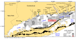
The U.S. Geological Survey (USGS) is working in cooperation with the National Oceanic and Atmospheric Administration (NOAA) and the Connecticut Department of Environmental Protection (CTDEP) to map the sea floor along the northeastern coast of the United States, including Long Island, Block Island, and Rhode Island Sounds and coastal Massachuestts. Multibeam echosounder (MBES) data obtained during NOAA hydrographic survey H11999 and sediment and photographic data acquired during USGS cruises 2010-010-FA and 2010-015-FA are used collectively to interpret the surficial geology of the sea floor in an area of Long Island Sound to the north of Duck Pond Point, New York (fig. 1). This report covers an area of 105.5 square kilometers (km²) where MBES data were obtained during October 2008. Sediment samples, bottom photographs, and video from 23 stations were acquired in April and May 2010. The purpose of this report is to (1) release geographic information system (GIS) data and (2) discuss the sediment types and sea-floor features found within the study area in order to better understand the sea-floor processes occurring in this part of Long Island Sound. GIS bathymetric data consist of ArcRaster grids and GeoTIFF imagery as well as Environmental Systems Research Institute (ESRI) shapefiles of sediment-sample and bottom-photograph locations and interpretations. These data are useful as basemaps for future studies of benthic habitats and for resource management. |