U.S. Geological Survey Open-File Report 2011–1222
Sea-Floor Geology and Sedimentary Processes in the Vicinity of Cross Rip Channel, Nantucket Sound, Offshore Southeastern Massachusetts
 |
||
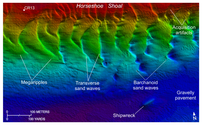
Figure 23. Detailed planar view of the bathymetric data collected during National Oceanic and Atmospheric Administration survey H12007 showing the southern flank of Horseshoe Shoal and the location of station CR13. Note that megaripples are common on the westward-facing stoss slopes of the sand waves; both transverse and barchanoid sand-wave morphologies are present; and the seabed just east of the shipwreck is relatively smooth, indicating scour. Location of view is shown in figure 19. | ||


