Skip past header information
USGS - science for a changing world
NOAA Logo with link to NOAA Home Page.Massachusetts CZM Logo with link to MA CZM Home Page.  

U.S. Geological Survey Open-File Report 2011–1222

Sea-Floor Geology and Sedimentary Processes in the Vicinity of Cross Rip Channel, Nantucket Sound, Offshore Southeastern Massachusetts


Skip past contents information

Title | List of Figures | Conversion Factors | Abstract | Introduction | Setting | Methods | Bathymetry | Sediment Distribution | Bottom Photography | GIS Data Catalog | Summary | Acknowledgments | References | Contacts


Figure 19. A map showing locations of figures.

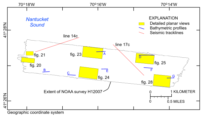
Figure 19. Locations of detailed planar views of the digital terrain model (yellow polygons), Uniboom seismic-reflection profiles (red lines) shown in figures 3 and 4, and bathymetric profiles of bedform morphology (blue lines) shown in figures 26, 27, and 29.

Skip USGS links group

Accessibility FOIA Privacy Policies and Notices

Take Pride in America logo USAGov logo U.S. Department of the Interior | U.S. Geological Survey
End of USGS links group