U.S. Geological Survey Open-File Report 2011–1222
Sea-Floor Geology and Sedimentary Processes in the Vicinity of Cross Rip Channel, Nantucket Sound, Offshore Southeastern Massachusetts
 |
||
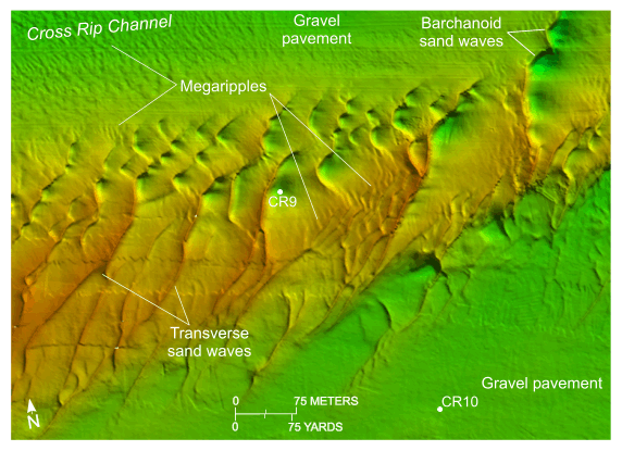
Figure 24. Detailed planar view of the bathymetric data collected during National Oceanic and Atmospheric Administration survey H12007 extending across the eastern part of Cross Rip Shoal and the locations of stations CR9 and CR10. Note that megaripples are common on the floor of Cross Rip Channel and on the stoss slopes of the sand waves; the symmetry of the sand waves is different on the northern flank, crest, and southern flank of the shoal; and scour has produced deep troughs in the lee of the barchanoid sand waves. Location of view is shown in figure 19. | ||


