U.S. Geological Survey Open-File Report 2011–1222
Sea-Floor Geology and Sedimentary Processes in the Vicinity of Cross Rip Channel, Nantucket Sound, Offshore Southeastern Massachusetts
 |
||
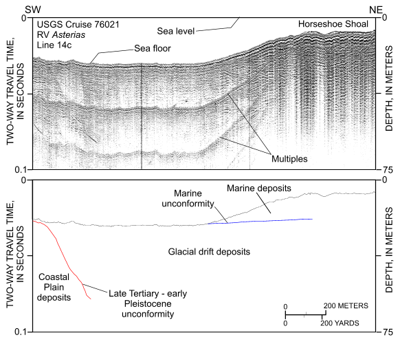
Figure 3. Segment of Uniboom seismic-reflection profile collected across the northwestern part of the study area (RV Asterias 76021, line 14c; O'Hara and Oldale, 1987). Profile reveals that (1) the stratigraphic section is composed of Coastal Plain, glacial drift, and marine deposits; (2) glacial drift is exposed in this part of the channel between Horseshoe and Cross Rip Shoals; and (3) Horseshoe Shoal is composed of Holocene marine deposits. Location of seismic profile is shown in figure 20. | ||


