Skip past header information
USGS - science for a changing world
NOAA Logo with link to NOAA Home Page.Massachusetts CZM Logo with link to MA CZM Home Page.  

U.S. Geological Survey Open-File Report 2011–1222

Sea-Floor Geology and Sedimentary Processes in the Vicinity of Cross Rip Channel, Nantucket Sound, Offshore Southeastern Massachusetts


Skip past contents information

Title | List of Figures | Conversion Factors | Abstract | Introduction | Setting | Methods | Bathymetry | Sediment Distribution | Bottom Photography | GIS Data Catalog | Summary | Acknowledgments | References | Contacts


Figure 31. Two photographs of shell beds in the study area.

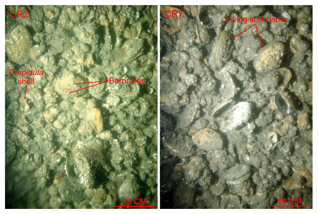
Figure 31. Bottom photographs from stations CR2 and CR7 showing the shell beds that cover the sea floor along the axis of Cross Rip Channel. Note that Crepidula and surf clam valves make up the majority of the shells, the shells are commonly encrusted with barnacles, and some of the surf clams are alive. Station locations are shown in figures 15 and 30.

Skip USGS links group

Accessibility FOIA Privacy Policies and Notices

Take Pride in America logo USAGov logo U.S. Department of the Interior | U.S. Geological Survey
End of USGS links group