Skip past header information
USGS - science for a changing world
NOAA Logo with link to NOAA Home Page.Massachusetts CZM Logo with link to MA CZM Home Page.  

U.S. Geological Survey Open-File Report 2011–1222

Sea-Floor Geology and Sedimentary Processes in the Vicinity of Cross Rip Channel, Nantucket Sound, Offshore Southeastern Massachusetts


Skip past contents information

Title | List of Figures | Conversion Factors | Abstract | Introduction | Setting | Methods | Bathymetry | Sediment Distribution | Bottom Photography | GIS Data Catalog | Summary | Acknowledgments | References | Contacts


Figure 32. Two photographs of gravelly sediment.

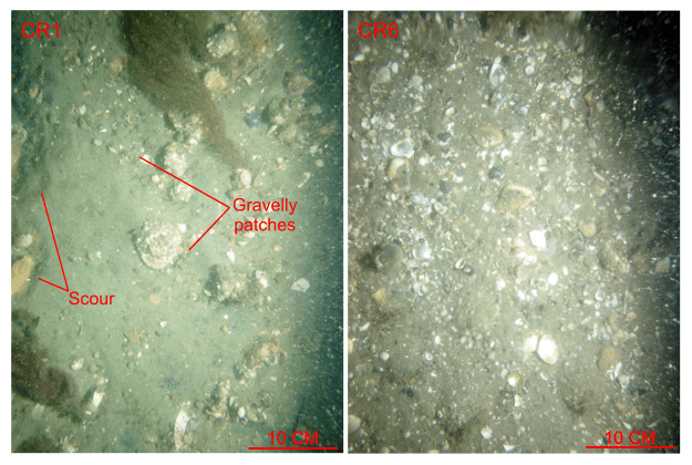
Figure 32. Bottom photographs from stations CR1 and CR6 showing the gravelly sediment that covers the sea floor along the sides of Cross Rip Channel. Note the patchy distribution of the gravel, slight scour depressions adjacent to the larger obstructions, and the ubiquitous presence of shell debris. Station locations are shown in figures 15 and 30.

Skip USGS links group

Accessibility FOIA Privacy Policies and Notices

Take Pride in America logo USAGov logo U.S. Department of the Interior | U.S. Geological Survey
End of USGS links group