Skip past header information
USGS - science for a changing world
NOAA Logo with link to NOAA Home Page.Massachusetts CZM Logo with link to MA CZM Home Page.  

U.S. Geological Survey Open-File Report 2011–1222

Sea-Floor Geology and Sedimentary Processes in the Vicinity of Cross Rip Channel, Nantucket Sound, Offshore Southeastern Massachusetts


Skip past contents information

Title | List of Figures | Conversion Factors | Abstract | Introduction | Setting | Methods | Bathymetry | Sediment Distribution | Bottom Photography | GIS Data Catalog | Summary | Acknowledgments | References | Contacts


Figure 33. Two photographs of the flat current-swept sea floor.

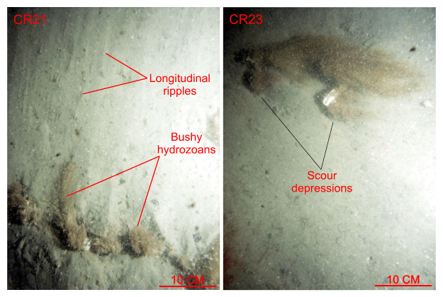
Figure 33. Bottom photographs from stations CR21 and CR23 showing the flat, current-swept appearance of the sea floor in some areas southeast of Cross Rip Shoal. Note the presence of faint longitudinal ripples, scour features, and bushy hydrozoans. Station locations are shown in figures 15 and 30.

Skip USGS links group

Accessibility FOIA Privacy Policies and Notices

Take Pride in America logo USAGov logo U.S. Department of the Interior | U.S. Geological Survey
End of USGS links group