U.S. Geological Survey Open-File Report 2011–1222
Sea-Floor Geology and Sedimentary Processes in the Vicinity of Cross Rip Channel, Nantucket Sound, Offshore Southeastern Massachusetts
 |
||
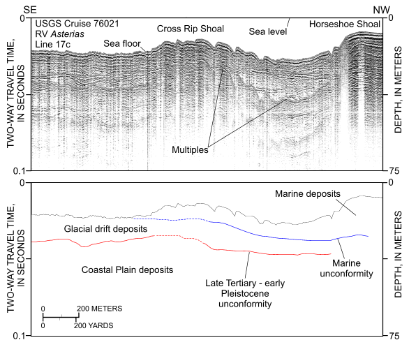
Figure 4. Segment of Uniboom seismic-reflection profile collected across the eastern extension of Cross Rip Shoal (RV Asterias 76021, line 17c; O'Hara and Oldale, 1987). Profile shows that (1) marine sediments thicken eastward on the floor of the channel between Horseshoe and Cross Rip Shoals, but are thin or absent south of Cross Rip Shoal; and (2) Cross Rip Shoal is composed of Holocene marine deposits. Location of seismic profile is shown in figure 20. | ||


