Open-File Report 2012-1258
High-Resolution Swath Interferometric Data Collected within Muskeget Channel, Massachusetts
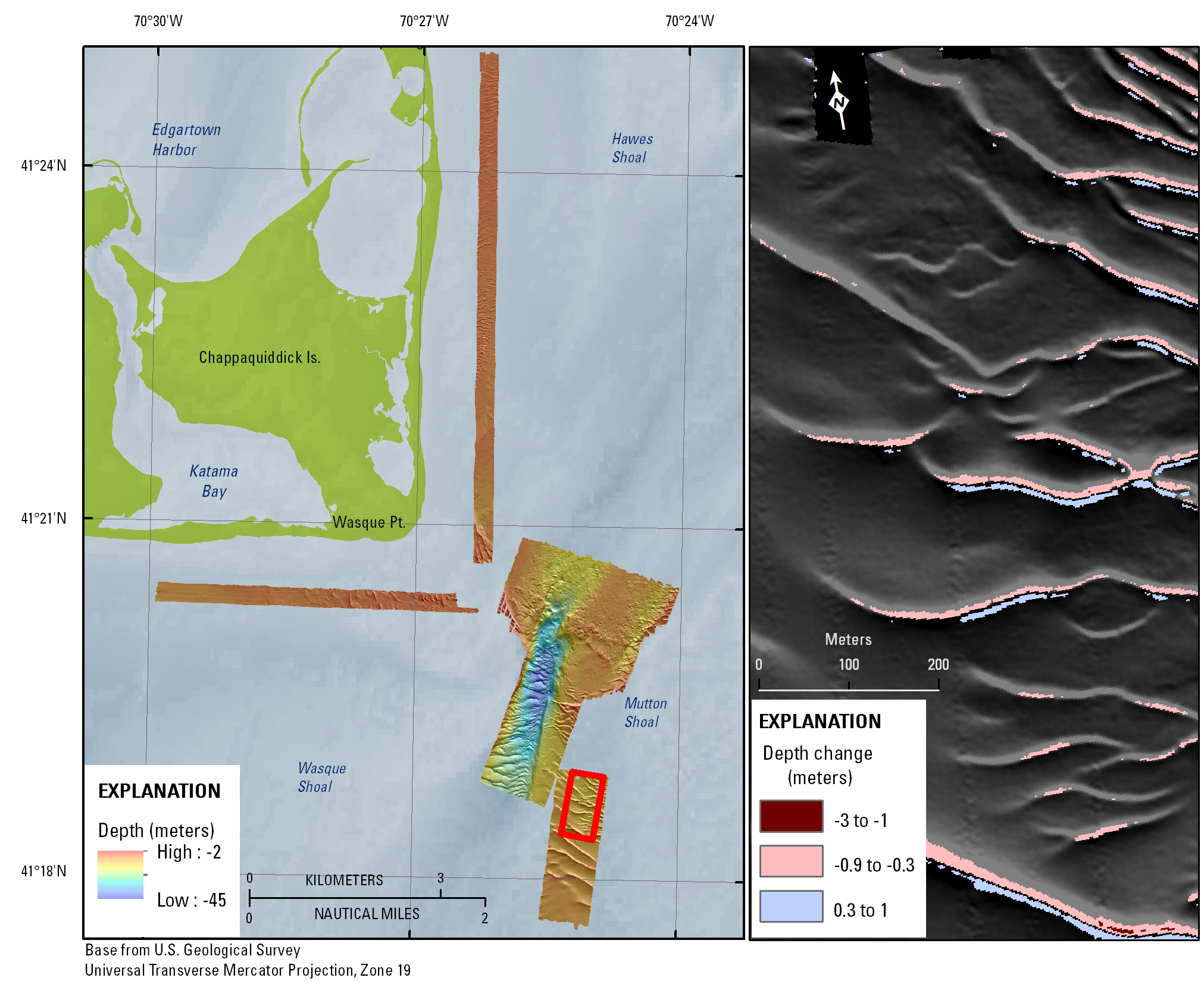
Figure 6. Map showing shaded-relief bathymetry collected within the vicinity of Muskeget Channel, Massachusetts, during a survey conducted in October 2010. Inset map is showing the change in bathymetry for a select area between Survey 1 in October 2010 and Survey 2 in November 2010. Pink and red tones indicate erosion and blue tones indicate deposition. Gray areas (hillshaded) are within ±30 centimeters and below instrument accuracy. Bedform migration is between 10 and 15 meters within the inset area, and net sediment transport is to the south. Is., Island; Pt., Point.

![]() U.S. Department of the Interior |
U.S. Geological Survey
U.S. Department of the Interior |
U.S. Geological Survey
URL: http://pubsdata.usgs.gov/pubs/of/2012/1258/html/imagepages/ofr2012-1258_Figure6.html
Page Contact Information: GS Pubs Web Contact
Page Last Modified: Monday, 02-Jun-2014 14:21:23 EDT
