|
This appendix describes the data collected for this project, the location of the data, and how to access the data.
Data Format and Projection
All vector data are delivered as Esri shapefiles in the geographic coordinate system (WGS 84). The raster data are in GeoTIFF and Esri grid formats in Universal Transverse Mercator (UTM), Zone 19N, WGS 84 projection.
All spatial data are distributed with Federal Geographic Data Committee (FGDC) compliant metadata in four formats—extensible markup language (XML), text (TXT), hypertext markup language (HTML), and frequently asked questions HTML (FAQ). Esri ArcCatalog 9.x can also be used to examine the metadata in a variety of additional formats.
Data Access
The complete datasets from this project can be accessed in the following ways, depending on available software:
- With ArcGIS 9.3.1 or later, all shapefile and raster data can be viewed and manipulated, although the Spatial Analyst extension will be required to fully examine and work with the Esri grids. Download the GIS_catalog.zip file (585 megabytes) to a computer and open the ArcMap document 2012_1258.mxd. This map document has all the data layers loaded in the table of contents and uses relative links.
- Without any geographic information system (GIS) software, view the data through ArcReader, a free mapping application distributed by Esri for Windows, Linux, and Unix operating systems. Download ArcReader from the Esri Web site (http://www.esri.com/software/arcgis/arcreader/download.html) and follow the directions for downloading and installing the free software. Once ArcReader is installed, all the data can be viewed by opening the published map file (PMF) named 2012_1258.pmf, which was created in ArcMap version 9.3.1.
Data Organization
The data are organized in folders in the zip file. Data layers can be downloaded individually by using the table below or collectively as the GIS_catalog.zip file.
 GIS_catalog GIS_catalog
The following is a listing of selected contents of the GIS_catalog.zip file:
2012_1258.mxd.—ArcGIS 9.3.1 map document with all data loaded in the ArcMap table of contents.
2012_1258.pmf.—Esri ArcReader (created with Esri ArcGIS Publisher 9.3.1) map document for use with free ArcReader software. Download ArcReader at http://www.esri.com/software/arcgis/arcreader/download.html.
basemap
MAGIS_25K_land.shp– Outline of the Commonwealth of Massachusetts (1:25,000)
bathy
- Survey1
- survey1_2m - Grid: Bathymetry of Survey 1 (October 2010) at 2.0-meter resolution.
- Survey2
- survey2_2m - Grid: Bathymetry of Survey 2 (November 2010) at 2.0-meter resolution.
- Survey1_hs.tif - Image: Hillshade relief image at 2.0-m resolution for Survey 1 (October 2010)
- Survey2_hs.tif -Image: Hillshade relief image at 2.0-m resolution for Survey 2 (November 2010)
hypack
- JD285: Raw HYPACK navigation for Survey 1, Julian Day 285 (October 12, 2010) in text format.
- JD286: Raw HYPACK navigation for Survey 1, Julian Day 286 (October 13, 2010) in text format.
- JD287: Raw HYPACK navigation for Survey 1, Julian Day 287 (October 14, 2010) in text format.
- JD292: Raw HYPACK navigation for Survey 1, Julian Day 292 (October 19, 2010) in text format.
- JD320: Raw HYPACK navigation for Survey 2, Julian Day 320 (November 16, 2010) in text format.
backscatter
- muskeget_swath.tif – GeoTIFF: 24-bit backscatter mosaic image at 1.0-m resolution.
svps
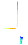
- XYsvp_locs.shp – Shapefile: sound velocity profile locations for surveys 2010-072-FA
tracklines
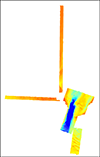
- tracklines_2010_072_FA.shp – Shapefile: Swath interferometric tracklines from surveys 2010-072-FA
Map documents:
2012_1258.mxd.—ArcGIS 9.3.1 map document with all data loaded in the ArcMap table of contents.
2012_1258.pmf.—Esri ArcReader (created with Esri ArcGIS Publisher 9.3.1) map document for use with free ArcReader software. Download ArcReader at http://www.esri.com/software/arcgis/arcreader/download.html.
Data Preview
To download raster and vector data, right click on the link within the 'transfer file' column in the tables below. 'Save Target As...' to save a compressed ZIP file to the local hard drive.
Raster Data.—The primary coordinate system for the raster data is WGS84 UTM Zone 19. The link in the "Download" column provides access to a compressed ZIP file, which contains the raster data.
Raster Layer (metadata) |
Description |
Preview |
Download file
(size) |
| survey1_2m |
2-m bathymetric grid for Survey 1 |
|
Grid
(10 MB) |
| survey_2m |
2-m bathymetric grid for Survey 2 |
|
Grid
(4 MB) |
| survey1_hs |
2-m bathymetric hillshaded relief image for Survey 1 |
|
GeoTIFF
(2.6 MB) |
| survey2_hs |
2-m bathymetric hillshaded relief image for Survey 2 |
|
GeoTIFF
(1 MB) |
muskeget_swath |
1-m backscatter mosaic image for Survey 1 |

|
GeoTIFF
(12.3 MB) |
Image Data.—The link in the "Download" column provides access to a compressed zip file, which contains PNG format images.
Navigation Data.—The link in the "Download" column provides access to a compressed zip-file, which contains the navigation files.
|