Skip past header information
USGS - science for a changing world

Open-File Report 2014-1221


Geological Sampling Data and Benthic Biota Classification: Buzzards Bay and Vineyard Sound, Massachusetts


Bottom Photograph Gallery - September 10, 2010 - 12:00 to 24:00 UTC


return to the Main Photo Index Page  
   
Go to the previous page of photos Go to the next page of photos

Image of seabed - photo.
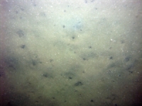
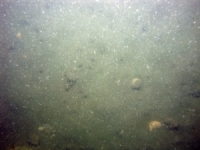
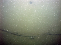
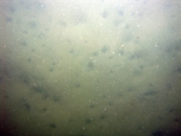
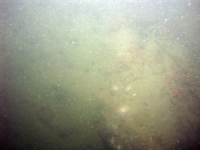
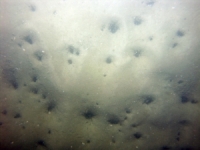
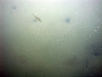
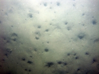
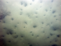
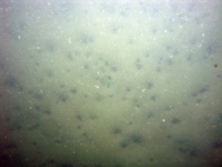
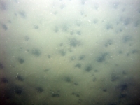
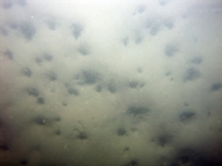
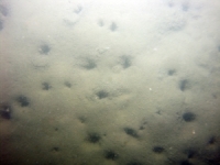
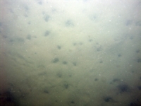
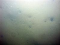
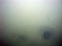
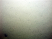
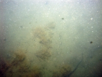
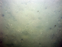
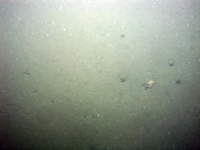
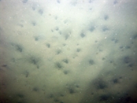
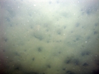
d2_PICT0726.JPG
Station # 067
Lat 41.517958
Long -70.890437
Time (UTC) 12:18:40
    Nearest Sediment Sample Info:
    • Classification = CLAYEY SILT
    • Station Number = 067
    • Distance = 297 meters
Image of seabed - photo.
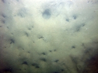
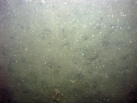
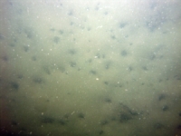
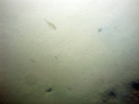
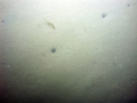
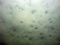
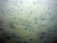
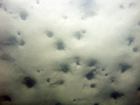
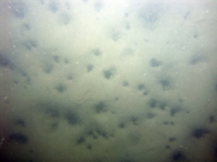
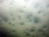
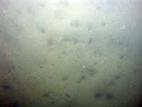
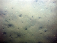
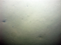
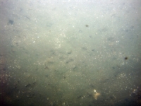
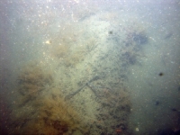
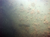
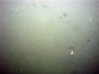
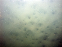
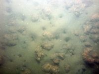
d2_PICT0727.JPG
Station # 067
Lat 41.518107
Long -70.889428
Time (UTC) 12:21:23
    Nearest Sediment Sample Info:
    • Classification = CLAYEY SILT
    • Station Number = 067
    • Distance = 211.2 meters
Image of seabed - photo.
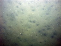
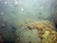
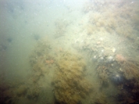
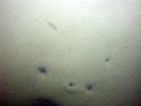
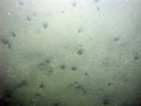
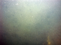
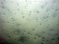
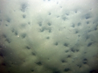
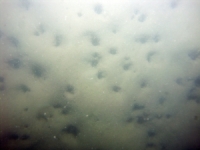
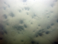
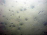
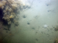
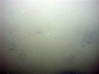
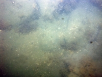
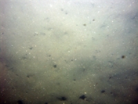
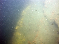
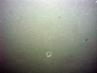
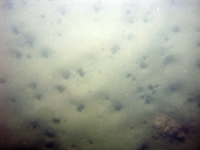
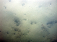
d2_PICT0728.JPG
Station # 067
Lat 41.518167
Long -70.888935
Time (UTC) 12:22:37
    Nearest Sediment Sample Info:
    • Classification = CLAYEY SILT
    • Station Number = 067
    • Distance = 169.5 meters
Image of seabed - photo.
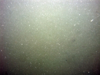
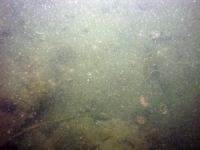
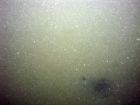
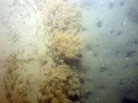
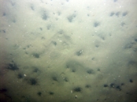
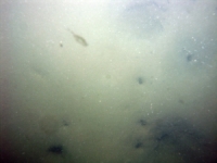
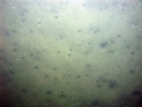
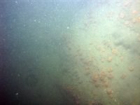
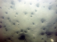
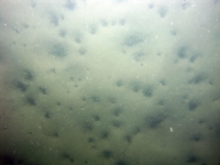
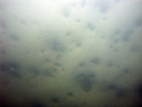
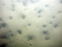
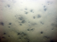
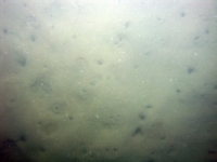
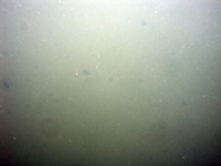
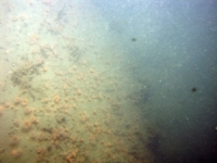
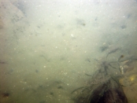
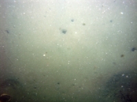
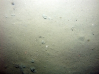
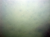
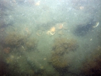
d2_PICT0729.JPG
Station # 067
Lat 41.518308
Long -70.887865
Time (UTC) 12:25:11
    Nearest Sediment Sample Info:
    • Classification = CLAYEY SILT
    • Station Number = 067
    • Distance = 78.9 meters
Image of seabed - photo.
d2_PICT0730.JPG
Station # 067
Lat 41.518417
Long -70.887035
Time (UTC) 12:27:15
    Nearest Sediment Sample Info:
    • Classification = CLAYEY SILT
    • Station Number = 067
    • Distance = 8.5 meters
Image of seabed - photo.
d2_PICT0731.JPG
Station # 068
Lat 41.518370
Long -70.877748
Time (UTC) 12:37:35
    Nearest Sediment Sample Info:
    • Classification = SANDY SILT
    • Station Number = 068
    • Distance = 215.8 meters
Image of seabed - photo.
d2_PICT0732.JPG
Station # 068
Lat 41.518353
Long -70.877375
Time (UTC) 12:38:30
    Nearest Sediment Sample Info:
    • Classification = SANDY SILT
    • Station Number = 068
    • Distance = 184.7 meters
Image of seabed - photo.
d2_PICT0733.JPG
Station # 068
Lat 41.518288
Long -70.876635
Time (UTC) 12:40:19
    Nearest Sediment Sample Info:
    • Classification = SANDY SILT
    • Station Number = 068
    • Distance = 122.6 meters
Image of seabed - photo.
d2_PICT0734.JPG
Station # 068
Lat 41.518213
Long -70.875922
Time (UTC) 12:42:01
    Nearest Sediment Sample Info:
    • Classification = SANDY SILT
    • Station Number = 068
    • Distance = 62.5 meters
Image of seabed - photo.
d2_PICT0735.JPG
Station # 069
Lat 41.517805
Long -70.857338
Time (UTC) 12:55:38
    Nearest Sediment Sample Info:
    • Classification = SAND
    • Station Number = 069
    • Distance = 211.2 meters
Image of seabed - photo.
d2_PICT0736.JPG
Station # 069
Lat 41.517717
Long -70.857035
Time (UTC) 12:56:25
    Nearest Sediment Sample Info:
    • Classification = SAND
    • Station Number = 069
    • Distance = 184.2 meters
Image of seabed - photo.
d2_PICT0737.JPG
Station # 069
Lat 41.517637
Long -70.856782
Time (UTC) 12:57:03
    Nearest Sediment Sample Info:
    • Classification = SAND
    • Station Number = 069
    • Distance = 161.3 meters
Image of seabed - photo.
d2_PICT0738.JPG
Station # 069
Lat 41.517485
Long -70.856400
Time (UTC) 12:58:04
    Nearest Sediment Sample Info:
    • Classification = SAND
    • Station Number = 069
    • Distance = 125.3 meters
Image of seabed - photo.
d2_PICT0739.JPG
Station # 070
Lat 41.519253
Long -70.852167
Time (UTC) 13:14:41
    Nearest Sediment Sample Info:
    • Classification = SANDY SILT
    • Station Number = 070
    • Distance = 161.4 meters
Image of seabed - photo.
d2_PICT0740.JPG
Station # 070
Lat 41.519112
Long -70.851523
Time (UTC) 13:16:11
    Nearest Sediment Sample Info:
    • Classification = SANDY SILT
    • Station Number = 070
    • Distance = 106.5 meters
Image of seabed - photo.
d2_PICT0741.JPG
Station # 071a
Lat 41.511912
Long -70.838538
Time (UTC) 13:32:30
    Nearest Sediment Sample Info:
    • Classification = CLAYEY SILT
    • Station Number = 072
    • Distance = 165.4 meters
Image of seabed - photo.
d2_PICT0742.JPG
Station # 071a
Lat 41.511692
Long -70.838107
Time (UTC) 13:33:41
    Nearest Sediment Sample Info:
    • Classification = CLAYEY SILT
    • Station Number = 072
    • Distance = 208.9 meters
Image of seabed - photo.
d2_PICT0743.JPG
Station # 071a
Lat 41.511467
Long -70.837770
Time (UTC) 13:34:42
    Nearest Sediment Sample Info:
    • Classification = CLAYEY SILT
    • Station Number = 072
    • Distance = 246.3 meters
Image of seabed - photo.
d2_PICT0744.JPG
Station # 071a
Lat 41.511322
Long -70.837575
Time (UTC) 13:35:21
    Nearest Sediment Sample Info:
    • Classification = CLAYEY SILT
    • Station Number = 072
    • Distance = 269 meters
Image of seabed - photo.
d2_PICT0745.JPG
Station # 071a
Lat 41.510972
Long -70.837073
Time (UTC) 13:37:07
    Nearest Sediment Sample Info:
    • Classification = SAND SILT CLAY
    • Station Number = 071
    • Distance = 324.8 meters
Image of seabed - photo.
d2_PICT0746.JPG
Station # 071a
Lat 41.510662
Long -70.836658
Time (UTC) 13:38:38
    Nearest Sediment Sample Info:
    • Classification = SAND SILT CLAY
    • Station Number = 071
    • Distance = 276 meters
Image of seabed - photo.
d2_PICT0747.JPG
Station # 071a
Lat 41.510372
Long -70.836247
Time (UTC) 13:40:03
    Nearest Sediment Sample Info:
    • Classification = SAND SILT CLAY
    • Station Number = 071
    • Distance = 228.9 meters
Image of seabed - photo.
d2_PICT0748.JPG
Station # 071a
Lat 41.510102
Long -70.835760
Time (UTC) 13:41:29
    Nearest Sediment Sample Info:
    • Classification = SAND SILT CLAY
    • Station Number = 071
    • Distance = 178.9 meters
Image of seabed - photo.
d2_PICT0749.JPG
Station # 071a
Lat 41.509138
Long -70.834473
Time (UTC) 13:45:46
    Nearest Sediment Sample Info:
    • Classification = SAND SILT CLAY
    • Station Number = 071
    • Distance = 27.2 meters
Image of seabed - photo.
d2_PICT0750.JPG
Station # 072
Lat 41.513418
Long -70.840687
Time (UTC) 14:06:44
    Nearest Sediment Sample Info:
    • Classification = CLAYEY SILT
    • Station Number = 072
    • Distance = 83.3 meters
Image of seabed - photo.
d2_PICT0751.JPG
Station # 072
Lat 41.513287
Long -70.840582
Time (UTC) 14:07:14
    Nearest Sediment Sample Info:
    • Classification = CLAYEY SILT
    • Station Number = 072
    • Distance = 66.3 meters
Image of seabed - photo.
d2_PICT0752.JPG
Station # 072
Lat 41.513178
Long -70.840490
Time (UTC) 14:07:38
    Nearest Sediment Sample Info:
    • Classification = CLAYEY SILT
    • Station Number = 072
    • Distance = 52 meters
Image of seabed - photo.
d2_PICT0753.JPG
Station # 072
Lat 41.512820
Long -70.840163
Time (UTC) 14:08:58
    Nearest Sediment Sample Info:
    • Classification = CLAYEY SILT
    • Station Number = 072
    • Distance = 3.8 meters
Image of seabed - photo.
d2_PICT0754.JPG
Station # 073
Lat 41.529688
Long -70.837750
Time (UTC) 14:28:57
    Nearest Sediment Sample Info:
    • Classification = SAND
    • Station Number = 073
    • Distance = 191.6 meters
Image of seabed - photo.
d2_PICT0755.JPG
Station # 073
Lat 41.529580
Long -70.837755
Time (UTC) 14:29:20
    Nearest Sediment Sample Info:
    • Classification = SAND
    • Station Number = 073
    • Distance = 180.3 meters
Image of seabed - photo.
d2_PICT0756.JPG
Station # 073
Lat 41.529492
Long -70.837743
Time (UTC) 14:29:39
    Nearest Sediment Sample Info:
    • Classification = SAND
    • Station Number = 073
    • Distance = 170.7 meters
Image of seabed - photo.
d2_PICT0757.JPG
Station # 073
Lat 41.529070
Long -70.837557
Time (UTC) 14:31:22
    Nearest Sediment Sample Info:
    • Classification = SAND
    • Station Number = 073
    • Distance = 121.4 meters
Image of seabed - photo.
d2_PICT0758.JPG
Station # 073
Lat 41.528925
Long -70.837492
Time (UTC) 14:31:57
    Nearest Sediment Sample Info:
    • Classification = SAND
    • Station Number = 073
    • Distance = 104.4 meters
Image of seabed - photo.
d2_PICT0759.JPG
Station # 073
Lat 41.528260
Long -70.837252
Time (UTC) 14:34:34
    Nearest Sediment Sample Info:
    • Classification = SAND
    • Station Number = 073
    • Distance = 28.5 meters
Image of seabed - photo.
d2_PICT0760.JPG
Station # 073
Lat 41.528170
Long -70.837170
Time (UTC) 14:35:03
    Nearest Sediment Sample Info:
    • Classification = SAND
    • Station Number = 073
    • Distance = 16.5 meters
Image of seabed - photo.
d2_PICT0761.JPG
Station # 074a
Lat 41.531108
Long -70.835222
Time (UTC) 14:45:27
    Nearest Sediment Sample Info:
    • Classification = SAND
    • Station Number = 075
    • Distance = 289.9 meters
Image of seabed - photo.
d2_PICT0762.JPG
Station # 074a
Lat 41.531117
Long -70.835157
Time (UTC) 14:46:07
    Nearest Sediment Sample Info:
    • Classification = SAND
    • Station Number = 075
    • Distance = 287.5 meters
Image of seabed - photo.
d2_PICT0763.JPG
Station # 074a
Lat 41.531098
Long -70.835082
Time (UTC) 14:46:27
    Nearest Sediment Sample Info:
    • Classification = SAND
    • Station Number = 075
    • Distance = 282.1 meters
Image of seabed - photo.
d2_PICT0764.JPG
Station # 074a
Lat 41.531065
Long -70.835032
Time (UTC) 14:46:42
    Nearest Sediment Sample Info:
    • Classification = SAND
    • Station Number = 075
    • Distance = 276.8 meters
Image of seabed - photo.
d2_PICT0765.JPG
Station # 074a
Lat 41.530910
Long -70.834863
Time (UTC) 14:47:33
    Nearest Sediment Sample Info:
    • Classification = SAND
    • Station Number = 075
    • Distance = 254.6 meters
Image of seabed - photo.
d2_PICT0766.JPG
Station # 074a
Lat 41.530813
Long -70.834800
Time (UTC) 14:48:00
    Nearest Sediment Sample Info:
    • Classification = SAND
    • Station Number = 075
    • Distance = 242.7 meters
Image of seabed - photo.
d2_PICT0767.JPG
Station # 074a
Lat 41.530628
Long -70.834718
Time (UTC) 14:48:44
    Nearest Sediment Sample Info:
    • Classification = SAND
    • Station Number = 075
    • Distance = 222 meters
Image of seabed - photo.
d2_PICT0768.JPG
Station # 074a
Lat 41.530575
Long -70.834703
Time (UTC) 14:48:56
    Nearest Sediment Sample Info:
    • Classification = SAND
    • Station Number = 075
    • Distance = 216.5 meters
Image of seabed - photo.
d2_PICT0769.JPG
Station # 074a
Lat 41.530343
Long -70.834647
Time (UTC) 14:49:46
    Nearest Sediment Sample Info:
    • Classification = SAND
    • Station Number = 075
    • Distance = 193.4 meters
Image of seabed - photo.
d2_PICT0770.JPG
Station # 074a
Lat 41.530230
Long -70.834618
Time (UTC) 14:50:11
    Nearest Sediment Sample Info:
    • Classification = SAND
    • Station Number = 075
    • Distance = 182.4 meters
Image of seabed - photo.
d2_PICT0771.JPG
Station # 074a
Lat 41.530107
Long -70.834605
Time (UTC) 14:50:36
    Nearest Sediment Sample Info:
    • Classification = SAND
    • Station Number = 075
    • Distance = 171.7 meters
Image of seabed - photo.
d2_PICT0772.JPG
Station # 074a
Lat 41.529863
Long -70.834577
Time (UTC) 14:51:26
    Nearest Sediment Sample Info:
    • Classification = SAND
    • Station Number = 075
    • Distance = 151.9 meters
Image of seabed - photo.
d2_PICT0773.JPG
Station # 074a
Lat 41.529550
Long -70.834538
Time (UTC) 14:52:31
    Nearest Sediment Sample Info:
    • Classification = SAND
    • Station Number = 075
    • Distance = 130.2 meters
Image of seabed - photo.
d2_PICT0774.JPG
Station # 074a
Lat 41.529270
Long -70.834517
Time (UTC) 14:53:27
    Nearest Sediment Sample Info:
    • Classification = SAND
    • Station Number = 075
    • Distance = 117.5 meters
Image of seabed - photo.
d2_PICT0775.JPG
Station # 074a
Lat 41.528905
Long -70.834495
Time (UTC) 14:54:37
    Nearest Sediment Sample Info:
    • Classification = SAND
    • Station Number = 075
    • Distance = 112.7 meters
Image of seabed - photo.
d2_PICT0776.JPG
Station # 074a
Lat 41.528273
Long -70.834480
Time (UTC) 14:56:37
    Nearest Sediment Sample Info:
    • Classification = SAND
    • Station Number = 074
    • Distance = 119.3 meters
Image of seabed - photo.
d2_PICT0777.JPG
Station # 074a
Lat 41.527688
Long -70.834462
Time (UTC) 14:58:27
    Nearest Sediment Sample Info:
    • Classification = SAND
    • Station Number = 074
    • Distance = 54.3 meters
Image of seabed - photo.
d2_PICT0778.JPG
Station # 074a
Lat 41.527322
Long -70.834427
Time (UTC) 14:59:37
    Nearest Sediment Sample Info:
    • Classification = SAND
    • Station Number = 074
    • Distance = 13.6 meters
Image of seabed - photo.
d2_PICT0779.JPG
Station # 075
Lat 41.529010
Long -70.833150
Time (UTC) 15:12:44
    Nearest Sediment Sample Info:
    • Classification = SAND
    • Station Number = 075
    • Distance = 0.3 meters
Image of seabed - photo.
d2_PICT0780.JPG
Station # 075
Lat 41.529018
Long -70.833152
Time (UTC) 15:13:07
    Nearest Sediment Sample Info:
    • Classification = SAND
    • Station Number = 075
    • Distance = 0.7 meters
Image of seabed - photo.
d2_PICT0781.JPG
Station # 075
Lat 41.529012
Long -70.833135
Time (UTC) 15:13:57
    Nearest Sediment Sample Info:
    • Classification = SAND
    • Station Number = 075
    • Distance = 1.4 meters
Image of seabed - photo.
d2_PICT0782.JPG
Station # 075
Lat 41.529020
Long -70.833155
Time (UTC) 15:14:16
    Nearest Sediment Sample Info:
    • Classification = SAND
    • Station Number = 075
    • Distance = 0.9 meters
Image of seabed - photo.
d2_PICT0783.JPG
Station # 076
Lat 41.528762
Long -70.831762
Time (UTC) 15:28:31
    Nearest Sediment Sample Info:
    • Classification = CLAYEY SILT
    • Station Number = 076
    • Distance = 3 meters
Image of seabed - photo.
d2_PICT0784.JPG
Station # 076
Lat 41.528758
Long -70.831763
Time (UTC) 15:28:48
    Nearest Sediment Sample Info:
    • Classification = CLAYEY SILT
    • Station Number = 076
    • Distance = 2.6 meters
Image of seabed - photo.
d2_PICT0785.JPG
Station # 076
Lat 41.528742
Long -70.831765
Time (UTC) 15:29:24
    Nearest Sediment Sample Info:
    • Classification = CLAYEY SILT
    • Station Number = 076
    • Distance = 0.8 meters
Image of seabed - photo.
d2_PICT0786.JPG
Station # 076
Lat 41.528733
Long -70.831767
Time (UTC) 15:30:18
    Nearest Sediment Sample Info:
    • Classification = CLAYEY SILT
    • Station Number = 076
    • Distance = 0.2 meters
Image of seabed - photo.
d2_PICT0787.JPG
Station # 077
Lat 41.530652
Long -70.811423
Time (UTC) 15:49:27
    Nearest Sediment Sample Info:
    • Classification = CLAYEY SILT
    • Station Number = 077
    • Distance = 79.2 meters
Image of seabed - photo.
d2_PICT0788.JPG
Station # 077
Lat 41.530565
Long -70.811387
Time (UTC) 15:49:50
    Nearest Sediment Sample Info:
    • Classification = CLAYEY SILT
    • Station Number = 077
    • Distance = 69.3 meters
Image of seabed - photo.
d2_PICT0789.JPG
Station # 077
Lat 41.530470
Long -70.811355
Time (UTC) 15:50:14
    Nearest Sediment Sample Info:
    • Classification = CLAYEY SILT
    • Station Number = 077
    • Distance = 58.5 meters
Image of seabed - photo.
d2_PICT0790.JPG
Station # 077
Lat 41.530313
Long -70.811320
Time (UTC) 15:50:49
    Nearest Sediment Sample Info:
    • Classification = CLAYEY SILT
    • Station Number = 077
    • Distance = 40.9 meters
Image of seabed - photo.
d2_PICT0791.JPG
Station # 077
Lat 41.530192
Long -70.811305
Time (UTC) 15:51:15
    Nearest Sediment Sample Info:
    • Classification = CLAYEY SILT
    • Station Number = 077
    • Distance = 27.4 meters
Image of seabed - photo.
d2_PICT0792.JPG
Station # 077
Lat 41.530027
Long -70.811295
Time (UTC) 15:51:49
    Nearest Sediment Sample Info:
    • Classification = CLAYEY SILT
    • Station Number = 077
    • Distance = 9.1 meters
Image of seabed - photo.
d2_PICT0793.JPG
Station # 078
Lat 41.529452
Long -70.806578
Time (UTC) 16:04:10
    Nearest Sediment Sample Info:
    • Classification = CLAYEY SILT
    • Station Number = 078
    • Distance = 144.9 meters
Image of seabed - photo.
d2_PICT0794.JPG
Station # 078
Lat 41.529402
Long -70.806563
Time (UTC) 16:04:24
    Nearest Sediment Sample Info:
    • Classification = CLAYEY SILT
    • Station Number = 078
    • Distance = 139.3 meters
Image of seabed - photo.
d2_PICT0795.JPG
Station # 078
Lat 41.529325
Long -70.806542
Time (UTC) 16:04:43
    Nearest Sediment Sample Info:
    • Classification = CLAYEY SILT
    • Station Number = 078
    • Distance = 130.7 meters
Image of seabed - photo.
d2_PICT0796.JPG
Station # 078
Lat 41.529250
Long -70.806520
Time (UTC) 16:05:00
    Nearest Sediment Sample Info:
    • Classification = CLAYEY SILT
    • Station Number = 078
    • Distance = 122.4 meters
Image of seabed - photo.
d2_PICT0797.JPG
Station # 078
Lat 41.528882
Long -70.806468
Time (UTC) 16:06:15
    Nearest Sediment Sample Info:
    • Classification = CLAYEY SILT
    • Station Number = 078
    • Distance = 81.6 meters
Image of seabed - photo.
d2_PICT0798.JPG
Station # 078
Lat 41.528627
Long -70.806483
Time (UTC) 16:07:09
    Nearest Sediment Sample Info:
    • Classification = CLAYEY SILT
    • Station Number = 078
    • Distance = 53.3 meters
Image of seabed - photo.
d2_PICT0799.JPG
Station # 079
Lat 41.517928
Long -70.787847
Time (UTC) 16:30:06
    Nearest Sediment Sample Info:
    • Classification = CLAYEY SILT
    • Station Number = 079
    • Distance = 71.8 meters
Image of seabed - photo.
d2_PICT0800.JPG
Station # 079
Lat 41.517818
Long -70.787947
Time (UTC) 16:30:37
    Nearest Sediment Sample Info:
    • Classification = CLAYEY SILT
    • Station Number = 079
    • Distance = 57.2 meters
Image of seabed - photo.
d2_PICT0801.JPG
Station # 079
Lat 41.517727
Long -70.788000
Time (UTC) 16:30:59
    Nearest Sediment Sample Info:
    • Classification = CLAYEY SILT
    • Station Number = 079
    • Distance = 46.2 meters
Image of seabed - photo.
d2_PICT0802.JPG
Station # 079
Lat 41.517447
Long -70.788137
Time (UTC) 16:32:01
    Nearest Sediment Sample Info:
    • Classification = CLAYEY SILT
    • Station Number = 079
    • Distance = 13.2 meters
Image of seabed - photo.
d2_PICT0803.JPG
Station # 079
Lat 41.517388
Long -70.788168
Time (UTC) 16:32:16
    Nearest Sediment Sample Info:
    • Classification = CLAYEY SILT
    • Station Number = 079
    • Distance = 6.3 meters
Image of seabed - photo.
d2_PICT0804.JPG
Station # 080
Lat 41.511683
Long -70.781147
Time (UTC) 16:52:03
    Nearest Sediment Sample Info:
    • Classification = SANDY SILT
    • Station Number = 080
    • Distance = 1.6 meters
Image of seabed - photo.
d2_PICT0805.JPG
Station # 081
Lat 41.511345
Long -70.780950
Time (UTC) 17:01:18
    Nearest Sediment Sample Info:
    • Classification = SANDY SILT
    • Station Number = 080
    • Distance = 40.3 meters
Image of seabed - photo.
d2_PICT0806.JPG
Station # 081
Lat 41.511333
Long -70.780952
Time (UTC) 17:01:31
    Nearest Sediment Sample Info:
    • Classification = SANDY SILT
    • Station Number = 080
    • Distance = 41.4 meters
Image of seabed - photo.
d2_PICT0807.JPG
Station # 081
Lat 41.511287
Long -70.780925
Time (UTC) 17:01:52
    Nearest Sediment Sample Info:
    • Classification = SANDY SILT
    • Station Number = 080
    • Distance = 47 meters
Image of seabed - photo.
d2_PICT0808.JPG
Station # 081
Lat 41.511133
Long -70.780820
Time (UTC) 17:02:38
    Nearest Sediment Sample Info:
    • Classification = SILTY SAND
    • Station Number = 081
    • Distance = 41.8 meters
Image of seabed - photo.
d2_PICT0809.JPG
Station # 081
Lat 41.511027
Long -70.780783
Time (UTC) 17:03:11
    Nearest Sediment Sample Info:
    • Classification = SILTY SAND
    • Station Number = 081
    • Distance = 29.6 meters
Image of seabed - photo.
d2_PICT0810.JPG
Station # 081
Lat 41.510845
Long -70.780702
Time (UTC) 17:04:39
    Nearest Sediment Sample Info:
    • Classification = SILTY SAND
    • Station Number = 081
    • Distance = 8.3 meters
Image of seabed - photo.
d2_PICT0811.JPG
Station # 082
Lat 41.505843
Long -70.791630
Time (UTC) 17:25:28
    Nearest Sediment Sample Info:
    • Classification = CLAYEY SILT
    • Station Number = 082
    • Distance = 407.7 meters
Image of seabed - photo.
d2_PICT0812.JPG
Station # 082
Lat 41.505698
Long -70.791692
Time (UTC) 17:26:14
    Nearest Sediment Sample Info:
    • Classification = CLAYEY SILT
    • Station Number = 082
    • Distance = 390.9 meters
Image of seabed - photo.
d2_PICT0813.JPG
Station # 082
Lat 41.505572
Long -70.791745
Time (UTC) 17:26:52
    Nearest Sediment Sample Info:
    • Classification = CLAYEY SILT
    • Station Number = 082
    • Distance = 376.2 meters
Image of seabed - photo.
d2_PICT0814.JPG
Station # 082
Lat 41.505252
Long -70.791867
Time (UTC) 17:28:16
    Nearest Sediment Sample Info:
    • Classification = CLAYEY SILT
    • Station Number = 082
    • Distance = 339.3 meters
Image of seabed - photo.
d2_PICT0815.JPG
Station # 082
Lat 41.505158
Long -70.791893
Time (UTC) 17:28:38
    Nearest Sediment Sample Info:
    • Classification = CLAYEY SILT
    • Station Number = 082
    • Distance = 328.7 meters
Image of seabed - photo.
d2_PICT0816.JPG
Station # 082
Lat 41.505040
Long -70.791930
Time (UTC) 17:29:06
    Nearest Sediment Sample Info:
    • Classification = CLAYEY SILT
    • Station Number = 082
    • Distance = 315.2 meters
Image of seabed - photo.
d2_PICT0817.JPG
Station # 082
Lat 41.504725
Long -70.792038
Time (UTC) 17:30:23
    Nearest Sediment Sample Info:
    • Classification = CLAYEY SILT
    • Station Number = 082
    • Distance = 279.1 meters
Image of seabed - photo.
d2_PICT0818.JPG
Station # 082
Lat 41.504450
Long -70.792120
Time (UTC) 17:31:28
    Nearest Sediment Sample Info:
    • Classification = CLAYEY SILT
    • Station Number = 082
    • Distance = 247.8 meters
Image of seabed - photo.
d2_PICT0819.JPG
Station # 082
Lat 41.504385
Long -70.792142
Time (UTC) 17:31:44
    Nearest Sediment Sample Info:
    • Classification = CLAYEY SILT
    • Station Number = 082
    • Distance = 240.3 meters
Image of seabed - photo.
d2_PICT0820.JPG
Station # 082
Lat 41.504320
Long -70.792163
Time (UTC) 17:32:00
    Nearest Sediment Sample Info:
    • Classification = CLAYEY SILT
    • Station Number = 082
    • Distance = 232.9 meters
Image of seabed - photo.
d2_PICT0821.JPG
Station # 082
Lat 41.504105
Long -70.792238
Time (UTC) 17:32:53
    Nearest Sediment Sample Info:
    • Classification = CLAYEY SILT
    • Station Number = 082
    • Distance = 208.3 meters
Image of seabed - photo.
d2_PICT0822.JPG
Station # 082
Lat 41.503962
Long -70.792290
Time (UTC) 17:33:29
    Nearest Sediment Sample Info:
    • Classification = CLAYEY SILT
    • Station Number = 082
    • Distance = 191.8 meters
Image of seabed - photo.
d2_PICT0823.JPG
Station # 082
Lat 41.503895
Long -70.792313
Time (UTC) 17:33:45
    Nearest Sediment Sample Info:
    • Classification = CLAYEY SILT
    • Station Number = 082
    • Distance = 184.1 meters
Image of seabed - photo.
d2_PICT0824.JPG
Station # 082
Lat 41.503770
Long -70.792363
Time (UTC) 17:34:17
    Nearest Sediment Sample Info:
    • Classification = CLAYEY SILT
    • Station Number = 082
    • Distance = 169.7 meters
Image of seabed - photo.
d2_PICT0825.JPG
Station # 082
Lat 41.503672
Long -70.792397
Time (UTC) 17:34:42
    Nearest Sediment Sample Info:
    • Classification = CLAYEY SILT
    • Station Number = 082
    • Distance = 158.5 meters
Image of seabed - photo.
d2_PICT0826.JPG
Station # 082
Lat 41.503487
Long -70.792457
Time (UTC) 17:35:25
    Nearest Sediment Sample Info:
    • Classification = CLAYEY SILT
    • Station Number = 082
    • Distance = 137.4 meters
Image of seabed - photo.
d2_PICT0827.JPG
Station # 083
Lat 41.503913
Long -70.785307
Time (UTC) 17:55:12
    Nearest Sediment Sample Info:
    • Classification = CLAYEY SILT
    • Station Number = 083
    • Distance = 61.1 meters
Image of seabed - photo.
d2_PICT0828.JPG
Station # 083
Lat 41.503773
Long -70.785312
Time (UTC) 17:55:48
    Nearest Sediment Sample Info:
    • Classification = CLAYEY SILT
    • Station Number = 083
    • Distance = 45.7 meters
Image of seabed - photo.
d2_PICT0829.JPG
Station # 083
Lat 41.503648
Long -70.785337
Time (UTC) 17:56:18
    Nearest Sediment Sample Info:
    • Classification = CLAYEY SILT
    • Station Number = 083
    • Distance = 31.7 meters
Image of seabed - photo.
d2_PICT0830.JPG
Station # 083
Lat 41.503545
Long -70.785363
Time (UTC) 17:56:44
    Nearest Sediment Sample Info:
    • Classification = CLAYEY SILT
    • Station Number = 083
    • Distance = 20 meters
Image of seabed - photo.
d2_PICT0831.JPG
Station # 083
Lat 41.503432
Long -70.785400
Time (UTC) 17:57:12
    Nearest Sediment Sample Info:
    • Classification = CLAYEY SILT
    • Station Number = 083
    • Distance = 7.1 meters
Image of seabed - photo.
d2_PICT0832.JPG
Station # 084
Lat 41.499390
Long -70.789842
Time (UTC) 18:08:20
    Nearest Sediment Sample Info:
    • Classification = SAND
    • Station Number = 084
    • Distance = 70.1 meters
Image of seabed - photo.
d2_PICT0833.JPG
Station # 084
Lat 41.499282
Long -70.789883
Time (UTC) 18:08:50
    Nearest Sediment Sample Info:
    • Classification = SAND
    • Station Number = 084
    • Distance = 57.7 meters
Image of seabed - photo.
d2_PICT0834.JPG
Station # 084
Lat 41.499220
Long -70.789910
Time (UTC) 18:09:08
    Nearest Sediment Sample Info:
    • Classification = SAND
    • Station Number = 084
    • Distance = 50.5 meters
Image of seabed - photo.
d2_PICT0835.JPG
Station # 084
Lat 41.499132
Long -70.789947
Time (UTC) 18:09:29
    Nearest Sediment Sample Info:
    • Classification = SAND
    • Station Number = 084
    • Distance = 40.2 meters
Image of seabed - photo.
d2_PICT0836.JPG
Station # 084
Lat 41.499000
Long -70.789990
Time (UTC) 18:10:05
    Nearest Sediment Sample Info:
    • Classification = SAND
    • Station Number = 084
    • Distance = 25.2 meters
Image of seabed - photo.
d2_PICT0837.JPG
Station # 084
Lat 41.498943
Long -70.790007
Time (UTC) 18:10:21
    Nearest Sediment Sample Info:
    • Classification = SAND
    • Station Number = 084
    • Distance = 18.7 meters
Image of seabed - photo.
d2_PICT0838.JPG
Station # 084
Lat 41.498557
Long -70.790102
Time (UTC) 18:12:12
    Nearest Sediment Sample Info:
    • Classification = SAND
    • Station Number = 084
    • Distance = 24.9 meters
Image of seabed - photo.
d2_PICT0839.JPG
Station # 084
Lat 41.498488
Long -70.790117
Time (UTC) 18:12:33
    Nearest Sediment Sample Info:
    • Classification = SAND
    • Station Number = 084
    • Distance = 32.7 meters
Image of seabed - photo.
d2_PICT0840.JPG
Station # 084
Lat 41.498413
Long -70.790132
Time (UTC) 18:12:57
    Nearest Sediment Sample Info:
    • Classification = SAND
    • Station Number = 084
    • Distance = 41.1 meters
Image of seabed - photo.
d2_PICT0841.JPG
Station # 084
Lat 41.498330
Long -70.790152
Time (UTC) 18:13:23
    Nearest Sediment Sample Info:
    • Classification = SAND
    • Station Number = 084
    • Distance = 50.5 meters
Image of seabed - photo.
d2_PICT0842.JPG
Station # 085
Lat 41.500228
Long -70.783752
Time (UTC) 18:27:23
    Nearest Sediment Sample Info:
    • Classification = SILTY SAND
    • Station Number = 085
    • Distance = 113.2 meters
Image of seabed - photo.
d2_PICT0843.JPG
Station # 085
Lat 41.500150
Long -70.783692
Time (UTC) 18:28:07
    Nearest Sediment Sample Info:
    • Classification = SILTY SAND
    • Station Number = 085
    • Distance = 104.4 meters
Image of seabed - photo.
d2_PICT0844.JPG
Station # 085
Lat 41.500047
Long -70.783660
Time (UTC) 18:28:47
    Nearest Sediment Sample Info:
    • Classification = SILTY SAND
    • Station Number = 085
    • Distance = 93 meters
Image of seabed - photo.
d2_PICT0845.JPG
Station # 085
Lat 41.499958
Long -70.783642
Time (UTC) 18:29:16
    Nearest Sediment Sample Info:
    • Classification = SILTY SAND
    • Station Number = 085
    • Distance = 83.1 meters
Image of seabed - photo.
d2_PICT0846.JPG
Station # 085
Lat 41.499793
Long -70.783633
Time (UTC) 18:30:09
    Nearest Sediment Sample Info:
    • Classification = SILTY SAND
    • Station Number = 085
    • Distance = 64.9 meters
Image of seabed - photo.
d2_PICT0847.JPG
Station # 085
Lat 41.499695
Long -70.783642
Time (UTC) 18:30:38
    Nearest Sediment Sample Info:
    • Classification = SILTY SAND
    • Station Number = 085
    • Distance = 54 meters
Image of seabed - photo.
d2_PICT0848.JPG
Station # 085
Lat 41.499475
Long -70.783663
Time (UTC) 18:31:40
    Nearest Sediment Sample Info:
    • Classification = SILTY SAND
    • Station Number = 085
    • Distance = 29.5 meters
Image of seabed - photo.
d2_PICT0849.JPG
Station # 085
Lat 41.499312
Long -70.783678
Time (UTC) 18:32:21
    Nearest Sediment Sample Info:
    • Classification = SILTY SAND
    • Station Number = 085
    • Distance = 11.3 meters
Image of seabed - photo.
d3_PICT0631.JPG
Station # 086
Lat 41.499447
Long -70.785342
Time (UTC) 19:05:42
    Nearest Sediment Sample Info:
    • Classification = CLAYEY SILT
    • Station Number = 086
    • Distance = 11.3 meters
Image of seabed - photo.
d3_PICT0632.JPG
Station # 086
Lat 41.499405
Long -70.785298
Time (UTC) 19:06:01
    Nearest Sediment Sample Info:
    • Classification = CLAYEY SILT
    • Station Number = 086
    • Distance = 5.4 meters
Image of seabed - photo.
d3_PICT0633.JPG
Station # 087
Lat 41.498153
Long -70.785275
Time (UTC) 19:12:27
    Nearest Sediment Sample Info:
    • Classification = CLAYEY SILT
    • Station Number = 090
    • Distance = 89.9 meters
Image of seabed - photo.
d3_PICT0634.JPG
Station # 087
Lat 41.497962
Long -70.785293
Time (UTC) 19:13:24
    Nearest Sediment Sample Info:
    • Classification = SILTY SAND
    • Station Number = 087
    • Distance = 73.2 meters
Image of seabed - photo.
d3_PICT0635.JPG
Station # 087
Lat 41.497895
Long -70.785303
Time (UTC) 19:13:45
    Nearest Sediment Sample Info:
    • Classification = SILTY SAND
    • Station Number = 087
    • Distance = 65.7 meters
Image of seabed - photo.
d3_PICT0636.JPG
Station # 087
Lat 41.497765
Long -70.785312
Time (UTC) 19:14:21
    Nearest Sediment Sample Info:
    • Classification = SILTY SAND
    • Station Number = 087
    • Distance = 51.3 meters
Image of seabed - photo.
d3_PICT0637.JPG
Station # 087
Lat 41.497650
Long -70.785320
Time (UTC) 19:14:52
    Nearest Sediment Sample Info:
    • Classification = SILTY SAND
    • Station Number = 087
    • Distance = 38.5 meters
Image of seabed - photo.
d3_PICT0638.JPG
Station # 087
Lat 41.497555
Long -70.785322
Time (UTC) 19:15:18
    Nearest Sediment Sample Info:
    • Classification = SILTY SAND
    • Station Number = 087
    • Distance = 28 meters
Image of seabed - photo.
d3_PICT0639.JPG
Station # 087
Lat 41.497410
Long -70.785323
Time (UTC) 19:16:00
    Nearest Sediment Sample Info:
    • Classification = SILTY SAND
    • Station Number = 087
    • Distance = 11.9 meters
Image of seabed - photo.
d3_PICT0640.JPG
Station # 088
Lat 41.494745
Long -70.785628
Time (UTC) 19:27:39
    Nearest Sediment Sample Info:
    • Classification = SAND
    • Station Number = 088
    • Distance = 25.5 meters
Image of seabed - photo.
d3_PICT0641.JPG
Station # 088
Lat 41.494667
Long -70.785598
Time (UTC) 19:28:05
    Nearest Sediment Sample Info:
    • Classification = SAND
    • Station Number = 088
    • Distance = 16.5 meters
Image of seabed - photo.
d3_PICT0642.JPG
Station # 088
Lat 41.494613
Long -70.785585
Time (UTC) 19:28:23
    Nearest Sediment Sample Info:
    • Classification = SAND
    • Station Number = 088
    • Distance = 10.4 meters
Image of seabed - photo.
d3_PICT0643.JPG
Station # 088
Lat 41.494438
Long -70.785547
Time (UTC) 19:29:19
    Nearest Sediment Sample Info:
    • Classification = SAND
    • Station Number = 088
    • Distance = 9.4 meters
Image of seabed - photo.
d3_PICT0644.JPG
Station # 088
Lat 41.494273
Long -70.785505
Time (UTC) 19:30:14
    Nearest Sediment Sample Info:
    • Classification = SAND
    • Station Number = 088
    • Distance = 28 meters
Image of seabed - photo.
d3_PICT0645.JPG
Station # 088
Lat 41.494235
Long -70.785487
Time (UTC) 19:30:27
    Nearest Sediment Sample Info:
    • Classification = SAND
    • Station Number = 088
    • Distance = 32.4 meters
Image of seabed - photo.
d3_PICT0646.JPG
Station # 088
Lat 41.494158
Long -70.785462
Time (UTC) 19:30:56
    Nearest Sediment Sample Info:
    • Classification = SAND
    • Station Number = 088
    • Distance = 41.2 meters
Image of seabed - photo.
d3_PICT0647.JPG
Station # 088
Lat 41.494102
Long -70.785427
Time (UTC) 19:31:15
    Nearest Sediment Sample Info:
    • Classification = SAND
    • Station Number = 088
    • Distance = 47.9 meters
Image of seabed - photo.
d3_PICT0648.JPG
Station # 089
Lat 41.497728
Long -70.781035
Time (UTC) 19:42:47
    Nearest Sediment Sample Info:
    • Classification = SAND
    • Station Number = 089
    • Distance = 88.3 meters
Image of seabed - photo.
d3_PICT0649.JPG
Station # 089
Lat 41.497675
Long -70.780940
Time (UTC) 19:43:31
    Nearest Sediment Sample Info:
    • Classification = SAND
    • Station Number = 089
    • Distance = 78.6 meters
Image of seabed - photo.
d3_PICT0650.JPG
Station # 089
Lat 41.497620
Long -70.780878
Time (UTC) 19:44:00
    Nearest Sediment Sample Info:
    • Classification = SAND
    • Station Number = 089
    • Distance = 70.6 meters
Image of seabed - photo.
d3_PICT0651.JPG
Station # 089
Lat 41.497583
Long -70.780842
Time (UTC) 19:44:19
    Nearest Sediment Sample Info:
    • Classification = SAND
    • Station Number = 089
    • Distance = 65.6 meters
Image of seabed - photo.
d3_PICT0652.JPG
Station # 089
Lat 41.497448
Long -70.780730
Time (UTC) 19:45:20
    Nearest Sediment Sample Info:
    • Classification = SAND
    • Station Number = 089
    • Distance = 48.2 meters
Image of seabed - photo.
d3_PICT0653.JPG
Station # 089
Lat 41.497112
Long -70.780170
Time (UTC) 19:48:46
    Nearest Sediment Sample Info:
    • Classification = SAND
    • Station Number = 089
    • Distance = 13.1 meters
Image of seabed - photo.
d3_PICT0654.JPG
Station # 089
Lat 41.497017
Long -70.779897
Time (UTC) 19:50:17
    Nearest Sediment Sample Info:
    • Classification = SAND
    • Station Number = 089
    • Distance = 38.1 meters
Image of seabed - photo.
d3_PICT0655.JPG
Station # 090
Lat 41.498972
Long -70.786400
Time (UTC) 20:03:13
    Nearest Sediment Sample Info:
    • Classification = CLAYEY SILT
    • Station Number = 090
    • Distance = 46.8 meters
Image of seabed - photo.
d3_PICT0656.JPG
Station # 090
Lat 41.498928
Long -70.786362
Time (UTC) 20:03:32
    Nearest Sediment Sample Info:
    • Classification = CLAYEY SILT
    • Station Number = 090
    • Distance = 41.1 meters
Image of seabed - photo.
d3_PICT0657.JPG
Station # 090
Lat 41.498890
Long -70.786318
Time (UTC) 20:03:57
    Nearest Sediment Sample Info:
    • Classification = CLAYEY SILT
    • Station Number = 090
    • Distance = 35.9 meters
Image of seabed - photo.
d3_PICT0658.JPG
Station # 090
Lat 41.498843
Long -70.786280
Time (UTC) 20:04:25
    Nearest Sediment Sample Info:
    • Classification = CLAYEY SILT
    • Station Number = 090
    • Distance = 30 meters
Image of seabed - photo.
d3_PICT0659.JPG
Station # 090
Lat 41.498780
Long -70.786250
Time (UTC) 20:04:40
    Nearest Sediment Sample Info:
    • Classification = CLAYEY SILT
    • Station Number = 090
    • Distance = 22.6 meters
Image of seabed - photo.
d3_PICT0660.JPG
Station # 090
Lat 41.498727
Long -70.786228
Time (UTC) 20:05:02
    Nearest Sediment Sample Info:
    • Classification = CLAYEY SILT
    • Station Number = 090
    • Distance = 16.4 meters
Image of seabed - photo.
d3_PICT0661.JPG
Station # 091
Lat 41.500287
Long -70.794478
Time (UTC) 20:19:10
    Nearest Sediment Sample Info:
    • Classification = CLAYEY SILT
    • Station Number = 091
    • Distance = 48.9 meters
Image of seabed - photo.
d3_PICT0662.JPG
Station # 091
Lat 41.500160
Long -70.794468
Time (UTC) 20:19:54
    Nearest Sediment Sample Info:
    • Classification = CLAYEY SILT
    • Station Number = 091
    • Distance = 35 meters
Image of seabed - photo.
d3_PICT0663.JPG
Station # 091
Lat 41.500108
Long -70.794462
Time (UTC) 20:20:13
    Nearest Sediment Sample Info:
    • Classification = CLAYEY SILT
    • Station Number = 091
    • Distance = 29.3 meters
Image of seabed - photo.
d3_PICT0664.JPG
Station # 091
Lat 41.500022
Long -70.794433
Time (UTC) 20:20:46
    Nearest Sediment Sample Info:
    • Classification = CLAYEY SILT
    • Station Number = 091
    • Distance = 19.5 meters
Image of seabed - photo.
d3_PICT0665.JPG
Station # 091
Lat 41.499955
Long -70.794408
Time (UTC) 20:21:09
    Nearest Sediment Sample Info:
    • Classification = CLAYEY SILT
    • Station Number = 091
    • Distance = 11.8 meters
Image of seabed - photo.
d3_PICT0666.JPG
Station # 092
Lat 41.502605
Long -70.805800
Time (UTC) 20:34:18
    Nearest Sediment Sample Info:
    • Classification = SAND
    • Station Number = 092
    • Distance = 33.9 meters
Image of seabed - photo.
d3_PICT0667.JPG
Station # 092
Lat 41.502553
Long -70.805782
Time (UTC) 20:34:42
    Nearest Sediment Sample Info:
    • Classification = SAND
    • Station Number = 092
    • Distance = 27.9 meters
Image of seabed - photo.
d3_PICT0668.JPG
Station # 092
Lat 41.502493
Long -70.805767
Time (UTC) 20:35:09
    Nearest Sediment Sample Info:
    • Classification = SAND
    • Station Number = 092
    • Distance = 21.1 meters
Image of seabed - photo.
d3_PICT0669.JPG
Station # 092
Lat 41.502447
Long -70.805757
Time (UTC) 20:35:33
    Nearest Sediment Sample Info:
    • Classification = SAND
    • Station Number = 092
    • Distance = 16 meters
Image of seabed - photo.
d3_PICT0670.JPG
Station # 092
Lat 41.502382
Long -70.805738
Time (UTC) 20:36:06
    Nearest Sediment Sample Info:
    • Classification = SAND
    • Station Number = 092
    • Distance = 8.6 meters
Image of seabed - photo.
d3_PICT0671.JPG
Station # 092
Lat 41.502272
Long -70.805685
Time (UTC) 20:37:03
    Nearest Sediment Sample Info:
    • Classification = SAND
    • Station Number = 092
    • Distance = 4.4 meters
Image of seabed - photo.
d3_PICT0672.JPG
Station # 092
Lat 41.502225
Long -70.805658
Time (UTC) 20:37:26
    Nearest Sediment Sample Info:
    • Classification = SAND
    • Station Number = 092
    • Distance = 10.1 meters
Image of seabed - photo.
d3_PICT0673.JPG
Station # 092
Lat 41.502190
Long -70.805637
Time (UTC) 20:37:44
    Nearest Sediment Sample Info:
    • Classification = SAND
    • Station Number = 092
    • Distance = 14.4 meters
Image of seabed - photo.
d3_PICT0674.JPG
Station # 092
Lat 41.502103
Long -70.805600
Time (UTC) 20:38:29
    Nearest Sediment Sample Info:
    • Classification = SAND
    • Station Number = 092
    • Distance = 24.5 meters
Image of seabed - photo.
d3_PICT0675.JPG
Station # 092
Lat 41.502055
Long -70.805573
Time (UTC) 20:38:54
    Nearest Sediment Sample Info:
    • Classification = SAND
    • Station Number = 092
    • Distance = 30.3 meters
Image of seabed - photo.
d3_PICT0676.JPG
Station # 093
Lat 41.514288
Long -70.816893
Time (UTC) 20:55:19
    Nearest Sediment Sample Info:
    • Classification = SANDY SILT
    • Station Number = 093
    • Distance = 48.3 meters
Image of seabed - photo.
d3_PICT0677.JPG
Station # 093
Lat 41.514288
Long -70.816825
Time (UTC) 20:55:42
    Nearest Sediment Sample Info:
    • Classification = SANDY SILT
    • Station Number = 093
    • Distance = 43.9 meters
Image of seabed - photo.
d3_PICT0678.JPG
Station # 093
Lat 41.514270
Long -70.816757
Time (UTC) 20:56:07
    Nearest Sediment Sample Info:
    • Classification = SANDY SILT
    • Station Number = 093
    • Distance = 38.3 meters
Image of seabed - photo.
d3_PICT0679.JPG
Station # 093
Lat 41.514222
Long -70.816638
Time (UTC) 20:57:01
    Nearest Sediment Sample Info:
    • Classification = SANDY SILT
    • Station Number = 093
    • Distance = 27.7 meters
Image of seabed - photo.
d3_PICT0680.JPG
Station # 093
Lat 41.514180
Long -70.816587
Time (UTC) 20:57:33
    Nearest Sediment Sample Info:
    • Classification = SANDY SILT
    • Station Number = 093
    • Distance = 21.4 meters
Image of seabed - photo.
d3_PICT0681.JPG
Station # 093
Lat 41.514107
Long -70.816507
Time (UTC) 20:58:25
    Nearest Sediment Sample Info:
    • Classification = SANDY SILT
    • Station Number = 093
    • Distance = 10.8 meters
Image of seabed - photo.
d3_PICT0682.JPG
Station # 094
Lat 41.508070
Long -70.823243
Time (UTC) 21:09:58
    Nearest Sediment Sample Info:
    • Classification = CLAYEY SILT
    • Station Number = 094
    • Distance = 80.5 meters
Image of seabed - photo.
d3_PICT0683.JPG
Station # 094
Lat 41.508015
Long -70.823192
Time (UTC) 21:10:25
    Nearest Sediment Sample Info:
    • Classification = CLAYEY SILT
    • Station Number = 094
    • Distance = 73.1 meters
Image of seabed - photo.
d3_PICT0684.JPG
Station # 094
Lat 41.507923
Long -70.823102
Time (UTC) 21:11:14
    Nearest Sediment Sample Info:
    • Classification = CLAYEY SILT
    • Station Number = 094
    • Distance = 60.5 meters
Image of seabed - photo.
d3_PICT0685.JPG
Station # 094
Lat 41.507857
Long -70.823028
Time (UTC) 21:11:51
    Nearest Sediment Sample Info:
    • Classification = CLAYEY SILT
    • Station Number = 094
    • Distance = 50.9 meters
Image of seabed - photo.
d3_PICT0686.JPG
Station # 094
Lat 41.507812
Long -70.822975
Time (UTC) 21:12:17
    Nearest Sediment Sample Info:
    • Classification = CLAYEY SILT
    • Station Number = 094
    • Distance = 44.2 meters
Image of seabed - photo.
d3_PICT0687.JPG
Station # 094
Lat 41.507768
Long -70.822923
Time (UTC) 21:12:45
    Nearest Sediment Sample Info:
    • Classification = CLAYEY SILT
    • Station Number = 094
    • Distance = 37.7 meters
Image of seabed - photo.
d3_PICT0688.JPG
Station # 094
Lat 41.507682
Long -70.822828
Time (UTC) 21:13:40
    Nearest Sediment Sample Info:
    • Classification = CLAYEY SILT
    • Station Number = 094
    • Distance = 25.3 meters
Image of seabed - photo.
d3_PICT0689.JPG
Station # 094
Lat 41.507540
Long -70.822675
Time (UTC) 21:14:56
    Nearest Sediment Sample Info:
    • Classification = CLAYEY SILT
    • Station Number = 094
    • Distance = 5 meters
Image of seabed - photo.
d3_PICT0690.JPG
Station # 095
Lat 41.500212
Long -70.839300
Time (UTC) 21:29:35
    Nearest Sediment Sample Info:
    • Classification = CLAYEY SILT
    • Station Number = 095
    • Distance = 34.4 meters
Image of seabed - photo.
d3_PICT0691.JPG
Station # 095
Lat 41.500173
Long -70.839282
Time (UTC) 21:30:00
    Nearest Sediment Sample Info:
    • Classification = CLAYEY SILT
    • Station Number = 095
    • Distance = 30.2 meters
Image of seabed - photo.
d3_PICT0692.JPG
Station # 095
Lat 41.500143
Long -70.839258
Time (UTC) 21:30:23
    Nearest Sediment Sample Info:
    • Classification = CLAYEY SILT
    • Station Number = 095
    • Distance = 26.3 meters
Image of seabed - photo.
d3_PICT0693.JPG
Station # 095
Lat 41.500063
Long -70.839202
Time (UTC) 21:31:20
    Nearest Sediment Sample Info:
    • Classification = CLAYEY SILT
    • Station Number = 095
    • Distance = 16.9 meters
Image of seabed - photo.
d3_PICT0694.JPG
Station # 095
Lat 41.499983
Long -70.839115
Time (UTC) 21:32:28
    Nearest Sediment Sample Info:
    • Classification = CLAYEY SILT
    • Station Number = 095
    • Distance = 6.3 meters
Image of seabed - photo.
d3_PICT0695.JPG
Station # 095
Lat 41.499980
Long -70.839090
Time (UTC) 21:32:45
    Nearest Sediment Sample Info:
    • Classification = CLAYEY SILT
    • Station Number = 095
    • Distance = 4.2 meters
Image of seabed - photo.
d3_PICT0696.JPG
Station # 096
Lat 41.497605
Long -70.843182
Time (UTC) 21:42:12
    Nearest Sediment Sample Info:
    • Classification = SILTY SAND
    • Station Number = 096
    • Distance = 14.9 meters
Image of seabed - photo.
d3_PICT0697.JPG
Station # 096
Lat 41.497593
Long -70.843137
Time (UTC) 21:42:48
    Nearest Sediment Sample Info:
    • Classification = SILTY SAND
    • Station Number = 096
    • Distance = 11 meters
Image of seabed - photo.
d3_PICT0698.JPG
Station # 096
Lat 41.497570
Long -70.843068
Time (UTC) 21:43:28
    Nearest Sediment Sample Info:
    • Classification = SILTY SAND
    • Station Number = 096
    • Distance = 4.7 meters
Image of seabed - photo.
d3_PICT0699.JPG
Station # 096
Lat 41.497528
Long -70.842830
Time (UTC) 21:45:36
    Nearest Sediment Sample Info:
    • Classification = SILTY SAND
    • Station Number = 096
    • Distance = 15.9 meters
Image of seabed - photo.
d3_PICT0700.JPG
Station # 096
Lat 41.497520
Long -70.842750
Time (UTC) 21:46:15
    Nearest Sediment Sample Info:
    • Classification = SILTY SAND
    • Station Number = 096
    • Distance = 22.6 meters
Image of seabed - photo.
d3_PICT0701.JPG
Station # 096
Lat 41.497513
Long -70.842687
Time (UTC) 21:46:48
    Nearest Sediment Sample Info:
    • Classification = SILTY SAND
    • Station Number = 096
    • Distance = 27.9 meters
Image of seabed - photo.
d3_PICT0702.JPG
Station # 096
Lat 41.497508
Long -70.842583
Time (UTC) 21:47:37
    Nearest Sediment Sample Info:
    • Classification = SILTY SAND
    • Station Number = 096
    • Distance = 36.6 meters
Image of seabed - photo.
d3_PICT0703.JPG
Station # 096
Lat 41.497483
Long -70.842375
Time (UTC) 21:49:08
    Nearest Sediment Sample Info:
    • Classification = SILTY SAND
    • Station Number = 096
    • Distance = 54.2 meters
Image of seabed - photo.
d3_PICT0704.JPG
Station # 096
Lat 41.497467
Long -70.842253
Time (UTC) 21:50:10
    Nearest Sediment Sample Info:
    • Classification = SILTY SAND
    • Station Number = 096
    • Distance = 64.5 meters
Image of seabed - photo.
d3_PICT0705.JPG
Station # 097
Lat 41.498310
Long -70.890782
Time (UTC) 22:48:14
    Nearest Sediment Sample Info:
    • Classification = CLAYEY SILT
    • Station Number = 097
    • Distance = 81.8 meters
Image of seabed - photo.
d3_PICT0706.JPG
Station # 097
Lat 41.498285
Long -70.890710
Time (UTC) 22:48:32
    Nearest Sediment Sample Info:
    • Classification = CLAYEY SILT
    • Station Number = 097
    • Distance = 75.3 meters
Image of seabed - photo.
d3_PICT0707.JPG
Station # 097
Lat 41.498222
Long -70.890530
Time (UTC) 22:49:18
    Nearest Sediment Sample Info:
    • Classification = CLAYEY SILT
    • Station Number = 097
    • Distance = 58.9 meters
Image of seabed - photo.
d3_PICT0708.JPG
Station # 097
Lat 41.498183
Long -70.890402
Time (UTC) 22:49:51
    Nearest Sediment Sample Info:
    • Classification = CLAYEY SILT
    • Station Number = 097
    • Distance = 47.4 meters
Image of seabed - photo.
d3_PICT0709.JPG
Station # 097
Lat 41.498140
Long -70.890182
Time (UTC) 22:50:42
    Nearest Sediment Sample Info:
    • Classification = CLAYEY SILT
    • Station Number = 097
    • Distance = 28.5 meters
Image of seabed - photo.
d3_PICT0710.JPG
Station # 097
Lat 41.498090
Long -70.889917
Time (UTC) 22:51:44
    Nearest Sediment Sample Info:
    • Classification = CLAYEY SILT
    • Station Number = 097
    • Distance = 5.7 meters
Image of seabed - photo.
d3_PICT0711.JPG
Station # 098
Lat 41.506770
Long -70.907507
Time (UTC) 23:07:33
    Nearest Sediment Sample Info:
    • Classification = GRAVEL
    • Station Number = 098
    • Distance = 110 meters
Image of seabed - photo.
d3_PICT0712.JPG
Station # 098
Lat 41.506707
Long -70.907283
Time (UTC) 23:08:02
    Nearest Sediment Sample Info:
    • Classification = GRAVEL
    • Station Number = 098
    • Distance = 90 meters
Image of seabed - photo.
d3_PICT0713.JPG
Station # 098
Lat 41.506645
Long -70.907077
Time (UTC) 23:08:31
    Nearest Sediment Sample Info:
    • Classification = GRAVEL
    • Station Number = 098
    • Distance = 71.5 meters
Image of seabed - photo.
d3_PICT0714.JPG
Station # 098
Lat 41.506570
Long -70.906840
Time (UTC) 23:09:08
    Nearest Sediment Sample Info:
    • Classification = GRAVEL
    • Station Number = 098
    • Distance = 50.1 meters
Image of seabed - photo.
d3_PICT0715.JPG
Station # 098
Lat 41.506540
Long -70.906753
Time (UTC) 23:09:23
    Nearest Sediment Sample Info:
    • Classification = GRAVEL
    • Station Number = 098
    • Distance = 42.1 meters
Image of seabed - photo.
d3_PICT0716.JPG
Station # 098
Lat 41.506510
Long -70.906657
Time (UTC) 23:09:40
    Nearest Sediment Sample Info:
    • Classification = GRAVEL
    • Station Number = 098
    • Distance = 33.5 meters
Image of seabed - photo.
d3_PICT0717.JPG
Station # 098
Lat 41.506460
Long -70.906482
Time (UTC) 23:10:13
    Nearest Sediment Sample Info:
    • Classification = GRAVEL
    • Station Number = 098
    • Distance = 17.9 meters
Image of seabed - photo.
d3_PICT0718.JPG
Station # 098
Lat 41.506423
Long -70.906273
Time (UTC) 23:10:53
    Nearest Sediment Sample Info:
    • Classification = GRAVEL
    • Station Number = 098
    • Distance = 0 meters
Image of seabed - photo.
d3_PICT0719.JPG
Station # 099
Lat 41.506307
Long -70.914362
Time (UTC) 23:24:53
    Nearest Sediment Sample Info:
    • Classification = SAND
    • Station Number = 099
    • Distance = 181.4 meters
Image of seabed - photo.
d3_PICT0720.JPG
Station # 099
Lat 41.506322
Long -70.914223
Time (UTC) 23:25:20
    Nearest Sediment Sample Info:
    • Classification = SAND
    • Station Number = 099
    • Distance = 169.7 meters
Image of seabed - photo.
d3_PICT0721.JPG
Station # 099
Lat 41.506350
Long -70.914043
Time (UTC) 23:25:53
    Nearest Sediment Sample Info:
    • Classification = SAND
    • Station Number = 099
    • Distance = 154.6 meters
Image of seabed - photo.
d3_PICT0722.JPG
Station # 099
Lat 41.506382
Long -70.913840
Time (UTC) 23:26:30
    Nearest Sediment Sample Info:
    • Classification = SAND
    • Station Number = 099
    • Distance = 137.5 meters
Image of seabed - photo.
d3_PICT0723.JPG
Station # 099
Lat 41.506395
Long -70.913620
Time (UTC) 23:27:08
    Nearest Sediment Sample Info:
    • Classification = SAND
    • Station Number = 099
    • Distance = 119.1 meters
Image of seabed - photo.
d3_PICT0724.JPG
Station # 099
Lat 41.506388
Long -70.913292
Time (UTC) 23:28:05
    Nearest Sediment Sample Info:
    • Classification = SAND
    • Station Number = 099
    • Distance = 91.8 meters
Image of seabed - photo.
d3_PICT0725.JPG
Station # 099
Lat 41.506383
Long -70.913163
Time (UTC) 23:28:27
    Nearest Sediment Sample Info:
    • Classification = SAND
    • Station Number = 099
    • Distance = 81 meters
Image of seabed - photo.
d3_PICT0726.JPG
Station # 099
Lat 41.506382
Long -70.913075
Time (UTC) 23:28:44
    Nearest Sediment Sample Info:
    • Classification = SAND
    • Station Number = 099
    • Distance = 73.7 meters
Image of seabed - photo.
d3_PICT0727.JPG
Station # 099
Lat 41.506378
Long -70.912940
Time (UTC) 23:29:08
    Nearest Sediment Sample Info:
    • Classification = SAND
    • Station Number = 099
    • Distance = 62.4 meters
Image of seabed - photo.
d3_PICT0728.JPG
Station # 099
Lat 41.506377
Long -70.912775
Time (UTC) 23:29:38
    Nearest Sediment Sample Info:
    • Classification = SAND
    • Station Number = 099
    • Distance = 48.7 meters
Image of seabed - photo.
d3_PICT0729.JPG
Station # 099
Lat 41.506390
Long -70.912528
Time (UTC) 23:30:22
    Nearest Sediment Sample Info:
    • Classification = SAND
    • Station Number = 099
    • Distance = 28 meters
Image of seabed - photo.
d3_PICT0730.JPG
Station # 099
Lat 41.506400
Long -70.912343
Time (UTC) 23:30:54
    Nearest Sediment Sample Info:
    • Classification = SAND
    • Station Number = 099
    • Distance = 12.5 meters
Image of seabed - photo.
d3_PICT0731.JPG
Station # 100
Lat 41.508753
Long -70.921428
Time (UTC) 23:43:48
    Nearest Sediment Sample Info:
    • Classification = SAND
    • Station Number = 100
    • Distance = 179.5 meters
Image of seabed - photo.
d3_PICT0732.JPG
Station # 100
Lat 41.508760
Long -70.921352
Time (UTC) 23:44:03
    Nearest Sediment Sample Info:
    • Classification = SAND
    • Station Number = 100
    • Distance = 173.2 meters
Image of seabed - photo.
d3_PICT0733.JPG
Station # 100
Lat 41.508775
Long -70.921235
Time (UTC) 23:44:24
    Nearest Sediment Sample Info:
    • Classification = SAND
    • Station Number = 100
    • Distance = 163.3 meters
Image of seabed - photo.
d3_PICT0734.JPG
Station # 100
Lat 41.508795
Long -70.921092
Time (UTC) 23:44:48
    Nearest Sediment Sample Info:
    • Classification = SAND
    • Station Number = 100
    • Distance = 151.1 meters
Image of seabed - photo.
d3_PICT0735.JPG
Station # 100
Lat 41.508817
Long -70.920950
Time (UTC) 23:45:10
    Nearest Sediment Sample Info:
    • Classification = SAND
    • Station Number = 100
    • Distance = 139 meters
Image of seabed - photo.
d3_PICT0736.JPG
Station # 100
Lat 41.508835
Long -70.920853
Time (UTC) 23:45:25
    Nearest Sediment Sample Info:
    • Classification = SAND
    • Station Number = 100
    • Distance = 130.7 meters
Image of seabed - photo.
d3_PICT0737.JPG
Station # 100
Lat 41.508875
Long -70.920625
Time (UTC) 23:45:59
    Nearest Sediment Sample Info:
    • Classification = SAND
    • Station Number = 100
    • Distance = 111.1 meters
Image of seabed - photo.
d3_PICT0738.JPG
Station # 100
Lat 41.508902
Long -70.920462
Time (UTC) 23:46:23
    Nearest Sediment Sample Info:
    • Classification = SAND
    • Station Number = 100
    • Distance = 97.2 meters
Image of seabed - photo.
d3_PICT0739.JPG
Station # 100
Lat 41.508928
Long -70.920308
Time (UTC) 23:46:45
    Nearest Sediment Sample Info:
    • Classification = SAND
    • Station Number = 100
    • Distance = 84.1 meters
Image of seabed - photo.
d3_PICT0740.JPG
Station # 100
Lat 41.508987
Long -70.919923
Time (UTC) 23:47:42
    Nearest Sediment Sample Info:
    • Classification = SAND
    • Station Number = 100
    • Distance = 51.3 meters
Image of seabed - photo.
d3_PICT0741.JPG
Station # 100
Lat 41.509003
Long -70.919808
Time (UTC) 23:47:59
    Nearest Sediment Sample Info:
    • Classification = SAND
    • Station Number = 100
    • Distance = 41.5 meters
Image of seabed - photo.
d3_PICT0742.JPG
Station # 100
Lat 41.509035
Long -70.919538
Time (UTC) 23:48:39
    Nearest Sediment Sample Info:
    • Classification = SAND
    • Station Number = 100
    • Distance = 18.7 meters


Go to the previous page of photos Go to the next page of photos
   
return to the Main Photo Index Page  

Accessibility FOIA Privacy Policies and Notices

Take Pride in America logo USA.gov logo U.S. Department of the Interior | U.S. Geological Survey
URL: http://pubsdata.usgs.gov/pubs/of/2014/1221/html/botphoto_gallery/ofr2014-1221-index_sept10b.html
Page Contact Information: GS Pubs Web Contact
Page Last Modified: Wednesday, 07-Dec-2016 20:02:47 EST