Skip past header information
USGS - science for a changing world

Open-File Report 2014-1221


Geological Sampling Data and Benthic Biota Classification: Buzzards Bay and Vineyard Sound, Massachusetts


Bottom Photograph Gallery - September 11, 2010 - 00:00 to 12:00 UTC


return to the Main Photo Index Page  
   
Go to the previous page of photos Go to the next page of photos

Image of seabed - photo.
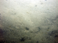
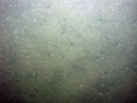
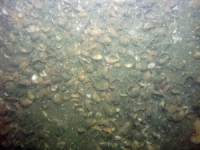
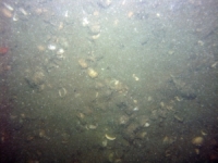
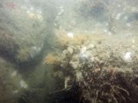
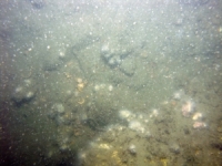
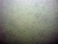
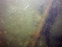
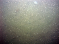
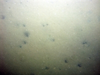
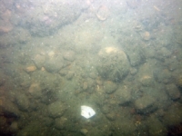
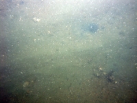
d3_PICT0743.JPG
Station # 101
Lat 41.508972
Long -70.929698
Time (UTC) 00:01:33
    Nearest Sediment Sample Info:
    • Classification = SAND SILT CLAY
    • Station Number = 101
    • Distance = 119.4 meters
Image of seabed - photo.
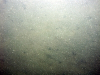
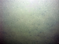
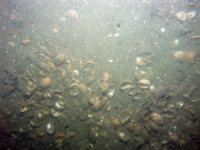
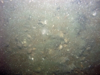
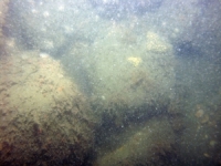
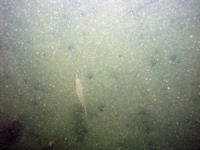
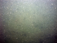
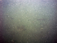
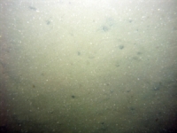
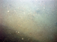
d3_PICT0744.JPG
Station # 101
Lat 41.509010
Long -70.929567
Time (UTC) 00:02:03
    Nearest Sediment Sample Info:
    • Classification = SAND SILT CLAY
    • Station Number = 101
    • Distance = 107.7 meters
Image of seabed - photo.
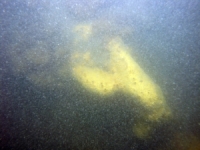
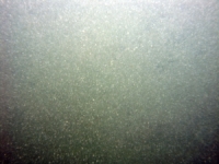
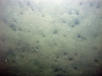
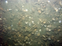
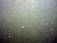
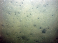
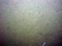
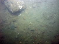
d3_PICT0745.JPG
Station # 101
Lat 41.509035
Long -70.929462
Time (UTC) 00:02:24
    Nearest Sediment Sample Info:
    • Classification = SAND SILT CLAY
    • Station Number = 101
    • Distance = 98.6 meters
Image of seabed - photo.
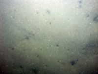
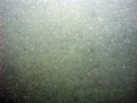
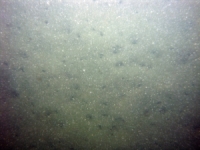
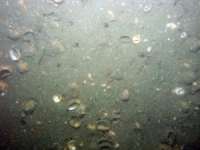
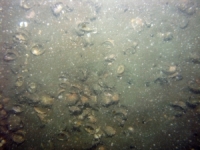
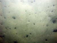
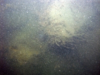
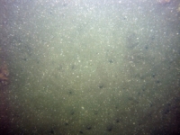
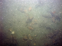
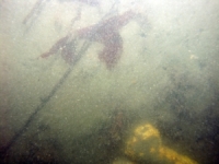
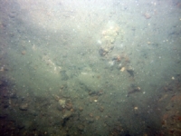
d3_PICT0746.JPG
Station # 101
Lat 41.509060
Long -70.929360
Time (UTC) 00:02:43
    Nearest Sediment Sample Info:
    • Classification = SAND SILT CLAY
    • Station Number = 101
    • Distance = 89.6 meters
Image of seabed - photo.
d3_PICT0747.JPG
Station # 101
Lat 41.509080
Long -70.929263
Time (UTC) 00:03:00
    Nearest Sediment Sample Info:
    • Classification = SAND SILT CLAY
    • Station Number = 101
    • Distance = 81.2 meters
Image of seabed - photo.
d3_PICT0748.JPG
Station # 101
Lat 41.509118
Long -70.929083
Time (UTC) 00:03:31
    Nearest Sediment Sample Info:
    • Classification = SAND SILT CLAY
    • Station Number = 101
    • Distance = 65.6 meters
Image of seabed - photo.
d3_PICT0749.JPG
Station # 101
Lat 41.509140
Long -70.928992
Time (UTC) 00:03:46
    Nearest Sediment Sample Info:
    • Classification = SAND SILT CLAY
    • Station Number = 101
    • Distance = 57.6 meters
Image of seabed - photo.
d3_PICT0750.JPG
Station # 101
Lat 41.509178
Long -70.928820
Time (UTC) 00:04:13
    Nearest Sediment Sample Info:
    • Classification = SAND SILT CLAY
    • Station Number = 101
    • Distance = 42.7 meters
Image of seabed - photo.
d3_PICT0751.JPG
Station # 101
Lat 41.509205
Long -70.928690
Time (UTC) 00:04:33
    Nearest Sediment Sample Info:
    • Classification = SAND SILT CLAY
    • Station Number = 101
    • Distance = 31.4 meters
Image of seabed - photo.
d3_PICT0752.JPG
Station # 101
Lat 41.509245
Long -70.928503
Time (UTC) 00:05:02
    Nearest Sediment Sample Info:
    • Classification = SAND SILT CLAY
    • Station Number = 101
    • Distance = 15.2 meters
Image of seabed - photo.
d3_PICT0753.JPG
Station # 102
Lat 41.491587
Long -70.940827
Time (UTC) 00:32:39
    Nearest Sediment Sample Info:
    • Classification = GRAVEL
    • Station Number = 102
    • Distance = 97.2 meters
Image of seabed - photo.
d3_PICT0754.JPG
Station # 102
Lat 41.491603
Long -70.940608
Time (UTC) 00:33:14
    Nearest Sediment Sample Info:
    • Classification = GRAVEL
    • Station Number = 102
    • Distance = 78.8 meters
Image of seabed - photo.
d3_PICT0755.JPG
Station # 102
Lat 41.491610
Long -70.940525
Time (UTC) 00:33:26
    Nearest Sediment Sample Info:
    • Classification = GRAVEL
    • Station Number = 102
    • Distance = 71.9 meters
Image of seabed - photo.
d3_PICT0756.JPG
Station # 102
Lat 41.491615
Long -70.940412
Time (UTC) 00:33:41
    Nearest Sediment Sample Info:
    • Classification = GRAVEL
    • Station Number = 102
    • Distance = 62.4 meters
Image of seabed - photo.
d3_PICT0757.JPG
Station # 102
Lat 41.491633
Long -70.940103
Time (UTC) 00:34:20
    Nearest Sediment Sample Info:
    • Classification = GRAVEL
    • Station Number = 102
    • Distance = 36.6 meters
Image of seabed - photo.
d3_PICT0758.JPG
Station # 102
Lat 41.491645
Long -70.939950
Time (UTC) 00:34:38
    Nearest Sediment Sample Info:
    • Classification = GRAVEL
    • Station Number = 102
    • Distance = 23.7 meters
Image of seabed - photo.
d3_PICT0759.JPG
Station # 102
Lat 41.491658
Long -70.939825
Time (UTC) 00:34:53
    Nearest Sediment Sample Info:
    • Classification = GRAVEL
    • Station Number = 102
    • Distance = 13.2 meters
Image of seabed - photo.
d3_PICT0760.JPG
Station # 102
Lat 41.491670
Long -70.939668
Time (UTC) 00:35:11
    Nearest Sediment Sample Info:
    • Classification = GRAVEL
    • Station Number = 102
    • Distance = 0 meters
Image of seabed - photo.
d3_PICT0761.JPG
Station # 103
Lat 41.492597
Long -70.932583
Time (UTC) 00:49:46
    Nearest Sediment Sample Info:
    • Classification = SANDY SILT
    • Station Number = 103
    • Distance = 235.7 meters
Image of seabed - photo.
d3_PICT0762.JPG
Station # 103
Lat 41.492607
Long -70.932475
Time (UTC) 00:50:05
    Nearest Sediment Sample Info:
    • Classification = SANDY SILT
    • Station Number = 103
    • Distance = 226.6 meters
Image of seabed - photo.
d3_PICT0763.JPG
Station # 103
Lat 41.492607
Long -70.932268
Time (UTC) 00:50:35
    Nearest Sediment Sample Info:
    • Classification = SANDY SILT
    • Station Number = 103
    • Distance = 209.3 meters
Image of seabed - photo.
d3_PICT0764.JPG
Station # 103
Lat 41.492612
Long -70.932108
Time (UTC) 00:50:56
    Nearest Sediment Sample Info:
    • Classification = SANDY SILT
    • Station Number = 103
    • Distance = 196 meters
Image of seabed - photo.
d3_PICT0765.JPG
Station # 103
Lat 41.492610
Long -70.931972
Time (UTC) 00:51:13
    Nearest Sediment Sample Info:
    • Classification = SANDY SILT
    • Station Number = 103
    • Distance = 184.6 meters
Image of seabed - photo.
d3_PICT0766.JPG
Station # 103
Lat 41.492618
Long -70.931807
Time (UTC) 00:51:34
    Nearest Sediment Sample Info:
    • Classification = SANDY SILT
    • Station Number = 103
    • Distance = 170.8 meters
Image of seabed - photo.
d3_PICT0767.JPG
Station # 103
Lat 41.492638
Long -70.931653
Time (UTC) 00:51:53
    Nearest Sediment Sample Info:
    • Classification = SANDY SILT
    • Station Number = 103
    • Distance = 157.9 meters
Image of seabed - photo.
d3_PICT0768.JPG
Station # 103
Lat 41.492635
Long -70.931515
Time (UTC) 00:52:09
    Nearest Sediment Sample Info:
    • Classification = SANDY SILT
    • Station Number = 103
    • Distance = 146.4 meters
Image of seabed - photo.
d3_PICT0769.JPG
Station # 103
Lat 41.492638
Long -70.931397
Time (UTC) 00:52:22
    Nearest Sediment Sample Info:
    • Classification = SANDY SILT
    • Station Number = 103
    • Distance = 136.5 meters
Image of seabed - photo.
d3_PICT0770.JPG
Station # 103
Lat 41.492658
Long -70.931120
Time (UTC) 00:52:53
    Nearest Sediment Sample Info:
    • Classification = SANDY SILT
    • Station Number = 103
    • Distance = 113.3 meters
Image of seabed - photo.
d3_PICT0771.JPG
Station # 103
Lat 41.492683
Long -70.930772
Time (UTC) 00:53:31
    Nearest Sediment Sample Info:
    • Classification = SANDY SILT
    • Station Number = 103
    • Distance = 84.3 meters
Image of seabed - photo.
d3_PICT0772.JPG
Station # 103
Lat 41.492693
Long -70.930520
Time (UTC) 00:54:01
    Nearest Sediment Sample Info:
    • Classification = SANDY SILT
    • Station Number = 103
    • Distance = 63.2 meters
Image of seabed - photo.
d3_PICT0773.JPG
Station # 103
Lat 41.492692
Long -70.930235
Time (UTC) 00:54:36
    Nearest Sediment Sample Info:
    • Classification = SANDY SILT
    • Station Number = 103
    • Distance = 39.4 meters
Image of seabed - photo.
d3_PICT0774.JPG
Station # 103
Lat 41.492687
Long -70.930113
Time (UTC) 00:54:51
    Nearest Sediment Sample Info:
    • Classification = SANDY SILT
    • Station Number = 103
    • Distance = 29.2 meters
Image of seabed - photo.
d3_PICT0775.JPG
Station # 103
Lat 41.492683
Long -70.930017
Time (UTC) 00:55:03
    Nearest Sediment Sample Info:
    • Classification = SANDY SILT
    • Station Number = 103
    • Distance = 21.2 meters
Image of seabed - photo.
d3_PICT0776.JPG
Station # 104
Lat 41.495242
Long -70.929247
Time (UTC) 01:11:07
    Nearest Sediment Sample Info:
    • Classification = SANDY SILT
    • Station Number = 104
    • Distance = 205.5 meters
Image of seabed - photo.
d3_PICT0777.JPG
Station # 104
Lat 41.495253
Long -70.929118
Time (UTC) 01:11:24
    Nearest Sediment Sample Info:
    • Classification = SANDY SILT
    • Station Number = 104
    • Distance = 194.7 meters
Image of seabed - photo.
d3_PICT0778.JPG
Station # 104
Lat 41.495270
Long -70.929010
Time (UTC) 01:11:39
    Nearest Sediment Sample Info:
    • Classification = SANDY SILT
    • Station Number = 104
    • Distance = 185.5 meters
Image of seabed - photo.
d3_PICT0779.JPG
Station # 104
Lat 41.495292
Long -70.928817
Time (UTC) 01:12:05
    Nearest Sediment Sample Info:
    • Classification = SANDY SILT
    • Station Number = 104
    • Distance = 169.2 meters
Image of seabed - photo.
d3_PICT0780.JPG
Station # 104
Lat 41.495308
Long -70.928668
Time (UTC) 01:12:25
    Nearest Sediment Sample Info:
    • Classification = SANDY SILT
    • Station Number = 104
    • Distance = 156.7 meters
Image of seabed - photo.
d3_PICT0781.JPG
Station # 104
Lat 41.495332
Long -70.928372
Time (UTC) 01:13:06
    Nearest Sediment Sample Info:
    • Classification = SANDY SILT
    • Station Number = 104
    • Distance = 131.9 meters
Image of seabed - photo.
d3_PICT0782.JPG
Station # 104
Lat 41.495347
Long -70.928055
Time (UTC) 01:13:51
    Nearest Sediment Sample Info:
    • Classification = SANDY SILT
    • Station Number = 104
    • Distance = 105.3 meters
Image of seabed - photo.
d3_PICT0783.JPG
Station # 104
Lat 41.495352
Long -70.927950
Time (UTC) 01:14:06
    Nearest Sediment Sample Info:
    • Classification = SANDY SILT
    • Station Number = 104
    • Distance = 96.5 meters
Image of seabed - photo.
d3_PICT0784.JPG
Station # 104
Lat 41.495380
Long -70.927435
Time (UTC) 01:15:18
    Nearest Sediment Sample Info:
    • Classification = SANDY SILT
    • Station Number = 104
    • Distance = 53.4 meters
Image of seabed - photo.
d3_PICT0785.JPG
Station # 105
Lat 41.486158
Long -70.912785
Time (UTC) 01:31:13
    Nearest Sediment Sample Info:
    • Classification = SAND
    • Station Number = 105
    • Distance = 164.5 meters
Image of seabed - photo.
d3_PICT0786.JPG
Station # 105
Lat 41.486122
Long -70.912582
Time (UTC) 01:31:40
    Nearest Sediment Sample Info:
    • Classification = SAND
    • Station Number = 105
    • Distance = 147.2 meters
Image of seabed - photo.
d3_PICT0787.JPG
Station # 105
Lat 41.486097
Long -70.912452
Time (UTC) 01:31:57
    Nearest Sediment Sample Info:
    • Classification = SAND
    • Station Number = 105
    • Distance = 136 meters
Image of seabed - photo.
d3_PICT0788.JPG
Station # 105
Lat 41.486065
Long -70.912290
Time (UTC) 01:32:18
    Nearest Sediment Sample Info:
    • Classification = SAND
    • Station Number = 105
    • Distance = 122.1 meters
Image of seabed - photo.
d3_PICT0789.JPG
Station # 105
Lat 41.486045
Long -70.912167
Time (UTC) 01:32:35
    Nearest Sediment Sample Info:
    • Classification = SAND
    • Station Number = 105
    • Distance = 111.7 meters
Image of seabed - photo.
d3_PICT0790.JPG
Station # 105
Lat 41.485998
Long -70.912010
Time (UTC) 01:32:55
    Nearest Sediment Sample Info:
    • Classification = SAND
    • Station Number = 105
    • Distance = 97.6 meters
Image of seabed - photo.
d3_PICT0791.JPG
Station # 105
Lat 41.485948
Long -70.911825
Time (UTC) 01:33:19
    Nearest Sediment Sample Info:
    • Classification = SAND
    • Station Number = 105
    • Distance = 81.2 meters
Image of seabed - photo.
d3_PICT0792.JPG
Station # 105
Lat 41.485898
Long -70.911647
Time (UTC) 01:33:42
    Nearest Sediment Sample Info:
    • Classification = SAND
    • Station Number = 105
    • Distance = 65.3 meters
Image of seabed - photo.
d3_PICT0793.JPG
Station # 105
Lat 41.485853
Long -70.911467
Time (UTC) 01:34:05
    Nearest Sediment Sample Info:
    • Classification = SAND
    • Station Number = 105
    • Distance = 49.5 meters
Image of seabed - photo.
d3_PICT0794.JPG
Station # 105
Lat 41.485748
Long -70.911125
Time (UTC) 01:34:51
    Nearest Sediment Sample Info:
    • Classification = SAND
    • Station Number = 105
    • Distance = 18.6 meters
Image of seabed - photo.
d3_PICT0795.JPG
Station # 106
Lat 41.487020
Long -70.898958
Time (UTC) 01:47:17
    Nearest Sediment Sample Info:
    • Classification = SAND
    • Station Number = 106
    • Distance = 180 meters
Image of seabed - photo.
d3_PICT0796.JPG
Station # 106
Lat 41.486935
Long -70.898707
Time (UTC) 01:47:50
    Nearest Sediment Sample Info:
    • Classification = SAND
    • Station Number = 106
    • Distance = 157 meters
Image of seabed - photo.
d3_PICT0797.JPG
Station # 106
Lat 41.486893
Long -70.898580
Time (UTC) 01:48:06
    Nearest Sediment Sample Info:
    • Classification = SAND
    • Station Number = 106
    • Distance = 145.4 meters
Image of seabed - photo.
d3_PICT0798.JPG
Station # 106
Lat 41.486815
Long -70.898353
Time (UTC) 01:48:35
    Nearest Sediment Sample Info:
    • Classification = SAND
    • Station Number = 106
    • Distance = 124.6 meters
Image of seabed - photo.
d3_PICT0799.JPG
Station # 106
Lat 41.486752
Long -70.898172
Time (UTC) 01:48:58
    Nearest Sediment Sample Info:
    • Classification = SAND
    • Station Number = 106
    • Distance = 107.9 meters
Image of seabed - photo.
d3_PICT0800.JPG
Station # 106
Lat 41.486693
Long -70.897983
Time (UTC) 01:49:21
    Nearest Sediment Sample Info:
    • Classification = SAND
    • Station Number = 106
    • Distance = 90.9 meters
Image of seabed - photo.
d3_PICT0801.JPG
Station # 106
Lat 41.486603
Long -70.897718
Time (UTC) 01:49:55
    Nearest Sediment Sample Info:
    • Classification = SAND
    • Station Number = 106
    • Distance = 66.6 meters
Image of seabed - photo.
d3_PICT0802.JPG
Station # 106
Lat 41.486545
Long -70.897547
Time (UTC) 01:50:17
    Nearest Sediment Sample Info:
    • Classification = SAND
    • Station Number = 106
    • Distance = 51 meters
Image of seabed - photo.
d3_PICT0803.JPG
Station # 106
Lat 41.486487
Long -70.897383
Time (UTC) 01:50:38
    Nearest Sediment Sample Info:
    • Classification = SAND
    • Station Number = 106
    • Distance = 35.9 meters
Image of seabed - photo.
d3_PICT0804.JPG
Station # 106
Lat 41.486368
Long -70.897117
Time (UTC) 01:51:14
    Nearest Sediment Sample Info:
    • Classification = SAND
    • Station Number = 106
    • Distance = 10.1 meters
Image of seabed - photo.
d3_PICT0805.JPG
Station # 107
Lat 41.476750
Long -70.891527
Time (UTC) 02:03:32
    Nearest Sediment Sample Info:
    • Classification = SAND
    • Station Number = 107
    • Distance = 146.9 meters
Image of seabed - photo.
d3_PICT0806.JPG
Station # 107
Lat 41.476650
Long -70.891423
Time (UTC) 02:03:55
    Nearest Sediment Sample Info:
    • Classification = SAND
    • Station Number = 107
    • Distance = 132.8 meters
Image of seabed - photo.
d3_PICT0807.JPG
Station # 107
Lat 41.476530
Long -70.891297
Time (UTC) 02:04:29
    Nearest Sediment Sample Info:
    • Classification = SAND
    • Station Number = 107
    • Distance = 115.8 meters
Image of seabed - photo.
d3_PICT0808.JPG
Station # 107
Lat 41.476463
Long -70.891235
Time (UTC) 02:04:45
    Nearest Sediment Sample Info:
    • Classification = SAND
    • Station Number = 107
    • Distance = 106.8 meters
Image of seabed - photo.
d3_PICT0809.JPG
Station # 107
Lat 41.476360
Long -70.891133
Time (UTC) 02:05:11
    Nearest Sediment Sample Info:
    • Classification = SAND
    • Station Number = 107
    • Distance = 92.5 meters
Image of seabed - photo.
d3_PICT0810.JPG
Station # 107
Lat 41.476207
Long -70.890973
Time (UTC) 02:05:50
    Nearest Sediment Sample Info:
    • Classification = SAND
    • Station Number = 107
    • Distance = 70.9 meters
Image of seabed - photo.
d3_PICT0811.JPG
Station # 107
Lat 41.476105
Long -70.890865
Time (UTC) 02:06:15
    Nearest Sediment Sample Info:
    • Classification = SAND
    • Station Number = 107
    • Distance = 56.4 meters
Image of seabed - photo.
d3_PICT0812.JPG
Station # 107
Lat 41.476038
Long -70.890790
Time (UTC) 02:06:32
    Nearest Sediment Sample Info:
    • Classification = SAND
    • Station Number = 107
    • Distance = 46.8 meters
Image of seabed - photo.
d3_PICT0813.JPG
Station # 107
Lat 41.475948
Long -70.890705
Time (UTC) 02:06:53
    Nearest Sediment Sample Info:
    • Classification = SAND
    • Station Number = 107
    • Distance = 34.5 meters
Image of seabed - photo.
d3_PICT0814.JPG
Station # 107
Lat 41.475867
Long -70.890637
Time (UTC) 02:07:10
    Nearest Sediment Sample Info:
    • Classification = SAND
    • Station Number = 107
    • Distance = 23.9 meters
Image of seabed - photo.
d3_PICT0815.JPG
Station # 107
Lat 41.475787
Long -70.890565
Time (UTC) 02:07:28
    Nearest Sediment Sample Info:
    • Classification = SAND
    • Station Number = 107
    • Distance = 13.1 meters
Image of seabed - photo.
d3_PICT0816.JPG
Station # 108
Lat 41.463790
Long -70.884878
Time (UTC) 02:24:17
    Nearest Sediment Sample Info:
    • Classification = SANDY SILT
    • Station Number = 108
    • Distance = 119.7 meters
Image of seabed - photo.
d3_PICT0817.JPG
Station # 108
Lat 41.463735
Long -70.884862
Time (UTC) 02:24:29
    Nearest Sediment Sample Info:
    • Classification = SANDY SILT
    • Station Number = 108
    • Distance = 113.7 meters
Image of seabed - photo.
d3_PICT0818.JPG
Station # 108
Lat 41.463657
Long -70.884785
Time (UTC) 02:24:49
    Nearest Sediment Sample Info:
    • Classification = SANDY SILT
    • Station Number = 108
    • Distance = 103 meters
Image of seabed - photo.
d3_PICT0819.JPG
Station # 108
Lat 41.463598
Long -70.884735
Time (UTC) 02:25:03
    Nearest Sediment Sample Info:
    • Classification = SANDY SILT
    • Station Number = 108
    • Distance = 95.2 meters
Image of seabed - photo.
d3_PICT0820.JPG
Station # 108
Lat 41.463450
Long -70.884632
Time (UTC) 02:25:36
    Nearest Sediment Sample Info:
    • Classification = SANDY SILT
    • Station Number = 108
    • Distance = 76.7 meters
Image of seabed - photo.
d3_PICT0821.JPG
Station # 108
Lat 41.463332
Long -70.884552
Time (UTC) 02:26:02
    Nearest Sediment Sample Info:
    • Classification = SANDY SILT
    • Station Number = 108
    • Distance = 62 meters
Image of seabed - photo.
d3_PICT0822.JPG
Station # 108
Lat 41.463185
Long -70.884392
Time (UTC) 02:26:41
    Nearest Sediment Sample Info:
    • Classification = SANDY SILT
    • Station Number = 108
    • Distance = 41.3 meters
Image of seabed - photo.
d3_PICT0823.JPG
Station # 108
Lat 41.463133
Long -70.884357
Time (UTC) 02:26:52
    Nearest Sediment Sample Info:
    • Classification = SANDY SILT
    • Station Number = 108
    • Distance = 34.8 meters
Image of seabed - photo.
d3_PICT0824.JPG
Station # 108
Lat 41.463038
Long -70.884302
Time (UTC) 02:27:11
    Nearest Sediment Sample Info:
    • Classification = SANDY SILT
    • Station Number = 108
    • Distance = 23.3 meters
Image of seabed - photo.
d3_PICT0825.JPG
Station # 108
Lat 41.462903
Long -70.884230
Time (UTC) 02:27:38
    Nearest Sediment Sample Info:
    • Classification = SANDY SILT
    • Station Number = 108
    • Distance = 7.5 meters
Image of seabed - photo.
d3_PICT0826.JPG
Station # 109
Lat 41.476273
Long -70.899682
Time (UTC) 02:50:23
    Nearest Sediment Sample Info:
    • Classification = SAND
    • Station Number = 109
    • Distance = 162.1 meters
Image of seabed - photo.
d3_PICT0827.JPG
Station # 109
Lat 41.476162
Long -70.899513
Time (UTC) 02:50:56
    Nearest Sediment Sample Info:
    • Classification = SAND
    • Station Number = 109
    • Distance = 144.2 meters
Image of seabed - photo.
d3_PICT0828.JPG
Station # 109
Lat 41.476012
Long -70.899347
Time (UTC) 02:51:31
    Nearest Sediment Sample Info:
    • Classification = SAND
    • Station Number = 109
    • Distance = 122.9 meters
Image of seabed - photo.
d3_PICT0829.JPG
Station # 109
Lat 41.475933
Long -70.899260
Time (UTC) 02:51:50
    Nearest Sediment Sample Info:
    • Classification = SAND
    • Station Number = 109
    • Distance = 111.8 meters
Image of seabed - photo.
d3_PICT0830.JPG
Station # 109
Lat 41.475852
Long -70.899190
Time (UTC) 02:52:09
    Nearest Sediment Sample Info:
    • Classification = SAND
    • Station Number = 109
    • Distance = 101.1 meters
Image of seabed - photo.
d3_PICT0831.JPG
Station # 109
Lat 41.475728
Long -70.899092
Time (UTC) 02:52:39
    Nearest Sediment Sample Info:
    • Classification = SAND
    • Station Number = 109
    • Distance = 85.1 meters
Image of seabed - photo.
d3_PICT0832.JPG
Station # 109
Lat 41.475435
Long -70.898888
Time (UTC) 02:53:46
    Nearest Sediment Sample Info:
    • Classification = SAND
    • Station Number = 109
    • Distance = 48.4 meters
Image of seabed - photo.
d3_PICT0833.JPG
Station # 109
Lat 41.475345
Long -70.898830
Time (UTC) 02:54:06
    Nearest Sediment Sample Info:
    • Classification = SAND
    • Station Number = 109
    • Distance = 37.3 meters
Image of seabed - photo.
d3_PICT0834.JPG
Station # 109
Lat 41.475192
Long -70.898730
Time (UTC) 02:54:40
    Nearest Sediment Sample Info:
    • Classification = SAND
    • Station Number = 109
    • Distance = 18.4 meters
Image of seabed - photo.
d3_PICT0835.JPG
Station # 110
Lat 41.477772
Long -70.911015
Time (UTC) 03:08:53
    Nearest Sediment Sample Info:
    • Classification = SAND
    • Station Number = 110
    • Distance = 149.8 meters
Image of seabed - photo.
d3_PICT0836.JPG
Station # 110
Lat 41.477673
Long -70.911073
Time (UTC) 03:09:18
    Nearest Sediment Sample Info:
    • Classification = SAND
    • Station Number = 110
    • Distance = 139.6 meters
Image of seabed - photo.
d3_PICT0837.JPG
Station # 110
Lat 41.477558
Long -70.911102
Time (UTC) 03:09:45
    Nearest Sediment Sample Info:
    • Classification = SAND
    • Station Number = 110
    • Distance = 127.4 meters
Image of seabed - photo.
d3_PICT0838.JPG
Station # 110
Lat 41.477453
Long -70.911110
Time (UTC) 03:10:09
    Nearest Sediment Sample Info:
    • Classification = SAND
    • Station Number = 110
    • Distance = 116.1 meters
Image of seabed - photo.
d3_PICT0839.JPG
Station # 110
Lat 41.477380
Long -70.911107
Time (UTC) 03:10:25
    Nearest Sediment Sample Info:
    • Classification = SAND
    • Station Number = 110
    • Distance = 108.2 meters
Image of seabed - photo.
d3_PICT0840.JPG
Station # 110
Lat 41.477262
Long -70.911090
Time (UTC) 03:10:51
    Nearest Sediment Sample Info:
    • Classification = SAND
    • Station Number = 110
    • Distance = 95.1 meters
Image of seabed - photo.
d3_PICT0841.JPG
Station # 110
Lat 41.477198
Long -70.911078
Time (UTC) 03:11:05
    Nearest Sediment Sample Info:
    • Classification = SAND
    • Station Number = 110
    • Distance = 88 meters
Image of seabed - photo.
d3_PICT0842.JPG
Station # 110
Lat 41.477148
Long -70.911065
Time (UTC) 03:11:16
    Nearest Sediment Sample Info:
    • Classification = SAND
    • Station Number = 110
    • Distance = 82.3 meters
Image of seabed - photo.
d3_PICT0843.JPG
Station # 110
Lat 41.476955
Long -70.911000
Time (UTC) 03:12:00
    Nearest Sediment Sample Info:
    • Classification = SAND
    • Station Number = 110
    • Distance = 60.2 meters
Image of seabed - photo.
d3_PICT0844.JPG
Station # 110
Lat 41.476768
Long -70.910932
Time (UTC) 03:12:42
    Nearest Sediment Sample Info:
    • Classification = SAND
    • Station Number = 110
    • Distance = 38.7 meters
Image of seabed - photo.
d3_PICT0845.JPG
Station # 110
Lat 41.476697
Long -70.910907
Time (UTC) 03:12:58
    Nearest Sediment Sample Info:
    • Classification = SAND
    • Station Number = 110
    • Distance = 30.5 meters
Image of seabed - photo.
d3_PICT0846.JPG
Station # 110
Lat 41.476610
Long -70.910875
Time (UTC) 03:13:17
    Nearest Sediment Sample Info:
    • Classification = SAND
    • Station Number = 110
    • Distance = 20.5 meters
Image of seabed - photo.
d3_PICT0847.JPG
Station # 110
Lat 41.476548
Long -70.910852
Time (UTC) 03:13:31
    Nearest Sediment Sample Info:
    • Classification = SAND
    • Station Number = 110
    • Distance = 13.4 meters
Image of seabed - photo.
d3_PICT0848.JPG
Station # 111
Lat 41.487500
Long -70.933393
Time (UTC) 03:32:51
    Nearest Sediment Sample Info:
    • Classification = SAND SILT CLAY
    • Station Number = 111
    • Distance = 126.8 meters
Image of seabed - photo.
d3_PICT0849.JPG
Station # 111
Lat 41.487475
Long -70.933348
Time (UTC) 03:33:04
    Nearest Sediment Sample Info:
    • Classification = SAND SILT CLAY
    • Station Number = 111
    • Distance = 123.7 meters
Image of seabed - photo.
d3_PICT0850.JPG
Station # 111
Lat 41.487308
Long -70.933213
Time (UTC) 03:33:50
    Nearest Sediment Sample Info:
    • Classification = SAND SILT CLAY
    • Station Number = 111
    • Distance = 104.7 meters
Image of seabed - photo.
d3_PICT0851.JPG
Station # 111
Lat 41.487238
Long -70.933185
Time (UTC) 03:34:05
    Nearest Sediment Sample Info:
    • Classification = SAND SILT CLAY
    • Station Number = 111
    • Distance = 97 meters
Image of seabed - photo.
d3_PICT0852.JPG
Station # 111
Lat 41.487007
Long -70.933142
Time (UTC) 03:34:49
    Nearest Sediment Sample Info:
    • Classification = SAND SILT CLAY
    • Station Number = 111
    • Distance = 71.6 meters
Image of seabed - photo.
d3_PICT0853.JPG
Station # 111
Lat 41.486932
Long -70.933135
Time (UTC) 03:35:04
    Nearest Sediment Sample Info:
    • Classification = SAND SILT CLAY
    • Station Number = 111
    • Distance = 63.4 meters
Image of seabed - photo.
d3_PICT0854.JPG
Station # 111
Lat 41.486800
Long -70.933137
Time (UTC) 03:35:32
    Nearest Sediment Sample Info:
    • Classification = SAND SILT CLAY
    • Station Number = 111
    • Distance = 48.9 meters
Image of seabed - photo.
d3_PICT0855.JPG
Station # 111
Lat 41.486737
Long -70.933137
Time (UTC) 03:35:46
    Nearest Sediment Sample Info:
    • Classification = SAND SILT CLAY
    • Station Number = 111
    • Distance = 42 meters
Image of seabed - photo.
d3_PICT0856.JPG
Station # 111
Lat 41.486607
Long -70.933158
Time (UTC) 03:36:15
    Nearest Sediment Sample Info:
    • Classification = SAND SILT CLAY
    • Station Number = 111
    • Distance = 27.5 meters
Image of seabed - photo.
d3_PICT0857.JPG
Station # 111
Lat 41.486420
Long -70.933207
Time (UTC) 03:36:59
    Nearest Sediment Sample Info:
    • Classification = SAND SILT CLAY
    • Station Number = 111
    • Distance = 6.3 meters
Image of seabed - photo.
d3_PICT0858.JPG
Station # 112
Lat 41.482472
Long -70.934645
Time (UTC) 03:49:04
    Nearest Sediment Sample Info:
    • Classification = GRAVEL
    • Station Number = 112
    • Distance = 123.4 meters
Image of seabed - photo.
d3_PICT0859.JPG
Station # 112
Lat 41.482393
Long -70.934687
Time (UTC) 03:49:23
    Nearest Sediment Sample Info:
    • Classification = GRAVEL
    • Station Number = 112
    • Distance = 114.1 meters
Image of seabed - photo.
d3_PICT0860.JPG
Station # 112
Lat 41.482257
Long -70.934773
Time (UTC) 03:49:58
    Nearest Sediment Sample Info:
    • Classification = GRAVEL
    • Station Number = 112
    • Distance = 97.6 meters
Image of seabed - photo.
d3_PICT0861.JPG
Station # 112
Lat 41.482143
Long -70.934863
Time (UTC) 03:50:29
    Nearest Sediment Sample Info:
    • Classification = GRAVEL
    • Station Number = 112
    • Distance = 82.9 meters
Image of seabed - photo.
d3_PICT0862.JPG
Station # 112
Lat 41.482052
Long -70.934945
Time (UTC) 03:50:56
    Nearest Sediment Sample Info:
    • Classification = GRAVEL
    • Station Number = 112
    • Distance = 70.7 meters
Image of seabed - photo.
d3_PICT0863.JPG
Station # 112
Lat 41.481982
Long -70.935010
Time (UTC) 03:51:18
    Nearest Sediment Sample Info:
    • Classification = GRAVEL
    • Station Number = 112
    • Distance = 61.2 meters
Image of seabed - photo.
d3_PICT0864.JPG
Station # 112
Lat 41.481913
Long -70.935072
Time (UTC) 03:51:40
    Nearest Sediment Sample Info:
    • Classification = GRAVEL
    • Station Number = 112
    • Distance = 52 meters
Image of seabed - photo.
d3_PICT0865.JPG
Station # 112
Lat 41.481842
Long -70.935147
Time (UTC) 03:52:04
    Nearest Sediment Sample Info:
    • Classification = GRAVEL
    • Station Number = 112
    • Distance = 41.9 meters
Image of seabed - photo.
d3_PICT0866.JPG
Station # 112
Lat 41.481770
Long -70.935220
Time (UTC) 03:52:27
    Nearest Sediment Sample Info:
    • Classification = GRAVEL
    • Station Number = 112
    • Distance = 31.9 meters
Image of seabed - photo.
d3_PICT0867.JPG
Station # 112
Lat 41.481603
Long -70.935385
Time (UTC) 03:53:19
    Nearest Sediment Sample Info:
    • Classification = GRAVEL
    • Station Number = 112
    • Distance = 8.8 meters
Image of seabed - photo.
d3_PICT0868.JPG
Station # 112
Lat 41.481537
Long -70.935443
Time (UTC) 03:53:39
    Nearest Sediment Sample Info:
    • Classification = GRAVEL
    • Station Number = 112
    • Distance = 0 meters
Image of seabed - photo.
d3_PICT0870.JPG
Station # 113
Lat 41.479547
Long -70.935925
Time (UTC) 04:13:52
    Nearest Sediment Sample Info:
    • Classification = GRAVEL
    • Station Number = 112
    • Distance = 224.6 meters
Image of seabed - photo.
d3_PICT0871.JPG
Station # 113
Lat 41.479485
Long -70.936027
Time (UTC) 04:14:12
    Nearest Sediment Sample Info:
    • Classification = GRAVEL
    • Station Number = 112
    • Distance = 233 meters
Image of seabed - photo.
d3_PICT0872.JPG
Station # 113
Lat 41.479308
Long -70.936292
Time (UTC) 04:15:08
    Nearest Sediment Sample Info:
    • Classification = GRAVEL
    • Station Number = 112
    • Distance = 257.5 meters
Image of seabed - photo.
d3_PICT0873.JPG
Station # 113
Lat 41.479137
Long -70.936510
Time (UTC) 04:15:58
    Nearest Sediment Sample Info:
    • Classification = GRAVEL
    • Station Number = 112
    • Distance = 281 meters
Image of seabed - photo.
d3_PICT0874.JPG
Station # 113
Lat 41.479042
Long -70.936618
Time (UTC) 04:16:24
    Nearest Sediment Sample Info:
    • Classification = GRAVEL
    • Station Number = 112
    • Distance = 293.9 meters
Image of seabed - photo.
d3_PICT0875.JPG
Station # 113
Lat 41.478948
Long -70.936727
Time (UTC) 04:16:50
    Nearest Sediment Sample Info:
    • Classification = SAND
    • Station Number = 113
    • Distance = 299.8 meters
Image of seabed - photo.
d3_PICT0876.JPG
Station # 113
Lat 41.478797
Long -70.936885
Time (UTC) 04:17:30
    Nearest Sediment Sample Info:
    • Classification = SAND
    • Station Number = 113
    • Distance = 278.5 meters
Image of seabed - photo.
d3_PICT0877.JPG
Station # 113
Lat 41.478480
Long -70.937247
Time (UTC) 04:18:53
    Nearest Sediment Sample Info:
    • Classification = SAND
    • Station Number = 113
    • Distance = 232.2 meters
Image of seabed - photo.
d3_PICT0878.JPG
Station # 113
Lat 41.478350
Long -70.937382
Time (UTC) 04:19:27
    Nearest Sediment Sample Info:
    • Classification = SAND
    • Station Number = 113
    • Distance = 213.8 meters
Image of seabed - photo.
d3_PICT0879.JPG
Station # 113
Lat 41.478218
Long -70.937515
Time (UTC) 04:20:02
    Nearest Sediment Sample Info:
    • Classification = SAND
    • Station Number = 113
    • Distance = 195.5 meters
Image of seabed - photo.
d3_PICT0880.JPG
Station # 113
Lat 41.477980
Long -70.937767
Time (UTC) 04:21:06
    Nearest Sediment Sample Info:
    • Classification = SAND
    • Station Number = 113
    • Distance = 161.7 meters
Image of seabed - photo.
d3_PICT0881.JPG
Station # 113
Lat 41.477790
Long -70.937975
Time (UTC) 04:21:59
    Nearest Sediment Sample Info:
    • Classification = SAND
    • Station Number = 113
    • Distance = 134.4 meters
Image of seabed - photo.
d3_PICT0882.JPG
Station # 113
Lat 41.477363
Long -70.938420
Time (UTC) 04:23:47
    Nearest Sediment Sample Info:
    • Classification = SAND
    • Station Number = 113
    • Distance = 74.2 meters
Image of seabed - photo.
d3_PICT0883.JPG
Station # 114
Lat 41.477468
Long -70.945193
Time (UTC) 04:36:10
    Nearest Sediment Sample Info:
    • Classification = SAND
    • Station Number = 114
    • Distance = 220.7 meters
Image of seabed - photo.
d3_PICT0884.JPG
Station # 114
Lat 41.477355
Long -70.945323
Time (UTC) 04:36:36
    Nearest Sediment Sample Info:
    • Classification = SAND
    • Station Number = 114
    • Distance = 204.1 meters
Image of seabed - photo.
d3_PICT0885.JPG
Station # 114
Lat 41.477213
Long -70.945470
Time (UTC) 04:37:06
    Nearest Sediment Sample Info:
    • Classification = SAND
    • Station Number = 114
    • Distance = 184.2 meters
Image of seabed - photo.
d3_PICT0886.JPG
Station # 114
Lat 41.476800
Long -70.945918
Time (UTC) 04:38:36
    Nearest Sediment Sample Info:
    • Classification = SAND
    • Station Number = 114
    • Distance = 125.1 meters
Image of seabed - photo.
d3_PICT0887.JPG
Station # 114
Lat 41.476568
Long -70.946210
Time (UTC) 04:39:28
    Nearest Sediment Sample Info:
    • Classification = SAND
    • Station Number = 114
    • Distance = 89.6 meters
Image of seabed - photo.
d3_PICT0888.JPG
Station # 114
Lat 41.476192
Long -70.946668
Time (UTC) 04:40:49
    Nearest Sediment Sample Info:
    • Classification = SAND
    • Station Number = 114
    • Distance = 33 meters
Image of seabed - photo.
d3_PICT0889.JPG
Station # 115
Lat 41.473012
Long -70.920888
Time (UTC) 04:59:51
    Nearest Sediment Sample Info:
    • Classification = SAND
    • Station Number = 115
    • Distance = 45.6 meters
Image of seabed - photo.
d3_PICT0890.JPG
Station # 115
Lat 41.472787
Long -70.920978
Time (UTC) 05:00:45
    Nearest Sediment Sample Info:
    • Classification = SAND
    • Station Number = 115
    • Distance = 19.6 meters
Image of seabed - photo.
d3_PICT0891.JPG
Station # 116a
Lat 41.471333
Long -70.923770
Time (UTC) 05:10:02
    Nearest Sediment Sample Info:
    • Classification = SAND
    • Station Number = 115
    • Distance = 266.8 meters
Image of seabed - photo.
d3_PICT0892.JPG
Station # 116a
Lat 41.471292
Long -70.923857
Time (UTC) 05:10:20
    Nearest Sediment Sample Info:
    • Classification = SAND
    • Station Number = 115
    • Distance = 275.4 meters
Image of seabed - photo.
d3_PICT0893.JPG
Station # 116a
Lat 41.470853
Long -70.924610
Time (UTC) 05:12:56
    Nearest Sediment Sample Info:
    • Classification = SAND
    • Station Number = 115
    • Distance = 354.7 meters
Image of seabed - photo.
d3_PICT0894.JPG
Station # 116a
Lat 41.470143
Long -70.925703
Time (UTC) 05:16:18
    Nearest Sediment Sample Info:
    • Classification = GRAVEL
    • Station Number = 116
    • Distance = 426.9 meters
Image of seabed - photo.
d3_PICT0895.JPG
Station # 116a
Lat 41.469935
Long -70.925997
Time (UTC) 05:17:14
    Nearest Sediment Sample Info:
    • Classification = GRAVEL
    • Station Number = 116
    • Distance = 393.4 meters
Image of seabed - photo.
d3_PICT0896.JPG
Station # 116a
Lat 41.469720
Long -70.926297
Time (UTC) 05:18:10
    Nearest Sediment Sample Info:
    • Classification = GRAVEL
    • Station Number = 116
    • Distance = 359 meters
Image of seabed - photo.
d3_PICT0897.JPG
Station # 116a
Lat 41.469212
Long -70.927152
Time (UTC) 05:20:40
    Nearest Sediment Sample Info:
    • Classification = GRAVEL
    • Station Number = 116
    • Distance = 268.1 meters
Image of seabed - photo.
d3_PICT0898.JPG
Station # 116a
Lat 41.469143
Long -70.927270
Time (UTC) 05:21:00
    Nearest Sediment Sample Info:
    • Classification = GRAVEL
    • Station Number = 116
    • Distance = 255.6 meters
Image of seabed - photo.
d3_PICT0899.JPG
Station # 116a
Lat 41.468753
Long -70.927947
Time (UTC) 05:22:53
    Nearest Sediment Sample Info:
    • Classification = GRAVEL
    • Station Number = 116
    • Distance = 184.5 meters
Image of seabed - photo.
d3_PICT0900.JPG
Station # 116b
Lat 41.468197
Long -70.928962
Time (UTC) 05:25:42
    Nearest Sediment Sample Info:
    • Classification = GRAVEL
    • Station Number = 116
    • Distance = 79.7 meters
Image of seabed - photo.
d3_PICT0901.JPG
Station # 116b
Lat 41.467812
Long -70.929767
Time (UTC) 05:27:53
    Nearest Sediment Sample Info:
    • Classification = GRAVEL
    • Station Number = 116
    • Distance = 0 meters
Image of seabed - photo.
d3_PICT0902.JPG
Station # 117
Lat 41.462023
Long -70.905780
Time (UTC) 05:45:48
    Nearest Sediment Sample Info:
    • Classification = SAND
    • Station Number = 117
    • Distance = 59.7 meters
Image of seabed - photo.
d3_PICT0903.JPG
Station # 117
Lat 41.462020
Long -70.905730
Time (UTC) 05:46:33
    Nearest Sediment Sample Info:
    • Classification = SAND
    • Station Number = 117
    • Distance = 63.8 meters
Image of seabed - photo.
d3_PICT0904.JPG
Station # 117
Lat 41.462035
Long -70.905850
Time (UTC) 05:47:58
    Nearest Sediment Sample Info:
    • Classification = SAND
    • Station Number = 117
    • Distance = 54.2 meters
Image of seabed - photo.
d3_PICT0905.JPG
Station # 117
Lat 41.461948
Long -70.906432
Time (UTC) 05:50:34
    Nearest Sediment Sample Info:
    • Classification = SAND
    • Station Number = 117
    • Distance = 4.7 meters
Image of seabed - photo.
d3_PICT0906.JPG
Station # 118a
Lat 41.464080
Long -70.918552
Time (UTC) 06:05:32
    Nearest Sediment Sample Info:
    • Classification = GRAVEL
    • Station Number = 118
    • Distance = 242.6 meters
Image of seabed - photo.
d3_PICT0907.JPG
Station # 118a
Lat 41.464148
Long -70.918642
Time (UTC) 06:06:14
    Nearest Sediment Sample Info:
    • Classification = GRAVEL
    • Station Number = 118
    • Distance = 238.3 meters
Image of seabed - photo.
d3_PICT0908.JPG
Station # 118a
Lat 41.464207
Long -70.918838
Time (UTC) 06:07:21
    Nearest Sediment Sample Info:
    • Classification = GRAVEL
    • Station Number = 118
    • Distance = 226.1 meters
Image of seabed - photo.
d3_PICT0909.JPG
Station # 118a
Lat 41.464178
Long -70.919117
Time (UTC) 06:08:31
    Nearest Sediment Sample Info:
    • Classification = GRAVEL
    • Station Number = 118
    • Distance = 203.8 meters
Image of seabed - photo.
d3_PICT0910.JPG
Station # 118b
Lat 41.463752
Long -70.920480
Time (UTC) 06:12:21
    Nearest Sediment Sample Info:
    • Classification = GRAVEL
    • Station Number = 118
    • Distance = 81.7 meters
Image of seabed - photo.
d3_PICT0911.JPG
Station # 118b
Lat 41.463573
Long -70.920827
Time (UTC) 06:13:26
    Nearest Sediment Sample Info:
    • Classification = GRAVEL
    • Station Number = 118
    • Distance = 46.6 meters
Image of seabed - photo.
d3_PICT0912.JPG
Station # 118b
Lat 41.463530
Long -70.920913
Time (UTC) 06:13:43
    Nearest Sediment Sample Info:
    • Classification = GRAVEL
    • Station Number = 118
    • Distance = 38 meters
Image of seabed - photo.
d3_PICT0913.JPG
Station # 118b
Lat 41.463325
Long -70.921277
Time (UTC) 06:14:45
    Nearest Sediment Sample Info:
    • Classification = GRAVEL
    • Station Number = 118
    • Distance = 0 meters
Image of seabed - photo.
d3_PICT0914.JPG
Station # 119
Lat 41.464302
Long -70.927998
Time (UTC) 06:25:03
    Nearest Sediment Sample Info:
    • Classification = SAND
    • Station Number = 119
    • Distance = 80.7 meters
Image of seabed - photo.
d3_PICT0915.JPG
Station # 119
Lat 41.464148
Long -70.928125
Time (UTC) 06:25:37
    Nearest Sediment Sample Info:
    • Classification = SAND
    • Station Number = 119
    • Distance = 93.4 meters
Image of seabed - photo.
d3_PICT0916.JPG
Station # 119
Lat 41.463615
Long -70.927903
Time (UTC) 06:27:26
    Nearest Sediment Sample Info:
    • Classification = SAND
    • Station Number = 119
    • Distance = 107.3 meters
Image of seabed - photo.
d3_PICT0917.JPG
Station # 119
Lat 41.464022
Long -70.927360
Time (UTC) 06:28:25
    Nearest Sediment Sample Info:
    • Classification = SAND
    • Station Number = 119
    • Distance = 43.4 meters
Image of seabed - photo.
d3_PICT0918.JPG
Station # 119
Lat 41.464173
Long -70.927195
Time (UTC) 06:28:49
    Nearest Sediment Sample Info:
    • Classification = SAND
    • Station Number = 119
    • Distance = 21.7 meters
Image of seabed - photo.
d3_PICT0919.JPG
Station # 120b
Lat 41.458945
Long -70.932753
Time (UTC) 06:40:08
    Nearest Sediment Sample Info:
    • Classification = SAND
    • Station Number = 120
    • Distance = 113 meters
Image of seabed - photo.
d3_PICT0920.JPG
Station # 120b
Lat 41.458917
Long -70.932840
Time (UTC) 06:40:23
    Nearest Sediment Sample Info:
    • Classification = SAND
    • Station Number = 120
    • Distance = 105.1 meters
Image of seabed - photo.
d3_PICT0921.JPG
Station # 120b
Lat 41.458835
Long -70.933093
Time (UTC) 06:41:07
    Nearest Sediment Sample Info:
    • Classification = SAND
    • Station Number = 120
    • Distance = 82.1 meters
Image of seabed - photo.
d3_PICT0922.JPG
Station # 120b
Lat 41.458783
Long -70.933245
Time (UTC) 06:41:34
    Nearest Sediment Sample Info:
    • Classification = SAND
    • Station Number = 120
    • Distance = 68.2 meters
Image of seabed - photo.
d3_PICT0923.JPG
Station # 120b
Lat 41.458642
Long -70.933643
Time (UTC) 06:42:45
    Nearest Sediment Sample Info:
    • Classification = SAND
    • Station Number = 120
    • Distance = 31.4 meters
Image of seabed - photo.
d3_PICT0924.JPG
Station # 120b
Lat 41.458555
Long -70.933862
Time (UTC) 06:43:24
    Nearest Sediment Sample Info:
    • Classification = SAND
    • Station Number = 120
    • Distance = 10.7 meters
Image of seabed - photo.
d3_PICT0925.JPG
Station # 121
Lat 41.469135
Long -70.940185
Time (UTC) 06:57:50
    Nearest Sediment Sample Info:
    • Classification = SAND
    • Station Number = 121
    • Distance = 141.1 meters
Image of seabed - photo.
d3_PICT0926.JPG
Station # 121
Lat 41.469145
Long -70.940218
Time (UTC) 06:58:03
    Nearest Sediment Sample Info:
    • Classification = SAND
    • Station Number = 121
    • Distance = 139.5 meters
Image of seabed - photo.
d3_PICT0927.JPG
Station # 121
Lat 41.469130
Long -70.940382
Time (UTC) 06:59:03
    Nearest Sediment Sample Info:
    • Classification = SAND
    • Station Number = 121
    • Distance = 127.8 meters
Image of seabed - photo.
d3_PICT0928.JPG
Station # 121
Lat 41.469028
Long -70.940603
Time (UTC) 07:00:15
    Nearest Sediment Sample Info:
    • Classification = SAND
    • Station Number = 121
    • Distance = 106.5 meters
Image of seabed - photo.
d3_PICT0929.JPG
Station # 121
Lat 41.468872
Long -70.940847
Time (UTC) 07:01:30
    Nearest Sediment Sample Info:
    • Classification = SAND
    • Station Number = 121
    • Distance = 79.8 meters
Image of seabed - photo.
d3_PICT0930.JPG
Station # 121
Lat 41.468470
Long -70.941422
Time (UTC) 07:04:06
    Nearest Sediment Sample Info:
    • Classification = SAND
    • Station Number = 121
    • Distance = 14.2 meters
Image of seabed - photo.
d3_PICT0931.JPG
Station # 122
Lat 41.461030
Long -70.949868
Time (UTC) 07:18:17
    Nearest Sediment Sample Info:
    • Classification = SAND
    • Station Number = 122
    • Distance = 174.1 meters
Image of seabed - photo.
d3_PICT0932.JPG
Station # 122
Lat 41.460898
Long -70.949960
Time (UTC) 07:19:00
    Nearest Sediment Sample Info:
    • Classification = SAND
    • Station Number = 122
    • Distance = 157.6 meters
Image of seabed - photo.
d3_PICT0933.JPG
Station # 122
Lat 41.460818
Long -70.950007
Time (UTC) 07:19:26
    Nearest Sediment Sample Info:
    • Classification = SAND
    • Station Number = 122
    • Distance = 147.9 meters
Image of seabed - photo.
d3_PICT0934.JPG
Station # 122
Lat 41.460633
Long -70.950128
Time (UTC) 07:20:30
    Nearest Sediment Sample Info:
    • Classification = SAND
    • Station Number = 122
    • Distance = 125 meters
Image of seabed - photo.
d3_PICT0935.JPG
Station # 122
Lat 41.460535
Long -70.950187
Time (UTC) 07:21:04
    Nearest Sediment Sample Info:
    • Classification = SAND
    • Station Number = 122
    • Distance = 113.1 meters
Image of seabed - photo.
d3_PICT0936.JPG
Station # 122
Lat 41.460337
Long -70.950295
Time (UTC) 07:22:18
    Nearest Sediment Sample Info:
    • Classification = SAND
    • Station Number = 122
    • Distance = 89.3 meters
Image of seabed - photo.
d3_PICT0937.JPG
Station # 122
Lat 41.460127
Long -70.950417
Time (UTC) 07:23:41
    Nearest Sediment Sample Info:
    • Classification = SAND
    • Station Number = 122
    • Distance = 63.9 meters
Image of seabed - photo.
d3_PICT0938.JPG
Station # 122
Lat 41.459828
Long -70.950625
Time (UTC) 07:25:34
    Nearest Sediment Sample Info:
    • Classification = SAND
    • Station Number = 122
    • Distance = 26.4 meters
Image of seabed - photo.
d3_PICT0939.JPG
Station # 122
Lat 41.459640
Long -70.950733
Time (UTC) 07:26:39
    Nearest Sediment Sample Info:
    • Classification = SAND
    • Station Number = 122
    • Distance = 3.7 meters
Image of seabed - photo.
d3_PICT0940.JPG
Station # 123
Lat 41.447923
Long -70.946803
Time (UTC) 07:39:58
    Nearest Sediment Sample Info:
    • Classification = SAND
    • Station Number = 123
    • Distance = 81.6 meters
Image of seabed - photo.
d3_PICT0941.JPG
Station # 123
Lat 41.447757
Long -70.946607
Time (UTC) 07:40:56
    Nearest Sediment Sample Info:
    • Classification = SAND
    • Station Number = 123
    • Distance = 57.1 meters
Image of seabed - photo.
d3_PICT0942.JPG
Station # 123
Lat 41.447710
Long -70.946543
Time (UTC) 07:41:14
    Nearest Sediment Sample Info:
    • Classification = SAND
    • Station Number = 123
    • Distance = 49.6 meters
Image of seabed - photo.
d3_PICT0943.JPG
Station # 123
Lat 41.447652
Long -70.946467
Time (UTC) 07:41:39
    Nearest Sediment Sample Info:
    • Classification = SAND
    • Station Number = 123
    • Distance = 40.6 meters
Image of seabed - photo.
d3_PICT0944.JPG
Station # 123
Lat 41.447598
Long -70.946385
Time (UTC) 07:42:01
    Nearest Sediment Sample Info:
    • Classification = SAND
    • Station Number = 123
    • Distance = 31.5 meters
Image of seabed - photo.
d3_PICT0945.JPG
Station # 123
Lat 41.447490
Long -70.946228
Time (UTC) 07:42:45
    Nearest Sediment Sample Info:
    • Classification = SAND
    • Station Number = 123
    • Distance = 13.7 meters
Image of seabed - photo.
d3_PICT0946.JPG
Station # 124
Lat 41.449572
Long -70.937908
Time (UTC) 07:53:34
    Nearest Sediment Sample Info:
    • Classification = SAND
    • Station Number = 124
    • Distance = 89.8 meters
Image of seabed - photo.
d3_PICT0947.JPG
Station # 124
Lat 41.449642
Long -70.937792
Time (UTC) 07:53:59
    Nearest Sediment Sample Info:
    • Classification = SAND
    • Station Number = 124
    • Distance = 77.4 meters
Image of seabed - photo.
d3_PICT0948.JPG
Station # 124
Lat 41.449722
Long -70.937662
Time (UTC) 07:54:31
    Nearest Sediment Sample Info:
    • Classification = SAND
    • Station Number = 124
    • Distance = 63.4 meters
Image of seabed - photo.
d3_PICT0949.JPG
Station # 124
Lat 41.449878
Long -70.937412
Time (UTC) 07:55:51
    Nearest Sediment Sample Info:
    • Classification = SAND
    • Station Number = 124
    • Distance = 36.3 meters
Image of seabed - photo.
d3_PICT0950.JPG
Station # 124
Lat 41.449973
Long -70.937270
Time (UTC) 07:56:48
    Nearest Sediment Sample Info:
    • Classification = SAND
    • Station Number = 124
    • Distance = 20.5 meters
Image of seabed - photo.
d3_PICT0951.JPG
Station # 125
Lat 41.446475
Long -70.949392
Time (UTC) 08:14:00
    Nearest Sediment Sample Info:
    • Classification = SANDY SILT
    • Station Number = 125
    • Distance = 70.8 meters
Image of seabed - photo.
d3_PICT0952.JPG
Station # 125
Lat 41.446342
Long -70.949238
Time (UTC) 08:14:44
    Nearest Sediment Sample Info:
    • Classification = SANDY SILT
    • Station Number = 125
    • Distance = 51.6 meters
Image of seabed - photo.
d3_PICT0953.JPG
Station # 125
Lat 41.446217
Long -70.949017
Time (UTC) 08:15:34
    Nearest Sediment Sample Info:
    • Classification = SANDY SILT
    • Station Number = 125
    • Distance = 28.5 meters
Image of seabed - photo.
d3_PICT0954.JPG
Station # 125
Lat 41.446067
Long -70.948732
Time (UTC) 08:16:36
    Nearest Sediment Sample Info:
    • Classification = SANDY SILT
    • Station Number = 125
    • Distance = 0.5 meters
Image of seabed - photo.
d3_PICT0955.JPG
Station # 126
Lat 41.441725
Long -70.962720
Time (UTC) 08:30:35
    Nearest Sediment Sample Info:
    • Classification = SILTY SAND
    • Station Number = 126
    • Distance = 74.6 meters
Image of seabed - photo.
d3_PICT0956.JPG
Station # 126
Lat 41.441545
Long -70.962575
Time (UTC) 08:31:41
    Nearest Sediment Sample Info:
    • Classification = SILTY SAND
    • Station Number = 126
    • Distance = 51.4 meters
Image of seabed - photo.
d3_PICT0957.JPG
Station # 126
Lat 41.441515
Long -70.962543
Time (UTC) 08:31:53
    Nearest Sediment Sample Info:
    • Classification = SILTY SAND
    • Station Number = 126
    • Distance = 47.1 meters
Image of seabed - photo.
d3_PICT0958.JPG
Station # 126
Lat 41.441430
Long -70.962463
Time (UTC) 08:32:29
    Nearest Sediment Sample Info:
    • Classification = SILTY SAND
    • Station Number = 126
    • Distance = 35.6 meters
Image of seabed - photo.
d3_PICT0959.JPG
Station # 126
Lat 41.441263
Long -70.962278
Time (UTC) 08:33:39
    Nearest Sediment Sample Info:
    • Classification = SILTY SAND
    • Station Number = 126
    • Distance = 11.4 meters
Image of seabed - photo.
d3_PICT0960.JPG
Station # 127
Lat 41.453183
Long -70.960630
Time (UTC) 08:47:28
    Nearest Sediment Sample Info:
    • Classification = SAND
    • Station Number = 128
    • Distance = 119.7 meters
Image of seabed - photo.
d3_PICT0961.JPG
Station # 127
Lat 41.453210
Long -70.960580
Time (UTC) 08:47:48
    Nearest Sediment Sample Info:
    • Classification = SAND
    • Station Number = 128
    • Distance = 123.3 meters
Image of seabed - photo.
d3_PICT0962.JPG
Station # 127
Lat 41.453163
Long -70.960308
Time (UTC) 08:49:43
    Nearest Sediment Sample Info:
    • Classification = SILTY SAND
    • Station Number = 127
    • Distance = 111.6 meters
Image of seabed - photo.
d3_PICT0963.JPG
Station # 127
Lat 41.452915
Long -70.960095
Time (UTC) 08:51:39
    Nearest Sediment Sample Info:
    • Classification = SILTY SAND
    • Station Number = 127
    • Distance = 79.7 meters
Image of seabed - photo.
d3_PICT0964.JPG
Station # 127
Lat 41.452308
Long -70.959853
Time (UTC) 08:55:17
    Nearest Sediment Sample Info:
    • Classification = SILTY SAND
    • Station Number = 127
    • Distance = 9.3 meters
Image of seabed - photo.
d3_PICT0965.JPG
Station # 128
Lat 41.454357
Long -70.963693
Time (UTC) 09:05:39
    Nearest Sediment Sample Info:
    • Classification = SAND
    • Station Number = 128
    • Distance = 174.5 meters
Image of seabed - photo.
d3_PICT0966.JPG
Station # 128
Lat 41.454260
Long -70.963593
Time (UTC) 09:06:15
    Nearest Sediment Sample Info:
    • Classification = SAND
    • Station Number = 128
    • Distance = 161.4 meters
Image of seabed - photo.
d3_PICT0967.JPG
Station # 128
Lat 41.454092
Long -70.963407
Time (UTC) 09:07:24
    Nearest Sediment Sample Info:
    • Classification = SAND
    • Station Number = 128
    • Distance = 138 meters
Image of seabed - photo.
d3_PICT0968.JPG
Station # 128
Lat 41.453955
Long -70.963153
Time (UTC) 09:08:40
    Nearest Sediment Sample Info:
    • Classification = SAND
    • Station Number = 128
    • Distance = 111.9 meters
Image of seabed - photo.
d3_PICT0969.JPG
Station # 128
Lat 41.453700
Long -70.962647
Time (UTC) 09:11:04
    Nearest Sediment Sample Info:
    • Classification = SAND
    • Station Number = 128
    • Distance = 61 meters
Image of seabed - photo.
d3_PICT0970.JPG
Station # 129
Lat 41.469213
Long -70.960135
Time (UTC) 09:29:46
    Nearest Sediment Sample Info:
    • Classification = SILTY SAND
    • Station Number = 129
    • Distance = 84.4 meters
Image of seabed - photo.
d3_PICT0971.JPG
Station # 129
Lat 41.469190
Long -70.960085
Time (UTC) 09:30:11
    Nearest Sediment Sample Info:
    • Classification = SILTY SAND
    • Station Number = 129
    • Distance = 80.4 meters
Image of seabed - photo.
d3_PICT0972.JPG
Station # 129
Lat 41.469052
Long -70.959928
Time (UTC) 09:31:48
    Nearest Sediment Sample Info:
    • Classification = SILTY SAND
    • Station Number = 129
    • Distance = 61.4 meters
Image of seabed - photo.
d3_PICT0973.JPG
Station # 129
Lat 41.468748
Long -70.959790
Time (UTC) 09:33:58
    Nearest Sediment Sample Info:
    • Classification = SILTY SAND
    • Station Number = 129
    • Distance = 25.8 meters
Image of seabed - photo.
d3_PICT0974.JPG
Station # 130
Lat 41.470992
Long -70.963230
Time (UTC) 09:44:50
    Nearest Sediment Sample Info:
    • Classification = SAND
    • Station Number = 130
    • Distance = 97.1 meters
Image of seabed - photo.
d3_PICT0975.JPG
Station # 130
Lat 41.471103
Long -70.963220
Time (UTC) 09:46:47
    Nearest Sediment Sample Info:
    • Classification = SAND
    • Station Number = 130
    • Distance = 107.9 meters
Image of seabed - photo.
d3_PICT0976.JPG
Station # 130
Lat 41.471037
Long -70.963078
Time (UTC) 09:48:07
    Nearest Sediment Sample Info:
    • Classification = SAND
    • Station Number = 130
    • Distance = 96.9 meters
Image of seabed - photo.
d3_PICT0977.JPG
Station # 130
Lat 41.470853
Long -70.962972
Time (UTC) 09:49:50
    Nearest Sediment Sample Info:
    • Classification = SAND
    • Station Number = 130
    • Distance = 74.7 meters
Image of seabed - photo.
d3_PICT0978.JPG
Station # 130
Lat 41.470758
Long -70.962937
Time (UTC) 09:50:35
    Nearest Sediment Sample Info:
    • Classification = SAND
    • Station Number = 130
    • Distance = 63.7 meters
Image of seabed - photo.
d3_PICT0979.JPG
Station # 130
Lat 41.470608
Long -70.962880
Time (UTC) 09:51:37
    Nearest Sediment Sample Info:
    • Classification = SAND
    • Station Number = 130
    • Distance = 46.4 meters
Image of seabed - photo.
d3_PICT0980.JPG
Station # 130
Lat 41.470338
Long -70.962762
Time (UTC) 09:53:34
    Nearest Sediment Sample Info:
    • Classification = SAND
    • Station Number = 130
    • Distance = 14.9 meters
Image of seabed - photo.
d3_PICT0981.JPG
Station # 130
Lat 41.470267
Long -70.962735
Time (UTC) 09:54:05
    Nearest Sediment Sample Info:
    • Classification = SAND
    • Station Number = 130
    • Distance = 6.7 meters
Image of seabed - photo.
d3_PICT0982.JPG
Station # 131
Lat 41.473755
Long -70.963920
Time (UTC) 10:04:36
    Nearest Sediment Sample Info:
    • Classification = SILTY SAND
    • Station Number = 131
    • Distance = 81.7 meters
Image of seabed - photo.
d3_PICT0983.JPG
Station # 131
Lat 41.473752
Long -70.963867
Time (UTC) 10:04:58
    Nearest Sediment Sample Info:
    • Classification = SILTY SAND
    • Station Number = 131
    • Distance = 78.6 meters
Image of seabed - photo.
d3_PICT0984.JPG
Station # 131
Lat 41.473742
Long -70.963805
Time (UTC) 10:05:26
    Nearest Sediment Sample Info:
    • Classification = SILTY SAND
    • Station Number = 131
    • Distance = 74.4 meters
Image of seabed - photo.
d3_PICT0985.JPG
Station # 131
Lat 41.473635
Long -70.963620
Time (UTC) 10:07:00
    Nearest Sediment Sample Info:
    • Classification = SILTY SAND
    • Station Number = 131
    • Distance = 55.8 meters
Image of seabed - photo.
d3_PICT0986.JPG
Station # 131
Lat 41.473523
Long -70.963507
Time (UTC) 10:08:02
    Nearest Sediment Sample Info:
    • Classification = SILTY SAND
    • Station Number = 131
    • Distance = 40.2 meters
Image of seabed - photo.
d3_PICT0987.JPG
Station # 131
Lat 41.473248
Long -70.963290
Time (UTC) 10:10:13
    Nearest Sediment Sample Info:
    • Classification = SILTY SAND
    • Station Number = 131
    • Distance = 4.7 meters
Image of seabed - photo.
d3_PICT0988.JPG
Station # 132
Lat 41.472015
Long -70.957662
Time (UTC) 10:35:33
    Nearest Sediment Sample Info:
    • Classification = SILTY SAND
    • Station Number = 132
    • Distance = 168.7 meters
Image of seabed - photo.
d3_PICT0989.JPG
Station # 132
Lat 41.471992
Long -70.957633
Time (UTC) 10:35:52
    Nearest Sediment Sample Info:
    • Classification = SILTY SAND
    • Station Number = 132
    • Distance = 165.2 meters
Image of seabed - photo.
d3_PICT0990.JPG
Station # 132
Lat 41.471865
Long -70.957483
Time (UTC) 10:37:06
    Nearest Sediment Sample Info:
    • Classification = SILTY SAND
    • Station Number = 132
    • Distance = 146.3 meters
Image of seabed - photo.
d3_PICT0991.JPG
Station # 132
Lat 41.471785
Long -70.957403
Time (UTC) 10:37:45
    Nearest Sediment Sample Info:
    • Classification = SILTY SAND
    • Station Number = 132
    • Distance = 135.2 meters
Image of seabed - photo.
d3_PICT0992.JPG
Station # 132
Lat 41.471682
Long -70.957293
Time (UTC) 10:38:36
    Nearest Sediment Sample Info:
    • Classification = SILTY SAND
    • Station Number = 132
    • Distance = 120.5 meters
Image of seabed - photo.
d3_PICT0993.JPG
Station # 132
Lat 41.471585
Long -70.957185
Time (UTC) 10:39:27
    Nearest Sediment Sample Info:
    • Classification = SILTY SAND
    • Station Number = 132
    • Distance = 106.5 meters
Image of seabed - photo.
d3_PICT0994.JPG
Station # 132
Lat 41.471518
Long -70.957103
Time (UTC) 10:40:02
    Nearest Sediment Sample Info:
    • Classification = SILTY SAND
    • Station Number = 132
    • Distance = 96.4 meters
Image of seabed - photo.
d3_PICT0995.JPG
Station # 132
Lat 41.471343
Long -70.956893
Time (UTC) 10:41:26
    Nearest Sediment Sample Info:
    • Classification = SILTY SAND
    • Station Number = 132
    • Distance = 70.2 meters
Image of seabed - photo.
d3_PICT0996.JPG
Station # 132
Lat 41.471122
Long -70.956632
Time (UTC) 10:43:08
    Nearest Sediment Sample Info:
    • Classification = SILTY SAND
    • Station Number = 132
    • Distance = 37.4 meters
Image of seabed - photo.
d3_PICT0997.JPG
Station # 133
Lat 41.483670
Long -70.985027
Time (UTC) 11:03:00
    Nearest Sediment Sample Info:
    • Classification = GRAVEL
    • Station Number = 133
    • Distance = 105.7 meters
Image of seabed - photo.
d3_PICT0998.JPG
Station # 133
Lat 41.483662
Long -70.984998
Time (UTC) 11:03:18
    Nearest Sediment Sample Info:
    • Classification = GRAVEL
    • Station Number = 133
    • Distance = 103.1 meters
Image of seabed - photo.
d3_PICT0999.JPG
Station # 133
Lat 41.483618
Long -70.984963
Time (UTC) 11:03:42
    Nearest Sediment Sample Info:
    • Classification = GRAVEL
    • Station Number = 133
    • Distance = 98.5 meters
Image of seabed - photo.
d3_PICT1000.JPG
Station # 133
Lat 41.483525
Long -70.984847
Time (UTC) 11:04:33
    Nearest Sediment Sample Info:
    • Classification = GRAVEL
    • Station Number = 133
    • Distance = 85.9 meters
Image of seabed - photo.
d3_PICT1001.JPG
Station # 133
Lat 41.483473
Long -70.984682
Time (UTC) 11:05:21
    Nearest Sediment Sample Info:
    • Classification = GRAVEL
    • Station Number = 133
    • Distance = 71 meters
Image of seabed - photo.
d3_PICT1002.JPG
Station # 133
Lat 41.483437
Long -70.984563
Time (UTC) 11:05:49
    Nearest Sediment Sample Info:
    • Classification = GRAVEL
    • Station Number = 133
    • Distance = 60.4 meters
Image of seabed - photo.
d3_PICT1003.JPG
Station # 133
Lat 41.483372
Long -70.984300
Time (UTC) 11:06:41
    Nearest Sediment Sample Info:
    • Classification = GRAVEL
    • Station Number = 133
    • Distance = 37.3 meters
Image of seabed - photo.
d3_PICT1004.JPG
Station # 133
Lat 41.483288
Long -70.983868
Time (UTC) 11:08:08
    Nearest Sediment Sample Info:
    • Classification = GRAVEL
    • Station Number = 133
    • Distance = 0 meters
Image of seabed - photo.
d3_PICT1005.JPG
Station # 134
Lat 41.487918
Long -71.000117
Time (UTC) 11:21:52
    Nearest Sediment Sample Info:
    • Classification = SAND
    • Station Number = 134
    • Distance = 55 meters
Image of seabed - photo.
d3_PICT1006.JPG
Station # 134
Lat 41.487940
Long -71.000178
Time (UTC) 11:22:16
    Nearest Sediment Sample Info:
    • Classification = SAND
    • Station Number = 134
    • Distance = 60.3 meters
Image of seabed - photo.
d3_PICT1007.JPG
Station # 134
Lat 41.487935
Long -71.000212
Time (UTC) 11:22:36
    Nearest Sediment Sample Info:
    • Classification = SAND
    • Station Number = 134
    • Distance = 62 meters
Image of seabed - photo.
d3_PICT1008.JPG
Station # 134
Lat 41.487705
Long -71.000018
Time (UTC) 11:25:07
    Nearest Sediment Sample Info:
    • Classification = SAND
    • Station Number = 134
    • Distance = 34.1 meters
Image of seabed - photo.
d3_PICT1009.JPG
Station # 134
Lat 41.487643
Long -70.999873
Time (UTC) 11:25:50
    Nearest Sediment Sample Info:
    • Classification = SAND
    • Station Number = 134
    • Distance = 20.2 meters
Image of seabed - photo.
d3_PICT1010.JPG
Station # 135
Lat 41.496808
Long -70.990593
Time (UTC) 11:39:44
    Nearest Sediment Sample Info:
    • Classification = GRAVELLY SEDIMENT
    • Station Number = 135
    • Distance = 159.1 meters
Image of seabed - photo.
d3_PICT1011.JPG
Station # 135
Lat 41.496795
Long -70.990565
Time (UTC) 11:39:56
    Nearest Sediment Sample Info:
    • Classification = GRAVELLY SEDIMENT
    • Station Number = 135
    • Distance = 156.3 meters
Image of seabed - photo.
d3_PICT1012.JPG
Station # 135
Lat 41.496762
Long -70.990510
Time (UTC) 11:40:16
    Nearest Sediment Sample Info:
    • Classification = GRAVELLY SEDIMENT
    • Station Number = 135
    • Distance = 150.4 meters
Image of seabed - photo.
d3_PICT1013.JPG
Station # 135
Lat 41.496690
Long -70.990403
Time (UTC) 11:40:52
    Nearest Sediment Sample Info:
    • Classification = GRAVELLY SEDIMENT
    • Station Number = 135
    • Distance = 138.6 meters
Image of seabed - photo.
d3_PICT1014.JPG
Station # 135
Lat 41.496623
Long -70.990362
Time (UTC) 11:41:18
    Nearest Sediment Sample Info:
    • Classification = GRAVELLY SEDIMENT
    • Station Number = 135
    • Distance = 131.7 meters
Image of seabed - photo.
d3_PICT1015.JPG
Station # 135
Lat 41.496525
Long -70.990295
Time (UTC) 11:41:52
    Nearest Sediment Sample Info:
    • Classification = GRAVELLY SEDIMENT
    • Station Number = 135
    • Distance = 121.5 meters
Image of seabed - photo.
d3_PICT1016.JPG
Station # 135
Lat 41.496473
Long -70.990258
Time (UTC) 11:42:10
    Nearest Sediment Sample Info:
    • Classification = GRAVELLY SEDIMENT
    • Station Number = 135
    • Distance = 116.1 meters
Image of seabed - photo.
d3_PICT1017.JPG
Station # 135
Lat 41.496373
Long -70.990177
Time (UTC) 11:42:51
    Nearest Sediment Sample Info:
    • Classification = GRAVELLY SEDIMENT
    • Station Number = 135
    • Distance = 105.3 meters
Image of seabed - photo.
d3_PICT1018.JPG
Station # 135
Lat 41.496290
Long -70.990068
Time (UTC) 11:43:35
    Nearest Sediment Sample Info:
    • Classification = GRAVELLY SEDIMENT
    • Station Number = 135
    • Distance = 93.5 meters
Image of seabed - photo.
d3_PICT1019.JPG
Station # 135
Lat 41.496177
Long -70.989830
Time (UTC) 11:44:42
    Nearest Sediment Sample Info:
    • Classification = GRAVELLY SEDIMENT
    • Station Number = 135
    • Distance = 70.8 meters
Image of seabed - photo.
d3_PICT1020.JPG
Station # 135
Lat 41.496058
Long -70.989307
Time (UTC) 11:46:26
    Nearest Sediment Sample Info:
    • Classification = GRAVELLY SEDIMENT
    • Station Number = 135
    • Distance = 25.2 meters


Go to the previous page of photos Go to the next page of photos
   
return to the Main Photo Index Page  

Accessibility FOIA Privacy Policies and Notices

Take Pride in America logo USA.gov logo U.S. Department of the Interior | U.S. Geological Survey
URL: http://pubsdata.usgs.gov/pubs/of/2014/1221/html/botphoto_gallery/ofr2014-1221-index_sept11a.html
Page Contact Information: GS Pubs Web Contact
Page Last Modified: Wednesday, 07-Dec-2016 20:02:48 EST