Skip past header information
USGS - science for a changing world

Open-File Report 2014-1221


Geological Sampling Data and Benthic Biota Classification: Buzzards Bay and Vineyard Sound, Massachusetts


Bottom Photograph Gallery - September 11, 2010 - 12:00 to 24:00 UTC


return to the Main Photo Index Page  
   
Go to the previous page of photos Go to the next page of photos

Image of seabed - photo.
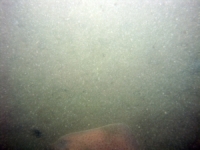
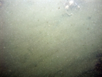
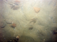
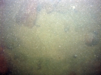
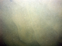
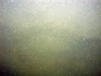
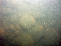
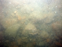
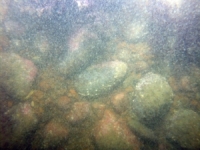
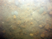
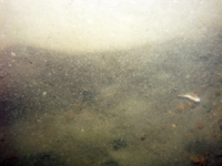
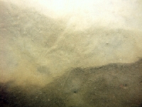
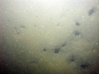
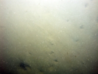
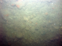
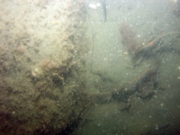
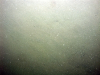
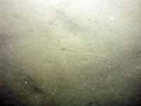
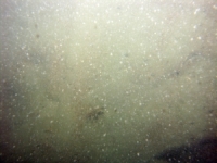
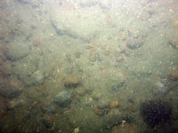
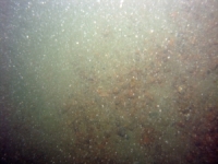
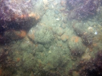
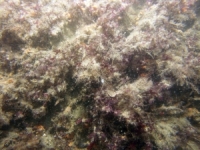
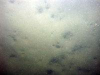
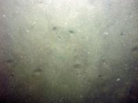
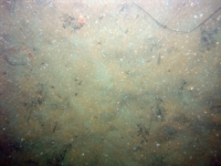
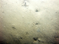
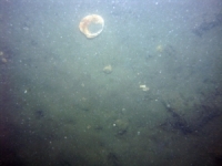
d3_PICT1021.JPG
Station # 136
Lat 41.497080
Long -71.004488
Time (UTC) 12:00:46
    Nearest Sediment Sample Info:
    • Classification = SAND
    • Station Number = 136
    • Distance = 50.3 meters
Image of seabed - photo.
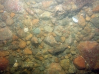
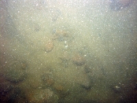
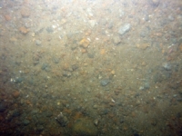
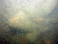
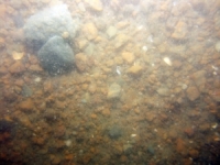
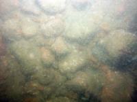
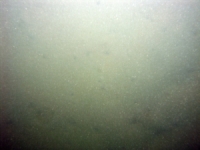
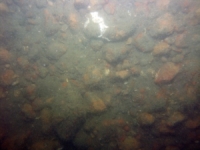
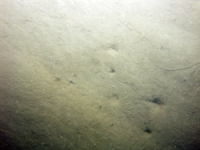
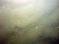
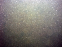
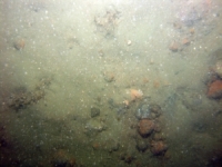
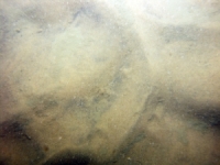
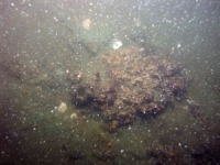
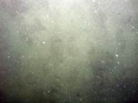
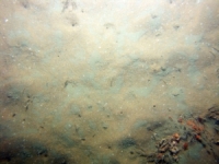
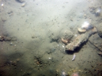
d3_PICT1022.JPG
Station # 136
Lat 41.497103
Long -71.004338
Time (UTC) 12:01:46
    Nearest Sediment Sample Info:
    • Classification = SAND
    • Station Number = 136
    • Distance = 40.3 meters
Image of seabed - photo.
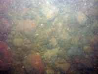
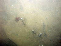
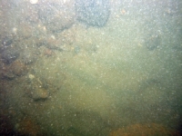
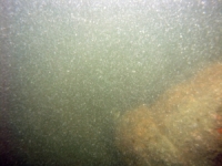
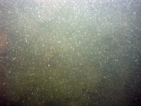
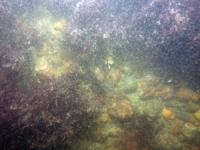
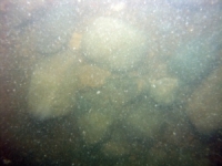
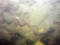
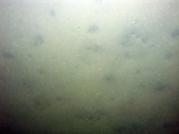
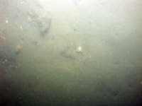
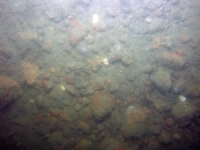
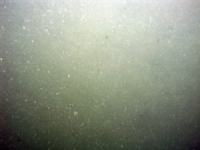
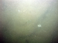
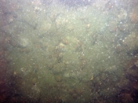
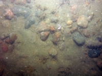
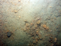
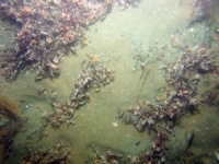
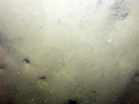
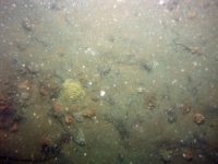
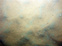
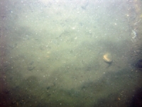
d3_PICT1023.JPG
Station # 136
Lat 41.497103
Long -71.004292
Time (UTC) 12:02:04
    Nearest Sediment Sample Info:
    • Classification = SAND
    • Station Number = 136
    • Distance = 37.1 meters
Image of seabed - photo.
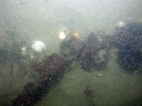
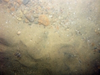
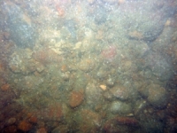
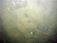
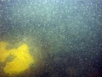
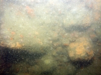
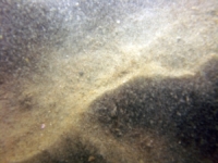
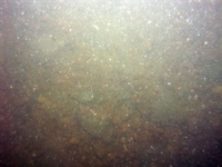
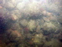
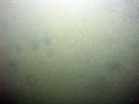
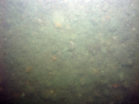
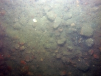
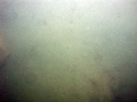
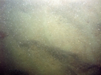
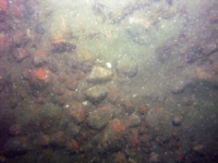
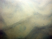
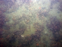
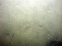
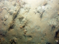
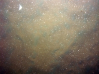
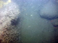
d3_PICT1024.JPG
Station # 136
Lat 41.497087
Long -71.004222
Time (UTC) 12:02:30
    Nearest Sediment Sample Info:
    • Classification = SAND
    • Station Number = 136
    • Distance = 31.3 meters
Image of seabed - photo.
d3_PICT1025.JPG
Station # 136
Lat 41.497005
Long -71.004062
Time (UTC) 12:03:41
    Nearest Sediment Sample Info:
    • Classification = SAND
    • Station Number = 136
    • Distance = 15.2 meters
Image of seabed - photo.
d3_PICT1026.JPG
Station # 136
Lat 41.496923
Long -71.003948
Time (UTC) 12:04:38
    Nearest Sediment Sample Info:
    • Classification = SAND
    • Station Number = 136
    • Distance = 2.1 meters
Image of seabed - photo.
d3_PICT1027.JPG
Station # 137
Lat 41.473572
Long -70.993073
Time (UTC) 12:28:20
    Nearest Sediment Sample Info:
    • Classification = SAND
    • Station Number = 137
    • Distance = 80.7 meters
Image of seabed - photo.
d3_PICT1028.JPG
Station # 137
Lat 41.473557
Long -70.993008
Time (UTC) 12:29:05
    Nearest Sediment Sample Info:
    • Classification = SAND
    • Station Number = 137
    • Distance = 75.1 meters
Image of seabed - photo.
d3_PICT1029.JPG
Station # 137
Lat 41.473422
Long -70.992678
Time (UTC) 12:31:13
    Nearest Sediment Sample Info:
    • Classification = SAND
    • Station Number = 137
    • Distance = 43.8 meters
Image of seabed - photo.
d3_PICT1030.JPG
Station # 137
Lat 41.473393
Long -70.992602
Time (UTC) 12:31:41
    Nearest Sediment Sample Info:
    • Classification = SAND
    • Station Number = 137
    • Distance = 36.7 meters
Image of seabed - photo.
d3_PICT1031.JPG
Station # 137
Lat 41.473305
Long -70.992413
Time (UTC) 12:32:51
    Nearest Sediment Sample Info:
    • Classification = SAND
    • Station Number = 137
    • Distance = 18.1 meters
Image of seabed - photo.
d3_PICT1032.JPG
Station # 137
Lat 41.473233
Long -70.992257
Time (UTC) 12:34:01
    Nearest Sediment Sample Info:
    • Classification = SAND
    • Station Number = 137
    • Distance = 2.8 meters
Image of seabed - photo.
d3_PICT1033.JPG
Station # 138
Lat 41.465907
Long -71.015188
Time (UTC) 12:51:15
    Nearest Sediment Sample Info:
    • Classification = SAND
    • Station Number = 138
    • Distance = 139.6 meters
Image of seabed - photo.
d3_PICT1034.JPG
Station # 138
Lat 41.465910
Long -71.015060
Time (UTC) 12:51:42
    Nearest Sediment Sample Info:
    • Classification = SAND
    • Station Number = 138
    • Distance = 128.9 meters
Image of seabed - photo.
d3_PICT1035.JPG
Station # 138
Lat 41.465920
Long -71.014805
Time (UTC) 12:52:29
    Nearest Sediment Sample Info:
    • Classification = SAND
    • Station Number = 138
    • Distance = 107.7 meters
Image of seabed - photo.
d3_PICT1036.JPG
Station # 138
Lat 41.465948
Long -71.014482
Time (UTC) 12:53:37
    Nearest Sediment Sample Info:
    • Classification = SAND
    • Station Number = 138
    • Distance = 81.1 meters
Image of seabed - photo.
d3_PICT1037.JPG
Station # 138
Lat 41.465868
Long -71.014245
Time (UTC) 12:54:28
    Nearest Sediment Sample Info:
    • Classification = SAND
    • Station Number = 138
    • Distance = 60.7 meters
Image of seabed - photo.
d3_PICT1038.JPG
Station # 138
Lat 41.465863
Long -71.014028
Time (UTC) 12:55:26
    Nearest Sediment Sample Info:
    • Classification = SAND
    • Station Number = 138
    • Distance = 42.6 meters
Image of seabed - photo.
d3_PICT1039.JPG
Station # 138
Lat 41.465870
Long -71.013808
Time (UTC) 12:56:19
    Nearest Sediment Sample Info:
    • Classification = SAND
    • Station Number = 138
    • Distance = 24.2 meters
Image of seabed - photo.
d3_PICT1040.JPG
Station # 138
Lat 41.465865
Long -71.013653
Time (UTC) 12:56:55
    Nearest Sediment Sample Info:
    • Classification = SAND
    • Station Number = 138
    • Distance = 11.3 meters
Image of seabed - photo.
d3_PICT1041.JPG
Station # 139
Lat 41.446028
Long -71.028900
Time (UTC) 13:21:56
    Nearest Sediment Sample Info:
    • Classification = GRAVEL
    • Station Number = 139
    • Distance = 334.6 meters
Image of seabed - photo.
d3_PICT1042.JPG
Station # 139
Lat 41.445987
Long -71.028773
Time (UTC) 13:22:20
    Nearest Sediment Sample Info:
    • Classification = GRAVEL
    • Station Number = 139
    • Distance = 323.1 meters
Image of seabed - photo.
d3_PICT1043.JPG
Station # 139
Lat 41.445922
Long -71.028630
Time (UTC) 13:22:50
    Nearest Sediment Sample Info:
    • Classification = GRAVEL
    • Station Number = 139
    • Distance = 309.2 meters
Image of seabed - photo.
d3_PICT1044.JPG
Station # 139
Lat 41.445807
Long -71.028387
Time (UTC) 13:23:44
    Nearest Sediment Sample Info:
    • Classification = GRAVEL
    • Station Number = 139
    • Distance = 285.2 meters
Image of seabed - photo.
d3_PICT1045.JPG
Station # 139
Lat 41.445710
Long -71.028168
Time (UTC) 13:24:35
    Nearest Sediment Sample Info:
    • Classification = GRAVEL
    • Station Number = 139
    • Distance = 264 meters
Image of seabed - photo.
d3_PICT1046.JPG
Station # 139
Lat 41.445622
Long -71.027950
Time (UTC) 13:25:21
    Nearest Sediment Sample Info:
    • Classification = GRAVEL
    • Station Number = 139
    • Distance = 243.3 meters
Image of seabed - photo.
d3_PICT1047.JPG
Station # 139
Lat 41.445507
Long -71.027668
Time (UTC) 13:26:15
    Nearest Sediment Sample Info:
    • Classification = GRAVEL
    • Station Number = 139
    • Distance = 216.5 meters
Image of seabed - photo.
d3_PICT1048.JPG
Station # 139
Lat 41.445433
Long -71.027495
Time (UTC) 13:26:49
    Nearest Sediment Sample Info:
    • Classification = GRAVEL
    • Station Number = 139
    • Distance = 199.9 meters
Image of seabed - photo.
d3_PICT1049.JPG
Station # 139
Lat 41.445390
Long -71.027398
Time (UTC) 13:27:09
    Nearest Sediment Sample Info:
    • Classification = GRAVEL
    • Station Number = 139
    • Distance = 190.5 meters
Image of seabed - photo.
d3_PICT1050.JPG
Station # 139
Lat 41.445292
Long -71.027148
Time (UTC) 13:28:02
    Nearest Sediment Sample Info:
    • Classification = GRAVEL
    • Station Number = 139
    • Distance = 166.9 meters
Image of seabed - photo.
d3_PICT1051.JPG
Station # 139
Lat 41.445153
Long -71.026825
Time (UTC) 13:29:08
    Nearest Sediment Sample Info:
    • Classification = GRAVEL
    • Station Number = 139
    • Distance = 135.9 meters
Image of seabed - photo.
d3_PICT1052.JPG
Station # 139
Lat 41.445107
Long -71.026677
Time (UTC) 13:29:41
    Nearest Sediment Sample Info:
    • Classification = GRAVEL
    • Station Number = 139
    • Distance = 122.6 meters
Image of seabed - photo.
d3_PICT1053.JPG
Station # 139
Lat 41.444935
Long -71.026295
Time (UTC) 13:31:05
    Nearest Sediment Sample Info:
    • Classification = GRAVEL
    • Station Number = 139
    • Distance = 85.4 meters
Image of seabed - photo.
d3_PICT1054.JPG
Station # 139
Lat 41.444823
Long -71.026057
Time (UTC) 13:31:58
    Nearest Sediment Sample Info:
    • Classification = GRAVEL
    • Station Number = 139
    • Distance = 62 meters
Image of seabed - photo.
d3_PICT1055.JPG
Station # 139
Lat 41.444658
Long -71.025635
Time (UTC) 13:33:35
    Nearest Sediment Sample Info:
    • Classification = GRAVEL
    • Station Number = 139
    • Distance = 22.2 meters
Image of seabed - photo.
d3_PICT1056.JPG
Station # 139
Lat 41.444603
Long -71.025500
Time (UTC) 13:34:05
    Nearest Sediment Sample Info:
    • Classification = GRAVEL
    • Station Number = 139
    • Distance = 9.4 meters
Image of seabed - photo.
d3_PICT1057.JPG
Station # 140
Lat 41.439532
Long -71.039205
Time (UTC) 13:49:29
    Nearest Sediment Sample Info:
    • Classification = GRAVEL
    • Station Number = 140
    • Distance = 131.6 meters
Image of seabed - photo.
d3_PICT1058.JPG
Station # 140
Lat 41.439383
Long -71.039110
Time (UTC) 13:50:30
    Nearest Sediment Sample Info:
    • Classification = GRAVEL
    • Station Number = 140
    • Distance = 113.7 meters
Image of seabed - photo.
d3_PICT1059.JPG
Station # 140
Lat 41.439280
Long -71.039027
Time (UTC) 13:51:10
    Nearest Sediment Sample Info:
    • Classification = GRAVEL
    • Station Number = 140
    • Distance = 100.4 meters
Image of seabed - photo.
d3_PICT1060.JPG
Station # 140
Lat 41.439245
Long -71.038997
Time (UTC) 13:51:23
    Nearest Sediment Sample Info:
    • Classification = GRAVEL
    • Station Number = 140
    • Distance = 95.8 meters
Image of seabed - photo.
d3_PICT1061.JPG
Station # 140
Lat 41.438955
Long -71.038675
Time (UTC) 13:53:24
    Nearest Sediment Sample Info:
    • Classification = GRAVEL
    • Station Number = 140
    • Distance = 53.9 meters
Image of seabed - photo.
d3_PICT1062.JPG
Station # 140
Lat 41.438807
Long -71.038498
Time (UTC) 13:54:27
    Nearest Sediment Sample Info:
    • Classification = GRAVEL
    • Station Number = 140
    • Distance = 31.8 meters
Image of seabed - photo.
d3_PICT1063.JPG
Station # 140
Lat 41.438688
Long -71.038360
Time (UTC) 13:55:19
    Nearest Sediment Sample Info:
    • Classification = GRAVEL
    • Station Number = 140
    • Distance = 14.2 meters
Image of seabed - photo.
d3_PICT1064.JPG
Station # 140
Lat 41.438587
Long -71.038255
Time (UTC) 13:56:02
    Nearest Sediment Sample Info:
    • Classification = GRAVEL
    • Station Number = 140
    • Distance = 0 meters
Image of seabed - photo.
d3_PICT1065.JPG
Station # 141
Lat 41.434390
Long -71.052128
Time (UTC) 14:07:32
    Nearest Sediment Sample Info:
    • Classification = SAND
    • Station Number = 141
    • Distance = 49 meters
Image of seabed - photo.
d3_PICT1066.JPG
Station # 141
Lat 41.434282
Long -71.052147
Time (UTC) 14:08:42
    Nearest Sediment Sample Info:
    • Classification = SAND
    • Station Number = 141
    • Distance = 38.4 meters
Image of seabed - photo.
d3_PICT1067.JPG
Station # 141
Lat 41.434050
Long -71.052022
Time (UTC) 14:10:28
    Nearest Sediment Sample Info:
    • Classification = SAND
    • Station Number = 141
    • Distance = 10.7 meters
Image of seabed - photo.
d3_PICT1068.JPG
Station # 141
Lat 41.434013
Long -71.051993
Time (UTC) 14:10:42
    Nearest Sediment Sample Info:
    • Classification = SAND
    • Station Number = 141
    • Distance = 5.9 meters
Image of seabed - photo.
d3_PICT1069.JPG
Station # 141
Lat 41.433968
Long -71.051955
Time (UTC) 14:11:00
    Nearest Sediment Sample Info:
    • Classification = SAND
    • Station Number = 141
    • Distance = 0 meters
Image of seabed - photo.
d3_PICT1070.JPG
Station # 142
Lat 41.428665
Long -71.068393
Time (UTC) 14:25:37
    Nearest Sediment Sample Info:
    • Classification = GRAVEL
    • Station Number = 142
    • Distance = 94.3 meters
Image of seabed - photo.
d3_PICT1071.JPG
Station # 142
Lat 41.428580
Long -71.068220
Time (UTC) 14:26:43
    Nearest Sediment Sample Info:
    • Classification = GRAVEL
    • Station Number = 142
    • Distance = 80.4 meters
Image of seabed - photo.
d3_PICT1072.JPG
Station # 142
Lat 41.428525
Long -71.068147
Time (UTC) 14:27:12
    Nearest Sediment Sample Info:
    • Classification = GRAVEL
    • Station Number = 142
    • Distance = 72.9 meters
Image of seabed - photo.
d3_PICT1073.JPG
Station # 142
Lat 41.428480
Long -71.068103
Time (UTC) 14:27:33
    Nearest Sediment Sample Info:
    • Classification = GRAVEL
    • Station Number = 142
    • Distance = 67.2 meters
Image of seabed - photo.
d3_PICT1074.JPG
Station # 142
Lat 41.428390
Long -71.068047
Time (UTC) 14:28:15
    Nearest Sediment Sample Info:
    • Classification = GRAVEL
    • Station Number = 142
    • Distance = 56.5 meters
Image of seabed - photo.
d3_PICT1075.JPG
Station # 142
Lat 41.428275
Long -71.067977
Time (UTC) 14:29:15
    Nearest Sediment Sample Info:
    • Classification = GRAVEL
    • Station Number = 142
    • Distance = 43.2 meters
Image of seabed - photo.
d3_PICT1076.JPG
Station # 142
Lat 41.428175
Long -71.067942
Time (UTC) 14:30:07
    Nearest Sediment Sample Info:
    • Classification = GRAVEL
    • Station Number = 142
    • Distance = 32 meters
Image of seabed - photo.
d3_PICT1077.JPG
Station # 142
Lat 41.428125
Long -71.067938
Time (UTC) 14:30:33
    Nearest Sediment Sample Info:
    • Classification = GRAVEL
    • Station Number = 142
    • Distance = 26.4 meters
Image of seabed - photo.
d3_PICT1078.JPG
Station # 142
Lat 41.427970
Long -71.067933
Time (UTC) 14:32:02
    Nearest Sediment Sample Info:
    • Classification = GRAVEL
    • Station Number = 142
    • Distance = 9.2 meters
Image of seabed - photo.
d3_PICT1079.JPG
Station # 142
Lat 41.427887
Long -71.067942
Time (UTC) 14:32:40
    Nearest Sediment Sample Info:
    • Classification = GRAVEL
    • Station Number = 142
    • Distance = 0 meters
Image of seabed - photo.
d3_PICT1080.JPG
Station # 143
Lat 41.435472
Long -71.078973
Time (UTC) 14:45:07
    Nearest Sediment Sample Info:
    • Classification = GRAVEL
    • Station Number = 143
    • Distance = 83.3 meters
Image of seabed - photo.
d3_PICT1081.JPG
Station # 143
Lat 41.435445
Long -71.079062
Time (UTC) 14:45:39
    Nearest Sediment Sample Info:
    • Classification = GRAVEL
    • Station Number = 143
    • Distance = 77.3 meters
Image of seabed - photo.
d3_PICT1082.JPG
Station # 143
Lat 41.435333
Long -71.079213
Time (UTC) 14:46:33
    Nearest Sediment Sample Info:
    • Classification = GRAVEL
    • Station Number = 143
    • Distance = 61 meters
Image of seabed - photo.
d3_PICT1083.JPG
Station # 143
Lat 41.435277
Long -71.079280
Time (UTC) 14:46:59
    Nearest Sediment Sample Info:
    • Classification = GRAVEL
    • Station Number = 143
    • Distance = 53.4 meters
Image of seabed - photo.
d3_PICT1084.JPG
Station # 143
Lat 41.435117
Long -71.079358
Time (UTC) 14:47:53
    Nearest Sediment Sample Info:
    • Classification = GRAVEL
    • Station Number = 143
    • Distance = 34.5 meters
Image of seabed - photo.
d3_PICT1085.JPG
Station # 143
Lat 41.435058
Long -71.079380
Time (UTC) 14:48:13
    Nearest Sediment Sample Info:
    • Classification = GRAVEL
    • Station Number = 143
    • Distance = 27.7 meters
Image of seabed - photo.
d3_PICT1086.JPG
Station # 143
Lat 41.434973
Long -71.079418
Time (UTC) 14:48:45
    Nearest Sediment Sample Info:
    • Classification = GRAVEL
    • Station Number = 143
    • Distance = 17.8 meters
Image of seabed - photo.
d3_PICT1087.JPG
Station # 143
Lat 41.434845
Long -71.079448
Time (UTC) 14:49:36
    Nearest Sediment Sample Info:
    • Classification = GRAVEL
    • Station Number = 143
    • Distance = 3.4 meters
Image of seabed - photo.
d3_PICT1088.JPG
Station # 143
Lat 41.434815
Long -71.079455
Time (UTC) 14:49:47
    Nearest Sediment Sample Info:
    • Classification = GRAVEL
    • Station Number = 143
    • Distance = 0 meters
Image of seabed - photo.
d3_PICT1089.JPG
Station # 144
Lat 41.458647
Long -71.057450
Time (UTC) 15:10:25
    Nearest Sediment Sample Info:
    • Classification = GRAVEL
    • Station Number = 144
    • Distance = 226.6 meters
Image of seabed - photo.
d3_PICT1090.JPG
Station # 144
Lat 41.458512
Long -71.057375
Time (UTC) 15:11:04
    Nearest Sediment Sample Info:
    • Classification = GRAVEL
    • Station Number = 144
    • Distance = 211.9 meters
Image of seabed - photo.
d3_PICT1091.JPG
Station # 144
Lat 41.458437
Long -71.057358
Time (UTC) 15:11:23
    Nearest Sediment Sample Info:
    • Classification = GRAVEL
    • Station Number = 144
    • Distance = 203.7 meters
Image of seabed - photo.
d3_PICT1092.JPG
Station # 144
Lat 41.458312
Long -71.057360
Time (UTC) 15:11:54
    Nearest Sediment Sample Info:
    • Classification = GRAVEL
    • Station Number = 144
    • Distance = 189.8 meters
Image of seabed - photo.
d3_PICT1093.JPG
Station # 144
Lat 41.458263
Long -71.057368
Time (UTC) 15:12:06
    Nearest Sediment Sample Info:
    • Classification = GRAVEL
    • Station Number = 144
    • Distance = 184.4 meters
Image of seabed - photo.
d3_PICT1094.JPG
Station # 144
Lat 41.458145
Long -71.057392
Time (UTC) 15:12:35
    Nearest Sediment Sample Info:
    • Classification = GRAVEL
    • Station Number = 144
    • Distance = 171.2 meters
Image of seabed - photo.
d3_PICT1095.JPG
Station # 144
Lat 41.457900
Long -71.057438
Time (UTC) 15:13:38
    Nearest Sediment Sample Info:
    • Classification = GRAVEL
    • Station Number = 144
    • Distance = 143.8 meters
Image of seabed - photo.
d3_PICT1096.JPG
Station # 144
Lat 41.457738
Long -71.057452
Time (UTC) 15:14:23
    Nearest Sediment Sample Info:
    • Classification = GRAVEL
    • Station Number = 144
    • Distance = 125.7 meters
Image of seabed - photo.
d3_PICT1097.JPG
Station # 144
Lat 41.457533
Long -71.057480
Time (UTC) 15:15:21
    Nearest Sediment Sample Info:
    • Classification = GRAVEL
    • Station Number = 144
    • Distance = 102.9 meters
Image of seabed - photo.
d3_PICT1098.JPG
Station # 144
Lat 41.457350
Long -71.057518
Time (UTC) 15:16:11
    Nearest Sediment Sample Info:
    • Classification = GRAVEL
    • Station Number = 144
    • Distance = 82.5 meters
Image of seabed - photo.
d3_PICT1099.JPG
Station # 144
Lat 41.457130
Long -71.057533
Time (UTC) 15:17:08
    Nearest Sediment Sample Info:
    • Classification = GRAVEL
    • Station Number = 144
    • Distance = 58.1 meters
Image of seabed - photo.
d3_PICT1100.JPG
Station # 144
Lat 41.457043
Long -71.057535
Time (UTC) 15:17:30
    Nearest Sediment Sample Info:
    • Classification = GRAVEL
    • Station Number = 144
    • Distance = 48.4 meters
Image of seabed - photo.
d3_PICT1101.JPG
Station # 144
Lat 41.456932
Long -71.057530
Time (UTC) 15:17:58
    Nearest Sediment Sample Info:
    • Classification = GRAVEL
    • Station Number = 144
    • Distance = 36.1 meters
Image of seabed - photo.
d3_PICT1102.JPG
Station # 144
Lat 41.456832
Long -71.057532
Time (UTC) 15:18:24
    Nearest Sediment Sample Info:
    • Classification = GRAVEL
    • Station Number = 144
    • Distance = 25 meters
Image of seabed - photo.
d3_PICT1103.JPG
Station # 144
Lat 41.456607
Long -71.057523
Time (UTC) 15:19:20
    Nearest Sediment Sample Info:
    • Classification = GRAVEL
    • Station Number = 144
    • Distance = 0 meters
Image of seabed - photo.
d3_PICT1104.JPG
Station # 145
Lat 41.468608
Long -71.061028
Time (UTC) 15:32:48
    Nearest Sediment Sample Info:
    • Classification = GRAVEL
    • Station Number = 145
    • Distance = 93.5 meters
Image of seabed - photo.
d3_PICT1105.JPG
Station # 145
Lat 41.468533
Long -71.061110
Time (UTC) 15:34:03
    Nearest Sediment Sample Info:
    • Classification = GRAVEL
    • Station Number = 145
    • Distance = 83.4 meters
Image of seabed - photo.
d3_PICT1106.JPG
Station # 145
Lat 41.468387
Long -71.061202
Time (UTC) 15:34:56
    Nearest Sediment Sample Info:
    • Classification = GRAVEL
    • Station Number = 145
    • Distance = 65.6 meters
Image of seabed - photo.
d3_PICT1107.JPG
Station # 145
Lat 41.468032
Long -71.061322
Time (UTC) 15:36:40
    Nearest Sediment Sample Info:
    • Classification = GRAVEL
    • Station Number = 145
    • Distance = 25 meters
Image of seabed - photo.
d3_PICT1108.JPG
Station # 145
Lat 41.467820
Long -71.061422
Time (UTC) 15:37:40
    Nearest Sediment Sample Info:
    • Classification = GRAVEL
    • Station Number = 145
    • Distance = 0 meters
Image of seabed - photo.
d3_PICT1109.JPG
Station # 146
Lat 41.467807
Long -71.068668
Time (UTC) 15:46:31
    Nearest Sediment Sample Info:
    • Classification = GRAVELLY SEDIMENT
    • Station Number = 146
    • Distance = 52.7 meters
Image of seabed - photo.
d3_PICT1110.JPG
Station # 146
Lat 41.467530
Long -71.068883
Time (UTC) 15:47:53
    Nearest Sediment Sample Info:
    • Classification = GRAVELLY SEDIMENT
    • Station Number = 146
    • Distance = 17.1 meters
Image of seabed - photo.
d3_PICT1111.JPG
Station # 146
Lat 41.467402
Long -71.068997
Time (UTC) 15:48:32
    Nearest Sediment Sample Info:
    • Classification = GRAVELLY SEDIMENT
    • Station Number = 146
    • Distance = 0 meters
Image of seabed - photo.
d3_PICT1112.JPG
Station # 147
Lat 41.468187
Long -71.075543
Time (UTC) 15:58:56
    Nearest Sediment Sample Info:
    • Classification = SAND
    • Station Number = 147
    • Distance = 45.7 meters
Image of seabed - photo.
d3_PICT1113.JPG
Station # 147
Lat 41.468102
Long -71.075652
Time (UTC) 15:59:31
    Nearest Sediment Sample Info:
    • Classification = SAND
    • Station Number = 147
    • Distance = 32.6 meters
Image of seabed - photo.
d3_PICT1114.JPG
Station # 147
Lat 41.468013
Long -71.075793
Time (UTC) 16:00:12
    Nearest Sediment Sample Info:
    • Classification = SAND
    • Station Number = 147
    • Distance = 17.3 meters
Image of seabed - photo.
d3_PICT1115.JPG
Station # 148
Lat 41.468360
Long -71.082570
Time (UTC) 16:26:34
    Nearest Sediment Sample Info:
    • Classification = SAND
    • Station Number = 148
    • Distance = 77.6 meters
Image of seabed - photo.
d3_PICT1116.JPG
Station # 148
Lat 41.468308
Long -71.082667
Time (UTC) 16:26:57
    Nearest Sediment Sample Info:
    • Classification = SAND
    • Station Number = 148
    • Distance = 67.9 meters
Image of seabed - photo.
d3_PICT1117.JPG
Station # 148
Lat 41.468255
Long -71.082748
Time (UTC) 16:27:18
    Nearest Sediment Sample Info:
    • Classification = SAND
    • Station Number = 148
    • Distance = 59 meters
Image of seabed - photo.
d3_PICT1118.JPG
Station # 148
Lat 41.468212
Long -71.082813
Time (UTC) 16:27:35
    Nearest Sediment Sample Info:
    • Classification = SAND
    • Station Number = 148
    • Distance = 51.9 meters
Image of seabed - photo.
d3_PICT1119.JPG
Station # 148
Lat 41.468135
Long -71.082907
Time (UTC) 16:28:03
    Nearest Sediment Sample Info:
    • Classification = SAND
    • Station Number = 148
    • Distance = 40.3 meters
Image of seabed - photo.
d3_PICT1120.JPG
Station # 148
Lat 41.467902
Long -71.083163
Time (UTC) 16:29:21
    Nearest Sediment Sample Info:
    • Classification = SAND
    • Station Number = 148
    • Distance = 6.7 meters
Image of seabed - photo.
d3_PICT1121.JPG
Station # 149
Lat 41.469890
Long -71.095967
Time (UTC) 16:40:13
    Nearest Sediment Sample Info:
    • Classification = SAND
    • Station Number = 149
    • Distance = 66.5 meters
Image of seabed - photo.
d3_PICT1122.JPG
Station # 149
Lat 41.469822
Long -71.096060
Time (UTC) 16:40:44
    Nearest Sediment Sample Info:
    • Classification = SAND
    • Station Number = 149
    • Distance = 55.6 meters
Image of seabed - photo.
d3_PICT1123.JPG
Station # 149
Lat 41.469758
Long -71.096152
Time (UTC) 16:41:11
    Nearest Sediment Sample Info:
    • Classification = SAND
    • Station Number = 149
    • Distance = 45.2 meters
Image of seabed - photo.
d3_PICT1124.JPG
Station # 149
Lat 41.469635
Long -71.096325
Time (UTC) 16:42:06
    Nearest Sediment Sample Info:
    • Classification = SAND
    • Station Number = 149
    • Distance = 25.3 meters
Image of seabed - photo.
d3_PICT1125.JPG
Station # 149
Lat 41.469547
Long -71.096428
Time (UTC) 16:42:42
    Nearest Sediment Sample Info:
    • Classification = SAND
    • Station Number = 149
    • Distance = 12.3 meters
Image of seabed - photo.
d3_PICT1126.JPG
Station # 150
Lat 41.476743
Long -71.069245
Time (UTC) 17:00:59
    Nearest Sediment Sample Info:
    • Classification = GRAVEL
    • Station Number = 150
    • Distance = 42.7 meters
Image of seabed - photo.
d3_PICT1127.JPG
Station # 150
Lat 41.476680
Long -71.069403
Time (UTC) 17:01:33
    Nearest Sediment Sample Info:
    • Classification = GRAVEL
    • Station Number = 150
    • Distance = 27.8 meters
Image of seabed - photo.
d3_PICT1128.JPG
Station # 150
Lat 41.476673
Long -71.069487
Time (UTC) 17:01:48
    Nearest Sediment Sample Info:
    • Classification = GRAVEL
    • Station Number = 150
    • Distance = 21.4 meters
Image of seabed - photo.
d3_PICT1129.JPG
Station # 150
Lat 41.476610
Long -71.069577
Time (UTC) 17:02:13
    Nearest Sediment Sample Info:
    • Classification = GRAVEL
    • Station Number = 150
    • Distance = 11.3 meters
Image of seabed - photo.
d3_PICT1130.JPG
Station # 150
Lat 41.476558
Long -71.069693
Time (UTC) 17:02:42
    Nearest Sediment Sample Info:
    • Classification = GRAVEL
    • Station Number = 150
    • Distance = 0 meters
Image of seabed - photo.
d3_PICT1132.JPG
Station # 151
Lat 41.477992
Long -71.068325
Time (UTC) 17:16:07
    Nearest Sediment Sample Info:
    • Classification = GRAVEL
    • Station Number = 151
    • Distance = 3.8 meters
Image of seabed - photo.
d3_PICT1133.JPG
Station # 151
Lat 41.478022
Long -71.068522
Time (UTC) 17:16:57
    Nearest Sediment Sample Info:
    • Classification = GRAVEL
    • Station Number = 151
    • Distance = 13.2 meters
Image of seabed - photo.
d3_PICT1134.JPG
Station # 151
Lat 41.478003
Long -71.068642
Time (UTC) 17:17:22
    Nearest Sediment Sample Info:
    • Classification = GRAVEL
    • Station Number = 151
    • Distance = 23.1 meters
Image of seabed - photo.
d3_PICT1135.JPG
Station # 151
Lat 41.477972
Long -71.068743
Time (UTC) 17:17:44
    Nearest Sediment Sample Info:
    • Classification = GRAVEL
    • Station Number = 151
    • Distance = 31.8 meters
Image of seabed - photo.
d3_PICT1136.JPG
Station # 151
Lat 41.477938
Long -71.068822
Time (UTC) 17:18:02
    Nearest Sediment Sample Info:
    • Classification = GRAVEL
    • Station Number = 151
    • Distance = 39 meters
Image of seabed - photo.
d3_PICT1137.JPG
Station # 151
Lat 41.477895
Long -71.068920
Time (UTC) 17:18:27
    Nearest Sediment Sample Info:
    • Classification = GRAVEL
    • Station Number = 151
    • Distance = 48 meters
Image of seabed - photo.
d3_PICT1138.JPG
Station # 151
Lat 41.477848
Long -71.069015
Time (UTC) 17:18:53
    Nearest Sediment Sample Info:
    • Classification = GRAVEL
    • Station Number = 151
    • Distance = 57.1 meters
Image of seabed - photo.
d3_PICT1139.JPG
Station # 151
Lat 41.477777
Long -71.069132
Time (UTC) 17:19:29
    Nearest Sediment Sample Info:
    • Classification = GRAVEL
    • Station Number = 151
    • Distance = 69 meters
Image of seabed - photo.
d3_PICT1140.JPG
Station # 151
Lat 41.477732
Long -71.069220
Time (UTC) 17:19:57
    Nearest Sediment Sample Info:
    • Classification = GRAVEL
    • Station Number = 151
    • Distance = 77.7 meters
Image of seabed - photo.
d3_PICT1141.JPG
Station # 151
Lat 41.477538
Long -71.069690
Time (UTC) 17:21:53
    Nearest Sediment Sample Info:
    • Classification = GRAVEL
    • Station Number = 150
    • Distance = 108.8 meters
Image of seabed - photo.
d3_PICT1142.JPG
Station # 152
Lat 41.483048
Long -71.061305
Time (UTC) 17:34:09
    Nearest Sediment Sample Info:
    • Classification = SAND
    • Station Number = 152
    • Distance = 83.3 meters
Image of seabed - photo.
d3_PICT1143.JPG
Station # 152
Lat 41.483000
Long -71.061308
Time (UTC) 17:34:28
    Nearest Sediment Sample Info:
    • Classification = SAND
    • Station Number = 152
    • Distance = 78.3 meters
Image of seabed - photo.
d3_PICT1144.JPG
Station # 152
Lat 41.482923
Long -71.061323
Time (UTC) 17:35:00
    Nearest Sediment Sample Info:
    • Classification = SAND
    • Station Number = 152
    • Distance = 70 meters
Image of seabed - photo.
d3_PICT1145.JPG
Station # 152
Lat 41.482863
Long -71.061340
Time (UTC) 17:35:25
    Nearest Sediment Sample Info:
    • Classification = SAND
    • Station Number = 152
    • Distance = 63.5 meters
Image of seabed - photo.
d3_PICT1146.JPG
Station # 153
Lat 41.487942
Long -71.065875
Time (UTC) 17:50:07
    Nearest Sediment Sample Info:
    • Classification = SAND
    • Station Number = 153
    • Distance = 50.6 meters
Image of seabed - photo.
d3_PICT1147.JPG
Station # 153
Lat 41.487825
Long -71.065975
Time (UTC) 17:50:52
    Nearest Sediment Sample Info:
    • Classification = SAND
    • Station Number = 153
    • Distance = 35.4 meters
Image of seabed - photo.
d3_PICT1148.JPG
Station # 153
Lat 41.487765
Long -71.066067
Time (UTC) 17:51:31
    Nearest Sediment Sample Info:
    • Classification = SAND
    • Station Number = 153
    • Distance = 25.3 meters
Image of seabed - photo.
d3_PICT1149.JPG
Station # 153
Lat 41.487733
Long -71.066133
Time (UTC) 17:51:59
    Nearest Sediment Sample Info:
    • Classification = SAND
    • Station Number = 153
    • Distance = 18.9 meters
Image of seabed - photo.
d3_PICT1150.JPG
Station # 154
Lat 41.487865
Long -71.064398
Time (UTC) 18:03:48
    Nearest Sediment Sample Info:
    • Classification = GRAVEL
    • Station Number = 154
    • Distance = 115.9 meters
Image of seabed - photo.
d3_PICT1151.JPG
Station # 154
Lat 41.487845
Long -71.064482
Time (UTC) 18:04:18
    Nearest Sediment Sample Info:
    • Classification = GRAVEL
    • Station Number = 154
    • Distance = 108.9 meters
Image of seabed - photo.
d3_PICT1152.JPG
Station # 154
Lat 41.487635
Long -71.064890
Time (UTC) 18:06:04
    Nearest Sediment Sample Info:
    • Classification = GRAVEL
    • Station Number = 154
    • Distance = 67.7 meters
Image of seabed - photo.
d3_PICT1153.JPG
Station # 154
Lat 41.487470
Long -71.065247
Time (UTC) 18:07:23
    Nearest Sediment Sample Info:
    • Classification = GRAVEL
    • Station Number = 154
    • Distance = 33.1 meters
Image of seabed - photo.
d3_PICT1154.JPG
Station # 155
Lat 41.459697
Long -70.985340
Time (UTC) 18:49:24
    Nearest Sediment Sample Info:
    • Classification = SILTY SAND
    • Station Number = 155
    • Distance = 229.1 meters
Image of seabed - photo.
d3_PICT1155.JPG
Station # 155
Lat 41.459428
Long -70.985732
Time (UTC) 18:50:04
    Nearest Sediment Sample Info:
    • Classification = SILTY SAND
    • Station Number = 155
    • Distance = 184.8 meters
Image of seabed - photo.
d3_PICT1156.JPG
Station # 155
Lat 41.459267
Long -70.985972
Time (UTC) 18:50:28
    Nearest Sediment Sample Info:
    • Classification = SILTY SAND
    • Station Number = 155
    • Distance = 157.9 meters
Image of seabed - photo.
d3_PICT1157.JPG
Station # 155
Lat 41.458448
Long -70.986935
Time (UTC) 18:52:21
    Nearest Sediment Sample Info:
    • Classification = SILTY SAND
    • Station Number = 155
    • Distance = 37.8 meters
Image of seabed - photo.
d3_PICT1158.JPG
Station # 155
Lat 41.458302
Long -70.987243
Time (UTC) 18:52:54
    Nearest Sediment Sample Info:
    • Classification = SILTY SAND
    • Station Number = 155
    • Distance = 7.3 meters
Image of seabed - photo.
d3_PICT1159.JPG
Station # 155
Lat 41.458175
Long -70.987533
Time (UTC) 18:53:30
    Nearest Sediment Sample Info:
    • Classification = SILTY SAND
    • Station Number = 155
    • Distance = 20.7 meters
Image of seabed - photo.
d3_PICT1160.JPG
Station # 155
Lat 41.457970
Long -70.988060
Time (UTC) 18:54:37
    Nearest Sediment Sample Info:
    • Classification = SILTY SAND
    • Station Number = 155
    • Distance = 70.2 meters
Image of seabed - photo.
d3_PICT1161.JPG
Station # 155
Lat 41.457935
Long -70.988150
Time (UTC) 18:54:48
    Nearest Sediment Sample Info:
    • Classification = SILTY SAND
    • Station Number = 155
    • Distance = 78.7 meters
Image of seabed - photo.
d3_PICT1162.JPG
Station # 155
Lat 41.457833
Long -70.988413
Time (UTC) 18:55:21
    Nearest Sediment Sample Info:
    • Classification = SILTY SAND
    • Station Number = 155
    • Distance = 103.4 meters
Image of seabed - photo.
d3_PICT1163.JPG
Station # 155
Lat 41.457703
Long -70.988732
Time (UTC) 18:56:01
    Nearest Sediment Sample Info:
    • Classification = SILTY SAND
    • Station Number = 155
    • Distance = 133.7 meters
Image of seabed - photo.
d3_PICT1164.JPG
Station # 155
Lat 41.457587
Long -70.989000
Time (UTC) 18:56:35
    Nearest Sediment Sample Info:
    • Classification = SILTY SAND
    • Station Number = 155
    • Distance = 159.5 meters
Image of seabed - photo.
d3_PICT1165.JPG
Station # 156
Lat 41.457680
Long -70.996242
Time (UTC) 19:05:35
    Nearest Sediment Sample Info:
    • Classification = GRAVEL
    • Station Number = 156
    • Distance = 130.8 meters
Image of seabed - photo.
d3_PICT1166.JPG
Station # 156
Lat 41.457558
Long -70.996507
Time (UTC) 19:05:58
    Nearest Sediment Sample Info:
    • Classification = GRAVEL
    • Station Number = 156
    • Distance = 104.9 meters
Image of seabed - photo.
d3_PICT1167.JPG
Station # 156
Lat 41.457470
Long -70.996703
Time (UTC) 19:06:15
    Nearest Sediment Sample Info:
    • Classification = GRAVEL
    • Station Number = 156
    • Distance = 85.8 meters
Image of seabed - photo.
d3_PICT1168.JPG
Station # 156
Lat 41.457392
Long -70.996887
Time (UTC) 19:06:31
    Nearest Sediment Sample Info:
    • Classification = GRAVEL
    • Station Number = 156
    • Distance = 68.2 meters
Image of seabed - photo.
d3_PICT1169.JPG
Station # 156
Lat 41.457308
Long -70.997082
Time (UTC) 19:06:48
    Nearest Sediment Sample Info:
    • Classification = GRAVEL
    • Station Number = 156
    • Distance = 49.4 meters
Image of seabed - photo.
d3_PICT1170.JPG
Station # 156
Lat 41.457237
Long -70.997262
Time (UTC) 19:07:03
    Nearest Sediment Sample Info:
    • Classification = GRAVEL
    • Station Number = 156
    • Distance = 32.5 meters
Image of seabed - photo.
d3_PICT1171.JPG
Station # 156
Lat 41.457107
Long -70.997610
Time (UTC) 19:07:32
    Nearest Sediment Sample Info:
    • Classification = GRAVEL
    • Station Number = 156
    • Distance = 0 meters
Image of seabed - photo.
d3_PICT1172.JPG
Station # 157
Lat 41.454407
Long -70.991190
Time (UTC) 19:20:39
    Nearest Sediment Sample Info:
    • Classification = SANDY SILT
    • Station Number = 157
    • Distance = 49 meters
Image of seabed - photo.
d3_PICT1173.JPG
Station # 157
Lat 41.454342
Long -70.991322
Time (UTC) 19:20:57
    Nearest Sediment Sample Info:
    • Classification = SANDY SILT
    • Station Number = 157
    • Distance = 35.8 meters
Image of seabed - photo.
d3_PICT1174.JPG
Station # 157
Lat 41.454283
Long -70.991432
Time (UTC) 19:21:13
    Nearest Sediment Sample Info:
    • Classification = SANDY SILT
    • Station Number = 157
    • Distance = 24.6 meters
Image of seabed - photo.
d3_PICT1175.JPG
Station # 157
Lat 41.454093
Long -70.991828
Time (UTC) 19:22:05
    Nearest Sediment Sample Info:
    • Classification = SANDY SILT
    • Station Number = 157
    • Distance = 14.7 meters
Image of seabed - photo.
d3_PICT1176.JPG
Station # 157
Lat 41.454040
Long -70.991940
Time (UTC) 19:22:23
    Nearest Sediment Sample Info:
    • Classification = SANDY SILT
    • Station Number = 157
    • Distance = 25.7 meters
Image of seabed - photo.
d3_PICT1177.JPG
Station # 157
Lat 41.453955
Long -70.992090
Time (UTC) 19:22:53
    Nearest Sediment Sample Info:
    • Classification = SANDY SILT
    • Station Number = 157
    • Distance = 41.4 meters
Image of seabed - photo.
d3_PICT1178.JPG
Station # 157
Lat 41.453905
Long -70.992175
Time (UTC) 19:23:12
    Nearest Sediment Sample Info:
    • Classification = SANDY SILT
    • Station Number = 157
    • Distance = 50.4 meters
Image of seabed - photo.
d3_PICT1179.JPG
Station # 157
Lat 41.453748
Long -70.992487
Time (UTC) 19:24:08
    Nearest Sediment Sample Info:
    • Classification = SANDY SILT
    • Station Number = 157
    • Distance = 81.7 meters
Image of seabed - photo.
d3_PICT1180.JPG
Station # 157
Lat 41.453632
Long -70.992762
Time (UTC) 19:24:38
    Nearest Sediment Sample Info:
    • Classification = SANDY SILT
    • Station Number = 157
    • Distance = 108 meters
Image of seabed - photo.
d3_PICT1181.JPG
Station # 157
Lat 41.453505
Long -70.992978
Time (UTC) 19:24:59
    Nearest Sediment Sample Info:
    • Classification = SANDY SILT
    • Station Number = 157
    • Distance = 130.8 meters
Image of seabed - photo.
d3_PICT1182.JPG
Station # 157
Lat 41.453445
Long -70.993098
Time (UTC) 19:25:11
    Nearest Sediment Sample Info:
    • Classification = SANDY SILT
    • Station Number = 157
    • Distance = 142.9 meters
Image of seabed - photo.
d3_PICT1183.JPG
Station # 158
Lat 41.450942
Long -70.981870
Time (UTC) 19:39:52
    Nearest Sediment Sample Info:
    • Classification = GRAVEL
    • Station Number = 158
    • Distance = 108.6 meters
Image of seabed - photo.
d3_PICT1184.JPG
Station # 158
Lat 41.450782
Long -70.982163
Time (UTC) 19:40:25
    Nearest Sediment Sample Info:
    • Classification = GRAVEL
    • Station Number = 158
    • Distance = 78.4 meters
Image of seabed - photo.
d3_PICT1185.JPG
Station # 158
Lat 41.450727
Long -70.982317
Time (UTC) 19:40:41
    Nearest Sediment Sample Info:
    • Classification = GRAVEL
    • Station Number = 158
    • Distance = 64.3 meters
Image of seabed - photo.
d3_PICT1186.JPG
Station # 158
Lat 41.450653
Long -70.982470
Time (UTC) 19:40:58
    Nearest Sediment Sample Info:
    • Classification = GRAVEL
    • Station Number = 158
    • Distance = 49.1 meters
Image of seabed - photo.
d3_PICT1187.JPG
Station # 158
Lat 41.450573
Long -70.982622
Time (UTC) 19:41:15
    Nearest Sediment Sample Info:
    • Classification = GRAVEL
    • Station Number = 158
    • Distance = 33.7 meters
Image of seabed - photo.
d3_PICT1188.JPG
Station # 158
Lat 41.450513
Long -70.982720
Time (UTC) 19:41:27
    Nearest Sediment Sample Info:
    • Classification = GRAVEL
    • Station Number = 158
    • Distance = 23.1 meters
Image of seabed - photo.
d3_PICT1189.JPG
Station # 158
Lat 41.450387
Long -70.982940
Time (UTC) 19:41:53
    Nearest Sediment Sample Info:
    • Classification = GRAVEL
    • Station Number = 158
    • Distance = 0 meters
Image of seabed - photo.
d3_PICT1190.JPG
Station # 159
Lat 41.451322
Long -71.003113
Time (UTC) 19:55:23
    Nearest Sediment Sample Info:
    • Classification = GRAVEL
    • Station Number = 159
    • Distance = 115.8 meters
Image of seabed - photo.
d3_PICT1191.JPG
Station # 159
Lat 41.451252
Long -71.003247
Time (UTC) 19:55:38
    Nearest Sediment Sample Info:
    • Classification = GRAVEL
    • Station Number = 159
    • Distance = 102.2 meters
Image of seabed - photo.
d3_PICT1192.JPG
Station # 159
Lat 41.451190
Long -71.003377
Time (UTC) 19:55:52
    Nearest Sediment Sample Info:
    • Classification = GRAVEL
    • Station Number = 159
    • Distance = 89.3 meters
Image of seabed - photo.
d3_PICT1193.JPG
Station # 159
Lat 41.451142
Long -71.003497
Time (UTC) 19:56:05
    Nearest Sediment Sample Info:
    • Classification = GRAVEL
    • Station Number = 159
    • Distance = 78 meters
Image of seabed - photo.
d3_PICT1194.JPG
Station # 159
Lat 41.451045
Long -71.003693
Time (UTC) 19:56:26
    Nearest Sediment Sample Info:
    • Classification = GRAVEL
    • Station Number = 159
    • Distance = 58.4 meters
Image of seabed - photo.
d3_PICT1195.JPG
Station # 159
Lat 41.450975
Long -71.003868
Time (UTC) 19:56:44
    Nearest Sediment Sample Info:
    • Classification = GRAVEL
    • Station Number = 159
    • Distance = 41.9 meters
Image of seabed - photo.
d3_PICT1196.JPG
Station # 159
Lat 41.450858
Long -71.004098
Time (UTC) 19:57:08
    Nearest Sediment Sample Info:
    • Classification = GRAVEL
    • Station Number = 159
    • Distance = 18.7 meters
Image of seabed - photo.
d3_PICT1197.JPG
Station # 160
Lat 41.442278
Long -71.016832
Time (UTC) 20:13:04
    Nearest Sediment Sample Info:
    • Classification = SAND
    • Station Number = 160
    • Distance = 99.4 meters
Image of seabed - photo.
d3_PICT1198.JPG
Station # 160
Lat 41.442198
Long -71.017032
Time (UTC) 20:13:24
    Nearest Sediment Sample Info:
    • Classification = SAND
    • Station Number = 160
    • Distance = 80.5 meters
Image of seabed - photo.
d3_PICT1199.JPG
Station # 160
Lat 41.442073
Long -71.017355
Time (UTC) 20:13:56
    Nearest Sediment Sample Info:
    • Classification = SAND
    • Station Number = 160
    • Distance = 50.2 meters
Image of seabed - photo.
d3_PICT1200.JPG
Station # 160
Lat 41.441998
Long -71.017568
Time (UTC) 20:14:18
    Nearest Sediment Sample Info:
    • Classification = SAND
    • Station Number = 160
    • Distance = 30.5 meters
Image of seabed - photo.
d3_PICT1201.JPG
Station # 160
Lat 41.441935
Long -71.017742
Time (UTC) 20:14:37
    Nearest Sediment Sample Info:
    • Classification = SAND
    • Station Number = 160
    • Distance = 14.4 meters
Image of seabed - photo.
d3_PICT1202.JPG
Station # 160
Lat 41.441818
Long -71.018053
Time (UTC) 20:15:11
    Nearest Sediment Sample Info:
    • Classification = SAND
    • Station Number = 160
    • Distance = 14.7 meters
Image of seabed - photo.
d3_PICT1203.JPG
Station # 160
Lat 41.441750
Long -71.018240
Time (UTC) 20:15:33
    Nearest Sediment Sample Info:
    • Classification = SAND
    • Station Number = 160
    • Distance = 32 meters
Image of seabed - photo.
d3_PICT1204.JPG
Station # 160
Lat 41.441657
Long -71.018550
Time (UTC) 20:16:17
    Nearest Sediment Sample Info:
    • Classification = SAND
    • Station Number = 160
    • Distance = 59.8 meters
Image of seabed - photo.
d3_PICT1205.JPG
Station # 160
Lat 41.441605
Long -71.018663
Time (UTC) 20:16:36
    Nearest Sediment Sample Info:
    • Classification = SAND
    • Station Number = 160
    • Distance = 70.8 meters
Image of seabed - photo.
d3_PICT1206.JPG
Station # 160
Lat 41.441508
Long -71.018837
Time (UTC) 20:17:04
    Nearest Sediment Sample Info:
    • Classification = SAND
    • Station Number = 160
    • Distance = 88.7 meters
Image of seabed - photo.
d3_PICT1207.JPG
Station # 160
Lat 41.441453
Long -71.018922
Time (UTC) 20:17:18
    Nearest Sediment Sample Info:
    • Classification = SAND
    • Station Number = 160
    • Distance = 97.8 meters
Image of seabed - photo.
d3_PICT1208.JPG
Station # 160
Lat 41.441327
Long -71.019135
Time (UTC) 20:17:51
    Nearest Sediment Sample Info:
    • Classification = SAND
    • Station Number = 160
    • Distance = 120.2 meters
Image of seabed - photo.
d3_PICT1209.JPG
Station # 160
Lat 41.441220
Long -71.019302
Time (UTC) 20:18:17
    Nearest Sediment Sample Info:
    • Classification = SAND
    • Station Number = 160
    • Distance = 138.3 meters
Image of seabed - photo.
d3_PICT1210.JPG
Station # 160
Lat 41.441140
Long -71.019428
Time (UTC) 20:18:35
    Nearest Sediment Sample Info:
    • Classification = SAND
    • Station Number = 160
    • Distance = 152 meters
Image of seabed - photo.
d3_PICT1211.JPG
Station # 161
Lat 41.432043
Long -71.021297
Time (UTC) 20:32:31
    Nearest Sediment Sample Info:
    • Classification = SAND
    • Station Number = 161
    • Distance = 177.3 meters
Image of seabed - photo.
d3_PICT1212.JPG
Station # 161
Lat 41.431913
Long -71.021623
Time (UTC) 20:33:11
    Nearest Sediment Sample Info:
    • Classification = SAND
    • Station Number = 161
    • Distance = 146.4 meters
Image of seabed - photo.
d3_PICT1213.JPG
Station # 161
Lat 41.431822
Long -71.021827
Time (UTC) 20:33:37
    Nearest Sediment Sample Info:
    • Classification = SAND
    • Station Number = 161
    • Distance = 126.6 meters
Image of seabed - photo.
d3_PICT1214.JPG
Station # 161
Lat 41.431762
Long -71.021975
Time (UTC) 20:33:55
    Nearest Sediment Sample Info:
    • Classification = SAND
    • Station Number = 161
    • Distance = 112.6 meters
Image of seabed - photo.
d3_PICT1215.JPG
Station # 161
Lat 41.431657
Long -71.022237
Time (UTC) 20:34:27
    Nearest Sediment Sample Info:
    • Classification = SAND
    • Station Number = 161
    • Distance = 87.8 meters
Image of seabed - photo.
d3_PICT1216.JPG
Station # 161
Lat 41.431618
Long -71.022327
Time (UTC) 20:34:38
    Nearest Sediment Sample Info:
    • Classification = SAND
    • Station Number = 161
    • Distance = 79.1 meters
Image of seabed - photo.
d3_PICT1217.JPG
Station # 161
Lat 41.431532
Long -71.022535
Time (UTC) 20:35:04
    Nearest Sediment Sample Info:
    • Classification = SAND
    • Station Number = 161
    • Distance = 59.3 meters
Image of seabed - photo.
d3_PICT1218.JPG
Station # 161
Lat 41.431428
Long -71.022777
Time (UTC) 20:35:34
    Nearest Sediment Sample Info:
    • Classification = SAND
    • Station Number = 161
    • Distance = 36 meters
Image of seabed - photo.
d3_PICT1219.JPG
Station # 161
Lat 41.431342
Long -71.022997
Time (UTC) 20:36:00
    Nearest Sediment Sample Info:
    • Classification = SAND
    • Station Number = 161
    • Distance = 15.3 meters
Image of seabed - photo.
d3_PICT1220.JPG
Station # 161
Lat 41.431198
Long -71.023387
Time (UTC) 20:36:48
    Nearest Sediment Sample Info:
    • Classification = SAND
    • Station Number = 161
    • Distance = 21 meters
Image of seabed - photo.
d3_PICT1221.JPG
Station # 161
Lat 41.431102
Long -71.023615
Time (UTC) 20:37:17
    Nearest Sediment Sample Info:
    • Classification = SAND
    • Station Number = 161
    • Distance = 42.9 meters
Image of seabed - photo.
d3_PICT1222.JPG
Station # 301
Lat 41.430605
Long -71.003750
Time (UTC) 20:54:33
    Nearest Sediment Sample Info:
    • Classification = GRAVEL
    • Station Number = 301
    • Distance = 26.4 meters
Image of seabed - photo.
d3_PICT1223.JPG
Station # 301
Lat 41.430547
Long -71.003845
Time (UTC) 20:54:48
    Nearest Sediment Sample Info:
    • Classification = GRAVEL
    • Station Number = 301
    • Distance = 16.2 meters
Image of seabed - photo.
d3_PICT1224.JPG
Station # 301
Lat 41.430462
Long -71.004003
Time (UTC) 20:55:10
    Nearest Sediment Sample Info:
    • Classification = GRAVEL
    • Station Number = 301
    • Distance = 0 meters
Image of seabed - photo.
d3_PICT1225.JPG
Station # 162
Lat 41.430325
Long -70.994687
Time (UTC) 21:10:48
    Nearest Sediment Sample Info:
    • Classification = SILTY SAND
    • Station Number = 162
    • Distance = 17.7 meters
Image of seabed - photo.
d3_PICT1226.JPG
Station # 162
Lat 41.430268
Long -70.994822
Time (UTC) 21:11:24
    Nearest Sediment Sample Info:
    • Classification = SILTY SAND
    • Station Number = 162
    • Distance = 4.8 meters
Image of seabed - photo.
d3_PICT1227.JPG
Station # 162
Lat 41.430165
Long -70.995050
Time (UTC) 21:12:32
    Nearest Sediment Sample Info:
    • Classification = SILTY SAND
    • Station Number = 162
    • Distance = 17.4 meters
Image of seabed - photo.
d3_PICT1228.JPG
Station # 162
Lat 41.430018
Long -70.995188
Time (UTC) 21:13:42
    Nearest Sediment Sample Info:
    • Classification = SILTY SAND
    • Station Number = 162
    • Distance = 36.7 meters
Image of seabed - photo.
d3_PICT1229.JPG
Station # 162
Lat 41.429960
Long -70.995255
Time (UTC) 21:14:19
    Nearest Sediment Sample Info:
    • Classification = SILTY SAND
    • Station Number = 162
    • Distance = 45.2 meters
Image of seabed - photo.
d3_PICT1230.JPG
Station # 162
Lat 41.429900
Long -70.995362
Time (UTC) 21:14:59
    Nearest Sediment Sample Info:
    • Classification = SILTY SAND
    • Station Number = 162
    • Distance = 56.3 meters
Image of seabed - photo.
d3_PICT1231.JPG
Station # 163
Lat 41.428707
Long -70.987695
Time (UTC) 21:29:45
    Nearest Sediment Sample Info:
    • Classification = SAND
    • Station Number = 163
    • Distance = 77.3 meters
Image of seabed - photo.
d3_PICT1232.JPG
Station # 163
Lat 41.428652
Long -70.987798
Time (UTC) 21:30:07
    Nearest Sediment Sample Info:
    • Classification = SAND
    • Station Number = 163
    • Distance = 67 meters
Image of seabed - photo.
d3_PICT1233.JPG
Station # 163
Lat 41.428608
Long -70.987893
Time (UTC) 21:30:25
    Nearest Sediment Sample Info:
    • Classification = SAND
    • Station Number = 163
    • Distance = 57.8 meters
Image of seabed - photo.
d3_PICT1234.JPG
Station # 163
Lat 41.428565
Long -70.987995
Time (UTC) 21:30:44
    Nearest Sediment Sample Info:
    • Classification = SAND
    • Station Number = 163
    • Distance = 48.1 meters
Image of seabed - photo.
d3_PICT1235.JPG
Station # 163
Lat 41.428530
Long -70.988093
Time (UTC) 21:31:02
    Nearest Sediment Sample Info:
    • Classification = SAND
    • Station Number = 163
    • Distance = 39 meters
Image of seabed - photo.
d3_PICT1236.JPG
Station # 163
Lat 41.428500
Long -70.988187
Time (UTC) 21:31:19
    Nearest Sediment Sample Info:
    • Classification = SAND
    • Station Number = 163
    • Distance = 30.5 meters
Image of seabed - photo.
d3_PICT1237.JPG
Station # 163
Lat 41.428475
Long -70.988280
Time (UTC) 21:31:35
    Nearest Sediment Sample Info:
    • Classification = SAND
    • Station Number = 163
    • Distance = 22.3 meters
Image of seabed - photo.
d3_PICT1238.JPG
Station # 163
Lat 41.428445
Long -70.988387
Time (UTC) 21:31:54
    Nearest Sediment Sample Info:
    • Classification = SAND
    • Station Number = 163
    • Distance = 12.7 meters
Image of seabed - photo.
d3_PICT1239.JPG
Station # 163
Lat 41.428377
Long -70.988655
Time (UTC) 21:32:42
    Nearest Sediment Sample Info:
    • Classification = SAND
    • Station Number = 163
    • Distance = 10.9 meters
Image of seabed - photo.
d3_PICT1240.JPG
Station # 164
Lat 41.440808
Long -70.991810
Time (UTC) 21:48:43
    Nearest Sediment Sample Info:
    • Classification = SILTY SAND
    • Station Number = 164
    • Distance = 61 meters
Image of seabed - photo.
d3_PICT1241.JPG
Station # 164
Lat 41.440777
Long -70.991902
Time (UTC) 21:48:58
    Nearest Sediment Sample Info:
    • Classification = SILTY SAND
    • Station Number = 164
    • Distance = 52.6 meters
Image of seabed - photo.
d3_PICT1242.JPG
Station # 164
Lat 41.440755
Long -70.991968
Time (UTC) 21:49:09
    Nearest Sediment Sample Info:
    • Classification = SILTY SAND
    • Station Number = 164
    • Distance = 46.6 meters
Image of seabed - photo.
d3_PICT1243.JPG
Station # 164
Lat 41.440673
Long -70.992242
Time (UTC) 21:49:55
    Nearest Sediment Sample Info:
    • Classification = SILTY SAND
    • Station Number = 164
    • Distance = 21.9 meters
Image of seabed - photo.
d3_PICT1244.JPG
Station # 164
Lat 41.440642
Long -70.992347
Time (UTC) 21:50:13
    Nearest Sediment Sample Info:
    • Classification = SILTY SAND
    • Station Number = 164
    • Distance = 12.5 meters
Image of seabed - photo.
d3_PICT1245.JPG
Station # 165
Lat 41.436875
Long -71.001743
Time (UTC) 22:01:32
    Nearest Sediment Sample Info:
    • Classification = SAND
    • Station Number = 165
    • Distance = 27 meters
Image of seabed - photo.
d3_PICT1246.JPG
Station # 165
Lat 41.436847
Long -71.001852
Time (UTC) 22:01:50
    Nearest Sediment Sample Info:
    • Classification = SAND
    • Station Number = 165
    • Distance = 17.4 meters
Image of seabed - photo.
d3_PICT1247.JPG
Station # 165
Lat 41.436817
Long -71.001967
Time (UTC) 22:02:09
    Nearest Sediment Sample Info:
    • Classification = SAND
    • Station Number = 165
    • Distance = 7.2 meters
Image of seabed - photo.
d3_PICT1248.JPG
Station # 165
Lat 41.436758
Long -71.002198
Time (UTC) 22:02:46
    Nearest Sediment Sample Info:
    • Classification = SAND
    • Station Number = 165
    • Distance = 13.2 meters
Image of seabed - photo.
d3_PICT1249.JPG
Station # 165
Lat 41.436700
Long -71.002430
Time (UTC) 22:03:24
    Nearest Sediment Sample Info:
    • Classification = SAND
    • Station Number = 165
    • Distance = 33.6 meters
Image of seabed - photo.
d3_PICT1250.JPG
Station # 165
Lat 41.436673
Long -71.002520
Time (UTC) 22:03:39
    Nearest Sediment Sample Info:
    • Classification = SAND
    • Station Number = 165
    • Distance = 41.7 meters
Image of seabed - photo.
d3_PICT1251.JPG
Station # 165
Lat 41.436637
Long -71.002660
Time (UTC) 22:04:02
    Nearest Sediment Sample Info:
    • Classification = SAND
    • Station Number = 165
    • Distance = 54.1 meters
Image of seabed - photo.
d3_PICT1252.JPG
Station # 165
Lat 41.436598
Long -71.002808
Time (UTC) 22:04:26
    Nearest Sediment Sample Info:
    • Classification = SAND
    • Station Number = 165
    • Distance = 67.2 meters
Image of seabed - photo.
d3_PICT1253.JPG
Station # 165
Lat 41.436560
Long -71.002938
Time (UTC) 22:04:48
    Nearest Sediment Sample Info:
    • Classification = SAND
    • Station Number = 165
    • Distance = 78.8 meters
Image of seabed - photo.
d3_PICT1254.JPG
Station # 166
Lat 41.423133
Long -71.002458
Time (UTC) 22:53:37
    Nearest Sediment Sample Info:
    • Classification = GRAVEL
    • Station Number = 166
    • Distance = 31.8 meters
Image of seabed - photo.
d3_PICT1255.JPG
Station # 166
Lat 41.423142
Long -71.002528
Time (UTC) 22:53:54
    Nearest Sediment Sample Info:
    • Classification = GRAVEL
    • Station Number = 166
    • Distance = 25.9 meters
Image of seabed - photo.
d3_PICT1256.JPG
Station # 166
Lat 41.423147
Long -71.002627
Time (UTC) 22:54:17
    Nearest Sediment Sample Info:
    • Classification = GRAVEL
    • Station Number = 166
    • Distance = 17.6 meters
Image of seabed - photo.
d3_PICT1257.JPG
Station # 166
Lat 41.423150
Long -71.002753
Time (UTC) 22:54:47
    Nearest Sediment Sample Info:
    • Classification = GRAVEL
    • Station Number = 166
    • Distance = 7 meters
Image of seabed - photo.
d3_PICT1258.JPG
Station # 166
Lat 41.423163
Long -71.002903
Time (UTC) 22:55:25
    Nearest Sediment Sample Info:
    • Classification = GRAVEL
    • Station Number = 166
    • Distance = 5.6 meters
Image of seabed - photo.
d3_PICT1259.JPG
Station # 166
Lat 41.423168
Long -71.002965
Time (UTC) 22:55:40
    Nearest Sediment Sample Info:
    • Classification = GRAVEL
    • Station Number = 166
    • Distance = 10.8 meters
Image of seabed - photo.
d3_PICT1260.JPG
Station # 166
Lat 41.423175
Long -71.003103
Time (UTC) 22:56:17
    Nearest Sediment Sample Info:
    • Classification = GRAVEL
    • Station Number = 166
    • Distance = 22.3 meters
Image of seabed - photo.
d3_PICT1261.JPG
Station # 166
Lat 41.423177
Long -71.003160
Time (UTC) 22:56:31
    Nearest Sediment Sample Info:
    • Classification = GRAVEL
    • Station Number = 166
    • Distance = 27.1 meters
Image of seabed - photo.
d3_PICT1262.JPG
Station # 166
Lat 41.423190
Long -71.003298
Time (UTC) 22:57:05
    Nearest Sediment Sample Info:
    • Classification = GRAVEL
    • Station Number = 166
    • Distance = 38.7 meters
Image of seabed - photo.
d3_PICT1263.JPG
Station # 167
Lat 41.420070
Long -70.996928
Time (UTC) 23:07:57
    Nearest Sediment Sample Info:
    • Classification = SAND
    • Station Number = 167
    • Distance = 47.9 meters
Image of seabed - photo.
d3_PICT1264.JPG
Station # 167
Lat 41.420082
Long -70.996998
Time (UTC) 23:08:19
    Nearest Sediment Sample Info:
    • Classification = SAND
    • Station Number = 167
    • Distance = 41.9 meters
Image of seabed - photo.
d3_PICT1265.JPG
Station # 167
Lat 41.420090
Long -70.997075
Time (UTC) 23:08:41
    Nearest Sediment Sample Info:
    • Classification = SAND
    • Station Number = 167
    • Distance = 35.4 meters
Image of seabed - photo.
d3_PICT1266.JPG
Station # 167
Lat 41.420093
Long -70.997168
Time (UTC) 23:09:06
    Nearest Sediment Sample Info:
    • Classification = SAND
    • Station Number = 167
    • Distance = 27.8 meters
Image of seabed - photo.
d3_PICT1267.JPG
Station # 167
Lat 41.420115
Long -70.997330
Time (UTC) 23:09:50
    Nearest Sediment Sample Info:
    • Classification = SAND
    • Station Number = 167
    • Distance = 14 meters
Image of seabed - photo.
d3_PICT1268.JPG
Station # 167
Lat 41.420138
Long -70.997440
Time (UTC) 23:10:21
    Nearest Sediment Sample Info:
    • Classification = SAND
    • Station Number = 167
    • Distance = 4.5 meters
Image of seabed - photo.
d3_PICT1269.JPG
Station # 168
Lat 41.419280
Long -70.990995
Time (UTC) 23:22:03
    Nearest Sediment Sample Info:
    • Classification = SILTY SAND
    • Station Number = 168
    • Distance = 50.3 meters
Image of seabed - photo.
d3_PICT1270.JPG
Station # 168
Lat 41.419328
Long -70.991053
Time (UTC) 23:22:27
    Nearest Sediment Sample Info:
    • Classification = SILTY SAND
    • Station Number = 168
    • Distance = 43.2 meters
Image of seabed - photo.
d3_PICT1271.JPG
Station # 168
Lat 41.419380
Long -70.991157
Time (UTC) 23:23:05
    Nearest Sediment Sample Info:
    • Classification = SILTY SAND
    • Station Number = 168
    • Distance = 32.8 meters
Image of seabed - photo.
d3_PICT1272.JPG
Station # 168
Lat 41.419447
Long -70.991275
Time (UTC) 23:23:53
    Nearest Sediment Sample Info:
    • Classification = SILTY SAND
    • Station Number = 168
    • Distance = 20.5 meters
Image of seabed - photo.
d3_PICT1273.JPG
Station # 168
Lat 41.419513
Long -70.991375
Time (UTC) 23:24:32
    Nearest Sediment Sample Info:
    • Classification = SILTY SAND
    • Station Number = 168
    • Distance = 9.4 meters
Image of seabed - photo.
d3_PICT1274.JPG
Station # 168
Lat 41.419545
Long -70.991435
Time (UTC) 23:24:53
    Nearest Sediment Sample Info:
    • Classification = SILTY SAND
    • Station Number = 168
    • Distance = 3.2 meters
Image of seabed - photo.
d3_PICT1275.JPG
Station # 170
Lat 41.406588
Long -71.010772
Time (UTC) 23:52:42
    Nearest Sediment Sample Info:
    • Classification = SAND
    • Station Number = 170
    • Distance = 40.2 meters
Image of seabed - photo.
d3_PICT1276.JPG
Station # 170
Lat 41.406615
Long -71.010800
Time (UTC) 23:52:58
    Nearest Sediment Sample Info:
    • Classification = SAND
    • Station Number = 170
    • Distance = 36.4 meters
Image of seabed - photo.
d3_PICT1277.JPG
Station # 170
Lat 41.406645
Long -71.010845
Time (UTC) 23:53:16
    Nearest Sediment Sample Info:
    • Classification = SAND
    • Station Number = 170
    • Distance = 31.4 meters
Image of seabed - photo.
d3_PICT1278.JPG
Station # 170
Lat 41.406680
Long -71.010897
Time (UTC) 23:53:34
    Nearest Sediment Sample Info:
    • Classification = SAND
    • Station Number = 170
    • Distance = 25.6 meters
Image of seabed - photo.
d3_PICT1279.JPG
Station # 170
Lat 41.406752
Long -71.011002
Time (UTC) 23:54:06
    Nearest Sediment Sample Info:
    • Classification = SAND
    • Station Number = 170
    • Distance = 13.7 meters


Go to the previous page of photos Go to the next page of photos
   
return to the Main Photo Index Page  

Accessibility FOIA Privacy Policies and Notices

Take Pride in America logo USA.gov logo U.S. Department of the Interior | U.S. Geological Survey
URL: http://pubsdata.usgs.gov/pubs/of/2014/1221/html/botphoto_gallery/ofr2014-1221-index_sept11b.html
Page Contact Information: GS Pubs Web Contact
Page Last Modified: Wednesday, 07-Dec-2016 20:02:49 EST