Skip past header information
USGS - science for a changing world

Open-File Report 2014-1221


Geological Sampling Data and Benthic Biota Classification: Buzzards Bay and Vineyard Sound, Massachusetts


Bottom Photograph Gallery - September 12, 2010 - 00:00 to 12:00 UTC


return to the Main Photo Index Page  
   
Go to the previous page of photos Go to the next page of photos

Image of seabed - photo.
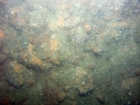
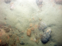
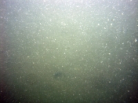
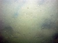
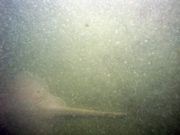
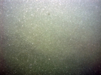
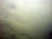
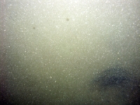
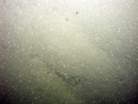
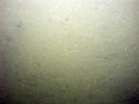
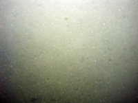
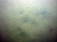
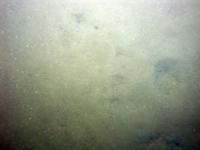
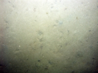
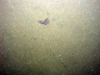
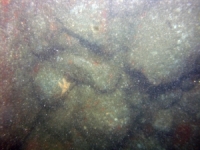
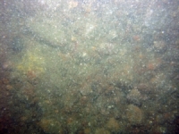
d3_PICT1280.JPG
Station # 171
Lat 41.420653
Long -71.021467
Time (UTC) 00:07:17
    Nearest Sediment Sample Info:
    • Classification = GRAVEL
    • Station Number = 171
    • Distance = 109.3 meters
Image of seabed - photo.
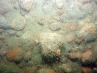
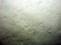
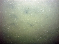
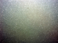
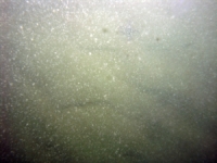
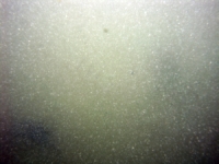
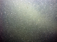
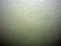
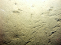
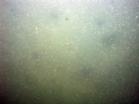
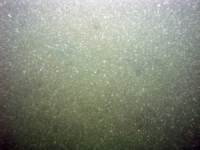
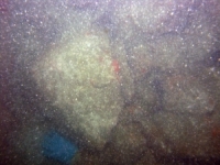
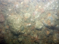
d3_PICT1281.JPG
Station # 171
Lat 41.420710
Long -71.021500
Time (UTC) 00:07:33
    Nearest Sediment Sample Info:
    • Classification = GRAVEL
    • Station Number = 171
    • Distance = 102.5 meters
Image of seabed - photo.
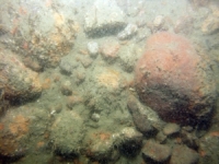
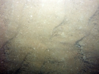
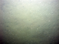
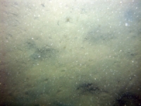
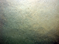
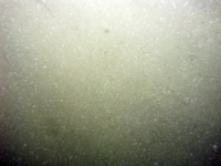
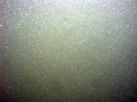
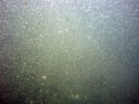
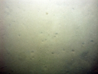
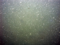
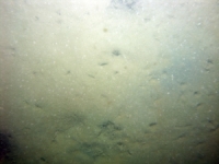
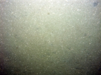
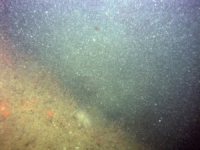
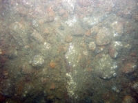
d3_PICT1282.JPG
Station # 171
Lat 41.420775
Long -71.021543
Time (UTC) 00:07:51
    Nearest Sediment Sample Info:
    • Classification = GRAVEL
    • Station Number = 171
    • Distance = 94.4 meters
Image of seabed - photo.
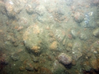
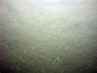
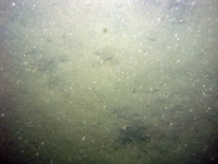
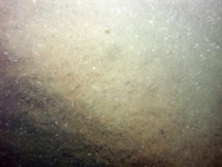
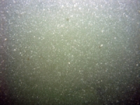
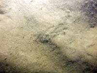
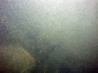
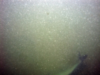
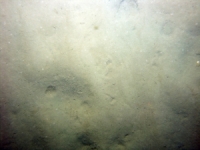
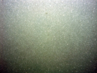
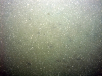
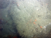
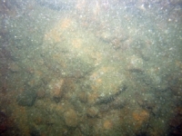
d3_PICT1283.JPG
Station # 171
Lat 41.420917
Long -71.021638
Time (UTC) 00:08:28
    Nearest Sediment Sample Info:
    • Classification = GRAVEL
    • Station Number = 171
    • Distance = 76.8 meters
Image of seabed - photo.
d3_PICT1284.JPG
Station # 171
Lat 41.421043
Long -71.021740
Time (UTC) 00:09:05
    Nearest Sediment Sample Info:
    • Classification = GRAVEL
    • Station Number = 171
    • Distance = 60.5 meters
Image of seabed - photo.
d3_PICT1285.JPG
Station # 171
Lat 41.421125
Long -71.021798
Time (UTC) 00:09:30
    Nearest Sediment Sample Info:
    • Classification = GRAVEL
    • Station Number = 171
    • Distance = 50.2 meters
Image of seabed - photo.
d3_PICT1286.JPG
Station # 171
Lat 41.421203
Long -71.021862
Time (UTC) 00:09:55
    Nearest Sediment Sample Info:
    • Classification = GRAVEL
    • Station Number = 171
    • Distance = 40 meters
Image of seabed - photo.
d3_PICT1287.JPG
Station # 171
Lat 41.421273
Long -71.021935
Time (UTC) 00:10:21
    Nearest Sediment Sample Info:
    • Classification = GRAVEL
    • Station Number = 171
    • Distance = 30.2 meters
Image of seabed - photo.
d3_PICT1288.JPG
Station # 171
Lat 41.421388
Long -71.022040
Time (UTC) 00:11:00
    Nearest Sediment Sample Info:
    • Classification = GRAVEL
    • Station Number = 171
    • Distance = 14.7 meters
Image of seabed - photo.
d3_PICT1289.JPG
Station # 171
Lat 41.421445
Long -71.022088
Time (UTC) 00:11:18
    Nearest Sediment Sample Info:
    • Classification = GRAVEL
    • Station Number = 171
    • Distance = 7.2 meters
Image of seabed - photo.
d3_PICT1290.JPG
Station # 172
Lat 41.388998
Long -71.023892
Time (UTC) 00:35:17
    Nearest Sediment Sample Info:
    • Classification = SAND
    • Station Number = 173
    • Distance = 10.5 meters
Image of seabed - photo.
d3_PICT1291.JPG
Station # 172
Lat 41.389045
Long -71.023995
Time (UTC) 00:35:34
    Nearest Sediment Sample Info:
    • Classification = SAND
    • Station Number = 173
    • Distance = 9.3 meters
Image of seabed - photo.
d3_PICT1292.JPG
Station # 172
Lat 41.389108
Long -71.024158
Time (UTC) 00:35:59
    Nearest Sediment Sample Info:
    • Classification = SAND
    • Station Number = 173
    • Distance = 21.4 meters
Image of seabed - photo.
d3_PICT1293.JPG
Station # 172
Lat 41.389223
Long -71.024370
Time (UTC) 00:36:30
    Nearest Sediment Sample Info:
    • Classification = SAND
    • Station Number = 173
    • Distance = 41.7 meters
Image of seabed - photo.
d3_PICT1294.JPG
Station # 172
Lat 41.389327
Long -71.024562
Time (UTC) 00:37:00
    Nearest Sediment Sample Info:
    • Classification = SAND
    • Station Number = 172
    • Distance = 42.2 meters
Image of seabed - photo.
d3_PICT1295.JPG
Station # 172
Lat 41.389502
Long -71.024860
Time (UTC) 00:37:45
    Nearest Sediment Sample Info:
    • Classification = SAND
    • Station Number = 172
    • Distance = 10.6 meters
Image of seabed - photo.
d3_PICT1296.JPG
Station # 173
Lat 41.388160
Long -71.021435
Time (UTC) 00:50:55
    Nearest Sediment Sample Info:
    • Classification = SAND
    • Station Number = 173
    • Distance = 230.9 meters
Image of seabed - photo.
d3_PICT1297.JPG
Station # 173
Lat 41.388178
Long -71.021618
Time (UTC) 00:51:22
    Nearest Sediment Sample Info:
    • Classification = SAND
    • Station Number = 173
    • Distance = 216.4 meters
Image of seabed - photo.
d3_PICT1298.JPG
Station # 173
Lat 41.388207
Long -71.021753
Time (UTC) 00:51:40
    Nearest Sediment Sample Info:
    • Classification = SAND
    • Station Number = 173
    • Distance = 204.9 meters
Image of seabed - photo.
d3_PICT1299.JPG
Station # 173
Lat 41.388220
Long -71.021863
Time (UTC) 00:51:54
    Nearest Sediment Sample Info:
    • Classification = SAND
    • Station Number = 173
    • Distance = 196.2 meters
Image of seabed - photo.
d3_PICT1300.JPG
Station # 173
Lat 41.388272
Long -71.022048
Time (UTC) 00:52:18
    Nearest Sediment Sample Info:
    • Classification = SAND
    • Station Number = 173
    • Distance = 179.9 meters
Image of seabed - photo.
d3_PICT1301.JPG
Station # 173
Lat 41.388350
Long -71.022260
Time (UTC) 00:52:45
    Nearest Sediment Sample Info:
    • Classification = SAND
    • Station Number = 173
    • Distance = 160.2 meters
Image of seabed - photo.
d3_PICT1302.JPG
Station # 173
Lat 41.388423
Long -71.022437
Time (UTC) 00:53:08
    Nearest Sediment Sample Info:
    • Classification = SAND
    • Station Number = 173
    • Distance = 143.4 meters
Image of seabed - photo.
d3_PICT1303.JPG
Station # 173
Lat 41.388477
Long -71.022558
Time (UTC) 00:53:24
    Nearest Sediment Sample Info:
    • Classification = SAND
    • Station Number = 173
    • Distance = 131.6 meters
Image of seabed - photo.
d3_PICT1304.JPG
Station # 173
Lat 41.388667
Long -71.022973
Time (UTC) 00:54:19
    Nearest Sediment Sample Info:
    • Classification = SAND
    • Station Number = 173
    • Distance = 91 meters
Image of seabed - photo.
d3_PICT1305.JPG
Station # 173
Lat 41.388780
Long -71.023223
Time (UTC) 00:54:52
    Nearest Sediment Sample Info:
    • Classification = SAND
    • Station Number = 173
    • Distance = 66.6 meters
Image of seabed - photo.
d3_PICT1306.JPG
Station # 173
Lat 41.388827
Long -71.023332
Time (UTC) 00:55:06
    Nearest Sediment Sample Info:
    • Classification = SAND
    • Station Number = 173
    • Distance = 56.1 meters
Image of seabed - photo.
d3_PICT1307.JPG
Station # 173
Lat 41.388883
Long -71.023457
Time (UTC) 00:55:22
    Nearest Sediment Sample Info:
    • Classification = SAND
    • Station Number = 173
    • Distance = 43.9 meters
Image of seabed - photo.
d3_PICT1308.JPG
Station # 173
Lat 41.388927
Long -71.023548
Time (UTC) 00:55:34
    Nearest Sediment Sample Info:
    • Classification = SAND
    • Station Number = 173
    • Distance = 34.9 meters
Image of seabed - photo.
d3_PICT1309.JPG
Station # 173
Lat 41.388982
Long -71.023672
Time (UTC) 00:55:50
    Nearest Sediment Sample Info:
    • Classification = SAND
    • Station Number = 173
    • Distance = 22.9 meters
Image of seabed - photo.
d3_PICT1310.JPG
Station # 173
Lat 41.389092
Long -71.023903
Time (UTC) 00:56:20
    Nearest Sediment Sample Info:
    • Classification = SAND
    • Station Number = 173
    • Distance = 0 meters
Image of seabed - photo.
d3_PICT1311.JPG
Station # 174
Lat 41.267625
Long -71.084905
Time (UTC) 02:02:21
    Nearest Sediment Sample Info:
    • Classification = SILTY SAND
    • Station Number = 174
    • Distance = 66.8 meters
Image of seabed - photo.
d3_PICT1312.JPG
Station # 174
Lat 41.267643
Long -71.085010
Time (UTC) 02:02:40
    Nearest Sediment Sample Info:
    • Classification = SILTY SAND
    • Station Number = 174
    • Distance = 57.7 meters
Image of seabed - photo.
d3_PICT1313.JPG
Station # 174
Lat 41.267667
Long -71.085135
Time (UTC) 02:03:04
    Nearest Sediment Sample Info:
    • Classification = SILTY SAND
    • Station Number = 174
    • Distance = 47 meters
Image of seabed - photo.
d3_PICT1314.JPG
Station # 174
Lat 41.267678
Long -71.085220
Time (UTC) 02:03:19
    Nearest Sediment Sample Info:
    • Classification = SILTY SAND
    • Station Number = 174
    • Distance = 39.7 meters
Image of seabed - photo.
d3_PICT1315.JPG
Station # 174
Lat 41.267693
Long -71.085302
Time (UTC) 02:03:35
    Nearest Sediment Sample Info:
    • Classification = SILTY SAND
    • Station Number = 174
    • Distance = 32.7 meters
Image of seabed - photo.
d3_PICT1316.JPG
Station # 175
Lat 41.283288
Long -71.049430
Time (UTC) 02:30:07
    Nearest Sediment Sample Info:
    • Classification = SILTY SAND
    • Station Number = 175
    • Distance = 140.7 meters
Image of seabed - photo.
d3_PICT1317.JPG
Station # 175
Lat 41.283377
Long -71.049703
Time (UTC) 02:30:49
    Nearest Sediment Sample Info:
    • Classification = SILTY SAND
    • Station Number = 175
    • Distance = 115.9 meters
Image of seabed - photo.
d3_PICT1318.JPG
Station # 175
Lat 41.283427
Long -71.049825
Time (UTC) 02:31:07
    Nearest Sediment Sample Info:
    • Classification = SILTY SAND
    • Station Number = 175
    • Distance = 104.2 meters
Image of seabed - photo.
d3_PICT1319.JPG
Station # 175
Lat 41.283527
Long -71.050068
Time (UTC) 02:31:44
    Nearest Sediment Sample Info:
    • Classification = SILTY SAND
    • Station Number = 175
    • Distance = 81 meters
Image of seabed - photo.
d3_PICT1320.JPG
Station # 175
Lat 41.283598
Long -71.050235
Time (UTC) 02:32:10
    Nearest Sediment Sample Info:
    • Classification = SILTY SAND
    • Station Number = 175
    • Distance = 65 meters
Image of seabed - photo.
d3_PICT1321.JPG
Station # 175
Lat 41.283647
Long -71.050370
Time (UTC) 02:32:31
    Nearest Sediment Sample Info:
    • Classification = SILTY SAND
    • Station Number = 175
    • Distance = 52.5 meters
Image of seabed - photo.
d3_PICT1322.JPG
Station # 175
Lat 41.283690
Long -71.050488
Time (UTC) 02:32:49
    Nearest Sediment Sample Info:
    • Classification = SILTY SAND
    • Station Number = 175
    • Distance = 41.5 meters
Image of seabed - photo.
d3_PICT1323.JPG
Station # 175
Lat 41.283832
Long -71.050828
Time (UTC) 02:33:45
    Nearest Sediment Sample Info:
    • Classification = SILTY SAND
    • Station Number = 175
    • Distance = 8.9 meters
Image of seabed - photo.
d3_PICT1324.JPG
Station # 176
Lat 41.367930
Long -71.014993
Time (UTC) 03:24:24
    Nearest Sediment Sample Info:
    • Classification = SAND
    • Station Number = 176
    • Distance = 124 meters
Image of seabed - photo.
d3_PICT1325.JPG
Station # 176
Lat 41.368053
Long -71.015208
Time (UTC) 03:25:16
    Nearest Sediment Sample Info:
    • Classification = SAND
    • Station Number = 176
    • Distance = 101.4 meters
Image of seabed - photo.
d3_PICT1326.JPG
Station # 176
Lat 41.368097
Long -71.015277
Time (UTC) 03:25:34
    Nearest Sediment Sample Info:
    • Classification = SAND
    • Station Number = 176
    • Distance = 93.8 meters
Image of seabed - photo.
d3_PICT1327.JPG
Station # 176
Lat 41.368157
Long -71.015380
Time (UTC) 03:25:57
    Nearest Sediment Sample Info:
    • Classification = SAND
    • Station Number = 176
    • Distance = 82.9 meters
Image of seabed - photo.
d3_PICT1328.JPG
Station # 176
Lat 41.368197
Long -71.015452
Time (UTC) 03:26:15
    Nearest Sediment Sample Info:
    • Classification = SAND
    • Station Number = 176
    • Distance = 75.5 meters
Image of seabed - photo.
d3_PICT1329.JPG
Station # 176
Lat 41.368257
Long -71.015550
Time (UTC) 03:26:40
    Nearest Sediment Sample Info:
    • Classification = SAND
    • Station Number = 176
    • Distance = 64.9 meters
Image of seabed - photo.
d3_PICT1330.JPG
Station # 176
Lat 41.368392
Long -71.015783
Time (UTC) 03:27:31
    Nearest Sediment Sample Info:
    • Classification = SAND
    • Station Number = 176
    • Distance = 40.3 meters
Image of seabed - photo.
d3_PICT1331.JPG
Station # 176
Lat 41.368467
Long -71.015915
Time (UTC) 03:27:57
    Nearest Sediment Sample Info:
    • Classification = SAND
    • Station Number = 176
    • Distance = 26.5 meters
Image of seabed - photo.
d3_PICT1332.JPG
Station # 177
Lat 41.371340
Long -70.986873
Time (UTC) 03:49:17
    Nearest Sediment Sample Info:
    • Classification = GRAVEL
    • Station Number = 177
    • Distance = 56.8 meters
Image of seabed - photo.
d3_PICT1333.JPG
Station # 177
Lat 41.371350
Long -70.986945
Time (UTC) 03:49:39
    Nearest Sediment Sample Info:
    • Classification = GRAVEL
    • Station Number = 177
    • Distance = 50.7 meters
Image of seabed - photo.
d3_PICT1334.JPG
Station # 177
Lat 41.371358
Long -70.987088
Time (UTC) 03:50:18
    Nearest Sediment Sample Info:
    • Classification = GRAVEL
    • Station Number = 177
    • Distance = 38.7 meters
Image of seabed - photo.
d3_PICT1335.JPG
Station # 177
Lat 41.371377
Long -70.987273
Time (UTC) 03:51:04
    Nearest Sediment Sample Info:
    • Classification = GRAVEL
    • Station Number = 177
    • Distance = 23.1 meters
Image of seabed - photo.
d3_PICT1336.JPG
Station # 177
Lat 41.371392
Long -70.987478
Time (UTC) 03:51:55
    Nearest Sediment Sample Info:
    • Classification = GRAVEL
    • Station Number = 177
    • Distance = 5.9 meters
Image of seabed - photo.
d3_PICT1337.JPG
Station # 177
Lat 41.371395
Long -70.987548
Time (UTC) 03:52:17
    Nearest Sediment Sample Info:
    • Classification = GRAVEL
    • Station Number = 177
    • Distance = 0 meters
Image of seabed - photo.
d3_PICT1338.JPG
Station # 178
Lat 41.353622
Long -70.992562
Time (UTC) 04:10:21
    Nearest Sediment Sample Info:
    • Classification = SILTY SAND
    • Station Number = 178
    • Distance = 84.7 meters
Image of seabed - photo.
d3_PICT1339.JPG
Station # 178
Lat 41.353658
Long -70.992642
Time (UTC) 04:10:50
    Nearest Sediment Sample Info:
    • Classification = SILTY SAND
    • Station Number = 178
    • Distance = 77 meters
Image of seabed - photo.
d3_PICT1340.JPG
Station # 178
Lat 41.353713
Long -70.992755
Time (UTC) 04:11:31
    Nearest Sediment Sample Info:
    • Classification = SILTY SAND
    • Station Number = 178
    • Distance = 65.7 meters
Image of seabed - photo.
d3_PICT1341.JPG
Station # 178
Lat 41.353898
Long -70.993163
Time (UTC) 04:13:50
    Nearest Sediment Sample Info:
    • Classification = SILTY SAND
    • Station Number = 178
    • Distance = 26 meters
Image of seabed - photo.
d3_PICT1342.JPG
Station # 178
Lat 41.353933
Long -70.993278
Time (UTC) 04:14:31
    Nearest Sediment Sample Info:
    • Classification = SILTY SAND
    • Station Number = 178
    • Distance = 15.6 meters
Image of seabed - photo.
d3_PICT1343.JPG
Station # 178
Lat 41.353982
Long -70.993415
Time (UTC) 04:15:19
    Nearest Sediment Sample Info:
    • Classification = SILTY SAND
    • Station Number = 178
    • Distance = 2.9 meters
Image of seabed - photo.
d3_PICT1344.JPG
Station # 179
Lat 41.354967
Long -70.988453
Time (UTC) 04:24:48
    Nearest Sediment Sample Info:
    • Classification = SAND
    • Station Number = 179
    • Distance = 89.7 meters
Image of seabed - photo.
d3_PICT1345.JPG
Station # 179
Lat 41.355010
Long -70.988525
Time (UTC) 04:25:17
    Nearest Sediment Sample Info:
    • Classification = SAND
    • Station Number = 179
    • Distance = 82 meters
Image of seabed - photo.
d3_PICT1346.JPG
Station # 179
Lat 41.355078
Long -70.988642
Time (UTC) 04:25:59
    Nearest Sediment Sample Info:
    • Classification = SAND
    • Station Number = 179
    • Distance = 69.6 meters
Image of seabed - photo.
d3_PICT1347.JPG
Station # 179
Lat 41.355215
Long -70.988885
Time (UTC) 04:27:19
    Nearest Sediment Sample Info:
    • Classification = SAND
    • Station Number = 179
    • Distance = 44.2 meters
Image of seabed - photo.
d3_PICT1348.JPG
Station # 179
Lat 41.355327
Long -70.989075
Time (UTC) 04:28:29
    Nearest Sediment Sample Info:
    • Classification = SAND
    • Station Number = 179
    • Distance = 24.1 meters
Image of seabed - photo.
d3_PICT1349.JPG
Station # 179
Lat 41.355432
Long -70.989255
Time (UTC) 04:29:33
    Nearest Sediment Sample Info:
    • Classification = SAND
    • Station Number = 179
    • Distance = 5 meters
Image of seabed - photo.
d3_PICT1350.JPG
Station # 180
Lat 41.356030
Long -70.985812
Time (UTC) 04:37:08
    Nearest Sediment Sample Info:
    • Classification = SAND
    • Station Number = 180
    • Distance = 88.5 meters
Image of seabed - photo.
d3_PICT1351.JPG
Station # 180
Lat 41.356137
Long -70.985970
Time (UTC) 04:38:10
    Nearest Sediment Sample Info:
    • Classification = SAND
    • Station Number = 180
    • Distance = 70.8 meters
Image of seabed - photo.
d3_PICT1352.JPG
Station # 180
Lat 41.356197
Long -70.986067
Time (UTC) 04:38:50
    Nearest Sediment Sample Info:
    • Classification = SAND
    • Station Number = 180
    • Distance = 60.3 meters
Image of seabed - photo.
d3_PICT1353.JPG
Station # 180
Lat 41.356305
Long -70.986237
Time (UTC) 04:39:58
    Nearest Sediment Sample Info:
    • Classification = SAND
    • Station Number = 180
    • Distance = 41.7 meters
Image of seabed - photo.
d3_PICT1354.JPG
Station # 180
Lat 41.356380
Long -70.986340
Time (UTC) 04:40:39
    Nearest Sediment Sample Info:
    • Classification = SAND
    • Station Number = 180
    • Distance = 29.7 meters
Image of seabed - photo.
d3_PICT1355.JPG
Station # 180
Lat 41.356483
Long -70.986475
Time (UTC) 04:41:31
    Nearest Sediment Sample Info:
    • Classification = SAND
    • Station Number = 180
    • Distance = 13.7 meters
Image of seabed - photo.
d3_PICT1356.JPG
Station # 181
Lat 41.355963
Long -70.981377
Time (UTC) 04:51:05
    Nearest Sediment Sample Info:
    • Classification = SAND
    • Station Number = 181
    • Distance = 64.1 meters
Image of seabed - photo.
d3_PICT1357.JPG
Station # 181
Lat 41.355948
Long -70.981463
Time (UTC) 04:51:37
    Nearest Sediment Sample Info:
    • Classification = SAND
    • Station Number = 181
    • Distance = 58.5 meters
Image of seabed - photo.
d3_PICT1358.JPG
Station # 181
Lat 41.355968
Long -70.981562
Time (UTC) 04:52:13
    Nearest Sediment Sample Info:
    • Classification = SAND
    • Station Number = 181
    • Distance = 50.3 meters
Image of seabed - photo.
d3_PICT1359.JPG
Station # 181
Lat 41.356010
Long -70.981670
Time (UTC) 04:52:55
    Nearest Sediment Sample Info:
    • Classification = SAND
    • Station Number = 181
    • Distance = 40.1 meters
Image of seabed - photo.
d3_PICT1360.JPG
Station # 181
Lat 41.356080
Long -70.981827
Time (UTC) 04:54:06
    Nearest Sediment Sample Info:
    • Classification = SAND
    • Station Number = 181
    • Distance = 24.9 meters
Image of seabed - photo.
d3_PICT1361.JPG
Station # 181
Lat 41.356155
Long -70.981973
Time (UTC) 04:55:13
    Nearest Sediment Sample Info:
    • Classification = SAND
    • Station Number = 181
    • Distance = 10.2 meters
Image of seabed - photo.
d3_PICT1362.JPG
Station # 182
Lat 41.358150
Long -70.972603
Time (UTC) 05:06:06
    Nearest Sediment Sample Info:
    • Classification = SAND
    • Station Number = 182
    • Distance = 63.4 meters
Image of seabed - photo.
d3_PICT1363.JPG
Station # 182
Lat 41.358172
Long -70.972618
Time (UTC) 05:06:24
    Nearest Sediment Sample Info:
    • Classification = SAND
    • Station Number = 182
    • Distance = 60.7 meters
Image of seabed - photo.
d3_PICT1364.JPG
Station # 182
Lat 41.358195
Long -70.972635
Time (UTC) 05:06:40
    Nearest Sediment Sample Info:
    • Classification = SAND
    • Station Number = 182
    • Distance = 57.9 meters
Image of seabed - photo.
d3_PICT1365.JPG
Station # 182
Lat 41.358230
Long -70.972660
Time (UTC) 05:07:03
    Nearest Sediment Sample Info:
    • Classification = SAND
    • Station Number = 182
    • Distance = 53.5 meters
Image of seabed - photo.
d3_PICT1366.JPG
Station # 182
Lat 41.358328
Long -70.972735
Time (UTC) 05:08:02
    Nearest Sediment Sample Info:
    • Classification = SAND
    • Station Number = 182
    • Distance = 41.3 meters
Image of seabed - photo.
d3_PICT1367.JPG
Station # 182
Lat 41.358393
Long -70.972807
Time (UTC) 05:08:59
    Nearest Sediment Sample Info:
    • Classification = SAND
    • Station Number = 182
    • Distance = 31.9 meters
Image of seabed - photo.
d3_PICT1368.JPG
Station # 182
Lat 41.358480
Long -70.972905
Time (UTC) 05:10:18
    Nearest Sediment Sample Info:
    • Classification = SAND
    • Station Number = 182
    • Distance = 19.3 meters
Image of seabed - photo.
d3_PICT1369.JPG
Station # 182
Lat 41.358507
Long -70.972942
Time (UTC) 05:10:50
    Nearest Sediment Sample Info:
    • Classification = SAND
    • Station Number = 182
    • Distance = 15 meters
Image of seabed - photo.
d3_PICT1370.JPG
Station # 182
Lat 41.358593
Long -70.973068
Time (UTC) 05:12:21
    Nearest Sediment Sample Info:
    • Classification = SAND
    • Station Number = 182
    • Distance = 0.7 meters
Image of seabed - photo.
d3_PICT1371.JPG
Station # 183
Lat 41.359270
Long -70.968125
Time (UTC) 05:21:27
    Nearest Sediment Sample Info:
    • Classification = SAND
    • Station Number = 183
    • Distance = 50.8 meters
Image of seabed - photo.
d3_PICT1372.JPG
Station # 183
Lat 41.359365
Long -70.968173
Time (UTC) 05:22:32
    Nearest Sediment Sample Info:
    • Classification = SAND
    • Station Number = 183
    • Distance = 40 meters
Image of seabed - photo.
d3_PICT1373.JPG
Station # 183
Lat 41.359392
Long -70.968235
Time (UTC) 05:23:20
    Nearest Sediment Sample Info:
    • Classification = SAND
    • Station Number = 183
    • Distance = 34.4 meters
Image of seabed - photo.
d3_PICT1374.JPG
Station # 183
Lat 41.359437
Long -70.968287
Time (UTC) 05:24:07
    Nearest Sediment Sample Info:
    • Classification = SAND
    • Station Number = 183
    • Distance = 27.8 meters
Image of seabed - photo.
d3_PICT1375.JPG
Station # 183
Lat 41.359485
Long -70.968330
Time (UTC) 05:24:48
    Nearest Sediment Sample Info:
    • Classification = SAND
    • Station Number = 183
    • Distance = 21.4 meters
Image of seabed - photo.
d3_PICT1376.JPG
Station # 183
Lat 41.359572
Long -70.968383
Time (UTC) 05:25:55
    Nearest Sediment Sample Info:
    • Classification = SAND
    • Station Number = 183
    • Distance = 11.1 meters
Image of seabed - photo.
d3_PICT1377.JPG
Station # 183
Lat 41.359592
Long -70.968407
Time (UTC) 05:26:17
    Nearest Sediment Sample Info:
    • Classification = SAND
    • Station Number = 183
    • Distance = 8.1 meters
Image of seabed - photo.
d3_PICT1378.JPG
Station # 183
Lat 41.359632
Long -70.968468
Time (UTC) 05:27:07
    Nearest Sediment Sample Info:
    • Classification = SAND
    • Station Number = 183
    • Distance = 1.4 meters
Image of seabed - photo.
d3_PICT1379.JPG
Station # 184
Lat 41.360107
Long -70.964297
Time (UTC) 05:37:21
    Nearest Sediment Sample Info:
    • Classification = SAND
    • Station Number = 184
    • Distance = 52.7 meters
Image of seabed - photo.
d3_PICT1380.JPG
Station # 184
Lat 41.360130
Long -70.964318
Time (UTC) 05:37:40
    Nearest Sediment Sample Info:
    • Classification = SAND
    • Station Number = 184
    • Distance = 49.7 meters
Image of seabed - photo.
d3_PICT1381.JPG
Station # 184
Lat 41.360147
Long -70.964332
Time (UTC) 05:37:51
    Nearest Sediment Sample Info:
    • Classification = SAND
    • Station Number = 184
    • Distance = 47.4 meters
Image of seabed - photo.
d3_PICT1382.JPG
Station # 184
Lat 41.360207
Long -70.964383
Time (UTC) 05:38:34
    Nearest Sediment Sample Info:
    • Classification = SAND
    • Station Number = 184
    • Distance = 39.5 meters
Image of seabed - photo.
d3_PICT1383.JPG
Station # 184
Lat 41.360225
Long -70.964398
Time (UTC) 05:38:49
    Nearest Sediment Sample Info:
    • Classification = SAND
    • Station Number = 184
    • Distance = 37.2 meters
Image of seabed - photo.
d3_PICT1384.JPG
Station # 184
Lat 41.360267
Long -70.964440
Time (UTC) 05:39:17
    Nearest Sediment Sample Info:
    • Classification = SAND
    • Station Number = 184
    • Distance = 31.3 meters
Image of seabed - photo.
d3_PICT1385.JPG
Station # 184
Lat 41.360327
Long -70.964490
Time (UTC) 05:39:57
    Nearest Sediment Sample Info:
    • Classification = SAND
    • Station Number = 184
    • Distance = 23.5 meters
Image of seabed - photo.
d3_PICT1386.JPG
Station # 184
Lat 41.360362
Long -70.964522
Time (UTC) 05:40:22
    Nearest Sediment Sample Info:
    • Classification = SAND
    • Station Number = 184
    • Distance = 18.8 meters
Image of seabed - photo.
d3_PICT1387.JPG
Station # 184
Lat 41.360438
Long -70.964585
Time (UTC) 05:41:10
    Nearest Sediment Sample Info:
    • Classification = SAND
    • Station Number = 184
    • Distance = 8.8 meters
Image of seabed - photo.
d3_PICT1388.JPG
Station # 184
Lat 41.360512
Long -70.964638
Time (UTC) 05:42:02
    Nearest Sediment Sample Info:
    • Classification = SAND
    • Station Number = 184
    • Distance = 0.6 meters
Image of seabed - photo.
d3_PICT1389.JPG
Station # 185
Lat 41.361632
Long -70.959448
Time (UTC) 05:51:26
    Nearest Sediment Sample Info:
    • Classification = GRAVEL
    • Station Number = 185
    • Distance = 61.1 meters
Image of seabed - photo.
d3_PICT1390.JPG
Station # 185
Lat 41.361685
Long -70.959467
Time (UTC) 05:51:57
    Nearest Sediment Sample Info:
    • Classification = GRAVEL
    • Station Number = 185
    • Distance = 56 meters
Image of seabed - photo.
d3_PICT1391.JPG
Station # 185
Lat 41.361732
Long -70.959497
Time (UTC) 05:52:29
    Nearest Sediment Sample Info:
    • Classification = GRAVEL
    • Station Number = 185
    • Distance = 50.7 meters
Image of seabed - photo.
d3_PICT1392.JPG
Station # 185
Lat 41.361780
Long -70.959573
Time (UTC) 05:53:23
    Nearest Sediment Sample Info:
    • Classification = GRAVEL
    • Station Number = 185
    • Distance = 42.4 meters
Image of seabed - photo.
d3_PICT1393.JPG
Station # 185
Lat 41.361803
Long -70.959615
Time (UTC) 05:53:49
    Nearest Sediment Sample Info:
    • Classification = GRAVEL
    • Station Number = 185
    • Distance = 38.1 meters
Image of seabed - photo.
d3_PICT1394.JPG
Station # 185
Lat 41.361848
Long -70.959665
Time (UTC) 05:54:33
    Nearest Sediment Sample Info:
    • Classification = GRAVEL
    • Station Number = 185
    • Distance = 31.8 meters
Image of seabed - photo.
d3_PICT1395.JPG
Station # 185
Lat 41.361873
Long -70.959647
Time (UTC) 05:54:45
    Nearest Sediment Sample Info:
    • Classification = GRAVEL
    • Station Number = 185
    • Distance = 31.6 meters
Image of seabed - photo.
d3_PICT1396.JPG
Station # 185
Lat 41.361927
Long -70.959837
Time (UTC) 05:57:22
    Nearest Sediment Sample Info:
    • Classification = GRAVEL
    • Station Number = 185
    • Distance = 15 meters
Image of seabed - photo.
d3_PICT1397.JPG
Station # 185
Lat 41.361942
Long -70.959875
Time (UTC) 05:57:55
    Nearest Sediment Sample Info:
    • Classification = GRAVEL
    • Station Number = 185
    • Distance = 11.5 meters
Image of seabed - photo.
d3_PICT1398.JPG
Station # 185
Lat 41.361978
Long -70.959918
Time (UTC) 05:58:42
    Nearest Sediment Sample Info:
    • Classification = GRAVEL
    • Station Number = 185
    • Distance = 6.2 meters
Image of seabed - photo.
d3_PICT1399.JPG
Station # 185
Lat 41.362010
Long -70.959978
Time (UTC) 05:59:34
    Nearest Sediment Sample Info:
    • Classification = GRAVEL
    • Station Number = 185
    • Distance = 0 meters
Image of seabed - photo.
d3_PICT1400.JPG
Station # 186a
Lat 41.383518
Long -70.952262
Time (UTC) 06:19:02
    Nearest Sediment Sample Info:
    • Classification = GRAVEL
    • Station Number = 186
    • Distance = 191.7 meters
Image of seabed - photo.
d3_PICT1401.JPG
Station # 186a
Lat 41.383567
Long -70.952255
Time (UTC) 06:19:24
    Nearest Sediment Sample Info:
    • Classification = GRAVEL
    • Station Number = 186
    • Distance = 188.1 meters
Image of seabed - photo.
d3_PICT1402.JPG
Station # 186b
Lat 41.383940
Long -70.953868
Time (UTC) 06:29:11
    Nearest Sediment Sample Info:
    • Classification = GRAVEL
    • Station Number = 186
    • Distance = 94.9 meters
Image of seabed - photo.
d3_PICT1403.JPG
Station # 186b
Lat 41.384613
Long -70.953852
Time (UTC) 06:30:44
    Nearest Sediment Sample Info:
    • Classification = GRAVEL
    • Station Number = 186
    • Distance = 20.3 meters
Image of seabed - photo.
d3_PICT1404.JPG
Station # 186b
Lat 41.384793
Long -70.953807
Time (UTC) 06:31:08
    Nearest Sediment Sample Info:
    • Classification = GRAVEL
    • Station Number = 186
    • Distance = 0 meters
Image of seabed - photo.
d3_PICT1405.JPG
Station # 187
Lat 41.369395
Long -70.929905
Time (UTC) 06:54:11
    Nearest Sediment Sample Info:
    • Classification = SILTY SAND
    • Station Number = 187
    • Distance = 75.7 meters
Image of seabed - photo.
d3_PICT1406.JPG
Station # 187
Lat 41.369357
Long -70.929967
Time (UTC) 06:54:41
    Nearest Sediment Sample Info:
    • Classification = SILTY SAND
    • Station Number = 187
    • Distance = 71 meters
Image of seabed - photo.
d3_PICT1407.JPG
Station # 187
Lat 41.369340
Long -70.930038
Time (UTC) 06:55:08
    Nearest Sediment Sample Info:
    • Classification = SILTY SAND
    • Station Number = 187
    • Distance = 65.4 meters
Image of seabed - photo.
d3_PICT1408.JPG
Station # 187
Lat 41.369348
Long -70.930273
Time (UTC) 06:56:40
    Nearest Sediment Sample Info:
    • Classification = SILTY SAND
    • Station Number = 187
    • Distance = 46 meters
Image of seabed - photo.
d3_PICT1409.JPG
Station # 187
Lat 41.369368
Long -70.930392
Time (UTC) 06:57:25
    Nearest Sediment Sample Info:
    • Classification = SILTY SAND
    • Station Number = 187
    • Distance = 35.8 meters
Image of seabed - photo.
d3_PICT1410.JPG
Station # 187
Lat 41.369378
Long -70.930433
Time (UTC) 06:57:40
    Nearest Sediment Sample Info:
    • Classification = SILTY SAND
    • Station Number = 187
    • Distance = 32.2 meters
Image of seabed - photo.
d3_PICT1411.JPG
Station # 187
Lat 41.369408
Long -70.930603
Time (UTC) 06:58:43
    Nearest Sediment Sample Info:
    • Classification = SILTY SAND
    • Station Number = 187
    • Distance = 17.6 meters
Image of seabed - photo.
d3_PICT1412.JPG
Station # 187
Lat 41.369442
Long -70.930797
Time (UTC) 06:59:53
    Nearest Sediment Sample Info:
    • Classification = SILTY SAND
    • Station Number = 187
    • Distance = 0.9 meters
Image of seabed - photo.
d3_PICT1413.JPG
Station # 188
Lat 41.370887
Long -70.927343
Time (UTC) 07:08:56
    Nearest Sediment Sample Info:
    • Classification = SAND
    • Station Number = 188
    • Distance = 73 meters
Image of seabed - photo.
d3_PICT1414.JPG
Station # 188
Lat 41.370898
Long -70.927368
Time (UTC) 07:09:20
    Nearest Sediment Sample Info:
    • Classification = SAND
    • Station Number = 188
    • Distance = 70.8 meters
Image of seabed - photo.
d3_PICT1415.JPG
Station # 188
Lat 41.370917
Long -70.927412
Time (UTC) 07:09:47
    Nearest Sediment Sample Info:
    • Classification = SAND
    • Station Number = 188
    • Distance = 66.8 meters
Image of seabed - photo.
d3_PICT1416.JPG
Station # 188
Lat 41.370943
Long -70.927527
Time (UTC) 07:10:31
    Nearest Sediment Sample Info:
    • Classification = SAND
    • Station Number = 188
    • Distance = 56.9 meters
Image of seabed - photo.
d3_PICT1417.JPG
Station # 188
Lat 41.370957
Long -70.927632
Time (UTC) 07:11:12
    Nearest Sediment Sample Info:
    • Classification = SAND
    • Station Number = 188
    • Distance = 48 meters
Image of seabed - photo.
d3_PICT1418.JPG
Station # 188
Lat 41.370975
Long -70.927825
Time (UTC) 07:12:22
    Nearest Sediment Sample Info:
    • Classification = SAND
    • Station Number = 188
    • Distance = 31.7 meters
Image of seabed - photo.
d3_PICT1419.JPG
Station # 188
Lat 41.370985
Long -70.927930
Time (UTC) 07:12:57
    Nearest Sediment Sample Info:
    • Classification = SAND
    • Station Number = 188
    • Distance = 22.9 meters
Image of seabed - photo.
d3_PICT1420.JPG
Station # 188
Lat 41.370995
Long -70.928097
Time (UTC) 07:13:50
    Nearest Sediment Sample Info:
    • Classification = SAND
    • Station Number = 188
    • Distance = 8.9 meters
Image of seabed - photo.
d3_PICT1421.JPG
Station # 189
Lat 41.351062
Long -70.929513
Time (UTC) 07:33:23
    Nearest Sediment Sample Info:
    • Classification = SILTY SAND
    • Station Number = 189
    • Distance = 48 meters
Image of seabed - photo.
d3_PICT1422.JPG
Station # 189
Lat 41.351112
Long -70.929750
Time (UTC) 07:35:21
    Nearest Sediment Sample Info:
    • Classification = SILTY SAND
    • Station Number = 189
    • Distance = 27.4 meters
Image of seabed - photo.
d3_PICT1423.JPG
Station # 189
Lat 41.351135
Long -70.929852
Time (UTC) 07:36:06
    Nearest Sediment Sample Info:
    • Classification = SILTY SAND
    • Station Number = 189
    • Distance = 18.5 meters
Image of seabed - photo.
d3_PICT1424.JPG
Station # 189
Lat 41.351150
Long -70.929913
Time (UTC) 07:36:31
    Nearest Sediment Sample Info:
    • Classification = SILTY SAND
    • Station Number = 189
    • Distance = 13.2 meters
Image of seabed - photo.
d3_PICT1425.JPG
Station # 189
Lat 41.351172
Long -70.930072
Time (UTC) 07:37:35
    Nearest Sediment Sample Info:
    • Classification = SILTY SAND
    • Station Number = 189
    • Distance = 0.3 meters
Image of seabed - photo.
d3_PICT1426.JPG
Station # 190
Lat 41.335405
Long -70.958023
Time (UTC) 07:57:04
    Nearest Sediment Sample Info:
    • Classification = SAND
    • Station Number = 190
    • Distance = 125.3 meters
Image of seabed - photo.
d3_PICT1427.JPG
Station # 190
Lat 41.335402
Long -70.958080
Time (UTC) 07:57:18
    Nearest Sediment Sample Info:
    • Classification = SAND
    • Station Number = 190
    • Distance = 120.5 meters
Image of seabed - photo.
d3_PICT1428.JPG
Station # 190
Lat 41.335402
Long -70.958218
Time (UTC) 07:57:52
    Nearest Sediment Sample Info:
    • Classification = SAND
    • Station Number = 190
    • Distance = 109 meters
Image of seabed - photo.
d3_PICT1429.JPG
Station # 190
Lat 41.335403
Long -70.958397
Time (UTC) 07:58:36
    Nearest Sediment Sample Info:
    • Classification = SAND
    • Station Number = 190
    • Distance = 94.1 meters
Image of seabed - photo.
d3_PICT1430.JPG
Station # 190
Lat 41.335360
Long -70.958772
Time (UTC) 08:00:12
    Nearest Sediment Sample Info:
    • Classification = SAND
    • Station Number = 190
    • Distance = 62.4 meters
Image of seabed - photo.
d3_PICT1431.JPG
Station # 190
Lat 41.335327
Long -70.959008
Time (UTC) 08:01:11
    Nearest Sediment Sample Info:
    • Classification = SAND
    • Station Number = 190
    • Distance = 42.4 meters
Image of seabed - photo.
d3_PICT1432.JPG
Station # 190
Lat 41.335293
Long -70.959508
Time (UTC) 08:03:15
    Nearest Sediment Sample Info:
    • Classification = SAND
    • Station Number = 190
    • Distance = 0.4 meters
Image of seabed - photo.
d3_PICT1433.JPG
Station # 191
Lat 41.336228
Long -70.941617
Time (UTC) 09:33:13
    Nearest Sediment Sample Info:
    • Classification = SAND
    • Station Number = 191
    • Distance = 161.6 meters
Image of seabed - photo.
d3_PICT1434.JPG
Station # 191
Lat 41.336217
Long -70.941687
Time (UTC) 09:33:24
    Nearest Sediment Sample Info:
    • Classification = SAND
    • Station Number = 191
    • Distance = 155.6 meters
Image of seabed - photo.
d3_PICT1435.JPG
Station # 191
Lat 41.336183
Long -70.941883
Time (UTC) 09:33:55
    Nearest Sediment Sample Info:
    • Classification = SAND
    • Station Number = 191
    • Distance = 138.8 meters
Image of seabed - photo.
d3_PICT1436.JPG
Station # 191
Lat 41.336167
Long -70.942010
Time (UTC) 09:34:15
    Nearest Sediment Sample Info:
    • Classification = SAND
    • Station Number = 191
    • Distance = 128 meters
Image of seabed - photo.
d3_PICT1437.JPG
Station # 191
Lat 41.336138
Long -70.942200
Time (UTC) 09:34:46
    Nearest Sediment Sample Info:
    • Classification = SAND
    • Station Number = 191
    • Distance = 111.8 meters
Image of seabed - photo.
d3_PICT1438.JPG
Station # 191
Lat 41.336082
Long -70.942522
Time (UTC) 09:35:38
    Nearest Sediment Sample Info:
    • Classification = SAND
    • Station Number = 191
    • Distance = 84.1 meters
Image of seabed - photo.
d3_PICT1439.JPG
Station # 191
Lat 41.336050
Long -70.942683
Time (UTC) 09:36:05
    Nearest Sediment Sample Info:
    • Classification = SAND
    • Station Number = 191
    • Distance = 70.2 meters
Image of seabed - photo.
d3_PICT1440.JPG
Station # 191
Lat 41.336003
Long -70.942928
Time (UTC) 09:36:44
    Nearest Sediment Sample Info:
    • Classification = SAND
    • Station Number = 191
    • Distance = 49.1 meters
Image of seabed - photo.
d3_PICT1441.JPG
Station # 191
Lat 41.335953
Long -70.943232
Time (UTC) 09:37:31
    Nearest Sediment Sample Info:
    • Classification = SAND
    • Station Number = 191
    • Distance = 23 meters
Image of seabed - photo.
d3_PICT1442.JPG
Station # 191
Lat 41.335922
Long -70.943432
Time (UTC) 09:38:03
    Nearest Sediment Sample Info:
    • Classification = SAND
    • Station Number = 191
    • Distance = 5.9 meters
Image of seabed - photo.
d3_PICT1443.JPG
Station # 192
Lat 41.350138
Long -70.914802
Time (UTC) 09:57:14
    Nearest Sediment Sample Info:
    • Classification = SILTY SAND
    • Station Number = 192
    • Distance = 113.1 meters
Image of seabed - photo.
d3_PICT1444.JPG
Station # 192
Lat 41.350155
Long -70.914858
Time (UTC) 09:57:40
    Nearest Sediment Sample Info:
    • Classification = SILTY SAND
    • Station Number = 192
    • Distance = 109.3 meters
Image of seabed - photo.
d3_PICT1445.JPG
Station # 192
Lat 41.350153
Long -70.915010
Time (UTC) 09:58:21
    Nearest Sediment Sample Info:
    • Classification = SILTY SAND
    • Station Number = 192
    • Distance = 97.3 meters
Image of seabed - photo.
d3_PICT1446.JPG
Station # 192
Lat 41.350128
Long -70.915192
Time (UTC) 09:58:59
    Nearest Sediment Sample Info:
    • Classification = SILTY SAND
    • Station Number = 192
    • Distance = 82.2 meters
Image of seabed - photo.
d3_PICT1447.JPG
Station # 192
Lat 41.350078
Long -70.915413
Time (UTC) 09:59:38
    Nearest Sediment Sample Info:
    • Classification = SILTY SAND
    • Station Number = 192
    • Distance = 63.1 meters
Image of seabed - photo.
d3_PICT1448.JPG
Station # 192
Lat 41.349958
Long -70.915730
Time (UTC) 10:00:35
    Nearest Sediment Sample Info:
    • Classification = SILTY SAND
    • Station Number = 192
    • Distance = 33.4 meters
Image of seabed - photo.
d3_PICT1449.JPG
Station # 192
Lat 41.349907
Long -70.915858
Time (UTC) 10:00:59
    Nearest Sediment Sample Info:
    • Classification = SILTY SAND
    • Station Number = 192
    • Distance = 21.3 meters
Image of seabed - photo.
d3_PICT1450.JPG
Station # 192
Lat 41.349832
Long -70.916063
Time (UTC) 10:01:36
    Nearest Sediment Sample Info:
    • Classification = SILTY SAND
    • Station Number = 192
    • Distance = 2.2 meters
Image of seabed - photo.
d3_PICT1451.JPG
Station # 193
Lat 41.340055
Long -70.915187
Time (UTC) 10:31:07
    Nearest Sediment Sample Info:
    • Classification = SILTY SAND
    • Station Number = 193
    • Distance = 170.1 meters
Image of seabed - photo.
d3_PICT1452.JPG
Station # 193
Lat 41.339985
Long -70.915417
Time (UTC) 10:31:44
    Nearest Sediment Sample Info:
    • Classification = SILTY SAND
    • Station Number = 193
    • Distance = 149.3 meters
Image of seabed - photo.
d3_PICT1453.JPG
Station # 193
Lat 41.339913
Long -70.915665
Time (UTC) 10:32:23
    Nearest Sediment Sample Info:
    • Classification = SILTY SAND
    • Station Number = 193
    • Distance = 127.1 meters
Image of seabed - photo.
d3_PICT1454.JPG
Station # 193
Lat 41.339822
Long -70.915978
Time (UTC) 10:33:13
    Nearest Sediment Sample Info:
    • Classification = SILTY SAND
    • Station Number = 193
    • Distance = 99.1 meters
Image of seabed - photo.
d3_PICT1455.JPG
Station # 193
Lat 41.339702
Long -70.916372
Time (UTC) 10:34:16
    Nearest Sediment Sample Info:
    • Classification = SILTY SAND
    • Station Number = 193
    • Distance = 63.6 meters
Image of seabed - photo.
d3_PICT1456.JPG
Station # 193
Lat 41.339538
Long -70.916798
Time (UTC) 10:35:29
    Nearest Sediment Sample Info:
    • Classification = SILTY SAND
    • Station Number = 193
    • Distance = 23.6 meters
Image of seabed - photo.
d3_PICT1457.JPG
Station # 193
Lat 41.339487
Long -70.916932
Time (UTC) 10:35:51
    Nearest Sediment Sample Info:
    • Classification = SILTY SAND
    • Station Number = 193
    • Distance = 11.1 meters
Image of seabed - photo.
d3_PICT1458.JPG
Station # 194
Lat 41.335528
Long -70.882713
Time (UTC) 10:55:42
    Nearest Sediment Sample Info:
    • Classification = SAND
    • Station Number = 194
    • Distance = 139.8 meters
Image of seabed - photo.
d3_PICT1459.JPG
Station # 194
Lat 41.335572
Long -70.882792
Time (UTC) 10:56:13
    Nearest Sediment Sample Info:
    • Classification = SAND
    • Station Number = 194
    • Distance = 131.9 meters
Image of seabed - photo.
d3_PICT1460.JPG
Station # 194
Lat 41.335648
Long -70.882887
Time (UTC) 10:57:06
    Nearest Sediment Sample Info:
    • Classification = SAND
    • Station Number = 194
    • Distance = 120.4 meters
Image of seabed - photo.
d3_PICT1461.JPG
Station # 194
Lat 41.335688
Long -70.882925
Time (UTC) 10:57:38
    Nearest Sediment Sample Info:
    • Classification = SAND
    • Station Number = 194
    • Distance = 114.9 meters
Image of seabed - photo.
d3_PICT1462.JPG
Station # 194
Lat 41.335712
Long -70.882965
Time (UTC) 10:58:22
    Nearest Sediment Sample Info:
    • Classification = SAND
    • Station Number = 194
    • Distance = 110.8 meters
Image of seabed - photo.
d3_PICT1463.JPG
Station # 194
Lat 41.335868
Long -70.883100
Time (UTC) 10:59:38
    Nearest Sediment Sample Info:
    • Classification = SAND
    • Station Number = 194
    • Distance = 90.2 meters
Image of seabed - photo.
d3_PICT1464.JPG
Station # 194
Lat 41.336023
Long -70.883227
Time (UTC) 11:00:55
    Nearest Sediment Sample Info:
    • Classification = SAND
    • Station Number = 194
    • Distance = 70 meters
Image of seabed - photo.
d3_PICT1465.JPG
Station # 194
Lat 41.336150
Long -70.883403
Time (UTC) 11:01:54
    Nearest Sediment Sample Info:
    • Classification = SAND
    • Station Number = 194
    • Distance = 49.9 meters
Image of seabed - photo.
d3_PICT1466.JPG
Station # 194
Lat 41.336292
Long -70.883545
Time (UTC) 11:02:52
    Nearest Sediment Sample Info:
    • Classification = SAND
    • Station Number = 194
    • Distance = 30.2 meters
Image of seabed - photo.
d3_PICT1467.JPG
Station # 194
Lat 41.336397
Long -70.883635
Time (UTC) 11:03:59
    Nearest Sediment Sample Info:
    • Classification = SAND
    • Station Number = 194
    • Distance = 16.3 meters
Image of seabed - photo.
d3_PICT1468.JPG
Station # 195
Lat 41.355433
Long -70.898770
Time (UTC) 11:20:07
    Nearest Sediment Sample Info:
    • Classification = SAND
    • Station Number = 195
    • Distance = 149.4 meters
Image of seabed - photo.
d3_PICT1469.JPG
Station # 195
Lat 41.355387
Long -70.898938
Time (UTC) 11:20:35
    Nearest Sediment Sample Info:
    • Classification = SAND
    • Station Number = 195
    • Distance = 134.5 meters
Image of seabed - photo.
d3_PICT1470.JPG
Station # 195
Lat 41.355247
Long -70.899323
Time (UTC) 11:21:25
    Nearest Sediment Sample Info:
    • Classification = SAND
    • Station Number = 195
    • Distance = 98.8 meters
Image of seabed - photo.
d3_PICT1471.JPG
Station # 195
Lat 41.355197
Long -70.899475
Time (UTC) 11:21:42
    Nearest Sediment Sample Info:
    • Classification = SAND
    • Station Number = 195
    • Distance = 85 meters
Image of seabed - photo.
d3_PICT1472.JPG
Station # 195
Lat 41.355085
Long -70.899882
Time (UTC) 11:22:24
    Nearest Sediment Sample Info:
    • Classification = SAND
    • Station Number = 195
    • Distance = 48.7 meters
Image of seabed - photo.
d3_PICT1473.JPG
Station # 195
Lat 41.354937
Long -70.900430
Time (UTC) 11:23:21
    Nearest Sediment Sample Info:
    • Classification = SAND
    • Station Number = 195
    • Distance = 0 meters
Image of seabed - photo.
d3_PICT1474.JPG
Station # 196
Lat 41.354413
Long -70.902943
Time (UTC) 11:27:45
    Nearest Sediment Sample Info:
    • Classification = SAND
    • Station Number = 196
    • Distance = 7.7 meters
Image of seabed - photo.
d3_PICT1475.JPG
Station # 197
Lat 41.375468
Long -70.901380
Time (UTC) 11:54:05
    Nearest Sediment Sample Info:
    • Classification = GRAVEL
    • Station Number = 197
    • Distance = 116.4 meters
Image of seabed - photo.
d3_PICT1476.JPG
Station # 197
Lat 41.375475
Long -70.901595
Time (UTC) 11:54:24
    Nearest Sediment Sample Info:
    • Classification = GRAVEL
    • Station Number = 197
    • Distance = 98.5 meters
Image of seabed - photo.
d3_PICT1477.JPG
Station # 197
Lat 41.375473
Long -70.901758
Time (UTC) 11:54:38
    Nearest Sediment Sample Info:
    • Classification = GRAVEL
    • Station Number = 197
    • Distance = 84.8 meters
Image of seabed - photo.
d3_PICT1478.JPG
Station # 197
Lat 41.375472
Long -70.902563
Time (UTC) 11:55:45
    Nearest Sediment Sample Info:
    • Classification = GRAVEL
    • Station Number = 197
    • Distance = 17.5 meters
Image of seabed - photo.
d3_PICT1479.JPG
Station # 197
Lat 41.375482
Long -70.902772
Time (UTC) 11:56:03
    Nearest Sediment Sample Info:
    • Classification = GRAVEL
    • Station Number = 197
    • Distance = 0 meters


Go to the previous page of photos Go to the next page of photos
   
return to the Main Photo Index Page  

Accessibility FOIA Privacy Policies and Notices

Take Pride in America logo USA.gov logo U.S. Department of the Interior | U.S. Geological Survey
URL: http://pubsdata.usgs.gov/pubs/of/2014/1221/html/botphoto_gallery/ofr2014-1221-index_sept12a.html
Page Contact Information: GS Pubs Web Contact
Page Last Modified: Wednesday, 07-Dec-2016 20:02:50 EST