Skip past header information
USGS - science for a changing world

Open-File Report 2014-1221


Geological Sampling Data and Benthic Biota Classification: Buzzards Bay and Vineyard Sound, Massachusetts


Bottom Photograph Gallery - September 12, 2010 - 12:00 to 24:00 UTC


return to the Main Photo Index Page  
   
Go to the previous page of photos Go to the next page of photos

Image of seabed - photo.
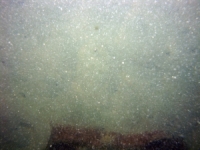
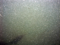
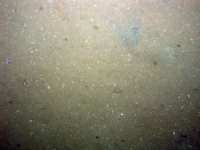
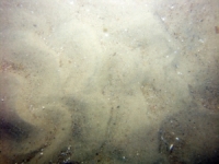
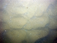
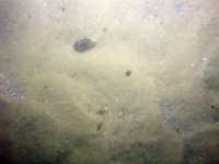
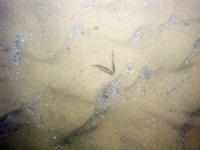
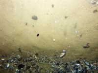
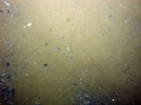
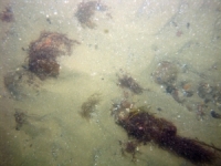
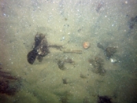
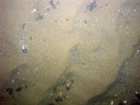
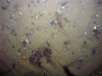
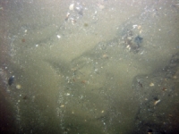
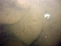
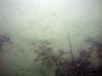
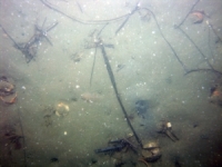
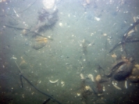
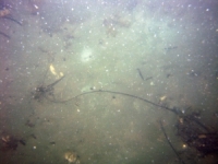
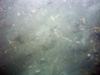
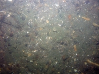
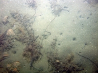
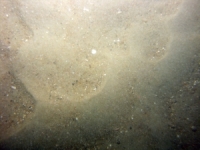
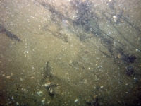
d3_PICT1480.JPG
Station # 198
Lat 41.378848
Long -70.920643
Time (UTC) 12:07:31
    Nearest Sediment Sample Info:
    • Classification = SILTY SAND
    • Station Number = 198
    • Distance = 123.5 meters
Image of seabed - photo.
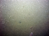
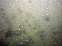
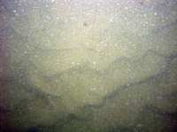
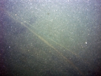
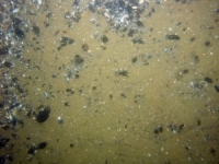
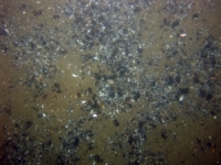
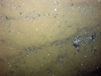
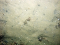
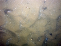
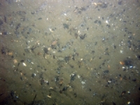
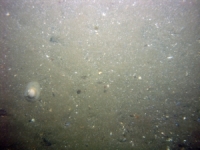
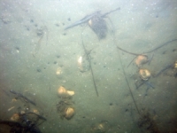
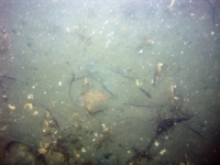
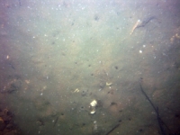
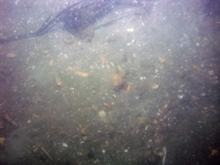
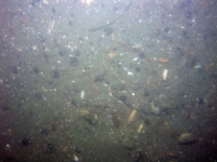
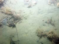
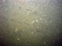
d3_PICT1481.JPG
Station # 198
Lat 41.378778
Long -70.920752
Time (UTC) 12:07:51
    Nearest Sediment Sample Info:
    • Classification = SILTY SAND
    • Station Number = 198
    • Distance = 112.8 meters
Image of seabed - photo.
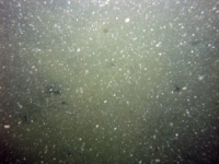
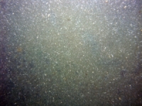
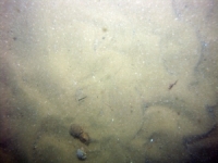
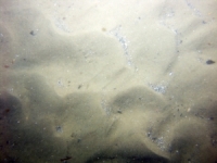
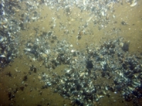
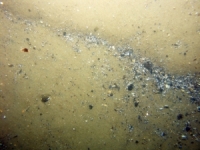
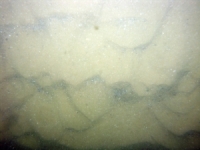
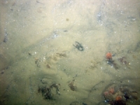
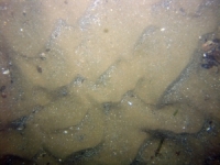
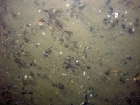
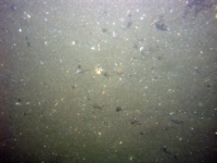
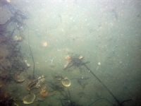
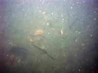
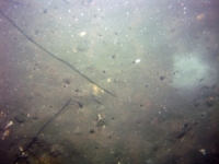
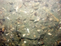
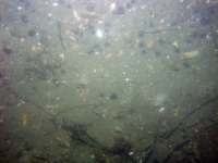
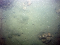
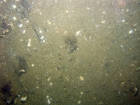
d3_PICT1482.JPG
Station # 198
Lat 41.378738
Long -70.920807
Time (UTC) 12:08:04
    Nearest Sediment Sample Info:
    • Classification = SILTY SAND
    • Station Number = 198
    • Distance = 107.4 meters
Image of seabed - photo.
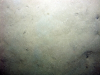
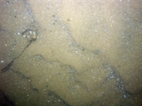
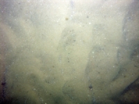
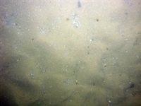
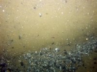
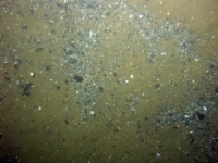
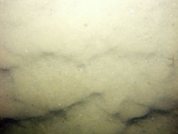
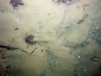
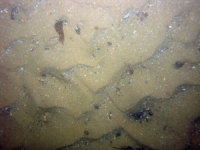
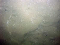
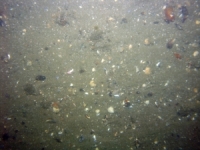
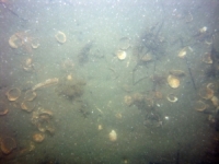
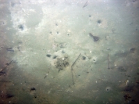
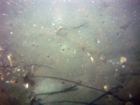
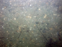
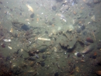
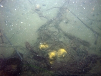
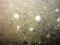
d3_PICT1483.JPG
Station # 198
Lat 41.378630
Long -70.921032
Time (UTC) 12:08:52
    Nearest Sediment Sample Info:
    • Classification = SILTY SAND
    • Station Number = 198
    • Distance = 87 meters
Image of seabed - photo.
d3_PICT1484.JPG
Station # 198
Lat 41.378588
Long -70.921162
Time (UTC) 12:09:17
    Nearest Sediment Sample Info:
    • Classification = SILTY SAND
    • Station Number = 198
    • Distance = 75.9 meters
Image of seabed - photo.
d3_PICT1485.JPG
Station # 198
Lat 41.378570
Long -70.921225
Time (UTC) 12:09:30
    Nearest Sediment Sample Info:
    • Classification = SILTY SAND
    • Station Number = 198
    • Distance = 70.5 meters
Image of seabed - photo.
d3_PICT1486.JPG
Station # 198
Lat 41.378517
Long -70.921528
Time (UTC) 12:10:32
    Nearest Sediment Sample Info:
    • Classification = SILTY SAND
    • Station Number = 198
    • Distance = 45.4 meters
Image of seabed - photo.
d3_PICT1487.JPG
Station # 198
Lat 41.378528
Long -70.921925
Time (UTC) 12:11:42
    Nearest Sediment Sample Info:
    • Classification = SILTY SAND
    • Station Number = 198
    • Distance = 12.4 meters
Image of seabed - photo.
d3_PICT1488.JPG
Station # 199
Lat 41.395273
Long -70.915092
Time (UTC) 12:27:02
    Nearest Sediment Sample Info:
    • Classification = SAND
    • Station Number = 199
    • Distance = 121.6 meters
Image of seabed - photo.
d3_PICT1489.JPG
Station # 199
Lat 41.395207
Long -70.915138
Time (UTC) 12:27:17
    Nearest Sediment Sample Info:
    • Classification = SAND
    • Station Number = 199
    • Distance = 115.6 meters
Image of seabed - photo.
d3_PICT1490.JPG
Station # 199
Lat 41.395090
Long -70.915253
Time (UTC) 12:27:44
    Nearest Sediment Sample Info:
    • Classification = SAND
    • Station Number = 199
    • Distance = 103 meters
Image of seabed - photo.
d3_PICT1491.JPG
Station # 199
Lat 41.394887
Long -70.915610
Time (UTC) 12:28:43
    Nearest Sediment Sample Info:
    • Classification = SAND
    • Station Number = 199
    • Distance = 70.9 meters
Image of seabed - photo.
d3_PICT1492.JPG
Station # 199
Lat 41.394835
Long -70.915953
Time (UTC) 12:29:42
    Nearest Sediment Sample Info:
    • Classification = SAND
    • Station Number = 199
    • Distance = 42.8 meters
Image of seabed - photo.
d3_PICT1493.JPG
Station # 199
Lat 41.394853
Long -70.916107
Time (UTC) 12:30:24
    Nearest Sediment Sample Info:
    • Classification = SAND
    • Station Number = 199
    • Distance = 29.8 meters
Image of seabed - photo.
d3_PICT1494.JPG
Station # 199
Lat 41.394892
Long -70.916358
Time (UTC) 12:31:32
    Nearest Sediment Sample Info:
    • Classification = SAND
    • Station Number = 199
    • Distance = 8.4 meters
Image of seabed - photo.
d3_PICT1495.JPG
Station # 200
Lat 41.404548
Long -70.890023
Time (UTC) 12:52:14
    Nearest Sediment Sample Info:
    • Classification = SAND
    • Station Number = 200
    • Distance = 141 meters
Image of seabed - photo.
d3_PICT1496.JPG
Station # 200
Lat 41.404405
Long -70.890053
Time (UTC) 12:52:53
    Nearest Sediment Sample Info:
    • Classification = SAND
    • Station Number = 200
    • Distance = 132.8 meters
Image of seabed - photo.
d3_PICT1497.JPG
Station # 200
Lat 41.404288
Long -70.890205
Time (UTC) 12:53:26
    Nearest Sediment Sample Info:
    • Classification = SAND
    • Station Number = 200
    • Distance = 116.8 meters
Image of seabed - photo.
d3_PICT1498.JPG
Station # 200
Lat 41.404188
Long -70.890452
Time (UTC) 12:54:08
    Nearest Sediment Sample Info:
    • Classification = SAND
    • Station Number = 200
    • Distance = 94.1 meters
Image of seabed - photo.
d3_PICT1499.JPG
Station # 200
Lat 41.404083
Long -70.890827
Time (UTC) 12:55:12
    Nearest Sediment Sample Info:
    • Classification = SAND
    • Station Number = 200
    • Distance = 61.2 meters
Image of seabed - photo.
d3_PICT1500.JPG
Station # 200
Lat 41.404050
Long -70.891062
Time (UTC) 12:55:48
    Nearest Sediment Sample Info:
    • Classification = SAND
    • Station Number = 200
    • Distance = 41.3 meters
Image of seabed - photo.
d3_PICT1501.JPG
Station # 200
Lat 41.404037
Long -70.891172
Time (UTC) 12:56:05
    Nearest Sediment Sample Info:
    • Classification = SAND
    • Station Number = 200
    • Distance = 32 meters
Image of seabed - photo.
d3_PICT1502.JPG
Station # 200
Lat 41.404013
Long -70.891477
Time (UTC) 12:56:55
    Nearest Sediment Sample Info:
    • Classification = SAND
    • Station Number = 200
    • Distance = 6.4 meters
Image of seabed - photo.
d3_PICT1503.JPG
Station # 201
Lat 41.398017
Long -70.883368
Time (UTC) 13:08:11
    Nearest Sediment Sample Info:
    • Classification = SAND
    • Station Number = 201
    • Distance = 145.4 meters
Image of seabed - photo.
d3_PICT1504.JPG
Station # 201
Lat 41.397973
Long -70.883450
Time (UTC) 13:08:31
    Nearest Sediment Sample Info:
    • Classification = SAND
    • Station Number = 201
    • Distance = 138 meters
Image of seabed - photo.
d3_PICT1505.JPG
Station # 201
Lat 41.397935
Long -70.883545
Time (UTC) 13:08:52
    Nearest Sediment Sample Info:
    • Classification = SAND
    • Station Number = 201
    • Distance = 129.7 meters
Image of seabed - photo.
d3_PICT1506.JPG
Station # 201
Lat 41.397878
Long -70.883775
Time (UTC) 13:09:38
    Nearest Sediment Sample Info:
    • Classification = SAND
    • Station Number = 201
    • Distance = 110.2 meters
Image of seabed - photo.
d3_PICT1507.JPG
Station # 201
Lat 41.397862
Long -70.883895
Time (UTC) 13:10:00
    Nearest Sediment Sample Info:
    • Classification = SAND
    • Station Number = 201
    • Distance = 100.1 meters
Image of seabed - photo.
d3_PICT1508.JPG
Station # 201
Lat 41.397850
Long -70.884305
Time (UTC) 13:11:13
    Nearest Sediment Sample Info:
    • Classification = SAND
    • Station Number = 201
    • Distance = 65.8 meters
Image of seabed - photo.
d3_PICT1509.JPG
Station # 201
Lat 41.397848
Long -70.884387
Time (UTC) 13:11:28
    Nearest Sediment Sample Info:
    • Classification = SAND
    • Station Number = 201
    • Distance = 59 meters
Image of seabed - photo.
d3_PICT1510.JPG
Station # 201
Lat 41.397847
Long -70.884620
Time (UTC) 13:12:09
    Nearest Sediment Sample Info:
    • Classification = SAND
    • Station Number = 201
    • Distance = 39.5 meters
Image of seabed - photo.
d3_PICT1511.JPG
Station # 201
Lat 41.397847
Long -70.884697
Time (UTC) 13:12:23
    Nearest Sediment Sample Info:
    • Classification = SAND
    • Station Number = 201
    • Distance = 33 meters
Image of seabed - photo.
d3_PICT1512.JPG
Station # 201
Lat 41.397850
Long -70.885010
Time (UTC) 13:13:23
    Nearest Sediment Sample Info:
    • Classification = SAND
    • Station Number = 201
    • Distance = 6.9 meters
Image of seabed - photo.
d3_PICT1513.JPG
Station # 202
Lat 41.386238
Long -70.880378
Time (UTC) 13:26:45
    Nearest Sediment Sample Info:
    • Classification = SAND
    • Station Number = 202
    • Distance = 165.8 meters
Image of seabed - photo.
d3_PICT1514.JPG
Station # 202
Lat 41.386260
Long -70.880468
Time (UTC) 13:27:06
    Nearest Sediment Sample Info:
    • Classification = SAND
    • Station Number = 202
    • Distance = 158.1 meters
Image of seabed - photo.
d3_PICT1515.JPG
Station # 202
Lat 41.386300
Long -70.880573
Time (UTC) 13:27:30
    Nearest Sediment Sample Info:
    • Classification = SAND
    • Station Number = 202
    • Distance = 148.2 meters
Image of seabed - photo.
d3_PICT1516.JPG
Station # 202
Lat 41.386395
Long -70.880827
Time (UTC) 13:28:18
    Nearest Sediment Sample Info:
    • Classification = SAND
    • Station Number = 202
    • Distance = 124.6 meters
Image of seabed - photo.
d3_PICT1517.JPG
Station # 202
Lat 41.386457
Long -70.880983
Time (UTC) 13:28:45
    Nearest Sediment Sample Info:
    • Classification = SAND
    • Station Number = 202
    • Distance = 109.9 meters
Image of seabed - photo.
d3_PICT1518.JPG
Station # 202
Lat 41.386575
Long -70.881265
Time (UTC) 13:29:30
    Nearest Sediment Sample Info:
    • Classification = SAND
    • Station Number = 202
    • Distance = 83 meters
Image of seabed - photo.
d3_PICT1519.JPG
Station # 202
Lat 41.386630
Long -70.881383
Time (UTC) 13:29:49
    Nearest Sediment Sample Info:
    • Classification = SAND
    • Station Number = 202
    • Distance = 71.4 meters
Image of seabed - photo.
d3_PICT1520.JPG
Station # 202
Lat 41.386810
Long -70.881727
Time (UTC) 13:30:51
    Nearest Sediment Sample Info:
    • Classification = SAND
    • Station Number = 202
    • Distance = 36.4 meters
Image of seabed - photo.
d3_PICT1521.JPG
Station # 202
Lat 41.386948
Long -70.881995
Time (UTC) 13:31:38
    Nearest Sediment Sample Info:
    • Classification = SAND
    • Station Number = 202
    • Distance = 9.2 meters
Image of seabed - photo.
d3_PICT1522.JPG
Station # 203
Lat 41.368012
Long -70.877382
Time (UTC) 13:48:45
    Nearest Sediment Sample Info:
    • Classification = GRAVEL
    • Station Number = 203
    • Distance = 128.2 meters
Image of seabed - photo.
d3_PICT1523.JPG
Station # 203
Lat 41.368058
Long -70.877272
Time (UTC) 13:49:14
    Nearest Sediment Sample Info:
    • Classification = GRAVEL
    • Station Number = 203
    • Distance = 119.8 meters
Image of seabed - photo.
d3_PICT1524.JPG
Station # 203
Lat 41.368093
Long -70.877230
Time (UTC) 13:49:27
    Nearest Sediment Sample Info:
    • Classification = GRAVEL
    • Station Number = 203
    • Distance = 114.9 meters
Image of seabed - photo.
d3_PICT1525.JPG
Station # 203
Lat 41.368153
Long -70.877172
Time (UTC) 13:49:44
    Nearest Sediment Sample Info:
    • Classification = GRAVEL
    • Station Number = 203
    • Distance = 106.9 meters
Image of seabed - photo.
d3_PICT1526.JPG
Station # 203
Lat 41.368220
Long -70.877118
Time (UTC) 13:50:01
    Nearest Sediment Sample Info:
    • Classification = GRAVEL
    • Station Number = 203
    • Distance = 98.4 meters
Image of seabed - photo.
d3_PICT1527.JPG
Station # 203
Lat 41.368337
Long -70.877007
Time (UTC) 13:50:34
    Nearest Sediment Sample Info:
    • Classification = GRAVEL
    • Station Number = 203
    • Distance = 83.2 meters
Image of seabed - photo.
d3_PICT1528.JPG
Station # 203
Lat 41.368513
Long -70.876913
Time (UTC) 13:51:17
    Nearest Sediment Sample Info:
    • Classification = GRAVEL
    • Station Number = 203
    • Distance = 62.3 meters
Image of seabed - photo.
d3_PICT1529.JPG
Station # 203
Lat 41.368615
Long -70.876877
Time (UTC) 13:51:38
    Nearest Sediment Sample Info:
    • Classification = GRAVEL
    • Station Number = 203
    • Distance = 50.6 meters
Image of seabed - photo.
d3_PICT1530.JPG
Station # 203
Lat 41.368697
Long -70.876847
Time (UTC) 13:51:54
    Nearest Sediment Sample Info:
    • Classification = GRAVEL
    • Station Number = 203
    • Distance = 41.2 meters
Image of seabed - photo.
d3_PICT1531.JPG
Station # 203
Lat 41.368952
Long -70.876763
Time (UTC) 13:52:39
    Nearest Sediment Sample Info:
    • Classification = GRAVEL
    • Station Number = 203
    • Distance = 12 meters
Image of seabed - photo.
d3_PICT1532.JPG
Station # 203
Lat 41.369058
Long -70.876735
Time (UTC) 13:52:57
    Nearest Sediment Sample Info:
    • Classification = GRAVEL
    • Station Number = 203
    • Distance = 0 meters
Image of seabed - photo.
d3_PICT1533.JPG
Station # 204
Lat 41.357565
Long -70.885763
Time (UTC) 14:06:32
    Nearest Sediment Sample Info:
    • Classification = SAND
    • Station Number = 204
    • Distance = 114.9 meters
Image of seabed - photo.
d3_PICT1534.JPG
Station # 204
Lat 41.357567
Long -70.885748
Time (UTC) 14:06:44
    Nearest Sediment Sample Info:
    • Classification = SAND
    • Station Number = 204
    • Distance = 114.4 meters
Image of seabed - photo.
d3_PICT1535.JPG
Station # 204
Lat 41.357597
Long -70.885717
Time (UTC) 14:07:11
    Nearest Sediment Sample Info:
    • Classification = SAND
    • Station Number = 204
    • Distance = 110.7 meters
Image of seabed - photo.
d3_PICT1536.JPG
Station # 204
Lat 41.357710
Long -70.885648
Time (UTC) 14:07:59
    Nearest Sediment Sample Info:
    • Classification = SAND
    • Station Number = 204
    • Distance = 97.4 meters
Image of seabed - photo.
d3_PICT1537.JPG
Station # 204
Lat 41.357767
Long -70.885622
Time (UTC) 14:08:15
    Nearest Sediment Sample Info:
    • Classification = SAND
    • Station Number = 204
    • Distance = 90.9 meters
Image of seabed - photo.
d3_PICT1538.JPG
Station # 204
Lat 41.357842
Long -70.885590
Time (UTC) 14:08:35
    Nearest Sediment Sample Info:
    • Classification = SAND
    • Station Number = 204
    • Distance = 82.3 meters
Image of seabed - photo.
d3_PICT1539.JPG
Station # 204
Lat 41.357972
Long -70.885562
Time (UTC) 14:09:07
    Nearest Sediment Sample Info:
    • Classification = SAND
    • Station Number = 204
    • Distance = 67.7 meters
Image of seabed - photo.
d3_PICT1540.JPG
Station # 204
Lat 41.358258
Long -70.885500
Time (UTC) 14:10:09
    Nearest Sediment Sample Info:
    • Classification = SAND
    • Station Number = 204
    • Distance = 35.8 meters
Image of seabed - photo.
d3_PICT1541.JPG
Station # 204
Lat 41.358527
Long -70.885490
Time (UTC) 14:11:03
    Nearest Sediment Sample Info:
    • Classification = SAND
    • Station Number = 204
    • Distance = 5.9 meters
Image of seabed - photo.
d3_PICT1542.JPG
Station # 205
Lat 41.359360
Long -70.878378
Time (UTC) 14:20:04
    Nearest Sediment Sample Info:
    • Classification = SAND
    • Station Number = 205
    • Distance = 213 meters
Image of seabed - photo.
d3_PICT1543.JPG
Station # 205
Lat 41.359508
Long -70.878368
Time (UTC) 14:20:45
    Nearest Sediment Sample Info:
    • Classification = SAND
    • Station Number = 205
    • Distance = 196.8 meters
Image of seabed - photo.
d3_PICT1544.JPG
Station # 205
Lat 41.359683
Long -70.878382
Time (UTC) 14:21:22
    Nearest Sediment Sample Info:
    • Classification = SAND
    • Station Number = 205
    • Distance = 177.5 meters
Image of seabed - photo.
d3_PICT1545.JPG
Station # 205
Lat 41.359783
Long -70.878383
Time (UTC) 14:21:41
    Nearest Sediment Sample Info:
    • Classification = SAND
    • Station Number = 205
    • Distance = 166.5 meters
Image of seabed - photo.
d3_PICT1546.JPG
Station # 205
Lat 41.359995
Long -70.878433
Time (UTC) 14:22:21
    Nearest Sediment Sample Info:
    • Classification = SAND
    • Station Number = 205
    • Distance = 142.6 meters
Image of seabed - photo.
d3_PICT1547.JPG
Station # 205
Lat 41.360123
Long -70.878458
Time (UTC) 14:22:43
    Nearest Sediment Sample Info:
    • Classification = SAND
    • Station Number = 205
    • Distance = 128.2 meters
Image of seabed - photo.
d3_PICT1548.JPG
Station # 205
Lat 41.360815
Long -70.878612
Time (UTC) 14:24:35
    Nearest Sediment Sample Info:
    • Classification = SAND
    • Station Number = 205
    • Distance = 50.3 meters
Image of seabed - photo.
d3_PICT1549.JPG
Station # 205
Lat 41.360973
Long -70.878650
Time (UTC) 14:25:00
    Nearest Sediment Sample Info:
    • Classification = SAND
    • Station Number = 205
    • Distance = 32.5 meters
Image of seabed - photo.
d3_PICT1550.JPG
Station # 205
Lat 41.361183
Long -70.878703
Time (UTC) 14:25:34
    Nearest Sediment Sample Info:
    • Classification = SAND
    • Station Number = 205
    • Distance = 8.7 meters
Image of seabed - photo.
d3_PICT1551.JPG
Station # 206
Lat 41.358668
Long -70.872955
Time (UTC) 14:35:32
    Nearest Sediment Sample Info:
    • Classification = SAND
    • Station Number = 206
    • Distance = 280.1 meters
Image of seabed - photo.
d3_PICT1552.JPG
Station # 206
Lat 41.358928
Long -70.872993
Time (UTC) 14:36:32
    Nearest Sediment Sample Info:
    • Classification = SAND
    • Station Number = 206
    • Distance = 251.1 meters
Image of seabed - photo.
d3_PICT1553.JPG
Station # 206
Lat 41.359037
Long -70.873005
Time (UTC) 14:36:53
    Nearest Sediment Sample Info:
    • Classification = SAND
    • Station Number = 206
    • Distance = 239 meters
Image of seabed - photo.
d3_PICT1554.JPG
Station # 206
Lat 41.359175
Long -70.873033
Time (UTC) 14:37:18
    Nearest Sediment Sample Info:
    • Classification = SAND
    • Station Number = 206
    • Distance = 223.6 meters
Image of seabed - photo.
d3_PICT1555.JPG
Station # 206
Lat 41.359767
Long -70.873088
Time (UTC) 14:38:51
    Nearest Sediment Sample Info:
    • Classification = SAND
    • Station Number = 206
    • Distance = 157.8 meters
Image of seabed - photo.
d3_PICT1556.JPG
Station # 206
Lat 41.360632
Long -70.873140
Time (UTC) 14:41:27
    Nearest Sediment Sample Info:
    • Classification = SAND
    • Station Number = 206
    • Distance = 61.9 meters
Image of seabed - photo.
d3_PICT1557.JPG
Station # 206
Lat 41.360712
Long -70.873132
Time (UTC) 14:41:40
    Nearest Sediment Sample Info:
    • Classification = SAND
    • Station Number = 206
    • Distance = 53 meters
Image of seabed - photo.
d3_PICT1558.JPG
Station # 206
Lat 41.361188
Long -70.873092
Time (UTC) 14:43:15
    Nearest Sediment Sample Info:
    • Classification = SAND
    • Station Number = 206
    • Distance = 0 meters
Image of seabed - photo.
d3_PICT1559.JPG
Station # 207
Lat 41.361217
Long -70.868945
Time (UTC) 14:51:42
    Nearest Sediment Sample Info:
    • Classification = SAND
    • Station Number = 209
    • Distance = 149.6 meters
Image of seabed - photo.
d3_PICT1560.JPG
Station # 207
Lat 41.361265
Long -70.868927
Time (UTC) 14:51:54
    Nearest Sediment Sample Info:
    • Classification = SAND
    • Station Number = 209
    • Distance = 145.1 meters
Image of seabed - photo.
d3_PICT1561.JPG
Station # 207
Lat 41.361390
Long -70.868902
Time (UTC) 14:52:20
    Nearest Sediment Sample Info:
    • Classification = SAND
    • Station Number = 209
    • Distance = 135.5 meters
Image of seabed - photo.
d3_PICT1562.JPG
Station # 207
Lat 41.361530
Long -70.868888
Time (UTC) 14:52:45
    Nearest Sediment Sample Info:
    • Classification = SAND
    • Station Number = 209
    • Distance = 126.8 meters
Image of seabed - photo.
d3_PICT1563.JPG
Station # 207
Lat 41.361795
Long -70.868885
Time (UTC) 14:53:29
    Nearest Sediment Sample Info:
    • Classification = SAND
    • Station Number = 209
    • Distance = 116.2 meters
Image of seabed - photo.
d3_PICT1564.JPG
Station # 207
Lat 41.361997
Long -70.868902
Time (UTC) 14:54:07
    Nearest Sediment Sample Info:
    • Classification = SAND
    • Station Number = 207
    • Distance = 109.3 meters
Image of seabed - photo.
d3_PICT1565.JPG
Station # 207
Lat 41.362062
Long -70.868898
Time (UTC) 14:54:20
    Nearest Sediment Sample Info:
    • Classification = SAND
    • Station Number = 207
    • Distance = 102.3 meters
Image of seabed - photo.
d3_PICT1566.JPG
Station # 207
Lat 41.362218
Long -70.868880
Time (UTC) 14:54:51
    Nearest Sediment Sample Info:
    • Classification = SAND
    • Station Number = 207
    • Distance = 85.4 meters
Image of seabed - photo.
d3_PICT1567.JPG
Station # 207
Lat 41.362288
Long -70.868868
Time (UTC) 14:55:05
    Nearest Sediment Sample Info:
    • Classification = SAND
    • Station Number = 207
    • Distance = 77.7 meters
Image of seabed - photo.
d3_PICT1568.JPG
Station # 207
Lat 41.362407
Long -70.868847
Time (UTC) 14:55:29
    Nearest Sediment Sample Info:
    • Classification = SAND
    • Station Number = 207
    • Distance = 64.8 meters
Image of seabed - photo.
d3_PICT1569.JPG
Station # 207
Lat 41.362567
Long -70.868798
Time (UTC) 14:56:07
    Nearest Sediment Sample Info:
    • Classification = SAND
    • Station Number = 207
    • Distance = 47 meters
Image of seabed - photo.
d3_PICT1570.JPG
Station # 207
Lat 41.362773
Long -70.868687
Time (UTC) 14:57:06
    Nearest Sediment Sample Info:
    • Classification = SAND
    • Station Number = 207
    • Distance = 22.5 meters
Image of seabed - photo.
d3_PICT1571.JPG
Station # 207
Lat 41.362868
Long -70.868605
Time (UTC) 14:57:38
    Nearest Sediment Sample Info:
    • Classification = SAND
    • Station Number = 207
    • Distance = 9.9 meters
Image of seabed - photo.
d3_PICT1572.JPG
Station # 208
Lat 41.364028
Long -70.860368
Time (UTC) 15:17:23
    Nearest Sediment Sample Info:
    • Classification = SAND
    • Station Number = 208
    • Distance = 2.7 meters
Image of seabed - photo.
d3_PICT1573.JPG
Station # 208
Lat 41.364028
Long -70.860390
Time (UTC) 15:17:51
    Nearest Sediment Sample Info:
    • Classification = SAND
    • Station Number = 208
    • Distance = 3.7 meters
Image of seabed - photo.
d3_PICT1574.JPG
Station # 208
Lat 41.364032
Long -70.860393
Time (UTC) 15:18:10
    Nearest Sediment Sample Info:
    • Classification = SAND
    • Station Number = 208
    • Distance = 4.2 meters
Image of seabed - photo.
d3_PICT1575.JPG
Station # 208
Lat 41.364012
Long -70.860393
Time (UTC) 15:19:16
    Nearest Sediment Sample Info:
    • Classification = SAND
    • Station Number = 208
    • Distance = 3 meters
Image of seabed - photo.
d3_PICT1576.JPG
Station # 208
Lat 41.364008
Long -70.860407
Time (UTC) 15:19:35
    Nearest Sediment Sample Info:
    • Classification = SAND
    • Station Number = 208
    • Distance = 4.1 meters
Image of seabed - photo.
d3_PICT1577.JPG
Station # 208
Lat 41.364012
Long -70.860413
Time (UTC) 15:20:15
    Nearest Sediment Sample Info:
    • Classification = SAND
    • Station Number = 208
    • Distance = 4.7 meters
Image of seabed - photo.
d3_PICT1578.JPG
Station # 208
Lat 41.363995
Long -70.860410
Time (UTC) 15:20:53
    Nearest Sediment Sample Info:
    • Classification = SAND
    • Station Number = 208
    • Distance = 4.5 meters
Image of seabed - photo.
d3_PICT1579.JPG
Station # 208
Lat 41.363995
Long -70.860398
Time (UTC) 15:21:30
    Nearest Sediment Sample Info:
    • Classification = SAND
    • Station Number = 208
    • Distance = 3.5 meters
Image of seabed - photo.
d3_PICT1580.JPG
Station # 208
Lat 41.364005
Long -70.860358
Time (UTC) 15:23:54
    Nearest Sediment Sample Info:
    • Classification = SAND
    • Station Number = 208
    • Distance = 0 meters
Image of seabed - photo.
d3_PICT1581.JPG
Station # 209
Lat 41.361363
Long -70.870027
Time (UTC) 15:39:17
    Nearest Sediment Sample Info:
    • Classification = SAND
    • Station Number = 207
    • Distance = 215.1 meters
Image of seabed - photo.
d3_PICT1582.JPG
Station # 209
Lat 41.361368
Long -70.870028
Time (UTC) 15:39:28
    Nearest Sediment Sample Info:
    • Classification = SAND
    • Station Number = 207
    • Distance = 214.7 meters
Image of seabed - photo.
d3_PICT1583.JPG
Station # 209
Lat 41.361477
Long -70.869900
Time (UTC) 15:40:38
    Nearest Sediment Sample Info:
    • Classification = SAND
    • Station Number = 207
    • Distance = 198.6 meters
Image of seabed - photo.
d3_PICT1584.JPG
Station # 209
Lat 41.361528
Long -70.869823
Time (UTC) 15:41:04
    Nearest Sediment Sample Info:
    • Classification = SAND
    • Station Number = 207
    • Distance = 190.3 meters
Image of seabed - photo.
d3_PICT1585.JPG
Station # 209
Lat 41.361557
Long -70.869802
Time (UTC) 15:41:15
    Nearest Sediment Sample Info:
    • Classification = SAND
    • Station Number = 207
    • Distance = 186.6 meters
Image of seabed - photo.
d3_PICT1586.JPG
Station # 209
Lat 41.361632
Long -70.869712
Time (UTC) 15:41:43
    Nearest Sediment Sample Info:
    • Classification = SAND
    • Station Number = 207
    • Distance = 175.5 meters
Image of seabed - photo.
d3_PICT1587.JPG
Station # 209
Lat 41.361730
Long -70.869517
Time (UTC) 15:42:29
    Nearest Sediment Sample Info:
    • Classification = SAND
    • Station Number = 207
    • Distance = 157.6 meters
Image of seabed - photo.
d3_PICT1588.JPG
Station # 209
Lat 41.361653
Long -70.869185
Time (UTC) 15:43:44
    Nearest Sediment Sample Info:
    • Classification = SAND
    • Station Number = 209
    • Distance = 144.7 meters
Image of seabed - photo.
d3_PICT1589.JPG
Station # 209
Lat 41.361650
Long -70.868997
Time (UTC) 15:44:08
    Nearest Sediment Sample Info:
    • Classification = SAND
    • Station Number = 209
    • Distance = 129.9 meters
Image of seabed - photo.
d3_PICT1590.JPG
Station # 209
Lat 41.361735
Long -70.868673
Time (UTC) 15:45:02
    Nearest Sediment Sample Info:
    • Classification = SAND
    • Station Number = 209
    • Distance = 101.2 meters
Image of seabed - photo.
d3_PICT1591.JPG
Station # 209
Lat 41.361785
Long -70.868542
Time (UTC) 15:45:42
    Nearest Sediment Sample Info:
    • Classification = SAND
    • Station Number = 209
    • Distance = 89 meters
Image of seabed - photo.
d3_PICT1592.JPG
Station # 209
Lat 41.361820
Long -70.868375
Time (UTC) 15:46:26
    Nearest Sediment Sample Info:
    • Classification = SAND
    • Station Number = 209
    • Distance = 74.5 meters
Image of seabed - photo.
d3_PICT1593.JPG
Station # 209
Lat 41.361848
Long -70.868207
Time (UTC) 15:47:18
    Nearest Sediment Sample Info:
    • Classification = SAND
    • Station Number = 209
    • Distance = 60.3 meters
Image of seabed - photo.
d3_PICT1594.JPG
Station # 209
Lat 41.361880
Long -70.868098
Time (UTC) 15:47:56
    Nearest Sediment Sample Info:
    • Classification = SAND
    • Station Number = 209
    • Distance = 50.5 meters
Image of seabed - photo.
d3_PICT1595.JPG
Station # 209
Lat 41.361908
Long -70.867952
Time (UTC) 15:48:41
    Nearest Sediment Sample Info:
    • Classification = SAND
    • Station Number = 209
    • Distance = 38 meters
Image of seabed - photo.
d3_PICT1596.JPG
Station # 209
Lat 41.361937
Long -70.867850
Time (UTC) 15:49:11
    Nearest Sediment Sample Info:
    • Classification = SAND
    • Station Number = 209
    • Distance = 28.9 meters
Image of seabed - photo.
d3_PICT1597.JPG
Station # 209
Lat 41.361953
Long -70.867792
Time (UTC) 15:49:28
    Nearest Sediment Sample Info:
    • Classification = SAND
    • Station Number = 209
    • Distance = 23.8 meters
Image of seabed - photo.
d3_PICT1598.JPG
Station # 209
Lat 41.361975
Long -70.867725
Time (UTC) 15:49:47
    Nearest Sediment Sample Info:
    • Classification = SAND
    • Station Number = 209
    • Distance = 17.6 meters
Image of seabed - photo.
d3_PICT1599.JPG
Station # 209
Lat 41.362010
Long -70.867632
Time (UTC) 15:50:15
    Nearest Sediment Sample Info:
    • Classification = SAND
    • Station Number = 209
    • Distance = 8.9 meters
Image of seabed - photo.
d3_PICT1600.JPG
Station # 209
Lat 41.362027
Long -70.867580
Time (UTC) 15:50:32
    Nearest Sediment Sample Info:
    • Classification = SAND
    • Station Number = 209
    • Distance = 4.2 meters
Image of seabed - photo.
d3_PICT1601.JPG
Station # 210
Lat 41.366207
Long -70.850632
Time (UTC) 16:04:36
    Nearest Sediment Sample Info:
    • Classification = GRAVELLY SEDIMENT
    • Station Number = 210
    • Distance = 158.6 meters
Image of seabed - photo.
d3_PICT1602.JPG
Station # 210
Lat 41.366260
Long -70.850605
Time (UTC) 16:04:54
    Nearest Sediment Sample Info:
    • Classification = GRAVELLY SEDIMENT
    • Station Number = 210
    • Distance = 152.5 meters
Image of seabed - photo.
d3_PICT1603.JPG
Station # 210
Lat 41.366305
Long -70.850582
Time (UTC) 16:05:09
    Nearest Sediment Sample Info:
    • Classification = GRAVELLY SEDIMENT
    • Station Number = 210
    • Distance = 147.4 meters
Image of seabed - photo.
d3_PICT1604.JPG
Station # 210
Lat 41.366407
Long -70.850555
Time (UTC) 16:05:40
    Nearest Sediment Sample Info:
    • Classification = GRAVELLY SEDIMENT
    • Station Number = 210
    • Distance = 136 meters
Image of seabed - photo.
d3_PICT1605.JPG
Station # 210
Lat 41.366533
Long -70.850545
Time (UTC) 16:06:13
    Nearest Sediment Sample Info:
    • Classification = GRAVELLY SEDIMENT
    • Station Number = 210
    • Distance = 122 meters
Image of seabed - photo.
d3_PICT1606.JPG
Station # 210
Lat 41.366683
Long -70.850535
Time (UTC) 16:06:50
    Nearest Sediment Sample Info:
    • Classification = GRAVELLY SEDIMENT
    • Station Number = 210
    • Distance = 105.3 meters
Image of seabed - photo.
d3_PICT1607.JPG
Station # 210
Lat 41.366828
Long -70.850522
Time (UTC) 16:07:23
    Nearest Sediment Sample Info:
    • Classification = GRAVELLY SEDIMENT
    • Station Number = 210
    • Distance = 89.2 meters
Image of seabed - photo.
d3_PICT1608.JPG
Station # 210
Lat 41.367032
Long -70.850513
Time (UTC) 16:08:08
    Nearest Sediment Sample Info:
    • Classification = GRAVELLY SEDIMENT
    • Station Number = 210
    • Distance = 66.5 meters
Image of seabed - photo.
d3_PICT1609.JPG
Station # 210
Lat 41.367235
Long -70.850512
Time (UTC) 16:08:55
    Nearest Sediment Sample Info:
    • Classification = GRAVELLY SEDIMENT
    • Station Number = 210
    • Distance = 44 meters
Image of seabed - photo.
d3_PICT1610.JPG
Station # 210
Lat 41.367403
Long -70.850500
Time (UTC) 16:09:34
    Nearest Sediment Sample Info:
    • Classification = GRAVELLY SEDIMENT
    • Station Number = 210
    • Distance = 25.3 meters
Image of seabed - photo.
d3_PICT1611.JPG
Station # 210
Lat 41.367630
Long -70.850473
Time (UTC) 16:10:27
    Nearest Sediment Sample Info:
    • Classification = GRAVELLY SEDIMENT
    • Station Number = 210
    • Distance = 0 meters
Image of seabed - photo.
d3_PICT1612.JPG
Station # 211
Lat 41.376770
Long -70.845965
Time (UTC) 16:49:28
    Nearest Sediment Sample Info:
    • Classification = SAND
    • Station Number = 211
    • Distance = 75.5 meters
Image of seabed - photo.
d3_PICT1613.JPG
Station # 211
Lat 41.376822
Long -70.845937
Time (UTC) 16:49:47
    Nearest Sediment Sample Info:
    • Classification = SAND
    • Station Number = 211
    • Distance = 69.3 meters
Image of seabed - photo.
d3_PICT1614.JPG
Station # 211
Lat 41.376892
Long -70.845910
Time (UTC) 16:50:13
    Nearest Sediment Sample Info:
    • Classification = SAND
    • Station Number = 211
    • Distance = 61.2 meters
Image of seabed - photo.
d3_PICT1615.JPG
Station # 211
Lat 41.377045
Long -70.845857
Time (UTC) 16:51:02
    Nearest Sediment Sample Info:
    • Classification = SAND
    • Station Number = 211
    • Distance = 43.7 meters
Image of seabed - photo.
d3_PICT1616.JPG
Station # 211
Lat 41.377097
Long -70.845833
Time (UTC) 16:51:18
    Nearest Sediment Sample Info:
    • Classification = SAND
    • Station Number = 211
    • Distance = 37.5 meters
Image of seabed - photo.
d3_PICT1617.JPG
Station # 211
Lat 41.377163
Long -70.845798
Time (UTC) 16:51:40
    Nearest Sediment Sample Info:
    • Classification = SAND
    • Station Number = 211
    • Distance = 29.7 meters
Image of seabed - photo.
d3_PICT1618.JPG
Station # 211
Lat 41.377288
Long -70.845737
Time (UTC) 16:52:20
    Nearest Sediment Sample Info:
    • Classification = SAND
    • Station Number = 211
    • Distance = 14.9 meters
Image of seabed - photo.
d3_PICT1619.JPG
Station # 211
Lat 41.377357
Long -70.845707
Time (UTC) 16:52:41
    Nearest Sediment Sample Info:
    • Classification = SAND
    • Station Number = 211
    • Distance = 6.8 meters
Image of seabed - photo.
d3_PICT1620.JPG
Station # 212
Lat 41.383553
Long -70.854098
Time (UTC) 17:05:33
    Nearest Sediment Sample Info:
    • Classification = SAND
    • Station Number = 212
    • Distance = 105.9 meters
Image of seabed - photo.
d3_PICT1621.JPG
Station # 212
Lat 41.383683
Long -70.854090
Time (UTC) 17:05:54
    Nearest Sediment Sample Info:
    • Classification = SAND
    • Station Number = 212
    • Distance = 92.5 meters
Image of seabed - photo.
d3_PICT1622.JPG
Station # 212
Lat 41.383993
Long -70.853997
Time (UTC) 17:06:53
    Nearest Sediment Sample Info:
    • Classification = SAND
    • Station Number = 212
    • Distance = 58.7 meters
Image of seabed - photo.
d3_PICT1623.JPG
Station # 212
Lat 41.384115
Long -70.853917
Time (UTC) 17:07:23
    Nearest Sediment Sample Info:
    • Classification = SAND
    • Station Number = 212
    • Distance = 43.7 meters
Image of seabed - photo.
d3_PICT1624.JPG
Station # 212
Lat 41.384213
Long -70.853830
Time (UTC) 17:07:53
    Nearest Sediment Sample Info:
    • Classification = SAND
    • Station Number = 212
    • Distance = 30.6 meters
Image of seabed - photo.
d3_PICT1625.JPG
Station # 212
Lat 41.384345
Long -70.853688
Time (UTC) 17:08:41
    Nearest Sediment Sample Info:
    • Classification = SAND
    • Station Number = 212
    • Distance = 11.8 meters
Image of seabed - photo.
d3_PICT1626.JPG
Station # 213
Lat 41.389273
Long -70.863907
Time (UTC) 17:22:06
    Nearest Sediment Sample Info:
    • Classification = SAND
    • Station Number = 213
    • Distance = 31.8 meters
Image of seabed - photo.
d3_PICT1627.JPG
Station # 213
Lat 41.389295
Long -70.863897
Time (UTC) 17:22:28
    Nearest Sediment Sample Info:
    • Classification = SAND
    • Station Number = 213
    • Distance = 29.3 meters
Image of seabed - photo.
d3_PICT1628.JPG
Station # 213
Lat 41.389317
Long -70.863862
Time (UTC) 17:22:58
    Nearest Sediment Sample Info:
    • Classification = SAND
    • Station Number = 213
    • Distance = 25.6 meters
Image of seabed - photo.
d3_PICT1629.JPG
Station # 213
Lat 41.389337
Long -70.863838
Time (UTC) 17:23:26
    Nearest Sediment Sample Info:
    • Classification = SAND
    • Station Number = 213
    • Distance = 22.6 meters
Image of seabed - photo.
d3_PICT1630.JPG
Station # 213
Lat 41.389343
Long -70.863828
Time (UTC) 17:23:39
    Nearest Sediment Sample Info:
    • Classification = SAND
    • Station Number = 213
    • Distance = 21.6 meters
Image of seabed - photo.
d3_PICT1631.JPG
Station # 213
Lat 41.389435
Long -70.863758
Time (UTC) 17:25:19
    Nearest Sediment Sample Info:
    • Classification = SAND
    • Station Number = 213
    • Distance = 9.9 meters
Image of seabed - photo.
d3_PICT1632.JPG
Station # 213
Lat 41.389502
Long -70.863698
Time (UTC) 17:26:25
    Nearest Sediment Sample Info:
    • Classification = SAND
    • Station Number = 213
    • Distance = 1.1 meters
Image of seabed - photo.
d3_PICT1633.JPG
Station # 214
Lat 41.390135
Long -70.860322
Time (UTC) 17:35:53
    Nearest Sediment Sample Info:
    • Classification = SAND
    • Station Number = 214
    • Distance = 104.2 meters
Image of seabed - photo.
d3_PICT1634.JPG
Station # 214
Lat 41.390132
Long -70.860305
Time (UTC) 17:36:10
    Nearest Sediment Sample Info:
    • Classification = SAND
    • Station Number = 214
    • Distance = 102.7 meters
Image of seabed - photo.
d3_PICT1635.JPG
Station # 214
Lat 41.390150
Long -70.860263
Time (UTC) 17:37:11
    Nearest Sediment Sample Info:
    • Classification = SAND
    • Station Number = 214
    • Distance = 99.9 meters
Image of seabed - photo.
d3_PICT1636.JPG
Station # 214
Lat 41.390168
Long -70.860255
Time (UTC) 17:37:37
    Nearest Sediment Sample Info:
    • Classification = SAND
    • Station Number = 214
    • Distance = 99.9 meters
Image of seabed - photo.
d3_PICT1637.JPG
Station # 214
Lat 41.390188
Long -70.860252
Time (UTC) 17:38:00
    Nearest Sediment Sample Info:
    • Classification = SAND
    • Station Number = 214
    • Distance = 100.4 meters
Image of seabed - photo.
d3_PICT1638.JPG
Station # 214
Lat 41.390232
Long -70.860240
Time (UTC) 17:38:39
    Nearest Sediment Sample Info:
    • Classification = SAND
    • Station Number = 214
    • Distance = 101.3 meters
Image of seabed - photo.
d3_PICT1639.JPG
Station # 214
Lat 41.390280
Long -70.860232
Time (UTC) 17:39:23
    Nearest Sediment Sample Info:
    • Classification = SAND
    • Station Number = 214
    • Distance = 102.8 meters
Image of seabed - photo.
d3_PICT1640.JPG
Station # 214
Lat 41.390182
Long -70.860195
Time (UTC) 17:40:21
    Nearest Sediment Sample Info:
    • Classification = SAND
    • Station Number = 214
    • Distance = 95.7 meters
Image of seabed - photo.
d3_PICT1641.JPG
Station # 214
Lat 41.390010
Long -70.859355
Time (UTC) 17:42:22
    Nearest Sediment Sample Info:
    • Classification = SAND
    • Station Number = 214
    • Distance = 24.2 meters
Image of seabed - photo.
d3_PICT1642.JPG
Station # 214
Lat 41.389998
Long -70.859288
Time (UTC) 17:42:39
    Nearest Sediment Sample Info:
    • Classification = SAND
    • Station Number = 214
    • Distance = 19 meters
Image of seabed - photo.
d3_PICT1643.JPG
Station # 214
Lat 41.389985
Long -70.859232
Time (UTC) 17:42:59
    Nearest Sediment Sample Info:
    • Classification = SAND
    • Station Number = 214
    • Distance = 14.8 meters
Image of seabed - photo.
d3_PICT1644.JPG
Station # 215
Lat 41.401810
Long -70.865428
Time (UTC) 17:58:42
    Nearest Sediment Sample Info:
    • Classification = SAND
    • Station Number = 215
    • Distance = 27.3 meters
Image of seabed - photo.
d3_PICT1645.JPG
Station # 215
Lat 41.401858
Long -70.865475
Time (UTC) 17:59:09
    Nearest Sediment Sample Info:
    • Classification = SAND
    • Station Number = 215
    • Distance = 21.3 meters
Image of seabed - photo.
d4_PICT1650.JPG
Station # 216
Lat 41.464572
Long -70.852620
Time (UTC) 18:50:48
    Nearest Sediment Sample Info:
    • Classification = SAND
    • Station Number = 216
    • Distance = 2.7 meters
Image of seabed - photo.
d4_PICT1651.JPG
Station # 217a
Lat 41.464532
Long -70.852580
Time (UTC) 18:56:41
    Nearest Sediment Sample Info:
    • Classification = SAND
    • Station Number = 216
    • Distance = 2.9 meters
Image of seabed - photo.
d4_PICT1652.JPG
Station # 217a
Lat 41.464530
Long -70.852482
Time (UTC) 18:57:16
    Nearest Sediment Sample Info:
    • Classification = SAND
    • Station Number = 216
    • Distance = 10.2 meters
Image of seabed - photo.
d4_PICT1653.JPG
Station # 217a
Lat 41.464532
Long -70.852422
Time (UTC) 18:57:27
    Nearest Sediment Sample Info:
    • Classification = SAND
    • Station Number = 216
    • Distance = 15.1 meters
Image of seabed - photo.
d4_PICT1654.JPG
Station # 217a
Lat 41.464538
Long -70.852268
Time (UTC) 18:57:55
    Nearest Sediment Sample Info:
    • Classification = SAND
    • Station Number = 216
    • Distance = 27.8 meters
Image of seabed - photo.
d4_PICT1655.JPG
Station # 217a
Lat 41.464533
Long -70.852038
Time (UTC) 18:58:45
    Nearest Sediment Sample Info:
    • Classification = SAND
    • Station Number = 216
    • Distance = 47 meters
Image of seabed - photo.
d4_PICT1656.JPG
Station # 217a
Lat 41.464518
Long -70.851623
Time (UTC) 19:00:05
    Nearest Sediment Sample Info:
    • Classification = SAND
    • Station Number = 216
    • Distance = 81.7 meters
Image of seabed - photo.
d4_PICT1657.JPG
Station # 217a
Lat 41.464445
Long -70.851252
Time (UTC) 19:01:19
    Nearest Sediment Sample Info:
    • Classification = SAND
    • Station Number = 216
    • Distance = 113.2 meters
Image of seabed - photo.
d4_PICT1658.JPG
Station # 217a
Lat 41.464430
Long -70.850977
Time (UTC) 19:02:16
    Nearest Sediment Sample Info:
    • Classification = SAND
    • Station Number = 216
    • Distance = 136.3 meters
Image of seabed - photo.
d4_PICT1659.JPG
Station # 217b
Lat 41.464407
Long -70.850318
Time (UTC) 19:04:26
    Nearest Sediment Sample Info:
    • Classification = SAND
    • Station Number = 216
    • Distance = 191.3 meters
Image of seabed - photo.
d4_PICT1660.JPG
Station # 217b
Lat 41.464398
Long -70.850222
Time (UTC) 19:04:46
    Nearest Sediment Sample Info:
    • Classification = SAND
    • Station Number = 216
    • Distance = 199.4 meters
Image of seabed - photo.
d4_PICT1661.JPG
Station # 217b
Lat 41.464390
Long -70.850038
Time (UTC) 19:05:26
    Nearest Sediment Sample Info:
    • Classification = SAND
    • Station Number = 216
    • Distance = 214.8 meters
Image of seabed - photo.
d4_PICT1662.JPG
Station # 217b
Lat 41.464393
Long -70.849745
Time (UTC) 19:06:26
    Nearest Sediment Sample Info:
    • Classification = SAND
    • Station Number = 217
    • Distance = 211.9 meters
Image of seabed - photo.
d4_PICT1663.JPG
Station # 217b
Lat 41.464395
Long -70.849663
Time (UTC) 19:06:42
    Nearest Sediment Sample Info:
    • Classification = SAND
    • Station Number = 217
    • Distance = 205.1 meters
Image of seabed - photo.
d4_PICT1664.JPG
Station # 217b
Lat 41.464390
Long -70.849552
Time (UTC) 19:07:05
    Nearest Sediment Sample Info:
    • Classification = SAND
    • Station Number = 217
    • Distance = 195.8 meters
Image of seabed - photo.
d4_PICT1665.JPG
Station # 217b
Lat 41.464397
Long -70.849468
Time (UTC) 19:07:23
    Nearest Sediment Sample Info:
    • Classification = SAND
    • Station Number = 217
    • Distance = 188.8 meters
Image of seabed - photo.
d4_PICT1666.JPG
Station # 217b
Lat 41.464388
Long -70.849380
Time (UTC) 19:07:40
    Nearest Sediment Sample Info:
    • Classification = SAND
    • Station Number = 217
    • Distance = 181.4 meters
Image of seabed - photo.
d4_PICT1667.JPG
Station # 217b
Lat 41.464387
Long -70.849317
Time (UTC) 19:07:55
    Nearest Sediment Sample Info:
    • Classification = SAND
    • Station Number = 217
    • Distance = 176.2 meters
Image of seabed - photo.
d4_PICT1668.JPG
Station # 217b
Lat 41.464392
Long -70.849248
Time (UTC) 19:08:09
    Nearest Sediment Sample Info:
    • Classification = SAND
    • Station Number = 217
    • Distance = 170.4 meters
Image of seabed - photo.
d4_PICT1669.JPG
Station # 217b
Lat 41.464395
Long -70.849172
Time (UTC) 19:08:25
    Nearest Sediment Sample Info:
    • Classification = SAND
    • Station Number = 217
    • Distance = 164.1 meters
Image of seabed - photo.
d4_PICT1670.JPG
Station # 217b
Lat 41.464400
Long -70.849105
Time (UTC) 19:08:38
    Nearest Sediment Sample Info:
    • Classification = SAND
    • Station Number = 217
    • Distance = 158.6 meters
Image of seabed - photo.
d4_PICT1671.JPG
Station # 217b
Lat 41.464400
Long -70.849035
Time (UTC) 19:08:52
    Nearest Sediment Sample Info:
    • Classification = SAND
    • Station Number = 217
    • Distance = 152.7 meters
Image of seabed - photo.
d4_PICT1672.JPG
Station # 217b
Lat 41.464400
Long -70.848962
Time (UTC) 19:09:08
    Nearest Sediment Sample Info:
    • Classification = SAND
    • Station Number = 217
    • Distance = 146.6 meters
Image of seabed - photo.
d4_PICT1673.JPG
Station # 217b
Lat 41.464397
Long -70.848855
Time (UTC) 19:09:32
    Nearest Sediment Sample Info:
    • Classification = SAND
    • Station Number = 217
    • Distance = 137.7 meters
Image of seabed - photo.
d4_PICT1674.JPG
Station # 217b
Lat 41.464390
Long -70.848722
Time (UTC) 19:09:59
    Nearest Sediment Sample Info:
    • Classification = SAND
    • Station Number = 217
    • Distance = 126.6 meters
Image of seabed - photo.
d4_PICT1675.JPG
Station # 217b
Lat 41.464387
Long -70.848622
Time (UTC) 19:10:17
    Nearest Sediment Sample Info:
    • Classification = SAND
    • Station Number = 217
    • Distance = 118.2 meters
Image of seabed - photo.
d4_PICT1676.JPG
Station # 217b
Lat 41.464385
Long -70.848512
Time (UTC) 19:10:38
    Nearest Sediment Sample Info:
    • Classification = SAND
    • Station Number = 217
    • Distance = 109 meters
Image of seabed - photo.
d4_PICT1677.JPG
Station # 217b
Lat 41.464365
Long -70.848338
Time (UTC) 19:11:08
    Nearest Sediment Sample Info:
    • Classification = SAND
    • Station Number = 217
    • Distance = 94.4 meters
Image of seabed - photo.
d4_PICT1678.JPG
Station # 217b
Lat 41.464360
Long -70.848223
Time (UTC) 19:11:26
    Nearest Sediment Sample Info:
    • Classification = SAND
    • Station Number = 217
    • Distance = 84.7 meters
Image of seabed - photo.
d4_PICT1679.JPG
Station # 217b
Lat 41.464358
Long -70.848132
Time (UTC) 19:11:44
    Nearest Sediment Sample Info:
    • Classification = SAND
    • Station Number = 217
    • Distance = 77.1 meters
Image of seabed - photo.
d4_PICT1680.JPG
Station # 217b
Lat 41.464352
Long -70.848002
Time (UTC) 19:12:14
    Nearest Sediment Sample Info:
    • Classification = SAND
    • Station Number = 217
    • Distance = 66.3 meters
Image of seabed - photo.
d4_PICT1681.JPG
Station # 217b
Lat 41.464340
Long -70.847873
Time (UTC) 19:12:44
    Nearest Sediment Sample Info:
    • Classification = SAND
    • Station Number = 217
    • Distance = 55.4 meters
Image of seabed - photo.
d4_PICT1682.JPG
Station # 217b
Lat 41.464330
Long -70.847753
Time (UTC) 19:13:09
    Nearest Sediment Sample Info:
    • Classification = SAND
    • Station Number = 217
    • Distance = 45.4 meters
Image of seabed - photo.
d4_PICT1683.JPG
Station # 217b
Lat 41.464332
Long -70.847612
Time (UTC) 19:13:36
    Nearest Sediment Sample Info:
    • Classification = SAND
    • Station Number = 217
    • Distance = 33.6 meters
Image of seabed - photo.
d4_PICT1684.JPG
Station # 217b
Lat 41.464325
Long -70.847458
Time (UTC) 19:14:05
    Nearest Sediment Sample Info:
    • Classification = SAND
    • Station Number = 217
    • Distance = 20.7 meters
Image of seabed - photo.
d4_PICT1685.JPG
Station # 217b
Lat 41.464323
Long -70.847373
Time (UTC) 19:14:23
    Nearest Sediment Sample Info:
    • Classification = SAND
    • Station Number = 217
    • Distance = 13.6 meters
Image of seabed - photo.
d4_PICT1686.JPG
Station # 218
Lat 41.464323
Long -70.847220
Time (UTC) 19:23:59
    Nearest Sediment Sample Info:
    • Classification = SAND
    • Station Number = 217
    • Distance = 1 meters
Image of seabed - photo.
d4_PICT1687.JPG
Station # 218
Lat 41.464322
Long -70.847005
Time (UTC) 19:25:01
    Nearest Sediment Sample Info:
    • Classification = SAND
    • Station Number = 217
    • Distance = 17.1 meters
Image of seabed - photo.
d4_PICT1688.JPG
Station # 218
Lat 41.464363
Long -70.846718
Time (UTC) 19:25:58
    Nearest Sediment Sample Info:
    • Classification = SAND
    • Station Number = 217
    • Distance = 41.4 meters
Image of seabed - photo.
d4_PICT1689.JPG
Station # 218
Lat 41.464385
Long -70.846622
Time (UTC) 19:26:20
    Nearest Sediment Sample Info:
    • Classification = SAND
    • Station Number = 217
    • Distance = 49.7 meters
Image of seabed - photo.
d4_PICT1690.JPG
Station # 218
Lat 41.464393
Long -70.846563
Time (UTC) 19:26:33
    Nearest Sediment Sample Info:
    • Classification = GRAVELLY SEDIMENT
    • Station Number = 218
    • Distance = 54.3 meters
Image of seabed - photo.
d4_PICT1691.JPG
Station # 218
Lat 41.464423
Long -70.846302
Time (UTC) 19:27:27
    Nearest Sediment Sample Info:
    • Classification = GRAVELLY SEDIMENT
    • Station Number = 218
    • Distance = 32.3 meters
Image of seabed - photo.
d4_PICT1692.JPG
Station # 218
Lat 41.464430
Long -70.846223
Time (UTC) 19:27:42
    Nearest Sediment Sample Info:
    • Classification = GRAVELLY SEDIMENT
    • Station Number = 218
    • Distance = 25.6 meters
Image of seabed - photo.
d4_PICT1693.JPG
Station # 218
Lat 41.464438
Long -70.846120
Time (UTC) 19:28:01
    Nearest Sediment Sample Info:
    • Classification = GRAVELLY SEDIMENT
    • Station Number = 218
    • Distance = 17 meters
Image of seabed - photo.
d4_PICT1694.JPG
Station # 218
Lat 41.464443
Long -70.846057
Time (UTC) 19:28:14
    Nearest Sediment Sample Info:
    • Classification = GRAVELLY SEDIMENT
    • Station Number = 218
    • Distance = 11.7 meters
Image of seabed - photo.
d4_PICT1695.JPG
Station # 219
Lat 41.466367
Long -70.840883
Time (UTC) 19:41:00
    Nearest Sediment Sample Info:
    • Classification = SAND
    • Station Number = 219
    • Distance = 40.9 meters
Image of seabed - photo.
d4_PICT1696.JPG
Station # 219
Lat 41.466385
Long -70.840942
Time (UTC) 19:41:15
    Nearest Sediment Sample Info:
    • Classification = SAND
    • Station Number = 219
    • Distance = 35.6 meters
Image of seabed - photo.
d4_PICT1697.JPG
Station # 219
Lat 41.466410
Long -70.841027
Time (UTC) 19:41:33
    Nearest Sediment Sample Info:
    • Classification = SAND
    • Station Number = 219
    • Distance = 27.9 meters
Image of seabed - photo.
d4_PICT1698.JPG
Station # 219
Lat 41.466423
Long -70.841083
Time (UTC) 19:41:45
    Nearest Sediment Sample Info:
    • Classification = SAND
    • Station Number = 219
    • Distance = 23.1 meters
Image of seabed - photo.
d4_PICT1699.JPG
Station # 219
Lat 41.466445
Long -70.841152
Time (UTC) 19:41:58
    Nearest Sediment Sample Info:
    • Classification = SAND
    • Station Number = 219
    • Distance = 16.8 meters
Image of seabed - photo.
d4_PICT1700.JPG
Station # 219
Lat 41.466478
Long -70.841252
Time (UTC) 19:42:16
    Nearest Sediment Sample Info:
    • Classification = SAND
    • Station Number = 219
    • Distance = 7.7 meters
Image of seabed - photo.
d4_PICT1701.JPG
Station # 220
Lat 41.409323
Long -70.858852
Time (UTC) 20:23:19
    Nearest Sediment Sample Info:
    • Classification = SAND
    • Station Number = 220
    • Distance = 226.1 meters
Image of seabed - photo.
d4_PICT1702.JPG
Station # 220
Lat 41.409148
Long -70.859193
Time (UTC) 20:23:53
    Nearest Sediment Sample Info:
    • Classification = SAND
    • Station Number = 220
    • Distance = 191.7 meters
Image of seabed - photo.
d4_PICT1703.JPG
Station # 220
Lat 41.409045
Long -70.859400
Time (UTC) 20:24:14
    Nearest Sediment Sample Info:
    • Classification = SAND
    • Station Number = 220
    • Distance = 171 meters
Image of seabed - photo.
d4_PICT1704.JPG
Station # 220
Lat 41.408948
Long -70.859602
Time (UTC) 20:24:34
    Nearest Sediment Sample Info:
    • Classification = SAND
    • Station Number = 220
    • Distance = 151 meters
Image of seabed - photo.
d4_PICT1705.JPG
Station # 220
Lat 41.408845
Long -70.859825
Time (UTC) 20:24:56
    Nearest Sediment Sample Info:
    • Classification = SAND
    • Station Number = 220
    • Distance = 129.1 meters
Image of seabed - photo.
d4_PICT1706.JPG
Station # 221
Lat 41.402963
Long -70.849683
Time (UTC) 20:47:56
    Nearest Sediment Sample Info:
    • Classification = SAND
    • Station Number = 221
    • Distance = 258.3 meters
Image of seabed - photo.
d4_PICT1707.JPG
Station # 221
Lat 41.402700
Long -70.850375
Time (UTC) 20:48:47
    Nearest Sediment Sample Info:
    • Classification = SAND
    • Station Number = 221
    • Distance = 193.5 meters
Image of seabed - photo.
d4_PICT1708.JPG
Station # 221
Lat 41.402350
Long -70.851057
Time (UTC) 20:49:39
    Nearest Sediment Sample Info:
    • Classification = SAND
    • Station Number = 221
    • Distance = 124.9 meters
Image of seabed - photo.
d4_PICT1709.JPG
Station # 221
Lat 41.401938
Long -70.852000
Time (UTC) 20:50:53
    Nearest Sediment Sample Info:
    • Classification = SAND
    • Station Number = 221
    • Distance = 34.4 meters
Image of seabed - photo.
d4_PICT1710.JPG
Station # 221
Lat 41.401863
Long -70.852300
Time (UTC) 20:51:19
    Nearest Sediment Sample Info:
    • Classification = SAND
    • Station Number = 221
    • Distance = 8 meters
Image of seabed - photo.
d4_PICT1711.JPG
Station # 222
Lat 41.407448
Long -70.849488
Time (UTC) 21:04:04
    Nearest Sediment Sample Info:
    • Classification = SAND
    • Station Number = 222
    • Distance = 320.6 meters
Image of seabed - photo.
d4_PICT1712.JPG
Station # 222
Lat 41.407465
Long -70.849613
Time (UTC) 21:04:16
    Nearest Sediment Sample Info:
    • Classification = SAND
    • Station Number = 222
    • Distance = 311 meters
Image of seabed - photo.
d4_PICT1713.JPG
Station # 222
Lat 41.407485
Long -70.849968
Time (UTC) 21:04:46
    Nearest Sediment Sample Info:
    • Classification = SAND
    • Station Number = 222
    • Distance = 282.9 meters
Image of seabed - photo.
d4_PICT1714.JPG
Station # 222
Lat 41.407477
Long -70.850185
Time (UTC) 21:05:03
    Nearest Sediment Sample Info:
    • Classification = SAND
    • Station Number = 222
    • Distance = 265.3 meters
Image of seabed - photo.
d4_PICT1715.JPG
Station # 222
Lat 41.407455
Long -70.850500
Time (UTC) 21:05:30
    Nearest Sediment Sample Info:
    • Classification = SAND
    • Station Number = 222
    • Distance = 239.5 meters
Image of seabed - photo.
d4_PICT1716.JPG
Station # 222
Lat 41.407432
Long -70.850685
Time (UTC) 21:05:48
    Nearest Sediment Sample Info:
    • Classification = SAND
    • Station Number = 222
    • Distance = 224 meters
Image of seabed - photo.
d4_PICT1717.JPG
Station # 222
Lat 41.407328
Long -70.850987
Time (UTC) 21:06:24
    Nearest Sediment Sample Info:
    • Classification = SAND
    • Station Number = 222
    • Distance = 196.4 meters
Image of seabed - photo.
d4_PICT1718.JPG
Station # 222
Lat 41.407232
Long -70.851153
Time (UTC) 21:06:44
    Nearest Sediment Sample Info:
    • Classification = SAND
    • Station Number = 222
    • Distance = 180 meters
Image of seabed - photo.
d4_PICT1719.JPG
Station # 223
Lat 41.402183
Long -70.841173
Time (UTC) 21:25:14
    Nearest Sediment Sample Info:
    • Classification = SAND
    • Station Number = 223
    • Distance = 35.2 meters
Image of seabed - photo.
d4_PICT1720.JPG
Station # 223
Lat 41.401983
Long -70.841625
Time (UTC) 21:25:54
    Nearest Sediment Sample Info:
    • Classification = SAND
    • Station Number = 223
    • Distance = 8.7 meters
Image of seabed - photo.
d4_PICT1721.JPG
Station # 223
Lat 41.401903
Long -70.841873
Time (UTC) 21:26:22
    Nearest Sediment Sample Info:
    • Classification = SAND
    • Station Number = 223
    • Distance = 31.3 meters
Image of seabed - photo.
d4_PICT1722.JPG
Station # 223
Lat 41.401845
Long -70.842030
Time (UTC) 21:26:44
    Nearest Sediment Sample Info:
    • Classification = SAND
    • Station Number = 223
    • Distance = 45.9 meters
Image of seabed - photo.
d4_PICT1723.JPG
Station # 223
Lat 41.401800
Long -70.842165
Time (UTC) 21:27:05
    Nearest Sediment Sample Info:
    • Classification = SAND
    • Station Number = 223
    • Distance = 58.2 meters
Image of seabed - photo.
d4_PICT1724.JPG
Station # 223
Lat 41.401772
Long -70.842265
Time (UTC) 21:27:21
    Nearest Sediment Sample Info:
    • Classification = SAND
    • Station Number = 223
    • Distance = 67.1 meters
Image of seabed - photo.
d4_PICT1725.JPG
Station # 223
Lat 41.401758
Long -70.842333
Time (UTC) 21:27:32
    Nearest Sediment Sample Info:
    • Classification = SAND
    • Station Number = 223
    • Distance = 73 meters
Image of seabed - photo.
d4_PICT1726.JPG
Station # 223
Lat 41.401730
Long -70.842480
Time (UTC) 21:27:54
    Nearest Sediment Sample Info:
    • Classification = SAND
    • Station Number = 223
    • Distance = 85.5 meters
Image of seabed - photo.
d4_PICT1727.JPG
Station # 223
Lat 41.401670
Long -70.842677
Time (UTC) 21:28:23
    Nearest Sediment Sample Info:
    • Classification = SAND
    • Station Number = 223
    • Distance = 103.3 meters
Image of seabed - photo.
d4_PICT1728.JPG
Station # 224
Lat 41.399568
Long -70.843213
Time (UTC) 21:38:39
    Nearest Sediment Sample Info:
    • Classification = SAND
    • Station Number = 224
    • Distance = 86.6 meters
Image of seabed - photo.
d4_PICT1729.JPG
Station # 224
Lat 41.399530
Long -70.843353
Time (UTC) 21:38:59
    Nearest Sediment Sample Info:
    • Classification = SAND
    • Station Number = 224
    • Distance = 74.5 meters
Image of seabed - photo.
d4_PICT1730.JPG
Station # 224
Lat 41.399493
Long -70.843645
Time (UTC) 21:39:37
    Nearest Sediment Sample Info:
    • Classification = SAND
    • Station Number = 224
    • Distance = 49.8 meters
Image of seabed - photo.
d4_PICT1731.JPG
Station # 224
Lat 41.399485
Long -70.843742
Time (UTC) 21:39:50
    Nearest Sediment Sample Info:
    • Classification = SAND
    • Station Number = 224
    • Distance = 41.7 meters
Image of seabed - photo.
d4_PICT1732.JPG
Station # 224
Lat 41.399473
Long -70.844358
Time (UTC) 21:41:18
    Nearest Sediment Sample Info:
    • Classification = SAND
    • Station Number = 224
    • Distance = 9.9 meters
Image of seabed - photo.
d4_PICT1733.JPG
Station # 224
Lat 41.399468
Long -70.844522
Time (UTC) 21:41:39
    Nearest Sediment Sample Info:
    • Classification = SAND
    • Station Number = 224
    • Distance = 23.6 meters
Image of seabed - photo.
d4_PICT1734.JPG
Station # 224
Lat 41.399468
Long -70.844677
Time (UTC) 21:41:59
    Nearest Sediment Sample Info:
    • Classification = SAND
    • Station Number = 224
    • Distance = 36.5 meters
Image of seabed - photo.
d4_PICT1738.JPG
Station # 225
Lat 41.374643
Long -70.825535
Time (UTC) 22:53:25
    Nearest Sediment Sample Info:
    • Classification = SAND
    • Station Number = 225
    • Distance = 55.6 meters
Image of seabed - photo.
d4_PICT1739.JPG
Station # 225
Lat 41.374592
Long -70.825808
Time (UTC) 22:53:51
    Nearest Sediment Sample Info:
    • Classification = SAND
    • Station Number = 225
    • Distance = 33.8 meters
Image of seabed - photo.
d4_PICT1740.JPG
Station # 225
Lat 41.374610
Long -70.826003
Time (UTC) 22:54:11
    Nearest Sediment Sample Info:
    • Classification = SAND
    • Station Number = 225
    • Distance = 17.7 meters
Image of seabed - photo.
d4_PICT1741.JPG
Station # 226
Lat 41.379612
Long -70.806292
Time (UTC) 23:10:59
    Nearest Sediment Sample Info:
    • Classification = SAND
    • Station Number = 226
    • Distance = 106.5 meters
Image of seabed - photo.
d4_PICT1742.JPG
Station # 226
Lat 41.379645
Long -70.806357
Time (UTC) 23:11:13
    Nearest Sediment Sample Info:
    • Classification = SAND
    • Station Number = 226
    • Distance = 101.7 meters
Image of seabed - photo.
d4_PICT1743.JPG
Station # 226
Lat 41.379672
Long -70.806432
Time (UTC) 23:11:25
    Nearest Sediment Sample Info:
    • Classification = SAND
    • Station Number = 226
    • Distance = 96.2 meters
Image of seabed - photo.
d4_PICT1744.JPG
Station # 226
Lat 41.379728
Long -70.806655
Time (UTC) 23:11:55
    Nearest Sediment Sample Info:
    • Classification = SAND
    • Station Number = 226
    • Distance = 80 meters
Image of seabed - photo.
d4_PICT1745.JPG
Station # 226
Lat 41.379772
Long -70.806890
Time (UTC) 23:12:23
    Nearest Sediment Sample Info:
    • Classification = SAND
    • Station Number = 226
    • Distance = 64.2 meters
Image of seabed - photo.
d4_PICT1746.JPG
Station # 226
Lat 41.379725
Long -70.807192
Time (UTC) 23:12:56
    Nearest Sediment Sample Info:
    • Classification = SAND
    • Station Number = 226
    • Distance = 40.6 meters
Image of seabed - photo.
d4_PICT1747.JPG
Station # 226
Lat 41.379675
Long -70.807313
Time (UTC) 23:13:12
    Nearest Sediment Sample Info:
    • Classification = SAND
    • Station Number = 226
    • Distance = 29.5 meters
Image of seabed - photo.
d4_PICT1748.JPG
Station # 226
Lat 41.379573
Long -70.807465
Time (UTC) 23:13:39
    Nearest Sediment Sample Info:
    • Classification = SAND
    • Station Number = 226
    • Distance = 12.7 meters
Image of seabed - photo.
d4_PICT1749.JPG
Station # 227
Lat 41.391077
Long -70.806843
Time (UTC) 23:25:28
    Nearest Sediment Sample Info:
    • Classification = SAND
    • Station Number = 227
    • Distance = 90.3 meters
Image of seabed - photo.
d4_PICT1750.JPG
Station # 227
Lat 41.391100
Long -70.806883
Time (UTC) 23:25:46
    Nearest Sediment Sample Info:
    • Classification = SAND
    • Station Number = 227
    • Distance = 86.7 meters
Image of seabed - photo.
d4_PICT1751.JPG
Station # 227
Lat 41.391138
Long -70.807020
Time (UTC) 23:26:20
    Nearest Sediment Sample Info:
    • Classification = SAND
    • Station Number = 227
    • Distance = 75 meters
Image of seabed - photo.
d4_PICT1752.JPG
Station # 227
Lat 41.391157
Long -70.807112
Time (UTC) 23:26:37
    Nearest Sediment Sample Info:
    • Classification = SAND
    • Station Number = 227
    • Distance = 67.2 meters
Image of seabed - photo.
d4_PICT1753.JPG
Station # 227
Lat 41.391183
Long -70.807322
Time (UTC) 23:27:12
    Nearest Sediment Sample Info:
    • Classification = SAND
    • Station Number = 227
    • Distance = 49.6 meters
Image of seabed - photo.
d4_PICT1754.JPG
Station # 227
Lat 41.391193
Long -70.807498
Time (UTC) 23:27:39
    Nearest Sediment Sample Info:
    • Classification = SAND
    • Station Number = 227
    • Distance = 34.9 meters
Image of seabed - photo.
d4_PICT1755.JPG
Station # 227
Lat 41.391195
Long -70.807608
Time (UTC) 23:27:55
    Nearest Sediment Sample Info:
    • Classification = SAND
    • Station Number = 227
    • Distance = 25.7 meters
Image of seabed - photo.
d4_PICT1756.JPG
Station # 227
Lat 41.391188
Long -70.807778
Time (UTC) 23:28:19
    Nearest Sediment Sample Info:
    • Classification = SAND
    • Station Number = 227
    • Distance = 11.5 meters
Image of seabed - photo.
d4_PICT1757.JPG
Station # 228
Lat 41.423080
Long -70.813345
Time (UTC) 23:49:47
    Nearest Sediment Sample Info:
    • Classification = SAND
    • Station Number = 228
    • Distance = 89.6 meters
Image of seabed - photo.
d4_PICT1758.JPG
Station # 228
Lat 41.423072
Long -70.813567
Time (UTC) 23:50:18
    Nearest Sediment Sample Info:
    • Classification = SAND
    • Station Number = 228
    • Distance = 71.6 meters
Image of seabed - photo.
d4_PICT1759.JPG
Station # 228
Lat 41.423070
Long -70.813767
Time (UTC) 23:50:52
    Nearest Sediment Sample Info:
    • Classification = SAND
    • Station Number = 228
    • Distance = 55.9 meters
Image of seabed - photo.
d4_PICT1760.JPG
Station # 228
Lat 41.423060
Long -70.813853
Time (UTC) 23:51:09
    Nearest Sediment Sample Info:
    • Classification = SAND
    • Station Number = 228
    • Distance = 49 meters
Image of seabed - photo.
d4_PICT1761.JPG
Station # 228
Lat 41.423048
Long -70.813922
Time (UTC) 23:51:23
    Nearest Sediment Sample Info:
    • Classification = SAND
    • Station Number = 228
    • Distance = 43.2 meters
Image of seabed - photo.
d4_PICT1762.JPG
Station # 228
Lat 41.423025
Long -70.814038
Time (UTC) 23:51:46
    Nearest Sediment Sample Info:
    • Classification = SAND
    • Station Number = 228
    • Distance = 33.6 meters
Image of seabed - photo.
d4_PICT1763.JPG
Station # 228
Lat 41.422997
Long -70.814127
Time (UTC) 23:52:04
    Nearest Sediment Sample Info:
    • Classification = SAND
    • Station Number = 228
    • Distance = 25.7 meters
Image of seabed - photo.
d4_PICT1764.JPG
Station # 228
Lat 41.422970
Long -70.814185
Time (UTC) 23:52:18
    Nearest Sediment Sample Info:
    • Classification = SAND
    • Station Number = 228
    • Distance = 20 meters
Image of seabed - photo.
d4_PICT1765.JPG
Station # 228
Lat 41.422917
Long -70.814288
Time (UTC) 23:52:44
    Nearest Sediment Sample Info:
    • Classification = SAND
    • Station Number = 228
    • Distance = 9.6 meters


Go to the previous page of photos Go to the next page of photos
   
return to the Main Photo Index Page  

Accessibility FOIA Privacy Policies and Notices

Take Pride in America logo USA.gov logo U.S. Department of the Interior | U.S. Geological Survey
URL: http://pubsdata.usgs.gov/pubs/of/2014/1221/html/botphoto_gallery/ofr2014-1221-index_sept12b.html
Page Contact Information: GS Pubs Web Contact
Page Last Modified: Wednesday, 07-Dec-2016 20:02:51 EST