Open-File Report 2016–1168
High-Resolution Geophysical Data From the Inner Continental Shelf: South of Martha’s Vineyard and North of Nantucket, Massachusetts
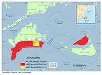
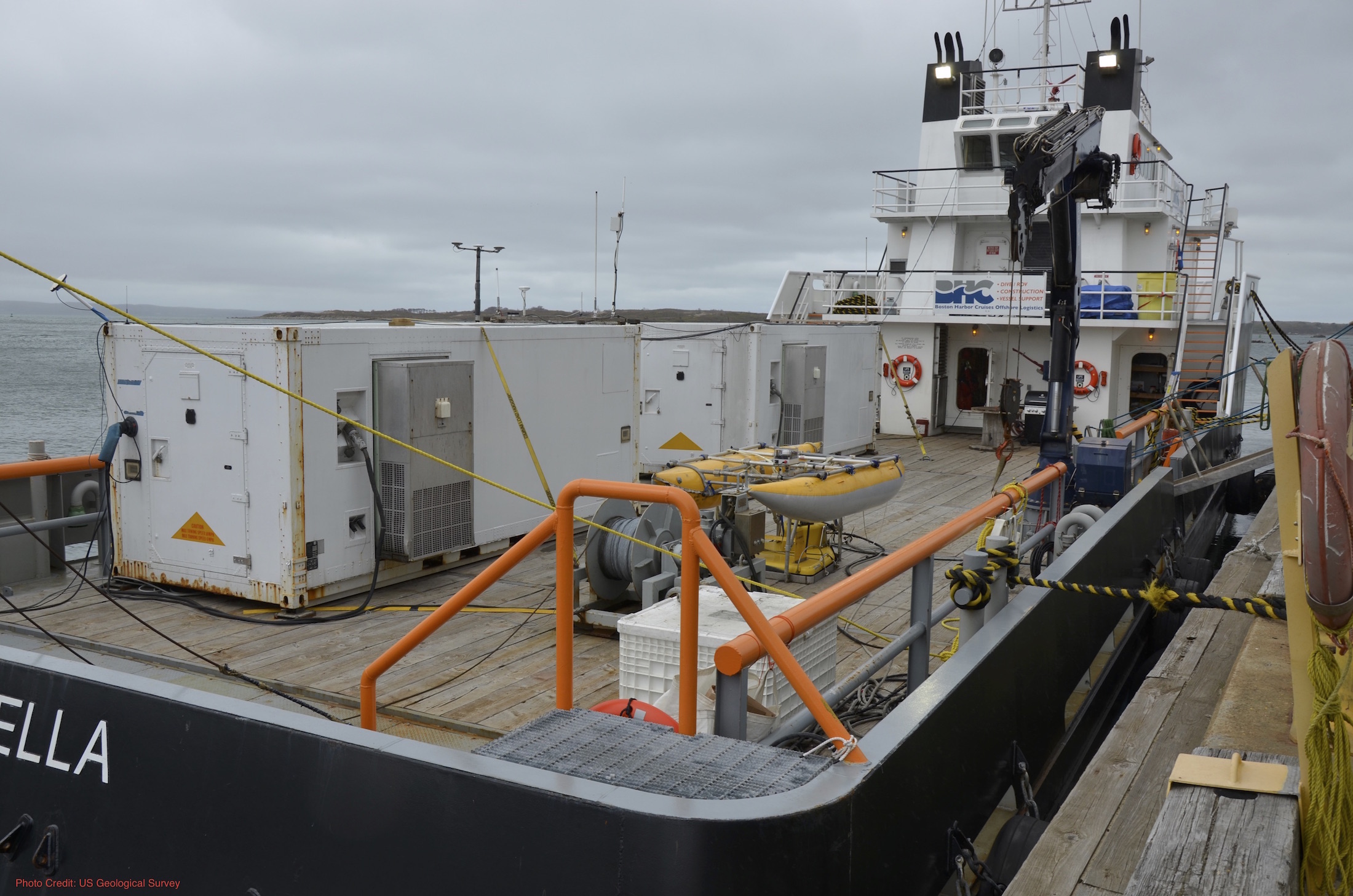
IntroductionThis report presents high-resolution spatial data for the sea floor south of Martha's Vineyard and north of Nantucket, Massachusetts (fig. 1). Approximately 220 square kilometers (km2) of the sea floor was mapped within these two survey areas in water depths of 6 to 32 meters (m). This report is the 17th in a series of publications produced by a cooperative mapping program between the U.S. Geological Survey (USGS) and the Massachusetts Office of Coastal Zone Management (CZM; http://woodshole.er.usgs.gov/project-pages/coastal_mass/; Ackerman and others, 2006, 2012, 2015; Andrews and others, 2010, 2012; Baldwin and others, 2016; Barnhardt and others, 2006, 2009, 2010; Foster and others, 2015; Pendleton and others, 2011, 2013, 2014a, 2014b, 2015; Turecek and others, 2012). This mapping program provides interpretive geologic datasets that can be used by managers and scientists to delineate marine resources, assess environmental change, inventory marine habitats, and support research concerning sea-level change, sediment supply, and coastal evolution. Detailed information and mapping products related to this cooperative can be accessed at http://woodshole.er.usgs.gov/project-pages/coastal_mass/. The marine geophysical data in this report were obtained during a USGS research cruise in 2013 aboard the motor vessel (MV) Scarlett Isabella (fig. 2). Additional bathymetric data were recently collected by the USGS with the same interferometric sonar for unrelated research projects. Data abutting the survey area south of Martha’s Vineyard were collected around the Martha’s Vineyard Coastal Observatory in 2007 (fig. 1, Denny and others, 2009) and another survey was conducted within Muskeget Channel, situated between Martha’s Vineyard and Nantucket, in 2010 (Pendleton and others, 2014b). Other bathymetric data from the region, collected by the National Oceanic and Atmospheric Administration (NOAA) to update navigation charts, have been used throughout this mapping program to help characterize sea-floor geology and morphology. Data from these adjacent and nearby surveys are not included in this report, but links are provided in the references section. The overall goal of the USGS–CZM mapping cooperative is to characterize the sea floor and shallow substrate inside the 3-mile limit of State waters, using high-resolution geophysical techniques, sediment sampling, and sea-floor photography and videography. The products developed and the knowledge gained in this project have broad applicability to scientific and resource-management issues in the region. Seabed-characterization maps and geospatial data help scientists understand the processes that have shaped the inner continental shelf and coast and illustrate the geologic and geomorphic evolution of the nearshore region over time, thereby helping to evaluate the vulnerability of these coastal environments. This report provides a science foundation for managing marine habitats, addressing offshore development projects, and assessing environmental changes caused by natural processes or human activities. Geologic SettingMartha’s Vineyard and Nantucket are the two largest islands in southeastern Massachusetts and are located approximately 6 and 45 kilometers (km) south of Cape Cod, respectively (fig. 1). The study area includes the inner continental shelf just south of Martha’s Vineyard, between Nomans Land Island and Muskeget Channel, and north of Nantucket Island between Tuckernuck Island and Great Point spit (fig. 1). The present-day coastal landscapes and offshore geology of these areas are the result of glacial and marine processes acting on the region over approximately the past 27,000 years (Oldale, 1992; Uchupi and Oldale, 1994; Uchupi and others, 1996; Balco, 2011). The Laurentide ice sheet was responsible for the ice-marginal deposits that form Cape Cod and the Martha’s Vineyard and Nantucket Islands. The most prominent features of these deposits are large moraine ridges (2–10 km wide; 50–100 m high) fronted by shallow-sloping outwash planes. These end moraines were deposited by the Buzzards Bay and Cape Cod Bay lobes of the Laurentide ice sheet and mark the southern extent of its most recent advance. The Buzzards Bay lobe deposited the end moraine that makes up Nomans Land and the western side of Martha’s Vineyard, while the Cape Cod Bay lobe deposited the end moraines present on the eastern side of Martha’s Vineyard and on Nantucket (Larson, 1982; Oldale, 1992). Glacial outwash planes were deposited southward of the end moraines as the glacier retreated. Following glacial retreat, Holocene sea-level rise further modified the landscape through erosional and depositional processes related to transgression (Kaye, 1964; Oldale, 1992; Uchupi and Oldale, 1994; Uchupi and others, 1996). Oceanographic processes including waves, currents and tides continue to shape the coast and adjacent sea-floor deposits (Goff and others, 2005; Gutierrez and others, 2003).
|
|

![]() U.S. Department of the Interior |
U.S. Geological Survey
U.S. Department of the Interior |
U.S. Geological Survey
URL: http://pubsdata.usgs.gov/pubs/of/2016/1168/ofr2016-1168-introduction.html
Page Contact Information: GS Pubs Web Contact
Page Last Modified: Wednesday, 07-Dec-2016 23:31:32 EST