Help Build the Protected Areas Database of the United States (PAD-US)
Links
- Document: Report (4.95 MB pdf) , HTML , XML
- Related Work: Protected Areas Resources
- Data Release: USGS data release - Protected Areas Database of the United States (PAD-US) 3.0 (ver. 2.0, March 2023)
- Download citation as: RIS | Dublin Core
Introduction
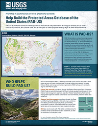
PAD-US provides a comprehensive geospatial database of protected and managed areas in the United States. We assemble known protected areas whose primary purpose is biodiversity conservation, as well as lands and waters that provide public access to nature. As a National Geospatial Data Asset (https://ngda-portfolio-community-geoplatform. hub.arcgis.com/), the PAD-US database (https://www.usgs.gov/programs/gap-analysis-project/science/protected-areas) is an aggregation of land and water management boundaries provided by authoritative sources and standardized into a common format
Suggested Citation
U.S. Geological Survey, 2023, Help build the Protected Areas Database of the United States (PAD-US): U.S. Geological Survey Fact Sheet 2023–3013, 2 p., https://doi.org/10.3133/fs20233013.
ISSN: 2327-6932 (online)
ISSN: 2327-6916 (print)
Study Area
Table of Contents
- What is PAD-US?
- Who helps build PAD-US?
- How are PAD-US data used?
- PAD-US Vision Goals for 2023–2025
- Get ready to submit your data!
| Publication type | Report |
|---|---|
| Publication Subtype | USGS Numbered Series |
| Title | Help build the Protected Areas Database of the United States (PAD-US) |
| Series title | Fact Sheet |
| Series number | 2023-3013 |
| DOI | 10.3133/fs20233013 |
| Publication Date | April 17, 2023 |
| Year Published | 2023 |
| Language | English |
| Publisher | U.S. Geological Survey |
| Publisher location | Reston, VA |
| Contributing office(s) | Science Analytics and Synthesis |
| Description | Report: 2 p.; Data Release |
| Country | United States |
| Online Only (Y/N) | N |


