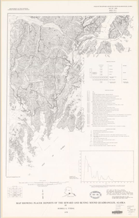
Map showing placer deposits of the Seward and Blying Sound quadrangles, Alaska
Links
- Plates:
- Download citation as: RIS | Dublin Core
Abstract
Placer gold was first recovered from stream gravels of the Seward quadrangle about 1850 by P.P. Doroshin, a mining engineer employed by the Russian-American Company. He obtained a few ounces of gold from gravels from two streams that flow into the Kenai River below Kenai Lake (Moffit, 1906, p. 8). Placer gold was found on Palmer Creek near Hope in about 1888, and on several nearby creeks in 1894 and 1895, precipitating a rush of miners to the region in 1896 (Moffit, 1906, p. 8, 9, 33). Prospecting subsequently was carried on through the Seward and Blying Sound quadrangles, but production of placer gold was confined to the western part of the Seward quadrangle; hence, the map shows only the pertinent area of these quadrangles. Most of the gold was recovered from stream and bench gravels in the western part of the Turnagain Arm drainage system, the most productive gravels from Mills, Canyon, Bear, Resurrection, and Crow Creeks. Only a small amount of gold was recovered from gravels of the Kenai River drainage system, chiefly from Copper Creek, and almost no production was recorded from the Resurrection River or its tributaries. (Resurrection River and Resurrection Creek are two different streams.)
Recovery of the gold was effected initially with sluice boxes and later by hydraulic mining methods (Martin and others, 1915, p. 186). Dredges were installed on Resurrection and Sixmile Creeks but never were operated successfully because of many large boulders, thin gravel deposits, and low gold tenor (Paige and Knopf, 1907, p. 119-120; Brooks, 1916, p. 55; Tuck, 1933, p. 523-527). Dredging also proved unsuccessful on the Kenai River for the same reasons (Martin and others, 1915, p. 186-187).
Suggested Citation
Tysdal, R.G., 1978, Map showing placer deposits of the Seward and Blying Sound quadrangles, Alaska: U.S. Geological Survey Miscellaneous Field Studies Map 880, 2 Plates: 22.38 x 35.64 inches and 33.84 x 27.09 inches, https://doi.org/10.3133/mf880B.
Study Area
| Publication type | Report |
|---|---|
| Publication Subtype | USGS Numbered Series |
| Title | Map showing placer deposits of the Seward and Blying Sound quadrangles, Alaska |
| Series title | Miscellaneous Field Studies Map |
| Series number | 880 |
| Chapter | B |
| ISBN | 0607803479 |
| DOI | 10.3133/mf880B |
| Year Published | 1978 |
| Language | English |
| Publisher | U.S. Geological Survey |
| Description | 2 Plates: 22.38 x 35.64 inches and 33.84 x 27.09 inches |
| Country | United States |
| State | Alaska |
| Other Geospatial | Blying Sound Quadrangle, Seward Quadrangle |
| Scale | 250000 |

