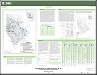
Potentiometric surface, 2013, and water-level differences, 1991-2013, of the Carrizo-Wilcox aquifer in northwest Louisiana
Links
- More information: USGS Index Page
- Plate: Map (1.02 MB pdf)
- Download citation as: RIS | Dublin Core
Abstract
The Carrizo-Wilcox aquifer is the primary source of fresh groundwater for public supply as well as industrial, agricultural, and domestic uses in several parishes in northwestern Louisiana, including Bienville, Bossier, Caddo, De Soto, Natchitoches, Red River, Sabine, and Webster. In 2010, about 19 million gallons per day (Mgal/d) were withdrawn from the Carrizo-Wilcox aquifer in Louisiana. This is an increase of over 6 Mgal/d from 1990 withdrawal amounts. The largest increase in withdrawals occurred in Caddo (3.79 Mgal/d) and De Soto Parishes (2.32 Mgal/d), whereas the largest decrease in withdrawals occurred in Natchitoches Parish (1.17 Mgal/d). Groundwater withdrawals from the Carrizo-Wilcox aquifer have caused water-level declines throughout much of the aquifer in the study area. Additional knowledge about the effects of withdrawals on water levels and flow directions in the Carrizo-Wilcox aquifer are needed to assess current conditions in the aquifer. In 2012, the U.S. Geological Survey (USGS) in cooperation with the Louisiana Department of Natural Resources began a study to document current water levels and water-level changes in selected aquifers.
This report presents data and maps that illustrate the potentiometric surface of the Carrizo-Wilcox aquifer during March–May 2013 and water-level differences from 1991 to 2013. The potentiometric surface map can be used for determining the direction of groundwater flow, hydraulic gradients, and effects of withdrawals on the groundwater resource. The rate of groundwater movement also can be estimated from the gradient when the hydraulic conductivity is applied. Water-level data collected for this study are stored in the USGS National Water Information System (NWIS) (http://waterdata.usgs.gov/nwis) and are on file at the USGS office in Baton Rouge, La.
Study Area
| Publication type | Report |
|---|---|
| Publication Subtype | USGS Numbered Series |
| Title | Potentiometric surface, 2013, and water-level differences, 1991-2013, of the Carrizo-Wilcox aquifer in northwest Louisiana |
| Series title | Scientific Investigations Map |
| Series number | 3311 |
| DOI | 10.3133/sim3311 |
| Year Published | 2015 |
| Language | English |
| Publisher | U.S. Geological Survey |
| Publisher location | Reston, VA |
| Contributing office(s) | Louisiana Water Science Center |
| Description | 44.0 x 34.0 inches |
| Time Range Start | 1991-01-01 |
| Time Range End | 2013-12-31 |
| Country | United States |
| State | Louisiana |
| Other Geospatial | Carrizo-Wilcox aquifer |
| Online Only (Y/N) | N |
| Additional Online Files (Y/N) | N |


